After an enthusiastic reception at a neighborhood meeting last week, we have more details of the planned Brownsboro Road Diet to share. Planned to get underway this summer, the $400,000 makeover will reduce the current street configuration from four lanes to three (one lane in each direction with a turning lane in the center). This “road diet” will largely provide room for missing segments of sidewalk along the corridor carrying 14,000 cars per day.

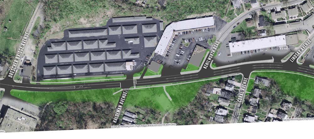
Previously misstated in the news, the official boundaries of the Brownsboro Road Diet lie between Drescher Bridge Avenue to the west and Ewing Avenue to the east as seen in the map above. The road diet is basically split up into two segments split at the Rally’s burger stand near Lindsay Avenue.
From Ewing Avenue to the Rally’s, the physical roadway will be reduced by four feet to accommodate sidewalks. One-foot gutters and two ten-foot travel lanes flank a 14-foot turning lane for an overall 36-foot width. On the north side of the street, the general configuration calls for two feet of grass and a five-foot sidewalk. The current layout includes four ten-foot travel lanes. Between Drescher Bridge Avenue and the Rally’s, Brownsboro Road will maintain it’s current 40-foot width, but will include two-foot gutters, two 11-foot travel lanes, and a 14-foot turning lane.
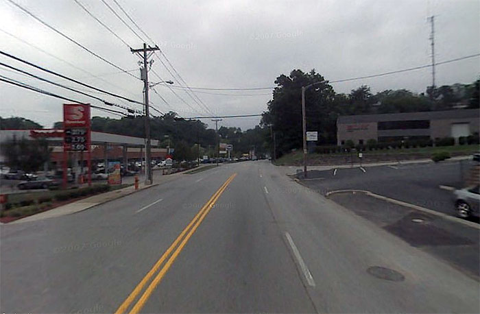
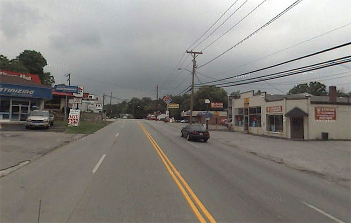
As I mentioned before, Kroger is seeking to tear down a series of commercial buildings to built another gas station near Ewing Avenue. While the plan was approved by Landmarks, it still has a way to go through the development process, but it really would be a setback to the progress of the road diet. It turns out there are three gas stations already nearby—a Thornton’s farther west and another toward Hillcrest to the east. And as you can see in the streetview photo above taken at the proposed location of the new gas station, there’s a Speedway on the same block (Existing and proposed gas stations indicated with an asterisk on the map below).
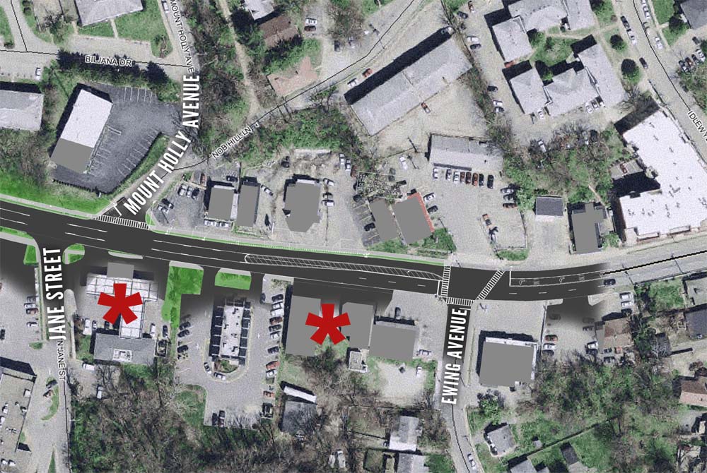
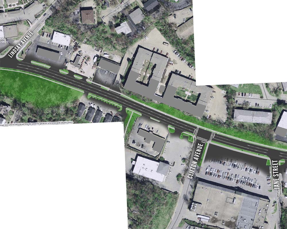
Moving from east to west along the proposed Brownsboro Road Diet, you can see in more detail how the roadway will change. (More maps below.) One major obstacle to pedestrians will remain after the road diet is complete—the prevalence of over-sized curb-cuts along the corridor. Dirk Gowin, transportation planning administrator with Metro Louisville, said the area needed a more in-depth access control study, but did note one curb cut near El Nopalito would be reduced in size. These curb cuts require a continuous turning lane as the opportunity for motorists to cross the sidewalk is significantly increased. The curb cuts also eliminate the opportunity for a median or central pedestrian refuges that make the street easier to cross.
Above-ground utilities and their massive poles taking taking up precious space on existing sidewalks will remain. Metro Louisville did not consider burying utilities as part of the project as it would have involved coordination with many more groups. Gowin said the cost could be significant. While no bike lanes or sharrows will be included in this project, Gowin, a cyclist himself, said he believes the new road will be no less bike friendly than it is today—motorists will easily be able to pass cyclists in the turning lanes.

While we’re looking into this stretch of Brownsboro Road, let’s take a look back at the area nearly a century ago. According to Sanborn maps, the stretch was largely undeveloped. In fact, it wasn’t even known as Brownsboro Road then, instead listed as Letterle Avenue. As you can see in the map on the left, the intersection of Ewing and Letterle avenues was home to the Clifton Brewery and a complex of greenhouses. There’s also a creek shown which I believe may be buried today. Anyone have more history on the corridor?


According to this 1864-65 map, Brownsboro Road was once called Brownsborough Turnpike Road. Also notice that a Civil War fort called Fort Elstmer was present at what is now that northern end of Bellaire Avenue.
http://www.flickr.com/photos/tellinghistory/5405658408/sizes/o/in/faves-76123902@N00/
There used to be a pond (Edward’s Pond) where the Dirty Kroger is now, from my review of aerial photos and old maps of the area. The pond fed a stream named Edward’s Pond Branch that flowed to the Muddy Fork of Beargrass Creek just upstream of its confluence with the mainstem near the flood pumping station, just west of Mellwood Arts Center. Most of the stream is buried and piped now.
Great map find, John. It would be amazing to see that pond still in place today! The historic watershed/ecosystem is really quite fascinating.
Noticed yesterday that demolition has started on the site where the gas station will be going in.