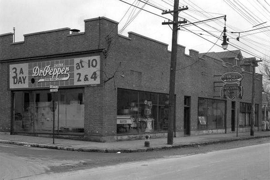
Congratulations to Joshua Poe and Jeff Noble for correctly identifying our last sidewalk photo as Franklin Street at the railroad tracks between Cabel and Buchanan streets in Butchertown. Once you walk toward the highway and through the “city gates” at the floodwall, the neighborhood loses urban quality rather abruptly. Here’s a new sidewalk photo ready to be identified in the comments below (hint: the building still exists but the houses peeking behind it do not).
And now on with the week’s top urbanism news:
“Anything threatening to be a subculture is commodified before it can walk”. William Gibson continues to create some really great fiction that sits at the intersection of design and urban discourses. Justin McGurik takes a look at Gibson’s new book, The Peripheral. Deezen
Why Habitat For Humanity Isn’t Building As Many Houses As It Used To. Due to rising land prices, the nonprofit famous for building homes for low-income families has set its sights on something else. Co.Design
The Rise of Men Who Don’t Work, and What They Do Instead. A critical issue for cities everywhere. Amanda Cox investigates what male residents are doing with their time when their un- and underemployed. New York Times
Student-led Rural Studio continues to prove the value of socially engaged architecture. Rural Studio in Arkansas continues to be an amazing example of what architecture could be given more community engaged model, and paired with some really creative student leadership. Archinect
Mapping how 530 global cities use their water. Future battles of commodification, and resource extraction will depend on how cities use or misuse this necessary resource. Urbanful
No Credit Card Needed for Community Access Bikeshare in Ontario, Canada. As Louisville begins its own bike share process, it would be wise to look at some diversity in delivery, and accessibility mechanisms. Sustainable Cities Collective
Highway Officials Find These 17 City Trees Threatening. Next City explores the Kentucky Highway Departments identification and efforts to protect city streets from these 17 killer trees. Next City
Are We Living in a Food Hub Bubble? David Sands takes a look at the challenges inherent to the Food Hub model. Can these socially conscious businesses balance their budget without a dependency on outside funding? Sustainable Cities Collective
No One’s Very Good at Correctly Identifying Gentrification. Lets be clear. The gentrification debate has long been underdeveloped to the point of absurdity. This article shows that clearly. Unfortunately, the lack of rigor in this conversation is now leading to calls of letting the concept go. That would be as dangerous as it would be foolish. CITYLAB
[Top image: Reference URL.]


Frankfort Ave. and S. Keats.
D and W silks?
N. Keats
fka D&W, nka “Refine Design”
It’s actually South Keats.
Frankfort Avenue divides the cross streets North & South from the RR tracks by Varanese to points east. I’ll look at the street sign the next time I pass by, but I’m pretty sure cross streets on the north side of FF are designed “North Keats” (Jane, Ewing, Hite, etc.) I’ll check the next time I walk to the Wine Rack.
Right. Frankfort Ave is the divider. I live on N. Keats. But the photo is taken looking down S. Keats from Frankfort Ave.