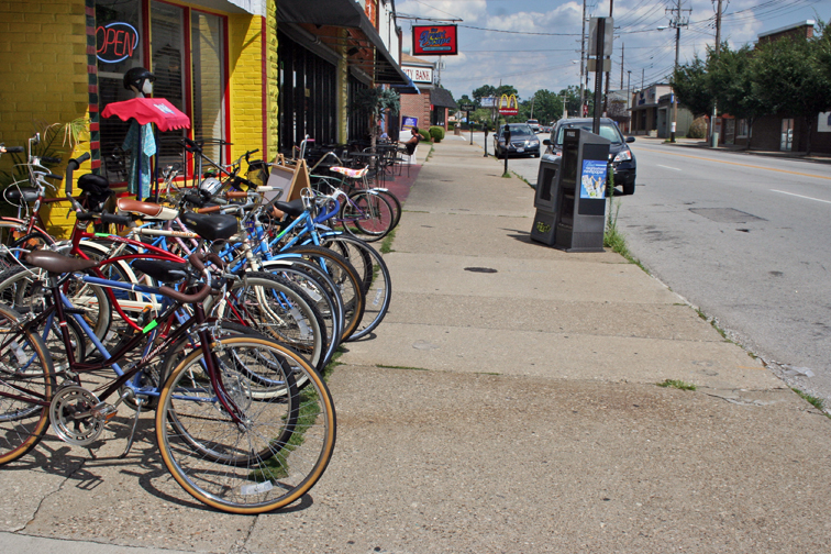
It seems last week’s “retro” sidewalk photo of the old White Castle on Market Street between First and Brook brought out some old memories. Needless to say, the sidewalk was handily identified by Thomas Braden, D. Jason Crowder, and Jeff Noble. Per reader request and to help keep those memories alive, we posted another historic view of the old White Castle once located at Bardstown Road and Eastern Parkway below. Here’s a new sidewalk photo to start off the short-week.
- AG says Mayor’s deal with Cordish at 4SL is legal (C-J)
- More from Ville-Voice and Page One.
- New Albany seeks ‘storytelling sculpture’ in its downtown (C-J)
- Youth shelter proposal still controversial, uncreative in New Albany (N & T)
- Center for child-abuse victims proposed in Old Louisville (C-J)
- Apparently no one likes the negligent Boston management co. at Park DuValle (C-J)
- Work continues toward establishing Affordable Housing Trust Fund (C-J)
- Jeffersontown launches rebranding web site (Official Site via Biz First)
- Cincy thinks Waterfront Wednesdays are pretty great (UrbanCincy)
- Rain gardens can help with stormwater runoff issues (C-J)
- One more word about the Bardstown Road Zombie Walk (Lou for Lovers)
- Despite rain, Mayor’s Hike & Bike draws a ‘couple thousand’ (C-J)
- River Fields lawsuit stops construction of Harrods Creek bride (C-J)
- It’s going to be important to cut sprawl & improve land use (World Changing)
- Imagine the ‘building you can eat’ using green walls (ArchDaily)
- Creating ’emotional connection’ to create a sense of place (Smart City via P-zen)
Thanks to Diane Deaton-Street who found this photo from the National Trust for Historic Places.


This picture is of Bardstown Road across from Kroger. The old White Castle in the picture is where my grandmother was born.
Yeah, Bardstown Road immediately north of Taylorsville. The sung for The Great Escape is a dead giveaway.
Even without the Great Escape sign it's easy.
Thanks for the WC pic at Bardstown and Eastern Parkway. And for a bonus, the pic includes not one, but two Ford Mavericks, the car former Louisville Mayor Harvey Sloane drove instead of the big Lincoln provided for him. Wasn't his red?
That photo looks to have been taken in the late 1970s or very early 1980s. I started driving in 1977. I do not remember the Gulf Station for some reason. Did it become the oil changing place that preceded where Heine Brothers is now? My mind is a little foggy there.
Thanks again.
Jeff Noble
This looks like Bardstown Road across the street from the Kroger between Wrocklage and Weber.
D&W Silks building is being demolished. FYI.
Wait. What? The D&W site had a ten-story project in the works a year or two ago that went dormant, and then… dead? Is the same project back on the books, or is there a new one (please, please, please… don't be a parking garage!?
May I just throw this out…? When are we going to have an honest addressing of the issue of race as it relates to development, education, and the growth of the city as an appealing place to the creative class? I was gone for 35 years in Rochester NY, where the county of Monroe was divided into a city of Rochester with 80 percent minority schools, and 18 municipalities that are 95 percent white. Smug apartheid. I returned to a Metro Louisville, where things seem much better, but I am beginning to see the cracks in the image. Are the Catholic schools, especially St. X and Trinity, responsible for keeping Louisville's power structure less diverse than it could be… Is the West End's absence of real development the result of benign neglect… or worse? I have so many questions…
I don’t remember that Gulf station either. Looks like it may have been at the corner of Baringer.
The Gulf Station was on the corner of Bardstown Rd and Eastern Parkway. I caught the bus for St. X there every morning in the late 50’s on my way to get off at 1st and Broadway.