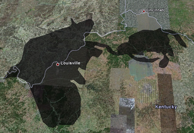
The massive Deepwater Horizon oil spill in the Gulf of Mexico has grown large enough to affect everyone, including Louisville, but how big is it exactly? There have been a lot of comparisons of the spill’s size, but 2,500 square miles is still a pretty abstract concept.
Up above is the oil spill as seen on May 6 overlayed on the Louisville region. You can see county lines lightly on the map and it’s apparent that the spill covers a huge part of the Louisville region stretching as far away as Cincinnati.
This disaster, of course, compels us to evaluate the role of oil in our lives and everything it affects from highways and driving to energy to petroleum-based products. Thoughts?
You can generate your own maps at Paul Rademacher’s spill utility. Hat tip Yglesias.


How about a story on the flood in Nashville? Coverage of the Derby and the oil spill seemed to get all the news. Any comparison between Nashville 2010 and Louisville 1937? The photos I’ve seen from Tennessee look pretty bad. Can you imagine how much worse the flood could have been if the dam at Lake Cumberland (which has been under repair for years) had failed?
“This disaster, of course, compels us to evaluate the role of oil in our lives and everything it affects from highways and driving to energy to petroleum-based products. Thoughts?”
how about constructing two auto bridges to continue to support and grow our driving and addiction to petroleum-based products. Seems rational to me..