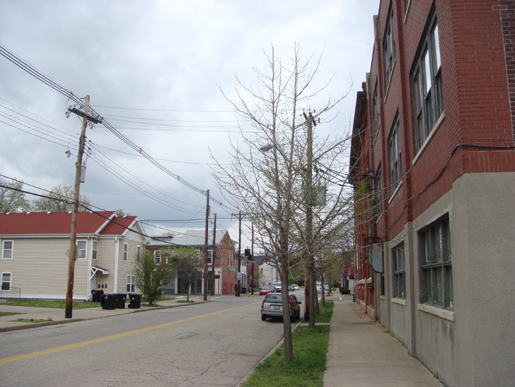
Congratulations to Blue who correctly identified our last sidewalk photo as Payne Street looking northeast at the Breckinridge Franklin Elementary School in Irish Hill. Here’s a new sidewalk ready to be identified in the comments.
Local News
- To the extreme: The past and future of Louisville’s skate park. (The Paper)
- The River’s City: The Ohio River and Louisville’s identity. (The Paper)
- Living a shelter life: What’s behind the frustration with emergency homeless shelters? (LEO)
- This is what low-income housing looks like in Lexington. (H-L)
- How to get involved in the 9th District Expanded Recycling program. (Green Triangle)
- Revised dumping ordinance allows confiscation of vehicles. (Insider)
- Koch family forms Bluegrass Boardwalk as part of pursuit of Kentucky Kingdom. (Insider)
- Bruegger’s bakery and cafe opens in St. Matthews. (Biz First)
- Two new buildings for federal agencies near Broadway now occupied. (C-J)
- Drumanard property to remain a historic site after state denies removal request. (Wave3)
- A Thousand Trees: More on the Bowman Field landscape changes. (Highlander)
- Conservancy fears losing trees in Seneca Park groves. (C-J)
- Birding 101: Introduction to backyard bird feeding. (Lou Naturally)
- Sandhill cranes on the move. (Lou Naturally)
- Info on the Payne Street rain barrel pilot project. (Green Triangle)
- Plant hardiness zones have been updated for the region. (Verdant Design)
- Apply for a Slow Food Bluegrass School Garden Grant. (SFB)
- Officials plan to bring food trucks to Lexington. (H-L)
Transportation
- Metro Louisville bike routes mapped on Google. (Google Maps)
- Eight achievable steps for creating cities fit for cycling. (This Big City)
- Apps due Feb. 20 for next round of TIGER funding. Can we get some funding? (USDOT)
- New report shows walking in non-urban areas higher than anticipated. (Bike League)
- An inside look at the Sherman Minton Bridge. (Wave 3)
- Public input mixed as Indiana comment period ends. (WFPL)
- Why do some cities get care shares and others don’t? (Transportation Nation)
- Finding the zone: The Zen of urban cycling. (Grist)
- Ensuring transportation for those who don’t drive. (AARP)
- Confessions of a recovering engineer. (Strong Towns)
- Traffic jam economics. (NY Times)
Other News
- Seeing Green: Urban agriculture as green infrastructure. (Omnibus)
- Empowering minorities to shape urban landscapes. (Grist)
- Pop-up Urbanism: Street makeovers put new spin on the block. (Miller-McCune)
- Why every city should be planting rain gardens. (Atlantic Cities)
- What Dollar Store locations reveal about America. (Atlantic Cities)
- Should cities of the future look more to the past? (Atlantic Cities)
- Communities learn the good life can be a killer. (NY Times)
- What’s the future of the troubled shopping mall? (NY Times)
- The decline and fall of the malls. (Shareable)
- How bookstores & libraries became to new community centers. (New Geo)
- A city is like a family portrait. (ASLA Dirt)
- Chart of the day: A nation of renters. (Atlantic Cities)


Shelby Street South of East Chestnut Street in Phoenix Hill
The historical photo site Shorpy has a series of Louisville photos including Union Station and the Post Office (circa 1906).
http://www.shorpy.com/image/tid/254
According to the encyclopaedia of Louisville the historically accurate names for this area are the East end and Uptown. The PHNA has done great work advocating for this area but to call this area Phoenix Hill is a stretch. The area will not develop a true sense of neighbourhood identity with borders of Broadway and Baxter to Main and Preston. In my opinion the Neighbourhood association should be called the east downtown neighbourhood association and include Phoenix Hill, Uptown, Liberty Green, and NuLu/E. Market districts.
Is this a photo of Rogers st and Baxter Ave, turning the corner from the alley known as Bishop?