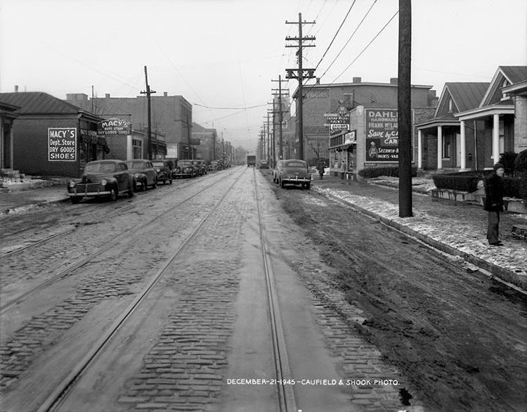
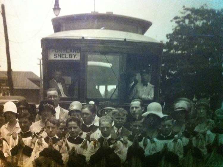
Schnitzelburg was once defined by a trolley loop connecting it with Downtown and beyond. The one-way tracks followed the route described in the amazing graphic above from Shelby Street onto Burnett Avenue to Texas Avenue, rounding on to Goss Avenue before heading North again on Shelby. In her 2011-book Louisville’s Germantown & Schnitzelburg, Lisa Pisterman noted that while Germantown’s borders have moved over time, “the boundaries of Schnitzelburg have always been defined by the trolley loop that circled the community,” demonstrating how important the trolley once was for the community.

In fact, the trolley loop is in many ways the reason Schnitzelburg exists. The neighborhood grew rapidly as a streetcar suburb of Louisville after the loop opened in 1891, but the route was closed sometime after World War II and the tracks and cobblestones were torn out or paved over. The loop route was generally preserved in the 1961 route 11 of the Louisville Transit Company, but the loop doesn’t exactly exist as a modern TARC route. Bus service to the area is largely defined by route 43, which passes through the area on its way to the farther suburbs.
Today Germantown and Schnitzelburg are as lively as ever, but imagine life along the Schnitzelburg Loop if it existed today. Could some modern version of the loop connecting to the Medical Center, Nulu, Downtown, and beyond via the Logan and Shelby street corridor help create a better city?
More information on Germantown & Schnitzelburg on Facebook and on this blog.


Also, sounds like a fun idea for a third Friday night trolley hop.
There is a precedent for urban ag in the area (next to last photo)! I don’t know about the return of a trolley. That is an amazing graphic.
Fabulous description & story about that which is Schnitzelburg vis a vis Germantown & great pics, to boot. Why would “Schnitzelburg” be linked to Portland via streetcar line?
>Jeff. The first trolley line in the area connected Louisville to Portland, then two cities. The Portland line eventually extended toButchertown. Shortly after the Civil War the same company added a new line on Shelby. That line only went to Ormsby, which was near the City Limit. A few years later the two trolley companys were merged. Later the City Limit was moved out to Burnett and Texas, and ‘Schnitzelburg’ began to develope the ‘Loop’ was added out to the City Lmits. When the trolleys became electric, and were not limited by mule power, the two lines were merged and became “Portland-Shelby”.
The Portland-Shelby and the Market Street trolleys used the same tracks on Market Street. To help people boarding from getting on the wrong trolley, the conductors would shout “OUT SHELBY”. Generally, that would mean you were headed home after a day’s work or shopping.
Still today, 60 years after the trolleys stopped, “OUT SHELBY” means you are leaving and headed towards home.
@Ray Obst – I never knew that about “Out Shelby” but I do recall a friend of mine’s Dad shouting “Out Shelby” everytime he bowled a strike or spare at the old Pee Wee Reese lanes.