")
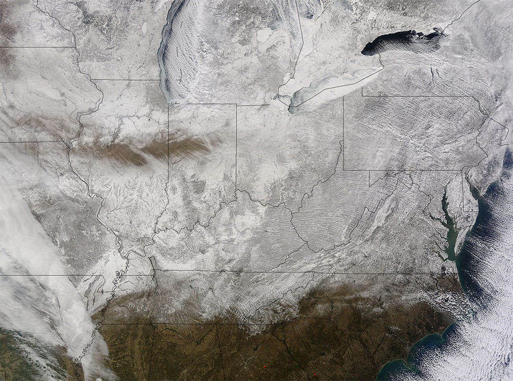
It’s cold out—we get it. But this snow-white satellite image of a frozen Kentucky really sends shivers up our spines. The image was captured by NASA on February 19, showing snow covering a giant chunk of the country. According to NASA:
NASA’s Terra satellite captured an image of the snow-covered eastern U.S. that looks like the states have been sitting in a freezer. In addition to the snow cover, Arctic and Siberian air masses have settled in over the Eastern U.S. triggering many record low temperatures in many states.
NASA went on to single out Louisville for its mind numbingly low temperatures:
In Louisville, Kentucky, temperatures dropped to -6F, breaking the old record low of 0F, according to meteorologist Brian Goode of WAVE-TV. Meanwhile, Richmond Kentucky bottomed out at a frigid -32F.
Take a look at the whole region below: