
Big changes are coming to one of the most historic parts of Louisville: the old Portland Wharf. Louisville’s Metropolitan Sewer District is holding a public meeting tonight, Monday, February 9 at 6:30p.m. to discuss the planned Combined Sewer Overflow retention basin, to be located on the site of the Portland Wharf Park, where the original city of Portland was first founded at the foot of the Falls of the Ohio. Here’s the blurb from MSD:
Louisville Metro District 4 Councilman David Tandy, District 5 Councilwoman Cheri Bryant Hamilton and MSD will share plans concerning the Portland Wharf area basin and green infrastructure projects located in the vicinity of N 17th and Bank streets. This informational session will provide an opportunity for you to learn about projects MSD will construct in your neighborhood to address untreated sewage entering our local waterways during rain events.
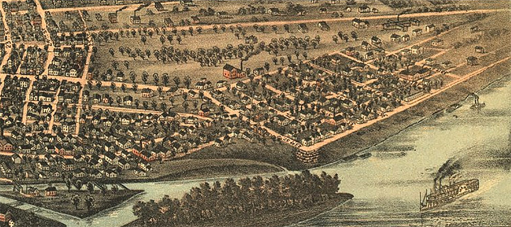
While the site looks barren and abandoned now, cordoned off from the rest of Portland by the elevated Interstate 64 and a massive earthen levee, the site was once a bustling city thriving on Louisville’s river trade. This part of Portland began its long, slow decline in the 1870s when the Portland Canal was enlarged, allowing boats to bypass the city. It was later completely erased from the map after being devastated by the 1937 flood and levee- and highway-building campaigns.
According to Louisville Metro Parks:
General William Lytle of Cincinnati owned the land next to the harbor below the Falls and in 1811 laid out the town of Portland. He planned to sell the lots to finance his plan to build a canal around the Falls. The town grew as travelers portaged around the Falls and later when Steamboats made it possible to come up river. Later, the port served as the terminus of the New Orleans run. Lytle never fulfilled his dream of building a canal but in 1829, an innovative three-tier lock system allowed the Louisville and Portland canal to by-pass the Falls. The reduced time and effort to pass the Falls improved river traffic and the Portland Wharf expanded into a bustling riverside town.
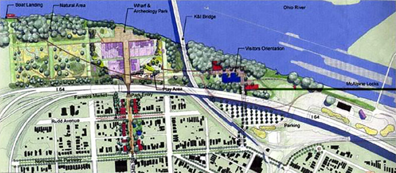
Today, the site is partially an open field and partially forested. A portion of the Louisville Loop runs through the site, which is publicly accessible and part of the 56-acre Portland Wharf Park, overseen by Louisville Metro Parks. At one point, a master plan was developed to create a waterfront park worthy of Portland’s history at the site, but that plan appears largely forgotten today.
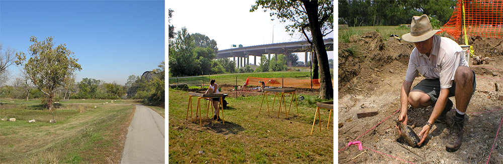
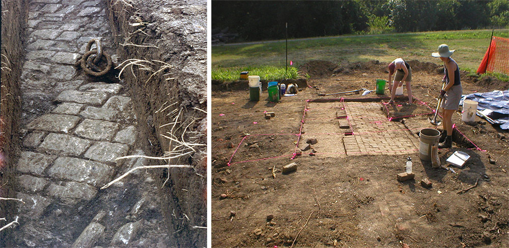
While the original Portland here is long gone, the roots of the city—the old wharf, streets, and building foundations—still exist just beneath the surface. Today, archaeological digs continue to excavate the area’s history—a strange phenomenon to uncover our recent history that has vanished before our eyes. According to the Kentucky Heritage Council:
The archaeological projects conducted at the Portland Wharf are a part of a community wide effort to develop Portland Wharf Park into a unique history and archaeology park that will benefit the Portland community. As part of this effort, Louisville Metro Parks, The Portland Museum and the Kentucky Archaeological Surveys have sponsored various educational programs related to the archaeology of Portland Wharf. These programs have helped people participate in and better understand the rich history that is a part of the community. More education and public outreach programs are in the works for Portland Wharf Park.
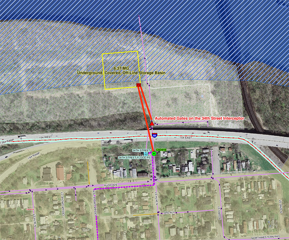
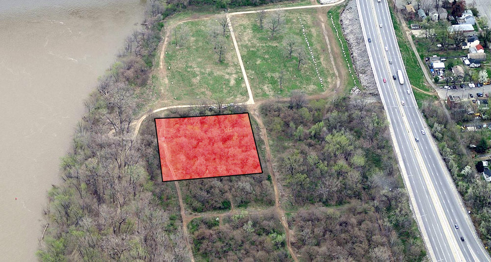
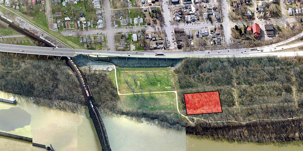
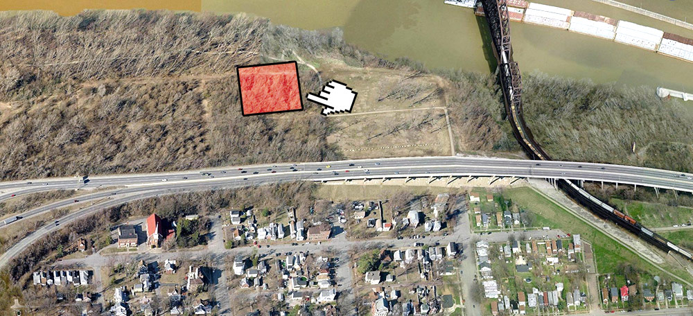
The Portland Wharf Area Basin is part of MSD’s consent decree with the EPA to reduce Combined Sewer Overflows (CSO), which contaminate local waterways. This project calls for a covered 6.37 million gallon tank to catch the CSOs before they hit the Ohio River. The goal is to reduce the number of overflows here to 18 a year. The project was estimated to cost $20 million in 2008. The basin project is still in the design phase, so now is the time to get involved. MSD expects plans to be finalized in the summer of 2017 with construction to commence by the fall of 2017.
According to MSD, “The possible site area is bounded by the Ohio River to the north, Interstate 264 on the west, Bank Street to the south and North 24th Street to the east. Input from the neighbors…will help determine the specific details and aesthetics of the finished project.”
“This is one of many projects MSD is in the process of constructing as part of the federal consent decree involving storm sewer drainage,” Councilwoman Cheri Bryant Hamilton said in a statement. “It is important that people in the Portland area understand this process from the beginning to be informed on how storm sewer overflow and run off will be handled in their neighborhood.”
The meeting takes place tonight, Monday, February 9 at 6:30p.m. at Western Middle School, 2201 West Main Street. This is a great opportunity for the community to learn how Portland’s historic waterfront will be affected by this major project and we encourage everyone to try to make it tonight. If you can’t go tonight, MSD is accepting comments via email at commentsIOAP@msdlouky.org.


Square?
>>> Columbus, O-H-I-O example that I beleive incorporated wetland characteristics into the Park design. Not sure where they ended up from the early sketches I saw about 10 yrs ago or its capacity to mitigate against sewer overflow (http://www.metroparks.net/parks-and-trails/scioto-audubon/park-map/)
To what degree do existing stands of trees drink up precipitation and the swells of Louisville area water ways? Does the shore line filter over flows? Has that been measured? A concrete box and pipes do a better job?
Also, how does an underground (per MSD November newsletter) CSO basin work on the river side of the flood wall? Not that all rain events that lead to sewer overflow would require installation of floodgates or even cause the Ohio River to breach its banks, this just seems like a bad location for Louisville to capture its discharge.
The portion of the Louisville Loop that runs through the Portland Wharf is no longer publicly accessible. Most of the path is buried under mud and has been closed by Metro Parks while the Corps of Engineers decides if the path will be restored.
Comments are closed.