
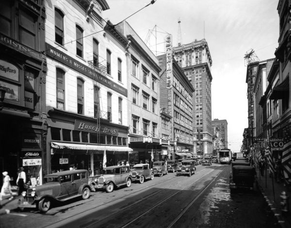
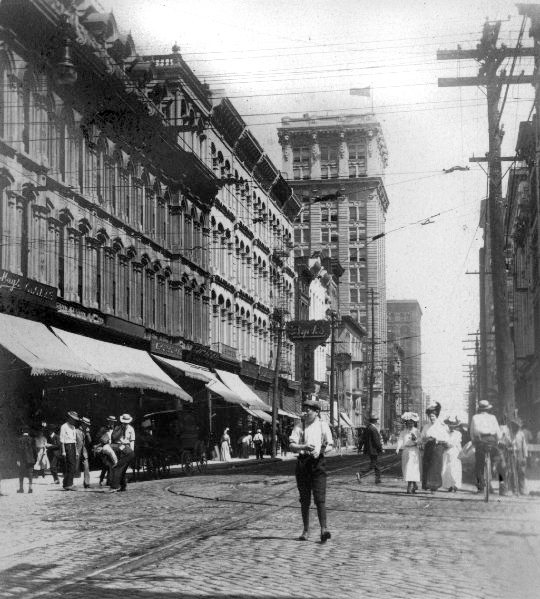
Fourth Street north of Jefferson was once a vibrant and architecturally stunning part of Louisville. The corridor has always been an important spine for the city and is celebrated in our history and culture. Dozens of postcards bear this view, seen above in 1946, and many more highlight individual landmarks lining the street.
")
Among the dozens of buildings on Fourth Street above Jefferson were the Romanesque Columbia Building, at one point the tallest building south of the Ohio River, the Beaux-Arts Lincoln Tower, once the tallest building in Kentucky, and the Todd Building, an excellent example of the Chicago school of architecture.
A street with this much history and quality architecture must be valued by its community one would imagine. But how did Louisville deal with the scene above? Louisville tore down every building seen in the photograph above, for as far as the eye can see. Every last structure has been destroyed.
")
")
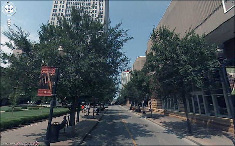
So above is what Fourth Street looks like today after a half century of failed urban policy and destructive urban renewal. Immediately obvious is the narrow width of the street and street trees. But beyond, it becomes apparent that every building is new. Nothing historic is in sight.
That’s not to say that every new building is bad, though. Some of these buildings are good and some of them are bad (most of them are obscured by the trees). I don’t think anyone, for example, would argue that the Aegon Plaza tower isn’t a beneficial addition to the city. What can be condemned, however, is the attitude that provided for the wholesale clearance of block upon block of quality urban fabric.
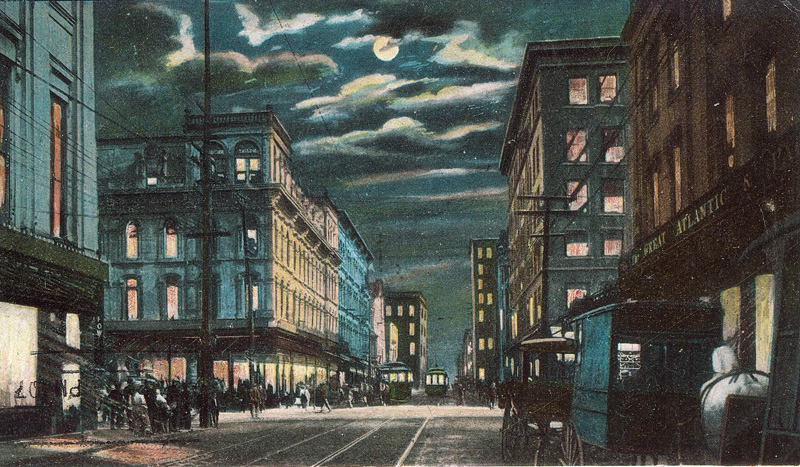
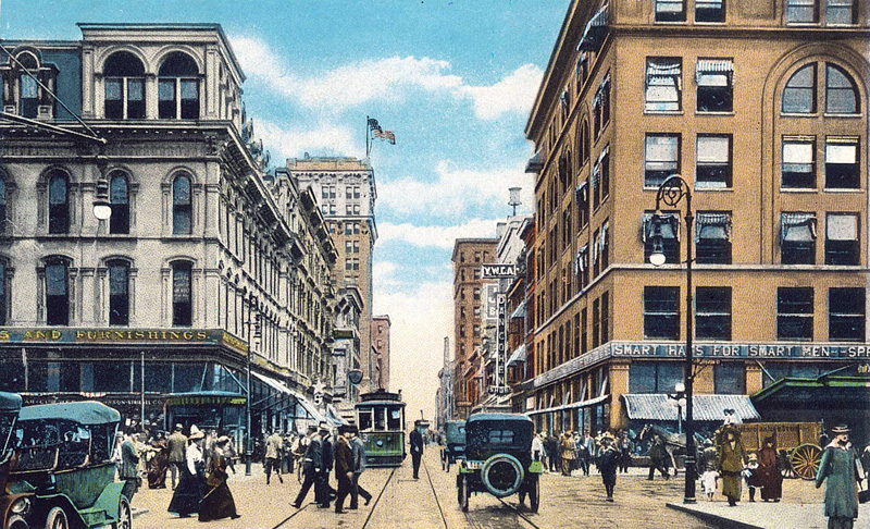
As I mentioned above, many postcards through Louisville’s history show scenes along Fourth Street. Most often, a community prints scenes on postcards that it’s proud of. A postcard announces what’s best about a city or place. At one point in Louisville’s past, the city knew it was really something and it wasn’t afraid to say so.
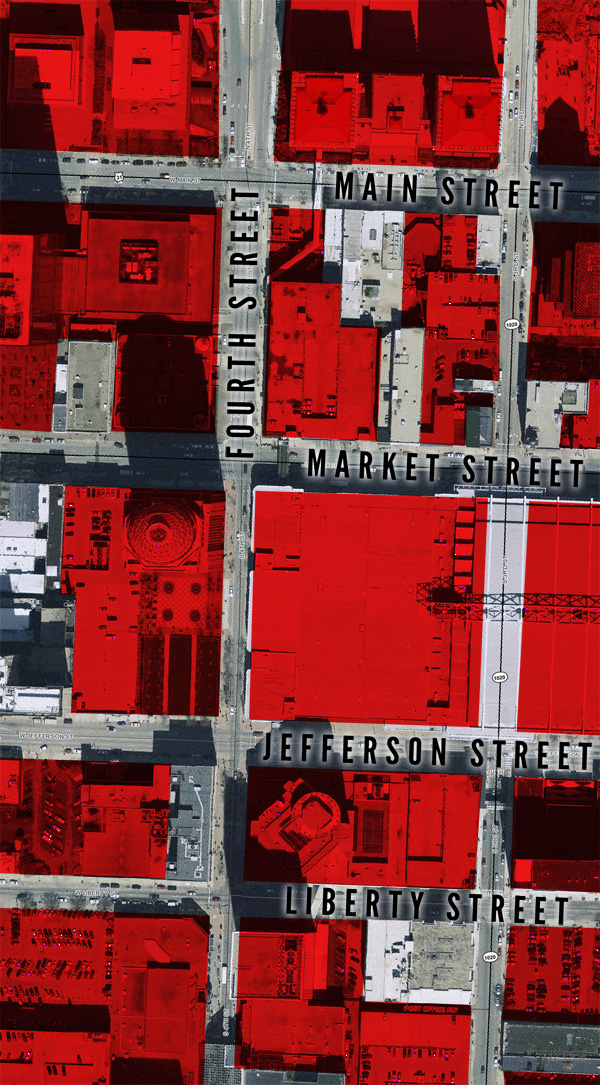
But then notice the map below. Everything shaded in red has been destroyed or rebuilt since World War II. You can see that these several blocks in the core of the city only contain a handful of historic structures and none survived directly on Fourth Street.
Like I said before, this isn’t to say we should have kept the city a museum and never built anything new. Really, though, was it necessary to tear down everything?
As part of National Preservation Month, I will be highlighting the plight of several buildings around Louisville that were torn down in the past including several along this stretch of Fourth Street. I’ll also show a few examples where demolition did not happen to show how the city has changed while remaining the same.
But can you imagine if we still had Fourth Street?


[ Credits: Postcard views from the Broken Sidewalk Archive, Map underlay via Lojic & graphic created by Broken Sidewalk; Modern street view via Google street view; Historic photos labeled U of L from the University of Louisville Photographic Archives – Reference URL 1, URL 2, URL 3. ]


What was the original use of the building with the marquee in Photo 8, next to Dan Cohen Shoes? In Photo 1, from the signage, it looks like it is where the Sutcliffe Co, a sporting goods store, was located for many years. I am guessing that the Sutcliffe Co was not the original owner/occupant.
Can we completely demolish Fourth Street Live and bring back even a tiny portion of what it used to be? Even a single brick from one of those old buildings would be better than what is there now.
How can we get the rail lines put back in! There are many cities applying for new streetcar systems across the country. It is not as crazy an idea as people have labeled it in the not too distant past. With new technology showcased at a conference in Charlotte, there is the ability to power the vehicles without overhead lines (though this may make most projects even more unaffordable at the moment, it is an option). It is high time that Louisville step up with some innovative projects or we will be less competitive to our peer cities who are implementing light rail and streetcar systems, and even a canal just across the river.
@Patrick Piuma:
Are we talking a 1 mile show line, ala the current #1 TARC phoney-baloney trolley route? Or are we talking something that could serve a real transportation value? I think there might be some real ridership and infill if the 4th street line reached to Central Park. That region has world-class residential properties that are already on the upswing.
That would be almost exactly 2 miles from the Galt House. A quick googling shows Streetcar starts at $25m/mile (Portland, 2001-2007). So you’re looking at $50m. That qualifies for federal Small Starts assistance, so with 10 years and some luck, the Feds could pick up $25m of that. That leaves us to get $25m from state and local sources.
Forget any help from the Kentucky legislature. They’re clueless on urban issues.
So Louisville stands alone.
An occupational tax of $2 on every $10,000 earned would generate $6m/year. That would be enough to get it built in 4 years (8 without Fed support – which would actually be faster) and to operate it for the next 30 years or so.
My concern is routing it through 4th street Live! They love to close the street down for concerts and stuff. My understanding is Louisville has no legal abilty to control traffic on that street. To do a real trolley, you pretty much either have to have it run through 4th street live, or you have to have red light pre-emption on the jink to 3rd/5th streets. Or perhaps just stop the trolley at Liberty street during special events. None are really good options in my opinion, though.
I don’t really find overhead wires annoying on streets that historically had them. And 4th street definitely had them!
Wonderful, and tragic observation in this post and I am so glad you did. I used to spend hours in the photo archives, and another tragic failed planning and zoning application are the demolished mansions and buildings along East Broadway. I don’t know if I can find it, but there was a gorgeous home on Broadway at Second where the McDonald’s now stands.
I’m not suggesting that we save EVERYTHING. However, my Father once suggested something I think that often gets overlooked in a cost-benefit analysis of the “financial hardship” burden a developer must overcome in gaining permission to demolish a building. My Father, Les Moise, was a professor at University of Louisville over the course of a 40 plus year tenure, he taught in the Political Science department. IF Louisville had decided to embrace its 19th and early 20th century architecture, rather than build sky scrapers and ill-planned placement of its interstates along racial lines, it would be a truly unique city.
I suggest with what we have left of the Iron Quarter, with the expansive example of our Victorian Homes, we still can. Fourth and Preston Streets were corridors. It is only through redefining the use of EXISTING real estate that we can avoid becoming a city that is ANYWHERE, USA… a series of contemporary strip malls and surrounding subdivisions masquerading as “green” even though the only true green reality is that green fields were overturned to create them.
As for the commentary of public transit: did you know that in 1887, there was over 100 miles of local light rail with six lines carrying over 20 million passengers a year? They were taken down with the automotive industry bought many of the local street car companies. It’s not a matter of INNOVATION in Louisville, but renovation and undoing our own undoing.
(SOURCE: _The city of Louisville and a glimpse of Kentucky_ By Young Ewing Allison; 1887; http://books.google.com/books?id=Hx48AAAAMAAJ&dq=louisville+ )
It is really amazing to see those images put together. It would be interesting to see a few more photos in between the heyday and now to get a feel for what went when.
From the google streetview perspective, 4th Street doesn’t appear to have any of the characteristics of width, vegetation, street wall, or activity that are appropriate for a street downtown. There are, however, more pedestrians in the streetview image than the first image. These scenes and many like it around downtown Louisville also highlight a fallacy in the plaza to building ratio on the ground currently.
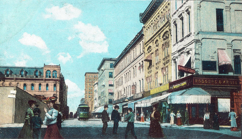
Was it a shortage of ‘smart hats’ or ‘smart men’ that led to the removal of those structures? (ref image 3)
You could probably do something similar with the areas west and east of the 5th/4th/3rd corridor. Louisville had perhaps one of the more aggresive urban renewal/removal programs, akin to what Detroit did along the Detroit River east and west of their downtown.
Here’s a rather lengthy thread on the “West Downtown” urban renewal effort:
http://www.urbanohio.com/forum2/index.php/topic,18720.0.html
Hi have an art print of columbia building 4th & main Louisville ky dated 9/16/66 was wondering who did the watercolor? print is numbered 124/2700 also have one of jefferson marked 124/2500 any information you can pass along would be appreciated Thank’s so much, Ray
PS.I live in Dubuque IA.
<Perhaps your print was drawn by artist Bill Fischer. There is an article in the Courier-Journal about him today. His studio is on Story Avenue in Butchertown. You might give him a call.
Comments are closed.