This small flood marker is barely bigger than a brick, but it’s the most elegant and informative 1937 Flood sign we’ve seen. Located next to the entrance beneath the Colgate Clock in Clarksville, the marker gives all the relevant information. It lists the day of the flood’s peak, its flood stage, and total elevation above sea level. And it’s hardly visible walking down the sidewalk.

That understatement is part of what we like about the sign. The marker went unnoticed on many trips past the Colgate plant until one day it just jumped out. The moment of discovery of such a detail is like holding a secret to the city. While it may be in plain sight, it’s not obvious. Many such details in the city are hiding similarly right in front of our eyes.
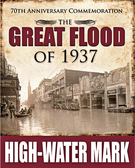
A couple years ago, Metro Louisville installed several 70th Anniversary high water markers around the city. Information in the public realm can keep important topics like the 1937 flood in the community consciousness. The new signs are large and feature a photograph of a flood scene in Louisville. You can even buy your own at the Louisville Store.
Louisville already has a varied array of details throughout the city, both planned and spontaneous, that surprise and delight upon discovery, but we’d like to see more small, “hidden” surprises perhaps revealing historical details or subtle art or just about anything else. Keeping a lookout for the details in the urban environment is one of the greatest benefits of being a pedestrian.
37 Flood High-Water Marks Sign Locations
4th St. and River Rd., at the wharf
4th and York Sts.
Baxter Ave. at Lexington Ave./Liberty St. intersection
E. Broadway, 400 block
E. Broadway at railroad overpass
W. Broadway and 4th St.
W. Broadway and 9th St.
W. Broadway, 4400 block
Brownsboro Rd. at Coral Ave.
Cane Run Rd., 9300 block
Cedar Grove Terrace and Rudd Ave.
Central Ave. near Churchill Downs Gate 1
Dixie Hwy., 14500 block at railroad overpass
Eastern Parkway and 3rd St.
Eastern Parkway, 1100 block
Lexington Rd. and Grinstead Dr.
Lexington Rd. and Payne St.
Northwestern Parkway near Shawnee Golf Clubhouse
Preston and Witherspoon Sts.
Preston Hwy. near Outer Loop
River Rd. at bridge over Beargrass Creek
River Rd. near Tumbleweed
River Rd. and Zorn Ave.
RiverWalk in Portland area
Southwestern Parkway near Shawnee ballfields


It is a little ambiguous on the new sign. My understanding has been the high water mark was the red bar at the bottom. That's just my visual response, though.
My question about the new High-Water Mark signs is: where on the sign is the high water mark? Did the water come up to the bottom of the sign? The top of the red rectangle? I feel like maybe I am missing something so obvious – help!
I have a 1937 Flood Marker. What would you think the value of it would be.