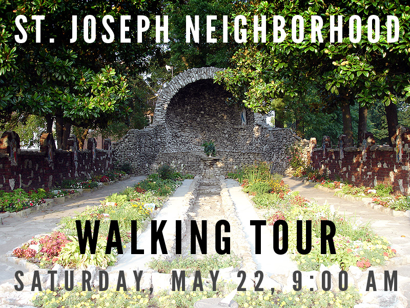
Mark your calendars for the St. Joseph Neighborhood Walking Tour on Saturday, May 22 beginning at 9:00 a.m. at the corner of Bradley Avenue and Atwood Street. Mike Zanone, Vice President of the St. Joseph Area Association, will be leading a free tour of the neighborhood to showcase the last 250 years of neighborhood history as part of National Preservation Month.

The tour will last about 90 minutes and cover about 1.5 miles ending at the Grotto & Garden of Our Lady of Lourdes (pictured above). The Grotto has been restored in recent years and is now a state historic landmark. Since it’s Bike to Work Month, it might be a good idea to ride to the tour, but there is also parking available at the old Stoddard-Johnston School on Bradley Avenue.
Latest posts by Branden Klayko (see all)


I wish I was in Louisville for this tour, I would love to go on it, but I’m in TX (born and raised in Louisville though).
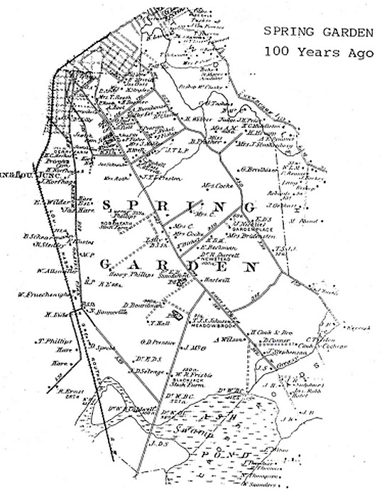
In researching my own family genealogy, I discovered that quite a few of my family members lived in Spring Garden. Several months ago I discovered the same map and attempted to manually overlay it on a modern Google map based on some of the features that appear to still exist. (Some of the rail lines, water ways, etc.)
If anyone is interested, it’s available here:
http://maps.google.com/maps/ms?ie=UTF&msa=0&msid=
105878621944673960736.0004787df5f472bd81679
URL got mangled… it’s try this http://bit.ly/bQFylZ
*SIGH* that link didn’t work for me either… wish I could edit. One last attempt: http://goo.gl/bZqa
Thanks Alan for the map overlay. I was having a little trouble figuring out where everything was in the above map.
Thanks for highlighting this. Sounds interesting
There are 2 easily visible features on the 1879 map that still exist today: the fork in the road where Preston & Shelby Streets split at Clarks Lane (which was the carriage path back to George Rogers Clark’s Mulberry Hill estate), & Bradley Avenue (known as Flat Lick Road back then), which meanders southward from St. Stephen Cemetery before connecting with Locust Lane, which turns eastward & takes you over to Preston Hwy, just south of the Jewish cemetery (also visible on the 1879 map). That ‘L’ intersection where Bradley & Locust connect is right by the present day Norfolk Southern RR line (not shown on the 1879 map because the tracks were not laid through this area until 1888). Some might remember that Bradley used to cross those RR tracks & was a back entrance to the fairgrounds not too many years ago; in the pre-RR days of Spring Garden it meandered southward through the various farms located where the fairgrounds is today. Ashbottom Road (Crittenden Drive), Hess Lane, & the L&N RR tracks that today go through Belknap Campus are also visible on the 1879 map, though you have to blow the map up a bit to see them. I plan to have copies of that map for everyone on the tour, & I can e-mail it to anyone else who’s interested. It’s always interesting to see what features have remained on the landscape over the years, & where some of the street names might have come from. I was fascinated many years ago to find Preston, Bradley & Locust on an 1858 map, & to realize that even back then Bradley was the short-cut that took you out Preston (as it is for many U of L students 150 years later!).
Mike, don’t know if you had a chance to look at the map I made, but I don’t claim that it’s 100% accurate and would definitely appreciate feedback if you see something obviously wrong.
I am interested in getting your e-mailed map. Don’t really want to post my e-mail address in the comments here, but if you click on my name it will take you to my blog. On the right sidebar is a box where you can retrieve my e-mail address using a captcha.
Thanks,
-Alan
I have been looking into family history and know my grandmother and her siblings grew up on a small farm on crittenden dr. near eastern pky.The name would be Theo Brumleve.His wife Katie beckman grew up in Spring Garden according to1880 census data. Her father Frank beckman lived there, no address, with his wife mary.Any information on these familes and thier involvement in the neighborhood would be help full filling in the blanks.