Taxpayers are on the hook for sprawl when impact fees are illegal

In Kentucky, development impact fees are illegal.

What’s an impact fee? According to the American Planning Association (APA), “Impact fees are payments required by local governments of new development for the purpose of providing new or expanded public capital facilities required to serve that development.” In short, they cover the cost of infrastructure required to make a private development work in the first place.

“The fees typically require cash payments in advance of the completion of development,” the APA continues, “are based on a methodology and calculation derived from the cost of the facility and the nature and size of the development, and are used to finance improvements offsite of, but to the benefit of the development.”

These impact fees are predictable and, when implemented, developers know to expect them when they build on greenfield sites. And impact fees are a recommended way to help shape the built environment without imposing more drastic restrictions on development in or out of the city. “As a general matter, impact fees are capitalized into land values, and thus represent an exaction on the incremental value of the land attributable to the higher and better use made possible by the new public facilities,” the APA states.
move-logoImpact fees are also one of the possible transportation funding mechanisms identified in the Move Louisville report that could be used to build a multi-modal transportation network across the city. But to date, we can’t use them—and there’s no telling how much good public money has been spent to support private development of sprawl in terms of road widenings, new public infrastructure such as electricity, water, and sewer lines, and the increased maintenance costs that are associated with the widespread expansion of sprawl farther and farther out into the exurbs.

Which makes us wonder, how has this been going on for so long? The Move Louisville report suggests changing the law to allow impact fees in the future—and we say get a move on. Especially when we hear news that the state of Kentucky is going to pick up the tab on a new interstate highway interchange and service road that would provide access to a private business park in Bullitt County—to the tune of $5 million for a mile of road not including the interchange.
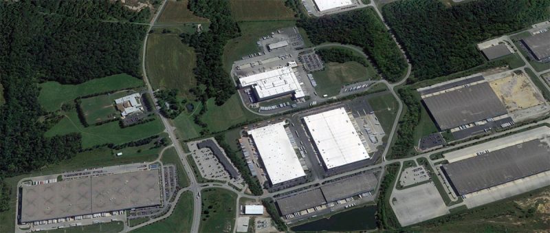
04-impact-fees-cedar-grove-business-parkAccording to a Courier-Journal report, “Money is being lined up to develop a new interchange to and from Interstate-65 and an access road at Shepherdsville in Bullitt County that would lead to the busy Cedar Grove Business Park.”

While many discussions of impact fees would necessarily look toward sprawling residential development, this logistics center, in the works for the past 16 years, provides another interesting example. Let’s take a look.
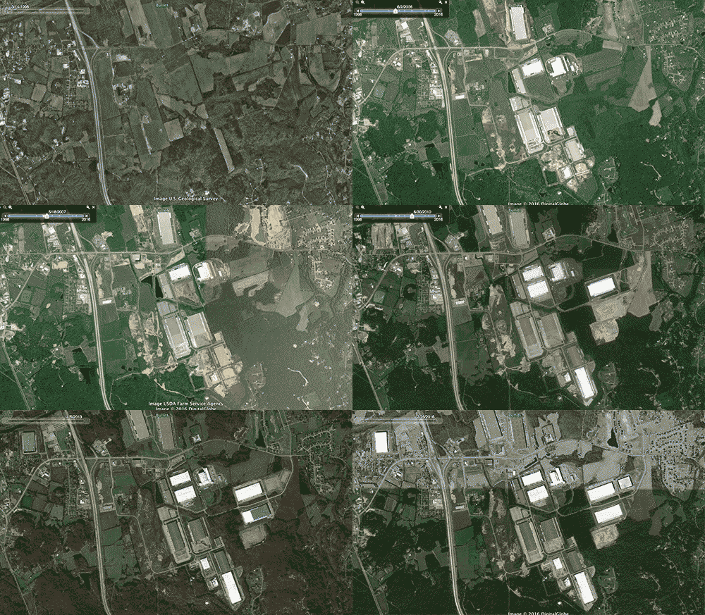
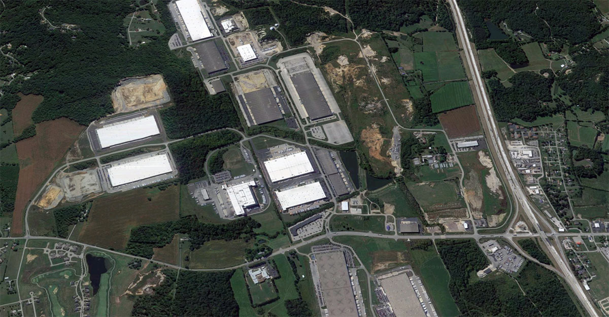
The changing landscape of a single private development over 16 years. (Courtesy Google / Montage by Broken Sidewalk)

The first phase of Cedar Grove Business Park, developed by brothers Patrick and Jesse Flynn of the Salt River Development Company, Inc. (The Flynns now operate Louisville-based Flynn Group Commercial Real Estate & Development). It comprised 420 acres of pristine rural and forested land just southeast of Shepherdsville, Kentucky, across the Salt River in Bullitt County. Of that initial phase, 350 acres were to be built up as light industrial space in the form of enormous warehouses, 50 acres went toward a strip mall and requisite parking lot, and the remaining 20 acres was conserved, according to a May 2000 Courier-Journal account.

Downtown Louisville, left, and Cedar Grove Business Park, right, at the same scale. (Courtesy Google)

It’s reasonable to believe that developing such a large tract of land into industrial space served by tractor trailers off a small country road might bring unintended infrastructural consequences. And it would follow that the private developer should bear responsibility for the impact such a development will have on its surroundings.

Another zoomed-in comparison showing just how big these warehouses are. (Courtesy Google)

But that’s not what typically happens. In this case, back in 2000, the state put $3 million in public funding toward widening Cedar Grove Road from two to three lanes. And of course after 16 years of growth on the same tract of land by the same developer, Shepherdsville is on the hook for another $5 million in funding for a mile of new road (not including a planned interchange) with plans in the KIPDA Transportation Improvement Program (TIP) to spend $9 million to widen another .8 mile portion of Cedar Grove Road again to five lanes by 2017 (of course with no pedestrian or bike facilities included in the project). (The KIPDA TIP is a short-term document outlining transportation priorities in the Louisville metropolitan region.)

Back in May 2000 when construction was about to begin on the complex’s first building, a distribution center for home-decor company Illuminations covering about 400,000 square feet on a 25-acre lot. The Kentucky Economic Development Finance Authority (KEDFA) chipped in $7 million in tax subsidies toward the warehouse, which was expected to create around 150 jobs paying in the neighborhood of $25,000. Illuminations was acquired by Yankee Candle Company in 2006 and was shut down by 2008. But while the company never had any Kentucky stores, it’s distribution center was still a hot commodity and speculative development boomed at Cedar Grove with its straight shot up Interstate 65 to the UPS Worldport and beyond.

(First a little napkin math: with the initial KEDFA subsidy of $7 million and the KYTC investment of $3 million, the state was already invested $10 million. Illuminations was projected to create 150 jobs at $25,000, or about $3.75 million in payroll, generating roughly $337,500 in local and state taxes, which lasted eight years before going out of business, totalling $2.7 million. Adding in rough corporate and property tax, the state likely brought in a little more than $5 million in taxes over those eight years of Illuminations.)
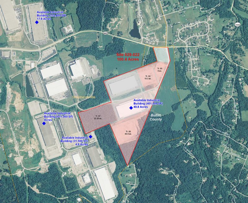
The third phase of Cedar Grove.

Back then, and probably still today, Shepherdsville thought it had struck gold. “The important thing for Bullitt County is that this is the one that starts the rush,” Shepherdsville Mayor Joe Sohm told the C-J‘s Jason Riley in 2000. “Once investors see this $20 million facility go up, they are going to want to be a part of it and will realize this is where they want to relocate.” And in some respects it really did hit greenfield gold. Today, the industrial complex employs 8,500 full-time and 4,000 seasonal workers, according to the Courier-Journal. And while logistics jobs are certainly not the best paying or skilled jobs out there, it’s still easy to point to them as jobs.

Fast forward to today and we’re in the third phase of development at Cedar Grove, which has already built space for the likes of Best Buy and Gordon Food Services. The business park is still going strong with some 150-acres more to develop, listed at $150,000–$450,000 per acre.

But there’s plenty of empty warehouse space as well. The C-J cited the KEDFA as stating Cedar Grove today includes over a million square feet of unoccupied space in need of tenants. And by now it’s safe to assume if that space is filled, there will be more impact than ever.

But with millions already spent and currently lined up for road improvements that will directly benefit a single private development, it seems impact fees could have helped offset some of those costs in the first place. We should have been able to expect that such a large-scale development over a decade would, as KEDFA files state, cause “significant delays for employees or residents in getting in or out of this area, which can be a major safety concern.”

Let’s legalize impact fees in Kentucky sooner rather than later.

Gallery: Pawsitively beautiful design on display at first Barkitecture Louisville

0

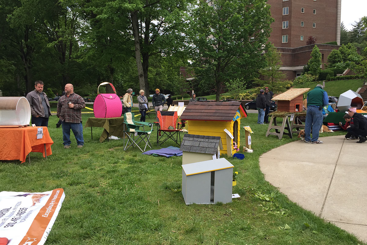
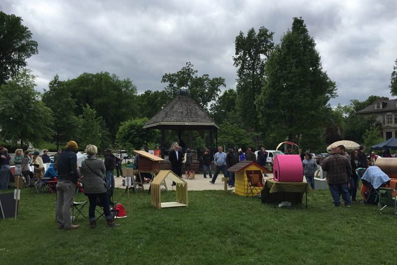
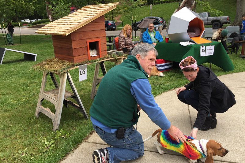
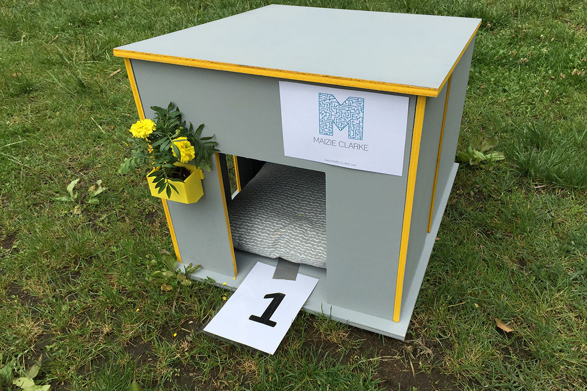
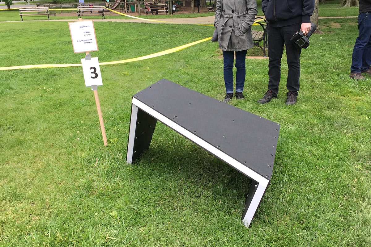
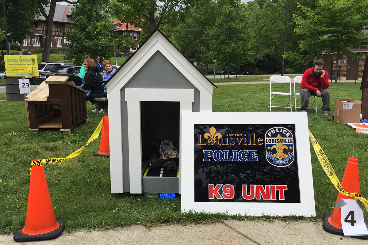
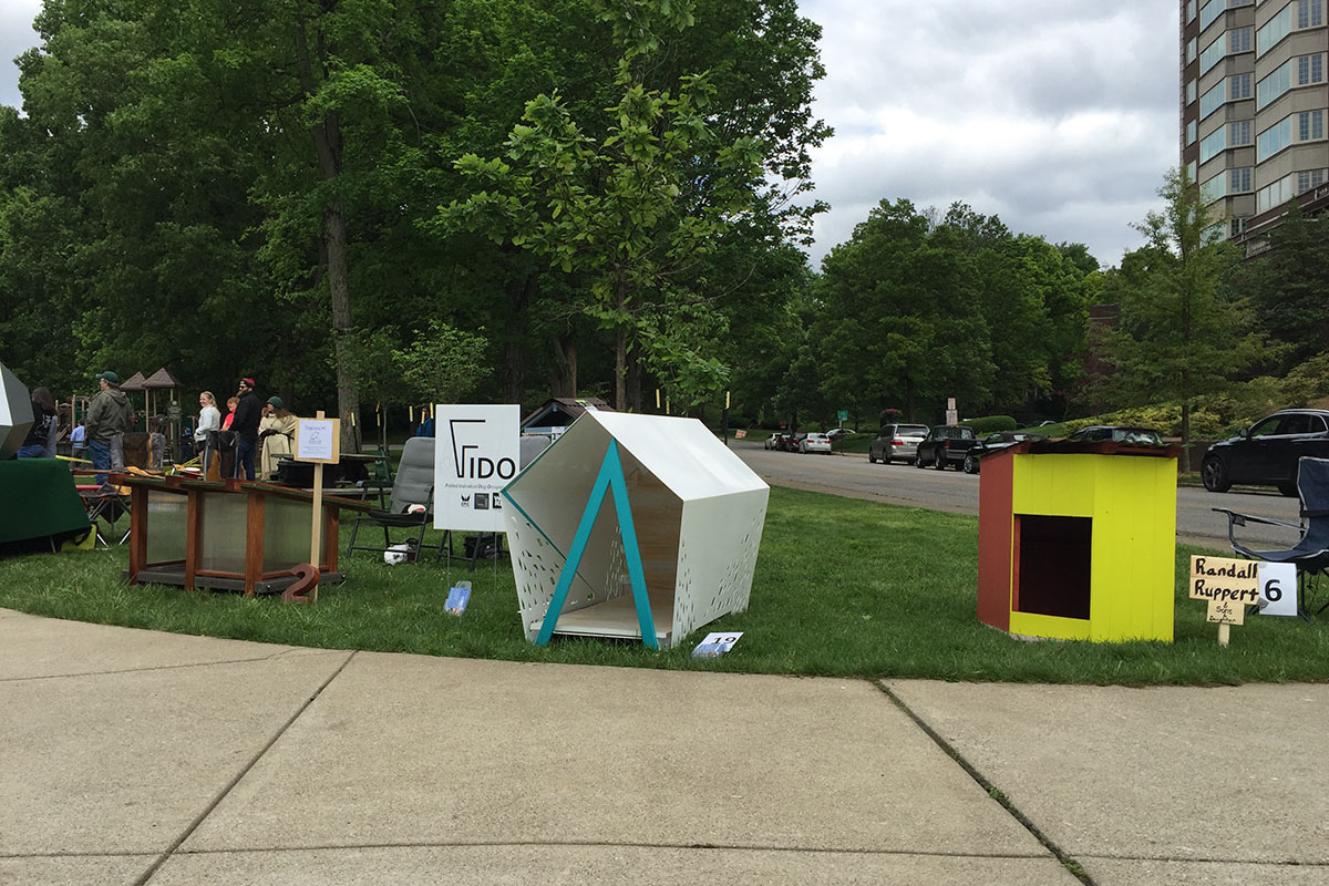
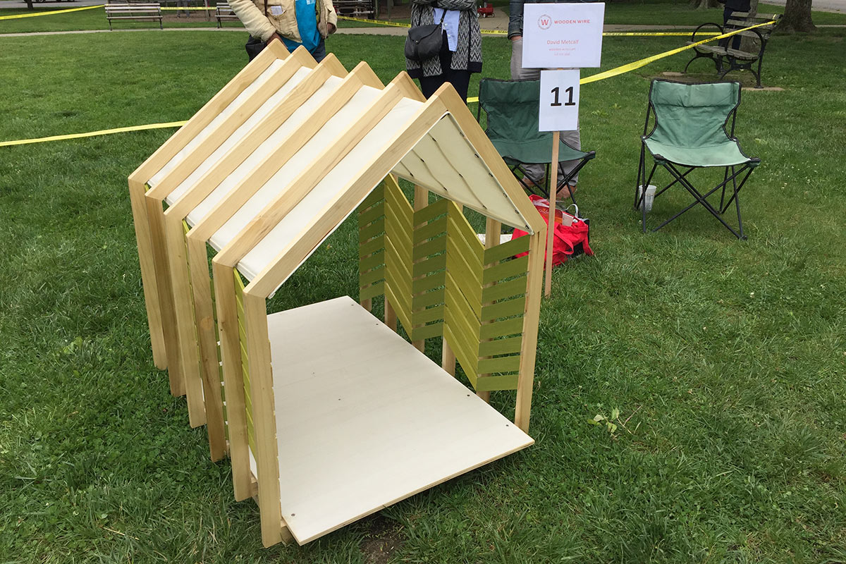
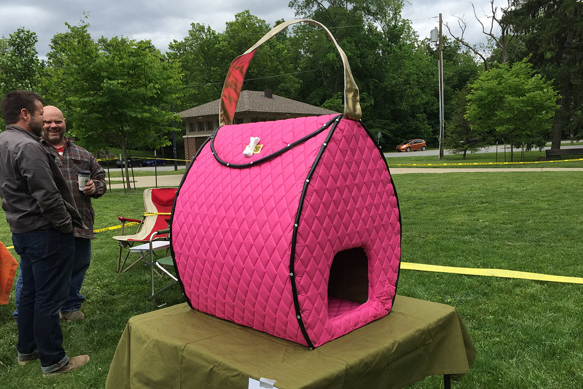
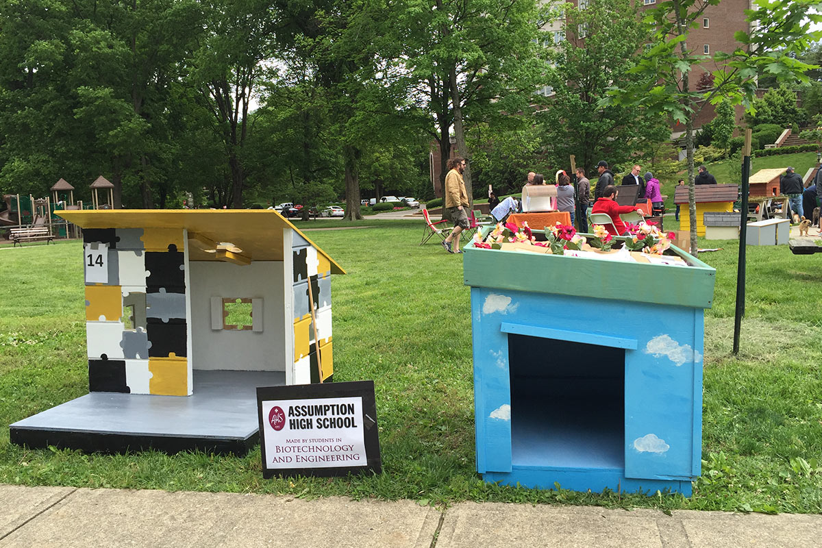
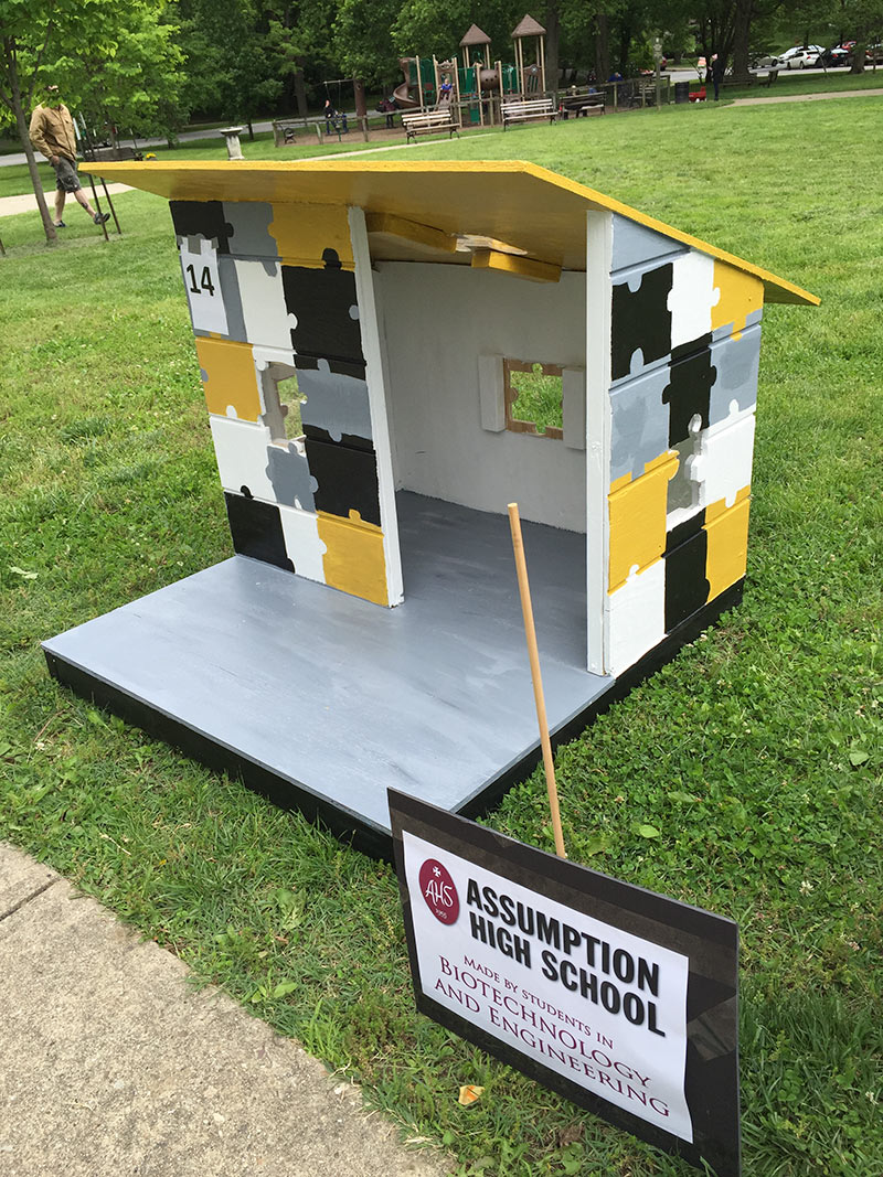
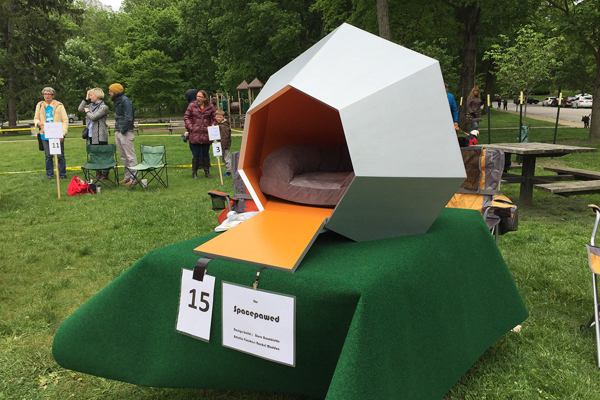
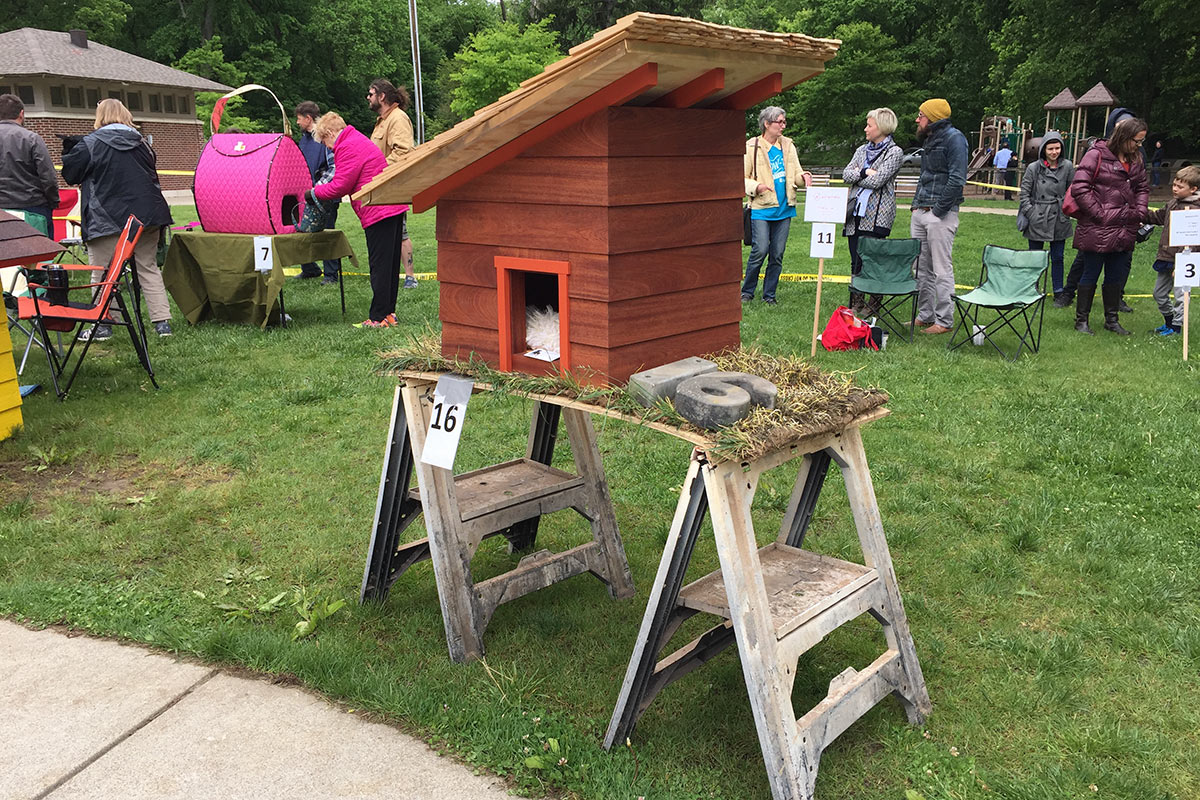
Over the weekend, designers, architects, and a cadre or pet-friendly people showed off a series of dog houses ranging from a futuristic space pod (or “pawed”) to a very pink purse. The first ever Barkitecture Louisville, organized by Louisville Metro Animal Services (LMAS), was held in a very chilly Willow Park in the Cherokee Triangle on Saturday, May 14. Over 20 unique dog houses were auctioned off to benefit homeless animals in Louisville.

Barkitecture Louisville 2016. (Broken Sidewalk)

“Barkitecture 2016 is an event designed to raise awareness of the plight of homeless animals in our community through the innovative design of living structures for dogs,” organizers wrote on its Facebook page. “This is the premiere event, but the goal is to host an annual event that will eventually expand to living and play structures for cats as well.”

Barkitecture Louisville 2016. (Broken Sidewalk)

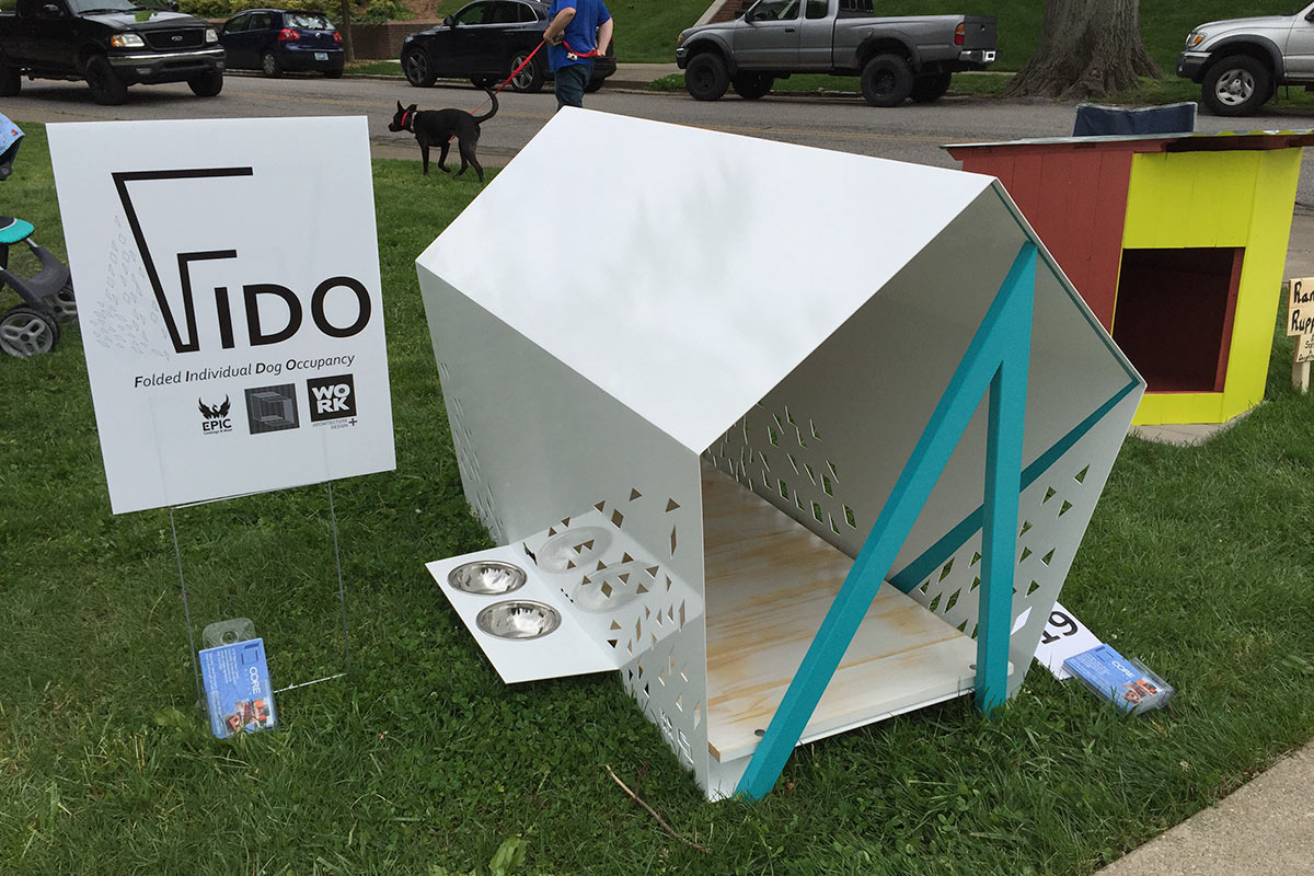
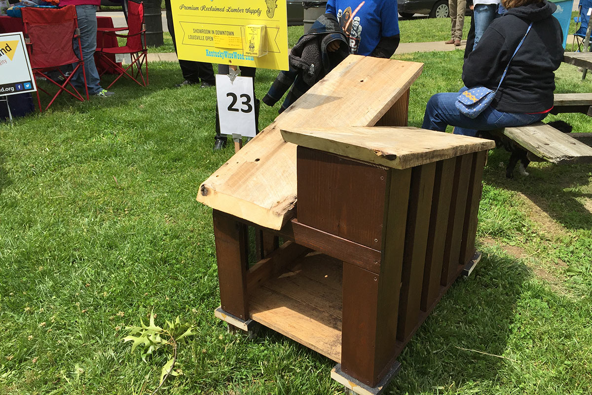
Entries were submitted by professional designers and amateurs alike, including WORK Architecture + Design, Kentucky Wisewood, Birdsquare Carpentry, Assumption High School, the K-9 Unit from the Louisville Metro Police Department, and the Buechel Fire Department, among others.

Check out the designer dog houses here:

Four special awards were designated during the event, including Mayor’s Choice, Director’s Choice, People’s Choice, and Best in Show. The pink handbag by Keith Stone took home Director’s Choice while Best in Show went to the metal house by WORK and Core Design’s FIDO, or Folded Individual Dog Occupancy. (Bark at us in the comments if you know who the other winners are and we’ll add them in.)

Jessica Montgomery, director of LMAS, had previously said in a press release that funds would help open a new animal shelter. She plans to make Barkitecture an annual event in the city. Better get started sketching your ideas for Barkitecture Louisville 2017!
[All images by Broken Sidewalk.]

Woman killed by motorist in New Albany

Chloe Allen, 83, is dead after being struck by a motorist in downtown New Albany over the weekend.

The collision took place at Spring Street and Vincennes Street in the Southern Indiana city at 2:00p.m. on Friday, May 13. Allen was crossing the street in the crosswalk when struck by Terra Lawrence, 42, who failed to observe Allen in the street. Lawrence was driving a 2013 Dodge Ram truck and turning left onto Spring from Vincennes, according to police reports. Allen died after being transported to University Hospital in Louisville.

02-pedestrian-killed-new-albany-spring-vincennesThe incident was reported by the WLKY, WDRB, WHAS11, and the News & Tribune.

While a great deal of information was rendered by an investigation, it’s unfortunate that for the sake of a catchy acronym, the unit is labeled the Floyd County Combined Accident Reconstruction Team. As we have discussed many times, crashes and accidents are very different things and should not be mislabeled.

All of the local news reported that the pedestrian was struck “by a vehicle” rather than the driver of that vehicle. Cars and trucks don’t drive themselves—people crash them into things. Both WDRB and WHAS11 labeled the crash an accident, with WHAS11 going as far as to include a large “Accident” graphic complete with cracked windshield illustrating its report.

01-pedestrian-killed-new-albany-spring-vincennesEach report duly noted a police statement that said speed nor alcohol are suspected in the crash. From a witness account, the motorist simply was not paying attention when turning, although none of the reports cited that the driver was errant or that charges were due.

New Albany has really let itself go at this intersection, allowing an anti-urban Walgreens, White Castle, and Rally’s to be built behind moats of parking that make walking unsafe. Low visibility crosswalks are clearly worn away by vehicle tires, compounding the walkability issue.

But the city should have seen this one coming. Back in 2014, urban planner Jeff Speck issued a report on the streets of downtown New Albany in which he identified Vincennes Street as “clearly oversized for its traffic.” Speck wrote of the three-lane street: “At no point do car accounts approach the number that would require a third lane. This condition is supported by the fact that the third lane, rather then (sic) being striped for left turns, merely provides northbound redundancy with no southbound counterpart.” He recommended a reconfiguration to improve safety.

Speck had also recommended making Spring Street west of here, among other local streets, a two-way thoroughfare (Spring is two-way to the east). He labeled Spring Street’s design as it moved from a grid to a highway layout as dangerous:

This four-lane section of Spring Street also feels very much like a highway, and experiences a large amount of speeding while creating an environment that is dangerous to walk along or live near. The ideal solution for this street would be to calm the traffic and create an environment of greater safety, without significantly changing its capacity, beyond perhaps a slight lowering of volume to match current demand.

Further, KIPDA has ranked two segments of Spring Street in New Albany—including this intersection—as among the most crash-prone in all of Southern Indiana, spurring plans for design changes on the street. Most of those changes call for lights making driving through the area easier, but buffered bike lanes are also part of the plan, which will be under construction this summer. Even these minor changes were challenged by area trucking companies in court, citing they make driving big rigs through the area more difficult.
New Albany has a long way to go on street safety.

[All images courtesy Google.]

For the record, the feds don’t require streets to speed car traffic

0
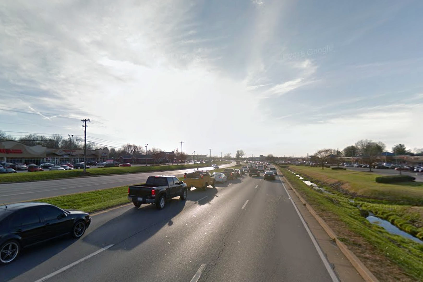
Hurstbourne Parkway in Louisville. (Courtesy Google)

When advocating for a street redesign that will take some space away from cars, it’s common to run up against this classic brush-off from your local transportation agency: The federal government won’t allow it.

Well, the Federal Highway Administration recently went on the record to shoot down that excuse. The FHWA doesn’t require states and local governments to speed cars through streets, even ones classified as part of the National Highway System. Stephen Lee Davis at Transportation for America published this excerpt of a memo from FHWA regarding Level of Service, or LOS, a measure of congestion:

…FHWA does not have regulations or policies that require specific minimum LOS values for projects on the NHS. [National Highway System] The recommended values in the Green Book are regarded by FHWA as guidance only. Traffic forecasts are just one factor to consider when planning and designing projects. Agencies should set expectations for operational performance based on existing and projected traffic conditions, current and proposed land use, context, and agency transportation planning goals, and should also take into account the input of a wide cross section of project stakeholders.

“This might seem like a minor clarification,” Davis writes, “but FHWA just gave the green light to localities that want to implement a complete streets approach. By making clear that there is zero federal requirement to use level of service (and that there never has been), FHWA is implying that transportation agencies should consider more than just traffic speeds when planning street projects.”

[Editor’s Note: This article has been cross-posted from Streetsblog. Top image courtesy Google.]

Attend one of four Move Louisville Public Open Houses to help change our streets

Your help is needed! As you know, we’re is in the middle of a public comment period for the recently released Move Louisville draft transportation plan that will guide how we design and build our streets over the next two decades. And your opinion really will matter to make a safer, more walkable, bikeable Louisville.

Metro Louisville has now set the dates for four public open houses to discuss the plan—and you can voice your opinions in favor of better street design all throughout the city. But act fast, the first meeting is tonight, Monday, May 16. Here’s the full line-up:

  • Monday, May 16, 6:00p.m.: Southwest Government Center, 7219 Dixie Highway
  • Tuesday, May 17, 6:00p.m.: TARC Headquarters, 1000 West Broadway
  • Monday, May 23, 6:00p.m.: Newburg Library, 4800 Exeter Avenue
  • Tuesday, May 24, 6:00p.m: Crescent Hill Library, 2732 Frankfort Avenue
TARC, Public Works, and Advanced Planning team members will be on hand to answer questions and to hear input. Each public meeting with consist of a presentation covering the MOVE Louisville plan, then breakout sessions for a more specific exchange of ideas.

At each public open house, officials from Metro Louisville Public Works, the Transit Authority of River City (TARC), and Advanced Planning staff will be on hand to answer questions about the Move Louisville Plan. You can download the full 100-page Move Louisville plan here or read through Broken Sidewalk coverage of the plan here.

If you can’t attend a meeting in person, public comment is also being accepted via this online form.

For more information about the meetings, email Jeff O’Brien, Deputy Director of Advanced Planning, or call Louisville Forward, the city’s economic development agency, at 502-574-4140. Find a transit route to the meetings via TARC’s transit directions tool in the upper right corner.

[Top image by frankieleon / Flickr.]

Making Place: How Louisville is using tactical urbanism to rebuild civic life

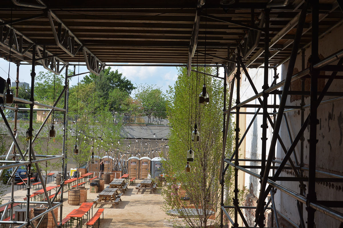
“You can have a space, and even though it’s vacant at the time, it can still have a life. It’s still part of the life–history of this particular parcel.”
—Marianne Zickuhr

kyplace-logoDowntown Louisville has a problem with vacant lots. With an unrelenting focus on automobile accommodation, developers have traditionally favored surface parking as a means of ensuring easy economic growth and prosperity. Instead, what we got were eroded streetscapes, a scorching heat island effect, and conditions that have been dangerous for pedestrians trying to navigate the city.

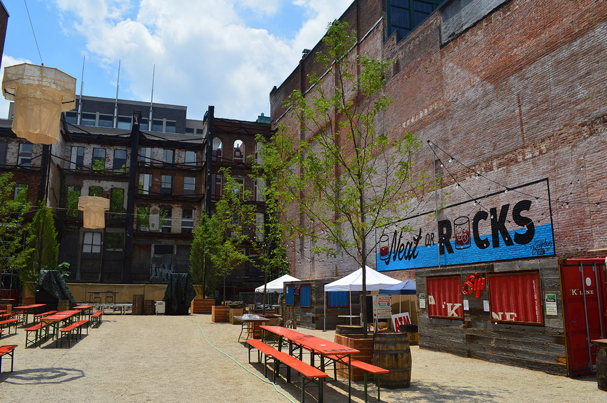
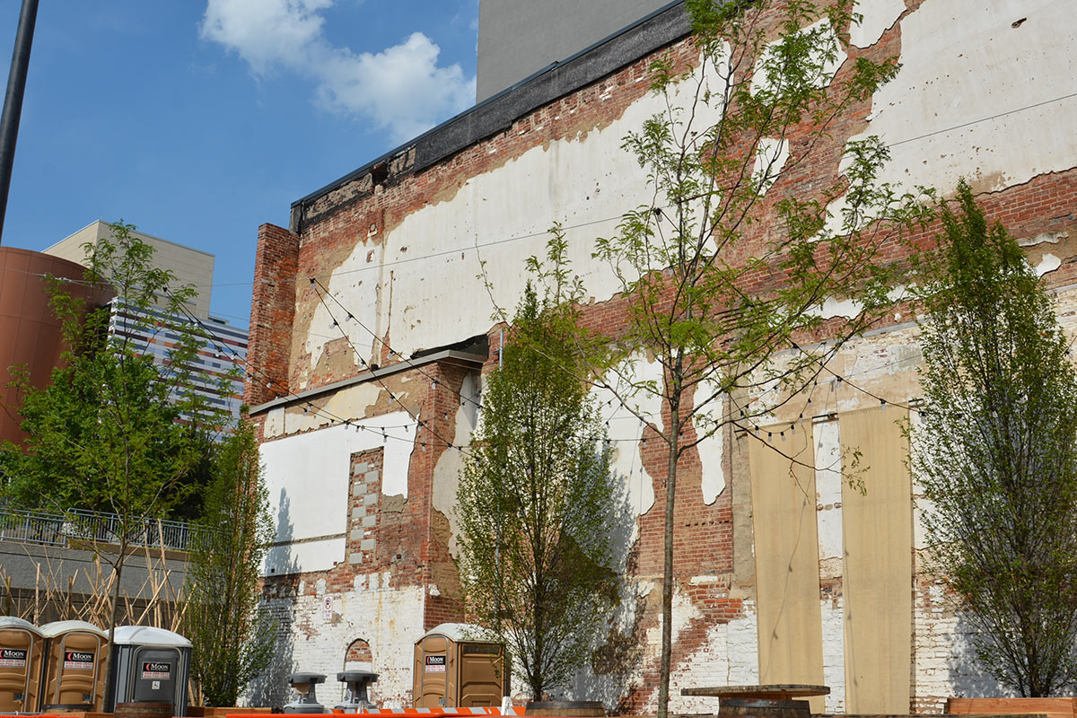
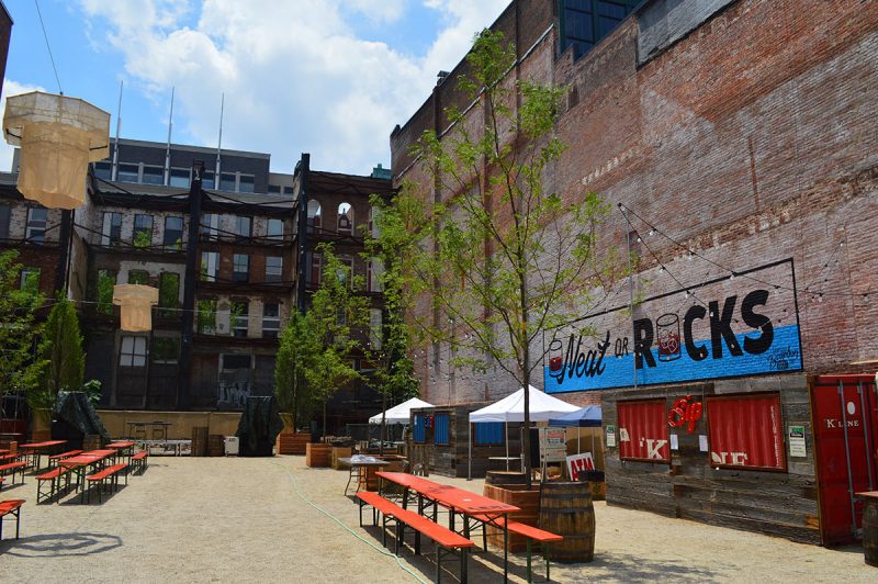
Good news is that in recent years, there has been a noticeable shift towards rebuilding density and walkability. In 2014, Louisville-based City Collaborative launched ReSurfaced – an initiative to create temporary “pop up plazas” on vacant lots across the city. Since making its debut on Main Street, the project has helped area residents to rethink the possible uses of abandoned spaces.

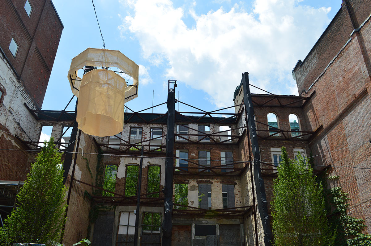
Resurfaced, Bourbon Edition. (Elizabeth Hayden)

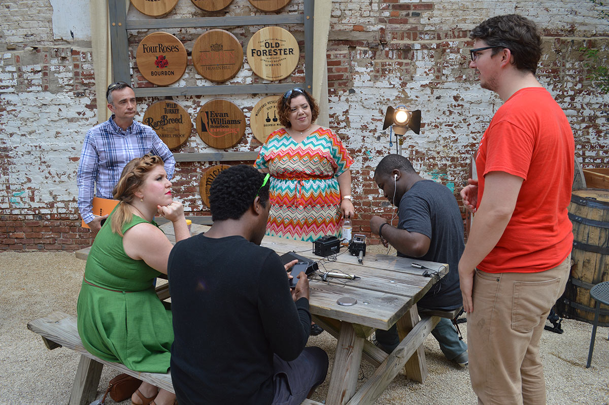
For the second installment of KY Place, we spoke with four individuals about land use policies in Louisville and if our current trajectory of urban development will bring the kind of connectivity and inclusion our city desperately needs. With ReSurfaced serving as the backdrop for this episode, we sought to explore the relationship between vacant lots and transportation, and how tactical urbanism can serve as a catalyst to bring about large-scale improvements to the city.

Left to right: Marianne Zickuhr; Jaison Gardner; Jennifer Chappell; Patrick Henry. (Elizabeth Hayden)

Featuring: Marianne Zickuhr (Founding executive director, Preservation Louisville), Patrick Henry (Landscape Architect, Patrick Henry Landscape Architects), Jennifer Chappell (Creator, Three Points Beautification Project), and Jaison Gardner (Co-host, WFPL’s “Strange Fruit”)

Report lists a short-and-sweet transportation to-do list for the next president

0

How can the next president improve American transportation policy?

Without wading into the spectacle that is the election, Beth Osborne, a former top official at the United States Department of Transportation (U.S. DOT) who’s now a vice president at Transportation for America, lays out a presidential agenda for transportation reform at The Century Foundation.

National transportation policy hasn’t fundamentally changed since the Eisenhower administration, and Osborne says the next president should take a fresh approach. Here are the priorities she lays out.


04-new-transportation-futures-century-foundation1. Fix It First

Too many state DOTs are splurging on fancy new highway flyovers while their roads and bridges crumble. Osborne says the next president should demand they “fix it first.” The federal government should continue sending most federal transportation funds to states, but those funds should be restricted to maintenance.

The current system enables extravagant waste. Texas, for instance, recently borrowed $840 million in federally-backed TIFIA loans to build the $5.2 billion Grand Parkway — a third outerbelt for Houston. Meanwhile, the state is allowing 83 miles of rural road to return to gravel because it doesn’t have enough money to maintain them.

While they’re repairing infrastructure, states and cities should be considering whether they really want to hang on to their 20th Century infrastructure at all, Osborne says. When it came time for Rochester to rebuild its Inner Loop Highway — often described as a “moat” around the city’s downtown — the city got smarter. Instead of replacing it, parts of the highway are being filled in, opening up land for development.

(Courtesy City of Rochester)

2. Ditch the Highways-vs.-Transit Funding Paradigm

The next president should do away with discrete funding pots for highways, transit, and (to a much smaller degree) biking and walking. The system should simply reward good projects, period, Osborne says.

Supporters of transit, biking, and walking might worry that this new system will result in lower levels of investment in those modes, since setting aside money for those modes was supposed to establish “a floor” for investment. Osborne argues that the current pots of money have in fact “become ceilings” and overhauling today’s funding structure would not tip the scales in favor of highways.

She also recommends “devolving” more federal funding to the local level, where transportation investments can be better coordinated with land use — so regions don’t end up wasting a bunch of money.

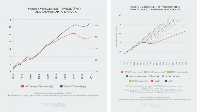
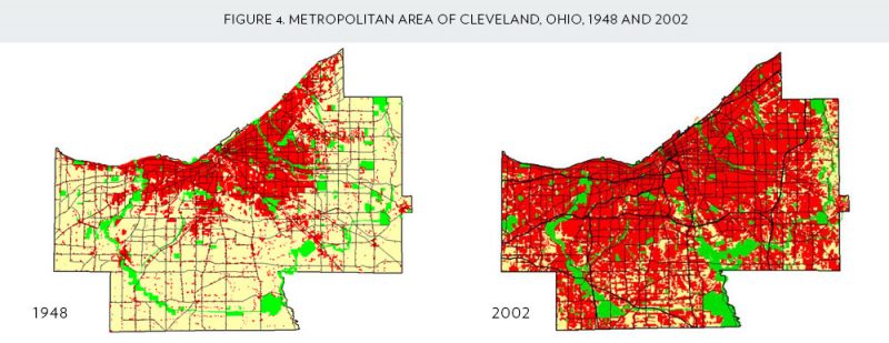
03-new-transportation-futures-century-foundationHere’s an example of the waste and dysfunction that can result when states and regions fail to coordinate land use and transportation investments: Greater Cleveland sprawled across five counties between 1948 and 2002, but its population remained roughly the same. Now the region is responsible for maintaining twice as many road miles, with the same population. Meanwhile, congestion and travel times actually increased.

3. Reward Performance

Instead of sending states what amounts to blank checks to spend however they wish, the next president should establish some quality control.

Osborne says agencies should have to make compelling arguments to receive federal support for their expansion projects. For example, if a state wants to receive funding to widen a highway, it would have to demonstrate that it can maintain its existing system.

The TIGER program, launched by the Obama administration, demonstrates how merit-based funding can help improve the quality of what gets built, Osborne says. “Knowing the competition is fierce likewise encourages applicants to find the lowest cost solution or to find as much local, state and/or private funds to match TIGER funds.”

The next president should also insist that the federal government assess how state and local governments put federal funds to use. Are they achieving goals like a safer, greener, more efficient transportation system, or are they pouring money into highway boondoggles? U.S. DOT is moving in that direction, slowly, by requiring states to track certain outcomes, like pedestrian and cyclist fatalities. But the next president could go farther, Osborne says. It’s not enough to have states set goals and measure progress. There should be concrete incentives to do better, and the federal government should reward good performance.

4. Make Users Pay

Finally, Osborne says the next president should stop bailing out the nation’s transportation program with general fund revenues and accounting tricks. A higher gas tax, expanding the use of tolling, instituting a vehicle miles traveled fee, or harnessing the power of congestion pricing would all be preferable to the status quo of endless gimmickry.

You can read the full report here.

[Editor’s Note: This article has been cross-posted from Streetsblog USA. All images courtesy Transportation for America / The Century Foundation.]

Anatomy of a Protected Bike Lane: Infographic shows overwhelming benefits of good street design

Have you ever pedaled along a real Protected Bike Lane? A bike lane separated from the stress of fast-paced streets filled with speeding motorists that gives cyclists of all ages the security and safety to travel in a way that makes them feel comfortable? There’s no comparison between a standard bike lane and their protected counterparts.

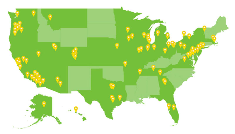
07-protected-bike-land-infographic-peopleforbikesLouisville still doesn’t have a true Protected Bike Lane. And Kentucky is one of 16 states without any such bike facilities. According to a new infographic from PeopleForBikes kicking off that organization’s National Protected Bike Lane Week, some 82 cities in 34 states already boast Protected Bike Lanes and the boost in cycling numbers they bring with them.

Let’s walk through some of the data collected by PeopleForBikes in its infographic to learn a little more about what makes Protected Bike Lanes so special. And, of course, don’t forget to make a public comment to Move Louisville saying you’d like to see Protected Bike Lanes built in our fair city (you’ve got to scroll all the way down for the form).


06-protected-bike-land-infographic-peopleforbikes

First of all, it’s important to remember that a Protected Bike Lane is fundamentally different than the bike lanes we typically see in Louisville. While there’s a wide array of ways to design and build a Protected Bike Lane, they all have one thing in common: they use some kind of physical divider to separate the bike lane from car traffic and from the sidewalk.

The best Protected Bike Lanes, of course, offer the most separation from the street, whether with raised planters, a parking lane, or even just a sturdy concrete curb. Check out some great examples from around the country here and here and here.

While Louisville’s best bike lanes try to offer as much of a buffer from the stresses of traffic, the infamous “door zone,” and more, they’re still limited by their design, especially along many state roads like this example along Westport Road.

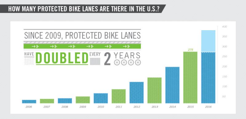
03-protected-bike-land-infographic-peopleforbikesAs mentioned above, Protected Bike Lanes are growing up across the country, with residents of 82 cities in 34 states already enjoying their benefits of safer, stress-free bicycling.

According to PeopleForBikes, Protected Bike Lanes have doubled every two years. And with cities like Louisville with so much potential for implementing these kinds of designs, there’s plenty of room for growth.

09-protected-bike-land-infographic-peopleforbikes

11-protected-bike-land-infographic-peopleforbikesBut beyond simply making bicycling more pleasant, data show Protected Bike Lanes are really effective at building a booming bicycling community and getting people out on two wheels. That’s something that could help us achieve the goals set out under the Move Louisville plan.

According to PeopleForBikes, new Protected Bike Lanes built in other cities boosted bike counts by an average of 75 percent in the first year alone. Big winners included Austin’s Rio Grande lane that boosted counts 126 percent and Chicago’s Dearborn lane, which sent bike counts soaring. And that means as more people see others using the bike lanes, more are likely to do so themselves.

12-protected-bike-land-infographic-peopleforbikesAs I began above, one of the greatest strengths of a Protected Bike Lane is its ability to make riding a bike easy and comfortable—and that’s what it’s going to take to build upon Louisville’s already growing bike network. According to PeopleForBikes, a well-designed Protected Bike Lane designed with a landscaped buffer to traffic is seven times more likely to attract cyclists than a conventional striped lane.

13-protected-bike-land-infographic-peopleforbikesThat comfort—combined with a meaningful design that separates lanes from traffic—easily translates into increased safety associated with Protected Bike Lanes. According to PeopleForBikes’s research, installing a Protected Bike Lane on a street cuts injury risk to bikes by 28 percent.

14-protected-bike-land-infographic-peopleforbikesBut also according to PeopleForBikes, Protected Bike Lanes benefit everyone on the street—bicyclists, pedestrians, and even motorists. “Protected Bike Lanes bring order to the street,” the infographic reads, “chilling everyone out.” Among non-biking adults, a 2013 survey shows that 79 percent preferred driving on a street with a protected bike lane versus a 68 percent preferring a street with no bike markings.

15-protected-bike-land-infographic-peopleforbikesThere’s more, too. Protected Bike Lanes are correlated with spikes in economic growth. The PeopleForBikes infographic points to the wildly successful Indianapolis Cultural Trail that opened in 2010. After that bike path opened, the number of building permits of issued in the surrounding Zip Codes rose 112 percent as a share of citywide permits.

A similar study from Salt Lake City showed that along a new Protected Bike Lane, sales through a commercial strip rose 8.8 percent compared to just 7 percent citywide.

Among the theories that go into this type of build it and they will come infrastructure is the physical investment in the streetscape they bring, helping to further beautify a place for all people. A typical painted stripe of a bike lane doesn’t instill confidence that a high-quality bike lane will continue to be located there. It can fade, be rerouted easily and any investment a shopkeeper wants to make could go down the drain with it.

With more significant infrastructure investment (we typically think light rail, street cars, etc.), such as concrete curbs, full streetscapes, or planted buffers between traffic and bike lanes, local investors feel more comfortable investing their own funds into a place.

16-protected-bike-land-infographic-peopleforbikesBack to safety, Protected Bike Lanes continue to promote safe streets for everyone. As we’ve discussed here before, sidewalk biking is a symptom of the larger issue of bike safety in cities. It doesn’t make it right, and we’re certainly not encouraging sidewalk biking, but we need to figure out what’s keeping bikers on the sidewalk and off the streets.

“People biking on sidewalks are trying to ride on the Protected Bike Lane that isn’t there,” PeopleForBikes’s infographics reads. “Adding a Protected Bike Lane immediately cuts sidewalk riding by 56 percent.”

In Hawaii and across the country, installing Protected Bike Lanes has helped solve problems of bicycle riding on sidewalks in very elegant manner.

17-protected-bike-land-infographic-peopleforbikes

Besides, Protected Bike Lanes add another layer of safety for pedestrians trying to cross the street. In New York City, the infographic points out, “pedestrian injuries plummeted on streets where [Protected Bike Lanes] were installed in NYC.” It’s all about design, and these bike lanes help organize a street around safety.

Here in Louisville, where our 20-year transportation plan, Move Louisville is trying to remake dangerous state arterials like Dixie Highway, Preston Highway, and others, Protected Bike Lanes offer one distinctly successful way in which to reorganize our streets, making them safer places for cyclists, pedestrians, and motorists.

For sure, just adding a Protected Bike Lane to a street and calling it a day is never the right solution—attention to detail, targeted investment, and good design are all needed to make Louisville’s streets safer. Let’s get busy with Protected Bike Lanes.

How different transportation modes can increase limited street capacity

0
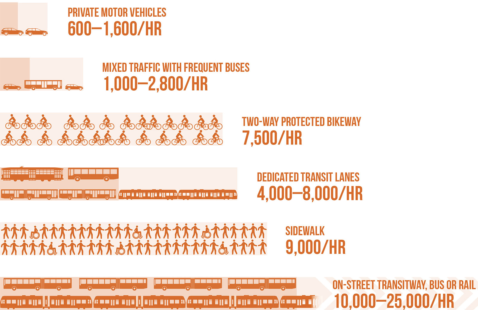
Here’s how many people a single traffic lane can carry “with normal operations,” according to the National Association of City Transportation Officials.

How can cities make more efficient use of street space, so more people can get where they want to go?

This graphic from the new NACTO Transit Street Design Guide provides a great visual answer. (Hat tip to Sandy Johnston for plucking it out.) It shows how the capacity of a single lane of traffic varies according to the mode of travel it’s designed for.

Dedicating street space to transit, cycling, or walking is almost always a tenacious fight, opposed by people who insist that streets are for cars. But unless cities make room for pedestrians, cyclists, and transit riders, there’s no room for them to grow beyond a certain point.

NACTO writes:

While street performance is conventionally measured based on vehicle traffic throughput and speed, measuring the number of people moved on a street — its person throughput and capacity — presents a more complete picture of how a city’s residents and visitors get around. Whether making daily commutes or discretionary trips, city residents will choose the mode that is reliable, convenient, and comfortable.

Transit has the highest capacity for moving people in a constrained space. Where a single travel lane of private vehicle traffic on an urban street might move 600 to 1,600 people per hour (assuming one to two passengers per vehicle and 600 to 800 vehicles per hour), a dedicated bus lane can carry up to 8,000 passengers per hour. A transitway lane can serve up to 25,000 people per hour per travel direction.

Of course, it usually takes more than changing a single street to fully realize these benefits. A bike lane won’t reach its potential if it’s not part of a cohesive network of safe streets for biking, and a transit lane won’t be useful to many people if it doesn’t connect them to walkable destinations.

But this graphic is a useful tool to communicate how sidewalks, bike lanes, and transitways are essential for growing cities looking to move more people on their streets without the costs and dangers inherent in widening roads.

[Editor’s Note: This article has been cross-posted from Streetsblog USA. Top image courtesy NACTO.]