Jeffersonville Planning Commission compromises on parkfront retail space

0
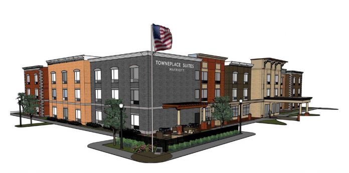
Rendering of the Jeffersonville TownPlace Suites sans retail. (Courtesy ARC / Dora Hospitality)

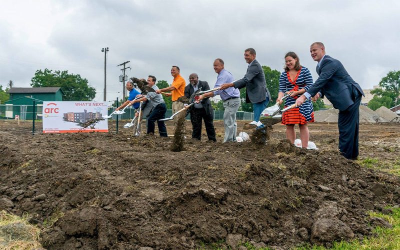
When a $15 million, faux-historic hotel broke ground in Jeffersonville, Indiana, in mid-July, developers surprised city officials by eliminating 1,200 square feet of corner retail space they had promised as a condition of the project’s approval. Nathan Pruitt, Jeffersonville’s Director of Zoning & Planning, caught the missing retail while going over the plans one last time before issuing a building permit.

The ceremonial groundbreaking went forward and speeches were given, but Pruitt sent the 93-room Marriott Towneplace Suites back to the city’s Planning Commission for a July 26 hearing to decide what to do about the retail. That meeting produced a compromise: the retail will go inside the hotel’s lobby, but there won’t be any entrances from the street.

City officials and developers ceremoniously broke ground on the hotel in mid July. (Courtesy City of Jeffersonville)

“The Planning Department and the Commission hopes that developers who invest in our community present final, vested, and accurate plans in their applications moving forward,” Pruitt told Broken Sidewalk. “We do have four moved homes on Pearl Street that are coming online with new food and beverages businesses soon. So this loss is mitigated by those new additions.

The 98-room hotel is being developed by ARC with hotel partner Dora Hotel Company. The building covers some 56,000 square feet over three floors. The site, a former elementary school turned boarding house, sits across from Big Four Station Park and the foot of the Big Four Bridge. The project is expected to open by April 2017.

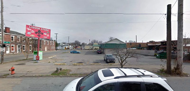
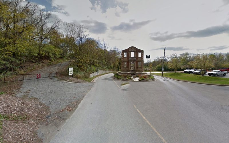
The hotel site before the former Rose Hill Elementary School was demolished. (Via Google)

“ARC attorney Jake Elder said Marriott required developers move retail inside,” Elizabeth Beilman wrote in the News & Tribune of the July 26 hearing. The amount of retail remains the same as an initial agreement—1,200 square feet. The area on the corner where the retail space was originally sited is now shown as “quasi-green space,” according to Beilman, and will be open to the public.

“Throughout this process, we met with the Rose Hill Neighborhood Association, and it was very important for them to have some sort of gathering space,” Beilman quoted ARC President Alan Muncy as saying at the meeting. A strange request considering the project is across the street from a major park.

Pruitt hopes Jeffersonville learns from this situation. “We must critically look at each proposal that does not include ground floor retail in all proposed downtown projects,” he said. “Individual projects that omit ground floor retail may not seem important but when you combine multiple missed opportunities over time and geography, each becomes more important.”

(Top rendering courtesy ARC / Dora.)


Shelby Park Bus Stop to be installed Wednesday, dedicated at CycLOUvia

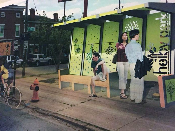
Shelby Park is about to install the second crowd-funded bus stop in Louisville. The first so-called Beta Bus Stop was installed and dedicated in the SoBro neighborhood last November.

Workers are expected to install the new bus stop on Wednesday, August 3, and an official dedication ceremony will be held this Sunday at CycLouvia Three Points. The dedication and ribbon cutting will be held at 4:00p.m. on Sunday, August 7. At the ribbon cutting, several people involved with the bus shelter will deliver remarks.

The bus shelter site. (Via Google)
03-louisville-shelby-park-bus-stop
CycLOUvia route with bus shelter location indicated.

CycLOUvia Three Points, part of Louisville’s Open Streets program, is the newest route that will stretch along Goss Avenue, Logan Street, and Shelby Street in the Schnitzelburg, Germantown, and Shelby Park neighborhoods, collectively known as Three Points as they all meet at a single intersection.

Three Points was coined by a neighborhood beautification and mural group under the same name. They’ll also be on hand at CycLOUvia launching their newest mural on Goss Avenue at Boyle Street.

CycLOUvia will open area streets to car-free use from 2:00 through 6:00p.m. along the indicated route.

Installing a new sidewalk for the bus stop in July. (Courtesy Three Points)
Installing a new sidewalk for the bus stop in July. (Courtesy Three Points / Facebook)

Last month, crews tore up and replaced a sidewalk where the bus stop will soon rest on the corner of Logan Street and Oak Street. The new bus stop replaces a sign on a pole with a sheltered structure and benches.

“We believe small enhancements to our public spaces encourage streetlife, generate vitality in our urban neighborhoods, and promote walking, biking, and transit use,” a team of designers, planners, and neighborhood activists said on their crowdfunding Ioby page. “In addition, we want this project to set the stage for future bus stop improvements across the city.” The team raised over $8,150 for the SoBro and Shelby Park bus stops.

05-louisville-shelby-park-bus-stop
The bus stop site on Logan Street. (Via Google)

The Shelby Park Beta Bus Stop represents a partnership between the Shelby Park Neighborhood Association, Bicycling for Louisville, and the Metro Louisville Office of Sustainability.

The bus stop will service TARC’s Route 25 running along Oak Street out to Westport Road and Route 43 running from Portland through Downtown and out to the Outer Loop via Poplar Level Road.

Like its SoBro counterpart, the Shelby Park bus stop includes benches, transit and bicycle maps, and a large dose of design using many local and salvaged materials. The design uses simple components designed for their replicability.

A brief history of zoning and highway construction in America

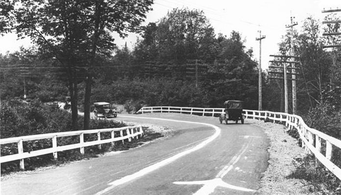
County Road 429 in Michigan, circa 1917. (Courtesy Strong Towns)

By Vince Graham

strongtowns-logo

This month marks the 100th anniversary of two pieces of legislation that revolutionized the way we live. On July 11, 1916, President Woodrow Wilson signed the first Federal Aid Road Bill. Two weeks later, on July 25, 1916, New York City passed the country’s first comprehensive zoning ordinance.

Prior to 1916, transportation infrastructure was primarily a local and/or private responsibility. For example, cities leased their rights-of-way to trolley companies, which operated transit lines. Railroad companies provided travel service between cities.

The 1916 Federal Road Bill was the first step in nationalizing transportation infrastructure funding. State highway departments were formed (South Carolina’s in 1917; Kentucky’s Department of Public Roads was established in 1912) to manage federal appropriations for roads.

Government favoritism of automotive infrastructure crowded out other transportation modes and undermined innovation. During the century before 1916, entrepreneurs invented steam ferries, trains, bicycles, trolleys, and automobiles. Such advances ceased after 1916. Yes, today’s cars are more comfortable and powerful, but they have the same steering wheel, four tires, and internal combustion engine as the Model-T Henry Ford was building 100 years ago. As for roads, the main difference is they are bigger.

Unable to compete with government favored automobiles, Charleston’s last private ferry operator closed shop in 1930. Its trolley lines, which carried 20 million passengers a year (compared with CARTA’s 5 million per year) stopped running in 1937.

Zoning is segregation—not only of land uses deemed incompatible, but of people deemed “undesirable.” Progressives behind New York’s 1916 zoning resolution regarded immigrants moving into northern cities from Europe and the South as “undesirable.”

In 1921, then U.S. Secretary of Commerce Herbert Hoover tapped Edward Bassett, the leading advocate of New York’s 1916 zoning, to create a model zoning ordinance. Engineer Morris Knowles also served on this committee.

In its 1926 landmark decision in Euclid v. Ambler Realty, the Supreme Court validated zoning. Among many divisive pronouncements Justice George Sutherland used in writing the 6–3 majority opinion, was one that asserted “the apartment house is a mere parasite.”

Morris Knowles (yes, the one on Hoover’s committee) came to Charleston in 1931 at the invitation of the Society for the Preservation of Old Buildings (now the Preservation Society). Dismissing 250 years of custom and tradition, Knowles advised widening narrow streets and segregating races. Just as the automobile was crowding out other forms of transportation, zoning outlawed growth patterns that enabled one to meet daily needs by walking. Following along, zoning was adopted by Mount Pleasant in 1949 and Charleston County in 1955.

The Autobahn. (Rolf van Melis / Wikimedia Commons)

Meanwhile, work continued on the auto-dominant vision. Awed by the Nazis’ autobahn program, U.S. Highway Chief Thomas MacDonald returned from visiting Hitler in 1936 to proclaim, “We can begin the building of roads similar to those in Germany.” Except rather than build around cities as was done in Germany, MacDonald aimed to build highways straight through them. Funding for his vision arrived with the Federal Highway Act of 1956.

The 1956 Act provided South Carolina $1.43 billion (in 2016 dollars), including $650 million to initiate the state’s portion of the Interstate Highways System, and $783 million to widen other federal highways. On July 11, 1956 (the 40th Anniversary of the first Federal Aid Road Bill) the Charleston Evening Post reported that, “An eighth-of-a-mile strip of moss-hung oaks on Highway 17 [Savannah Highway] were laid flat this morning by order of the SC Highway Department.”

13-months later, an August 16, 1957 Evening Post headline announced “Super highway to be built into heart of Charleston.” Rather than ending 15 miles north, I-26 was to, “make an easy connection with US 17.” Over the next decade, such “easy connections” would eviscerate Charleston neighborhoods with high speed, blight-inducing expressways.

Our problems are caused by what some would have us believe are cures—segregating land uses and connecting them with wide roads. These “cures” result in maximized congestion. The anti-social policies that fed this predicament were unwittingly launched by starry-eyed politicians and business leaders at a time when the U.S. was the world’s biggest creditor. Today, we are the world’s biggest debtor. This is no coincidence.

Land use and transportation policies provide the pretense of order through artificial constructs that suppress the natural order. Moreover, they mask the incompetence of modern urban designers. Is your city getting uglier and more congested? Well, you obviously need more zoning and road widening. Madness!

A 1955 federal government report noted policies were intended “to disperse our factories, our stores, our people; in short, to create a revolution in living habits.” We are the inheritors of this revolution. Continuing to advance it is a betrayal of those who founded and built beautiful cities. Leaders, please contemplate the root of the problem.

(This article has been cross-posted from Strong Towns. Vince Graham is the founder of I’On Group, a development firm. He serves as Chairman of the South Carolina Transportation Infrastructure Bank. He originally wrote this article as an op-ed for his local paper and has shared it through the Strong Towns website. Top image of County Road 429 in Michigan, circa 1917, courtesy Strong Towns.)

Sign of the Times: Why variances and waivers aren’t the right way to bring noncompliance up to code

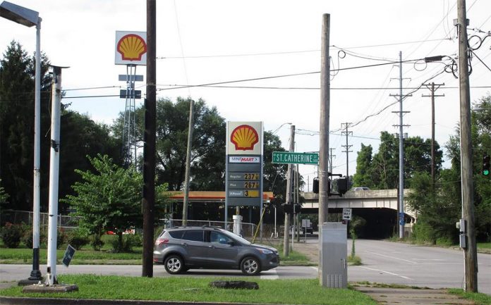
The gas station viewed from St. Catherine Street. (Via Metro Louisville)

A request for a signage variance at a gas station sandwiched between Old Louisville and Shelby Park raises a few important questions about how we should shape our built environment, especially in the built up, historic parts of the city.

Westlake, Ohio–based Travel Centers of America has filed a variance seeking permission to reclad a sign at its Shell Gas Station at 1123 South Floyd Street, just south of St. Catherine Street. But that sign is way bigger than the maximum signage allowed under the current Land Development Code, and of an entirely different type.

06-floyd-street-gas-station-sign
Variance details. (Via Metro Louisville)

The sign, standing since 1998, is five times taller than new signs allowed in the area—30 feet versus an allowed six feet—requiring a 24 foot variance. It’s signage area is also more than five times larger than the current requirement—172 square feet versus an allowed 32 square feet—adding a variance of 140 square feet.

The second sign on the site stands 80 feet tall. (Via Metro Louisville)

According to Table 8.3.2 of the Land Development Code, a property is also only allowed to have one free-standing sign. The gas station property already has two, the other being a much taller “high rise” sign set closer to the minimart structure. That sign stands 80 feet tall, hoisting up a 16-foot-by-16-foot Shell logo. A second variance was also filed for the high rise sign stating that the owners would like to keep it in place without any changes, but according to a staff report, because no changes are proposed, that sign remains “grandfathered” and can remain.

The recladding of the sign would add two changing LED sections displaying gas prices and rearrange the rest of the sign’s panels. One LED panel would be approximately 7.5 feet by 30 inches and the other around 3 feet by 18 inches. The gas station’s main argument for the variance is that trees in the area make the business difficult to see, making the larger sign necessary.

The existing sign and the recladding proposal. (Via Metro Louisville)

The gas station’s mini-mart is already undergoing a $239,000 renovation. It’s unfortunate that the structure couldn’t have been rebuilt at the sidewalk level to make it useful for both the neighborhoods and those driving in to fill up.

According to the Land Development Code, freestanding signs in Traditional Neighborhoods shall either be “monument style” or “columnar”1 signs. The gas station’s sign qualifies as a “Changing Image Sign” due to its LED components, which carry their own set of extra rules.

A changing image sign is not allowed within 300 feet of a residentially zoned district, according to the Land Development Code. Due to the gas station’s location between Shelby Park and Old Louisville, it doesn’t meet that requirement. Houses along St. Catherine Street would be able to see the illuminated sign from their front windows.

To be eligible for a free-standing sign in a Traditional Neighborhood in the first place, a property must have 120 feet of street frontage. The gas station is eligible because its Floyd Street frontage is 228 feet.

The existing gas station sign on Floyd Street. (Via Metro Louisville)

So will the Floyd Street gas station be able to move ahead with its new LED sign and keep its existing high rise sign? Probably.

The Board of Zoning Adjustments (BOZA) is scheduled to discuss this variance among others at its next meeting on Monday, August 1 (it’s the sixth item of 14 on the agenda). That meeting will begin at 8:30a.m. at the Old Jail Courtroom, 514 West Liberty Street.

The gas station parcel highlighted. (Via Lojic)

The thing is, though, that the Metro Louisville Planning & Design Staff Report has already recommended that BOZA approve the request.

“The size, height and style of the sign has been ‘grandfathered’ but is now losing that status due to the addition of the LED signs,” the staff report states. But it’s explanation of how to fix the problem seems heavily reliant on variances and not on bringing things into compliance with current codes. “[T]herefore, the sign size, style and LED requirements must all be reviewed before BOZA and brought into compliance with the granting of a variance and waivers to allow the proposed changes,” the staff report reads (emphasis added). What it doesn’t say is that the BOZA could also deny the variances and require the gas station to bring the sign up to current code.

The gas station viewed from St. Catherine Street. (Via Metro Louisville)

“The requested variance will not allow an unreasonable circumvention of the zoning regulations,” the staff report continues, “as the height and area of the sign have existed as is since the sign was erected and the applicant now seeks to bring the non-conforming status into compliance.” Now we’d argue that asking for a variance isn’t bringing a nonconforming sign into compliance, rather skirting the rules because it just so darn easy to in Louisville.

The staff report also believes it would create a hardship for Shell if it was forced to build a new sign that wasn’t quite as glaringly visible as the noncompliant one. It also made the judgement that the new sign with its LED components is more aesthetically pleasing than the old one. It continues that the “waiver will not adversely affect adjacent property owners as it is surrounded by interstate and another commercial establishment.”

Ultimately, the staff report concludes that the “variance and waivers appear to be adequately justified and meet the standard of review.”

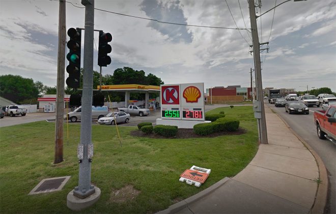
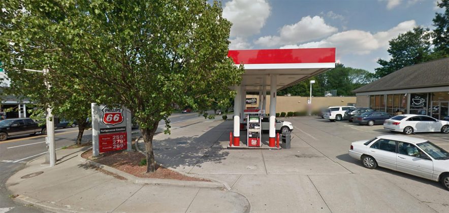
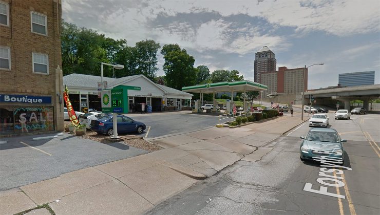
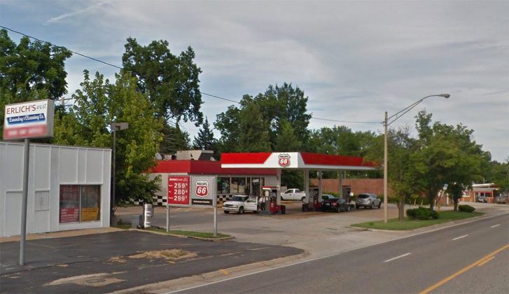
In other communities, gas stations do just fine keeping to the standards Louisville already has in place for places like Floyd Street. Take a look at four examples of gas stations in St. Louis with smaller, less obtrusive signs. There are plenty of examples from all around the country, just not that many good ones in Louisville, where every sign has to be seen by a motorist speeding by at 50 miles per hour.

What’s more troubling is that the Planning & Design staff report finds the appropriate action to bring a noncompliant sign up to code is to issue variances and state that the updated code is an economic hardship on the business of selling cheap gas in an urban neighborhood. That’s a bad precedent to set. Why even bother updating Louisville’s Land Development Codes at all if we’re not going to enforce them or declare them hardships and push bad designs through with a stamp from BOZA?

While a gas station sign might seem small, it’s a sign of a larger problem in Louisville that’s keeping us from building the best city we can for all citizens. It’s a problem that’s only going to get worse unless we confront it head on. BOZA should require this gas station to rebuild its sign in compliance with the Land Development Code rather than issuing waivers and variances that take the teeth out of the city’s codes entirely.

Barrington Place changes name to Vue, plans new signage, renovations

    1

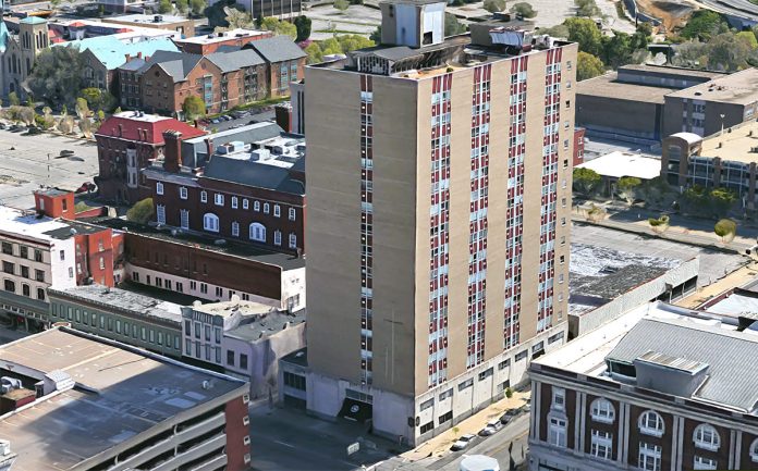
    The Barrington Place Apartments on the corner of Third and Guthrie streets have seen a lot in the past few years. Back in 2014, the 17-story property went into foreclosure resulting in its sale for $5.87 million to Utah-based investment firm Sundance Bay (that’s up from its 2002 sale price of $1.3 million in which the 218-unit tower was renamed Barrington Place—it was called Trinity Towers when it opened in 1962). In March 2015, the new owner invested $562,500 in renovations to the building. Then this past May, the building sold again for $12.8 million to Nashville investment firm Covenant Capital Group.

    Now the tower at 537 South Third Street has been rebranded as the Vue at Third, keeping pace with other recent apartment projects like the Amp on Frankfort or the Axis on Lexington. And there’ll be new amenities and signage marking the change.

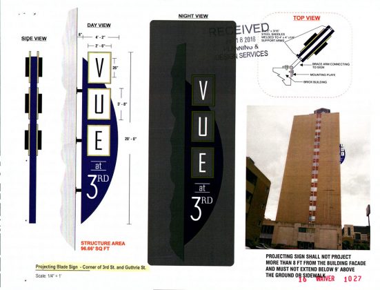
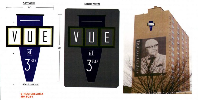
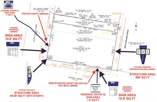
    Plans were filed with the city this month for the new signage to replace temporary banners previously installed on the building. In total, six new signs in various sizes—from a 1.5 square foot resident entry sign to a 280-square-foot marker readable from Interstate 65—covering planned for a total of some 400 square feet. Many of the signs are simply replacements of older Barrington Place signs on the building.

    According to the application, the signage simply needs review by the city as there are no signage rules in place for multifamily buildings in the Downtown Form District. The new owners plan to keep the Hometown Hero banner of Kentucky’s Colonel on the building’s east facade.

    And there could be more change on the way for the Vue at Third. “Over 3 million dollars is being infused into the project to restore resident’s [sic] sense of place and pride in their neighborhood,” the application reads.

    A call to Covenant Capital Group Managing Partner Rick Scarola seeking additional information was not immediately returned, but we’ll have an update when we know more.

    A number of active permits, mostly for electrical work at the building have been issued by the city. One building permit reveals that $150,000 in renovations is planned for the Vue’s 4,220-square-foot lobby. Those renovations carry an architect’s stamp from Louisville’s Prodigy Construction Corporation.

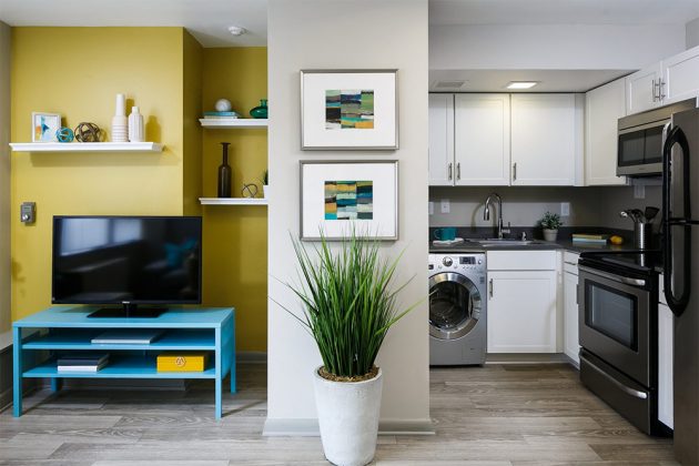
    Apartments in the Vue range from $900 per month for 430-square-foot studio to $1,100 for a 606-square-foot one-bedroom. A variety of floor plans are available. Units carry amenities like a washer and dryer, quartz countertops, and, interestingly, “HGTV Inspired Cabinetry.”

    The Vue’s website lists the building amenities as including an “Extravagant Rooftop Lounge” with an outdoor kitchen, a pet boutique, a Wifi Lounge with a cafe, a wellness center, and, interestingly, a “24-Hour Juice Bar.”

    Academic building to replace Crawford Gym’s elliptical paraboloid roof at UL’s Belknap Campus

    The University of Louisville's Crawford Gym.

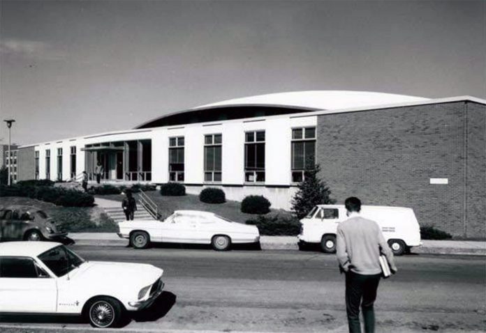
    When Crawford Gymnasium opened on the University of Louisville’s Belknap campus in 1964, it was unlike any building in Louisville. “The unusual roof will be the first elliptical paraboloid in this part of the United States,” an October 20, 1963, Courier-Journal article noted. The paper called the roof a “saucer,” and there’s little doubt that to many the gym would have appeared to have just touched down from outer space in the post-Sputnik era.

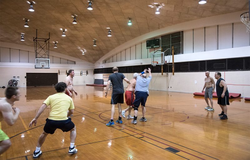
    “The form of the U. of L. gym is not just an experiment in shaping geometric designs in concrete,” the C-J article went on. “The shape has real practical advantages.” Among those are the elimination of any columns inside the structure. The roof rests on its four corners and its geometry gives it enough strength to stand with no additional support. The architects also claimed the shape “gives the greatest volume of usable space for the least expense.”

    Crawford Gym in 2010. (UL Photo Archives - Reference)
    Crawford Gym in 2010. (UL Photo Archives – Reference)

    To build the roof, an elaborate wooden scaffolding was shaped into the elliptical paraboloid shape and two inches of fibrous insulation put in place. Four inches of concrete—some 180 tons—was then poured on top.

    This type of structure is very rare in Louisville. A similar thin-shell roof, this time a hyperbolic paraboloid, can be seen on the Immanuel Church of Christ at 2300 Taylorsville Road. What’s particularly nice about these old hyperbolic buildings is their purity of form. There’s a singular idea governing the design of the entire structure.

    Inside Crawford Gym. (Courtesy UL / Flickr)
    Inside Crawford Gym. (Courtesy UL / Flickr)

    The $1.1 million structure (or about $8.7 million in today’s dollars) was funded by $467,000 from the estate of Matthew H. Crawford his two sisters, according to the newspaper, giving the structure it’s official name of the John A. & Mary D. Crawford Memorial Gymnasium after their parents. Another $642,500 came from the City of Louisville.

    Crawford Gym opened with two basketball courts, the state’s largest indoor swimming pool at the time, handball courts, weightlifting rooms, classrooms, offices, and a physical education library—but no air conditioning. The gym also had another structural trick up its sleeve: “Concrete folded plate in a sawtooth design was used for the ceiling” of the swimming pool, the newspaper noted. “This ceiling spans 97 feet.”

    Crawford Gym. (Courtesy UL)
    Crawford Gym. (Courtesy UL)

    The gym was, among other things, the practice facility for the university’s basketball teams, including the 1980 team, which brought UL its first national championship.

    Crawford Gym was designed by Louisville’s Hartstern, Louis & Henry Architects. By the time the gym was complete, that firm had split into two. Wehr Construction and O.S. Sendler Engineers also worked on the project.

    Crawford Gym turned 52 years old this year, just three years shy of the 55 years required to be listed on the National Register of Historic Places. But now, the gym’s days are numbered as the university plans to raze the innovative thin-shell concrete structure next month.

    Rendering of the new academic building to be built on the site of Crawford Gym. (Courtesy UL)
    Rendering of the new academic building to be built on the site of Crawford Gym. (Courtesy UL)

    A new academic building designed by Boston-based Goody Clancy and Louisville’s K. Norman Berry Architecture will take its place. The new structure, predominantly clad in brick and glass stands quite a bit taller than the gym, and will certainly define the grassy quad on which it sits more as an outdoor room.

    The university will host a free open house at the gym from 10:00a.m. through 7:00p.m. on Thursday, August 4 for anyone wanting to take one last look at the facility.Former basketball coach Denny Crum and some former players will share their memories at an 11:00a.m. tribute.

    Additionally, the university will be selling off pieces of the old gym, including 12-inch-by-12-inch sections of the gym floor for $50 and scoreboards, bleachers, goals, and other items via an auction. All proceeds go towards the Denny Crum Scholarship Fund.

    (Top image of Crawford Gym courtesy UL Photo Archives – Reference.)

    Convention center construction, traffic congestion spur changes in 23 TARC routes

    (Courtesy TARC)
    (Courtesy TARC)

    The Transit Authority of River City (TARC) has announced service changes to 23 of its routes due to construction activity and traffic delays around the city. Route changes to the ZeroBus (noted below) went into effect on Monday, July 25 and changes to the other routes will go into effect Sunday, August 21.

    “Most of the changes are minor but passengers are advised to check schedules in advance of the changes and plan trips accordingly,” TARC wrote in a press release. Here’s information on the changes from TARC:

    • Route #1Fourth Street ZeroBus Northbound (Map) — Northbound, the route will be extended two blocks on Fifth Street, traveling east on Market Street instead of Liberty Street to reconnect to Fourth Street. Southbound, buses on Fourth Street will go east on Market, and south on Second Street, instead of Third Street, and then west on Muhammad Ali Boulevard, reconnecting to Fourth Street. This routing will avoid anticipated impacts from the closure of Third and Fourth streets between Market and Jefferson streets for the Kentucky International Convention Center rebuilding project.
    • Route #31 & #31XMiddletown & Middletown Express (Map) — In response to community requests, the #31 and #31X will operate on Shelbyville Road instead of on several side streets in the Middletown area.  Stops on the new routing will be within three blocks of stops being eliminated. A late night round-trip will be added on weekdays and Saturday between downtown Louisville and Middletown Station. Daily service is also added for Middletown Commons.

    The below routes will be adjusted with scheduled changes in arrival times at stops and additional changes as noted. On all express routes, Downtown bus arrival and departure times are maintained as close as possible to current schedules. However, most morning trips will leave the stop at the end of the route earlier than the current schedule, and arrival times at those locations will be later in the afternoon.

    City to study Frankfort Avenue sidewalks between Pope Street and River Road

    The Heigold House facade. (Google)

    While it only represents .006 percent of the recently passed $822 million budget for Metro Louisville in the next year, $50,000 in funds could go a long way in planning for a better Frankfort Avenue.

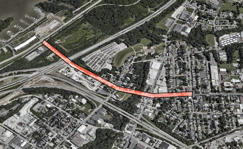
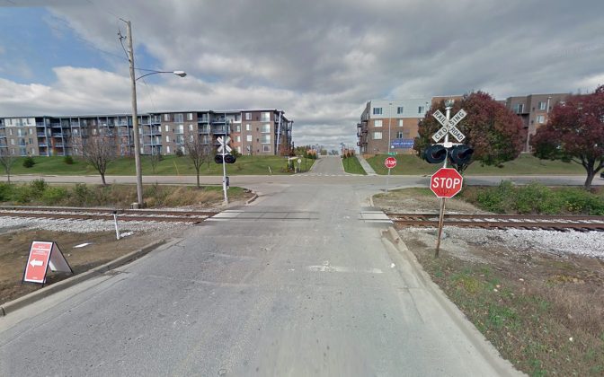
    Those funds, part of $1,090,000 slated for sidewalks, will pay for the Frankfort Avenue Sidewalk Extension Project, an upcoming study that will look at a .8-mile stretch of Frankfort Avenue between Pope Street and River Road. That study could get underway this fall.

    The study will look at Frankfort Avenue from River Road to Pope Street. (Via Google)
    The study will look at Frankfort Avenue from River Road to Pope Street. (Via Google)

    “I’m particularly interested in the sidewalk connection because we have a pretty much totally missing sidewalk from Story Avenue until River Road,” Metro Councilman Bill Hollander (D-9) told Broken Sidewalk. “You see people all the time going from Butchertown, Clifton going down to the waterfront walking in the street. It’s really a high priority for me.”

    While the $50,000, which became available July 1, won’t pay for any sidewalks outright—it’s only for a planning study—it does pave the way for a completely new streetscape from Pope Street to River Road in the future. “We’re probably a few months away from getting this started,” Hollander said.

    “We plan to start on Frankfort Avenue in the fall,” Gretchen Milliken, director of advanced planning at Develop Louisville, said. The study will be conducted out of her department, but there are several steps that need to be completed first.

    This fall, Develop Louisville will issue a Request for Proposals (RFP) for a consultant to conduct the study, which generally takes around two weeks. Then the city will review the responses and issue a contract, which takes another couple weeks.

    “This isn’t a really long one—six months max,” Milliken said. “We do want to get the community engagement piece right.” Once the study is complete, then funding for the actual sidewalks and streetscapes will be sought. That amount could run into the millions of dollars depending on the recommendations of the study.

    (Google)
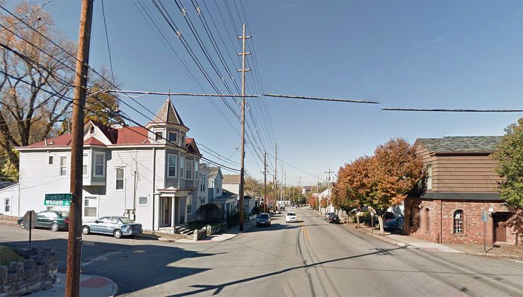
    Frankfort Avenue looking toward the river from Pope Street. (Google)

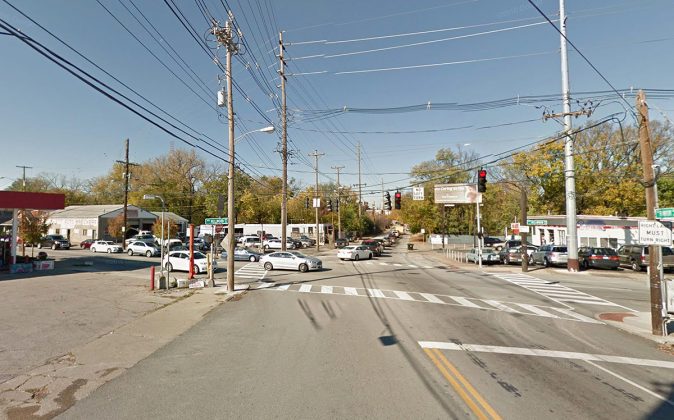
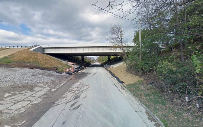
    The project bounds begin at Frankfort Avenue and Pope Street at the top of the hill where Frankfort rises up from Beargrass Creek. “There’s a section between Story and Pope Street,” Hollander said, “where much of it is not very visually appealing.” For instance, around Frankfort and Mellwood, there’s a used car lot, an abandoned gas station, a parking lot, and the blank wall of a metal warehouse.

    (Google)
    The state has not properly maintained a bridge crossing Beargrass Creek. (Google)

    “It crosses Beargrass Creek,” Hollander continued. He said an old bridge over the creek with iron railings is in need of repair. “The state’s reaction to that was to put up these huge chain link sections over the black fencing. Now the weeds have grown up and you can’t see the creek.”

    10-frankfort-avenue-sidewalk-study-louisville
    The floodwall is an engineering challenge along the route. (Google)

    Then the situation gets really bad. “You’ve got to get around the flood wall,” Hollander said. “It needs some thought and engineering.” Milliken agreed: “The flood wall is going to be an issue,” she said. “It’s really tight there.” She said the study will consider, among other things, the feasibility of cutting a pedestrian doorway into the flood wall.

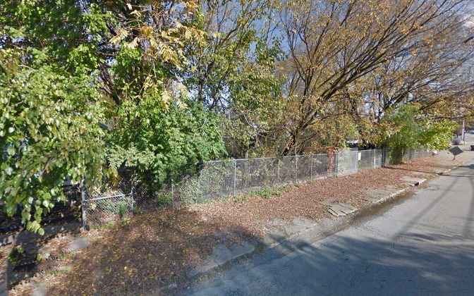
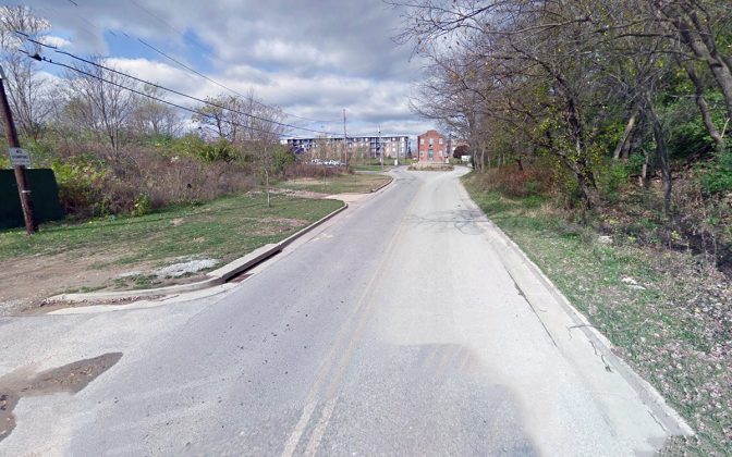
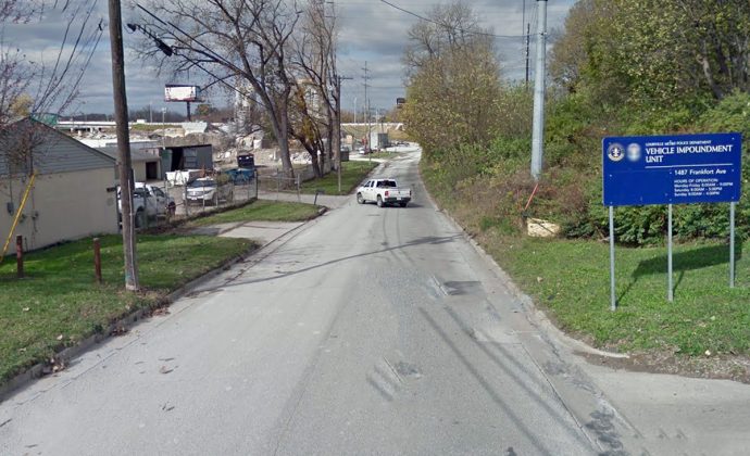
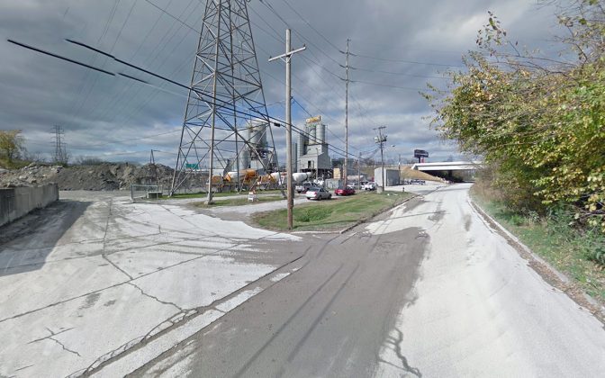
    Past the floodwall, there are no sidewalks at all. “You have the entrance to the impoundment lot, the concrete plant,” Hollander said. “Right now, the study area is a complete mess.”

    The Ohio Street landfill on the left will be transformed into the Waterfront Botanical Garden. (Google)
    The Ohio Street landfill on the left will be transformed into the Waterfront Botanical Garden. (Google)

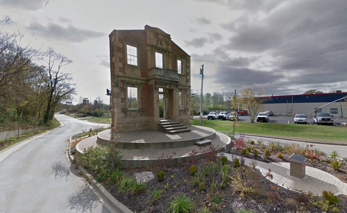
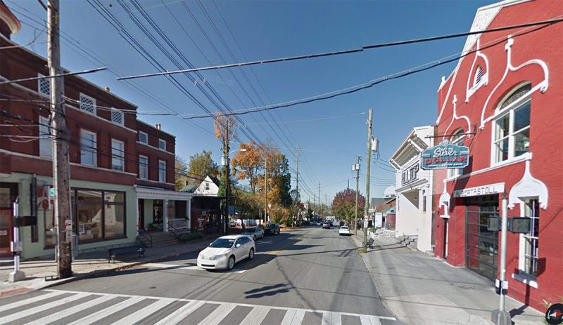
    Toward the waterfront at the base of the old Heigold House facade, Botanica is planning an ambitious new Waterfront Botanical Gardens. “We’re not doing this because of Botanica,” Milliken said, “but that’s going to be a big piece of it.” She add that the city could try to coordinate with Public Works on repaving the corridor as part of the project.

    For many Frankfort Avenue effectively ends at Story Avenue, but there’s a lot of potential to create a real gateway to Waterfront Park and the Ohio River. “It’s about connectivity to the riverfront, it’s about pedestrian safety and how that corridor gets used,” Milliken said. Changes here can’t come soon enough.

    How sprawling development is poisoning Floyds Fork

    Have you been to the Parklands of Floyds Fork yet? Visiting the pristine landscapes on the far eastern edge of Jefferson County is like “being dropped off in Yellowstone,” Scott Martin, parks director at 21st Century Parks, told Broken Sidewalk’s Matthew Beck. Beck was writing this past May about how unchecked sprawling development around the 4,000-acre series of parks in consuming some of Louisville’s last farmland and forests.

    This month, WDRB’s Sterling Riggs published a special report on another threat to the Parklands: contamination along Floyds Fork that could potentially make people sick. Riggs worked for several months with an environmental group Salt River Watershed Watch to test the creek waters.

    According to Riggs:

    It looks inviting, but some are alarmed by what’s in the water. WDRB collected water samples in May, June and July at the Parklands’ multiple parks to reveal the amount of fecal coliform in the popular creek. Fecal coliform is bacteria found in human and animal feces and can lead to ear and skin infections and gastrointestinal illnesses.

    The state requires water to be tested five times a month. If the geometric average of fecal coliform is above 200, swimming is not recommended and is considered hazardous to your health.

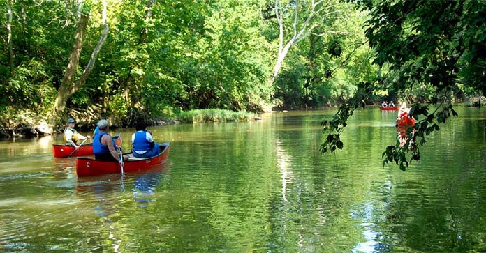
    “We’ve had some above and some below. You cannot conclude that the entire area is grossly contaminated,” Bob Fuchs, a chemist at Astbury Water Technology in Clarksville, Indiana, told Riggs. Still, Fuchs said he would not advise swimming at the Parklands. The report also notes that the levels were safe for kayaking.

    It’s important to know there’s a problem, but what’s the cause? It turns out the contaminated waters are largely due to sprawling development in the area. Way down in the story’s 25th paragraph, Riggs writes, “Research shows bacteria levels have increased over the years, because more homes are being built along the creek.”

    “The land is what you need to look at,” Russell Barnett, a volunteer at the Salt River Watershed Watch and director of the Kentucky Institute for the Environment & Sustainable Development at the University of Louisville. “If you look at the land, that’s a mirror of what the water quality is going to be.”

    A 2014 study of the Chesapeake Bay watershed called “Polluted Runoff” revealed that developed land can make waterway pollution worse. And the contaminants don’t just include fecal coliform, they also include more toxic fertilizers and chemicals that keep sprawling lawns green to road salt and heavy metals that fall off passing cars. According to the study:

    Rain water increases in speed as it flows across developed landscapes. And as the water accelerates, it warms, picks up anything left in its way, erodes stream banks, and pollutes the water into which it flows.

    The list of pollutants in runoff is long. Trash dropped on the street. Nitrogen and phosphorus from fertilizers on lawns and air pollution that settles on the ground. Fecal bacteria, viruses, and other pathogens from animal and human waste. Oil and toxic petroleum products from vehicles and driveway sealants. Pesticides and herbicides from lawns and gardens. Road salt. Dirt from stream banks and construction sites that lack runoff control fencing. Toxic metals, such as copper, lead, and zinc from vehicles, roofing materials, and paints.

    The brake linings of cars and trucks are often made with copper, and they shed a fine dust of this toxic metal onto streets. The Maryland Department of the Environment sampled runoff from the state’s major urban areas and found copper in 92 percent of the samples. Fifty-three percent of the time the levels would be acutely toxic to aquatic life. (Copper also appears in waterways because, among other reasons, the metal is an ingredient in herbicides.) Zinc from car tires, road salt, paint, and other products has also been found in runoff, as well as the toxic metals lead, chromium, and cadmium.

    “Cars are very significant, because we build so much infrastructure for the cars—the parking lots, roads, garages, and driveways,” Dr. Robert G. Traver, a professor of Civil Engineering at Villanova University, said in the report. “It’s the pollution from the cars, but it’s more than that. It is, for example, the heat of the water that comes off the pavement and the volume of the runoff from the pavement.”

    Barnett also listed a number of other contributing factors to increased levels of contamination. “Waste water treatment plants, septic tanks—it could be from any type of animal that you can think of, warm blooded, cold blooded,” he told Riggs.

    “Conditions have worsened,” Karen Schaffer, a retired environmental consultant and Salt River Watershed Watch volunteer, told Riggs. “When the stream flow is higher because of recent rainfall, that’s when the bacteria levels tend to be higher.”

    And this problem stands to get much worse in coming years. With continued sprawling development around the park and ill-advised roads that Metro Louisville plans to build to open up the area on the far side of the Parklands for development, Floyds Fork will likely become even more contaminated.

    [Top image of Floyds Fork courtesy Metro Louisville / Flickr.]