How sprawling development is threatening the Parklands of Floyds Fork

“Unabashedly urban” is an unusual portrayal of the drive out to the Beckley Creek portion of The Parklands of Floyds Fork, nearly 17 miles from downtown on the edge of eastern Jefferson County. Yet that’s how Scott Martin, parks director at 21st Century Parks, the group behind the Parklands, described the project to Broken Sidewalk in an interview last year. Beckley Creek has no public transportation access, its surrounding census tracts are among the least dense in the city, and the rugged and rural terrain surrounding it is some of the wildest in Louisville. Martin likened visiting the park to being “dropped off in Yellowstone.”

However curious the characterization, “urban” is what the forces behind the new parks system are calling the area they seek to further develop. That’s because they have the ambitious goal of not only creating and preserving thousands of acres of pastoral public space, but shaping entire communities and neighborhoods that will surround it. In the way Louisville’s Olmsted parks created some of the city’s most charming urban neighborhoods, 21st Century Parks, as the name implies, sees itself as a modern expression of this tradition.

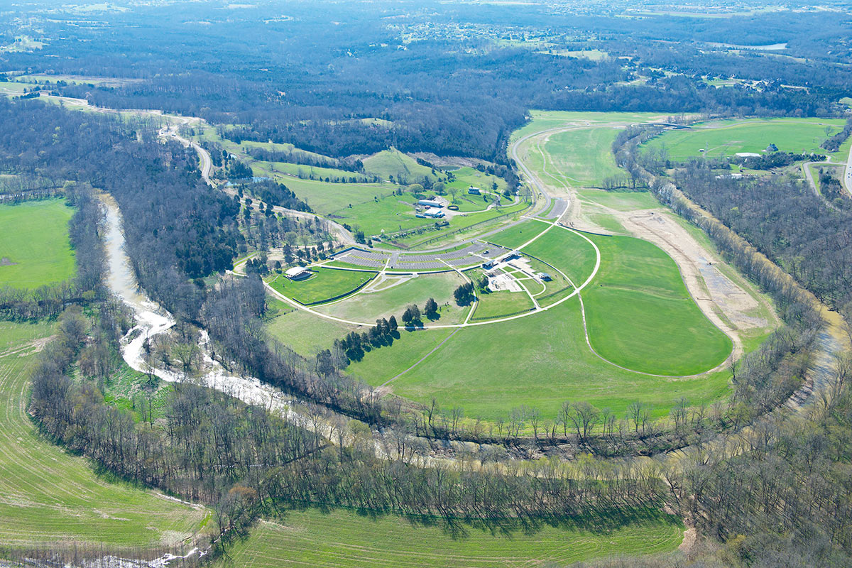
A scene at the Parklands of Floyds Fork. (John Nation)

On April 15th, the Parklands of Floyds Fork was completed—just five years after construction began. And while the completion of this project signifies the permanent transformation of this space into a protected, world-class park system, its ancillary impact on long-term regional development is only beginning to come into focus. What’s materializing is anarchic sprawl born from contradictory land use regulations and virtually non-existent city planning. If the Parklands is to have the same positive impact on the urban fabric of Louisville as Olmsted’s parks did, we need a roadmap to take us there.

Floyds Fork is a 62 mile tributary of the Salt River and the county’s largest watershed. It’s home to bass, bluegill, catfish, and the old Grosscurth Distillery, which blew up in 1968. Historically, eastern Jefferson County was agricultural, and there was never a planning framework in place to guide development. In the 1980s, when the Gene Snyder Freeway began encircling the city, the newly accessible rural east end experienced a population boom and became home to sprawling subdivisions like Lake Forest.
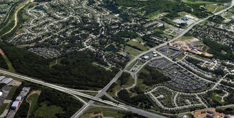
The Gene Snyder Expressway and the sprawling development it helped spur. (Courtesy Google)

Overdevelopment near Floyds Fork quickly became a concern, and in the early 1990s, the Future Fund, a private land trust, was created to buy up properties abutting the Floyds Fork waterway and shield it from suburban sprawl. In 2003, when 21st Century Parks was created, they teamed up with the Future Fund, and working collectively, managed to permanently protect nearly 4,000 acres of land along Floyds Fork. (The Future Fund owns additional acreage that it protects that is not part of the Parklands project.)

A scene at the Parklands of Floyds Fork. (John Nation)

These 4,000 acres comprise the Parklands of Floyds Fork, and are distributed throughout its four public parks, all connected by a central parkway. Without the Parklands, the forests and countryside it protects, including dramatic limestone ridges and cliffs along Floyds Fork, would likely have been developed into suburban tract housing. Instead, the Parklands has provided precious public space for a populous slice of Louisville that has practically none. But in doing so, the project has diverged from its Olmstedian blueprint.

At first blush, the premise that the Parklands are neo-Olmstedian is reasonable. Like Floyds Fork, Cherokee, Iroquois, and Shawnee Parks were designed as suburban landscapes, built on the outskirts of Louisville at the end of the 19th century. These parks were intended to open up the city to create a healthier environment for its residents.

But unlike today, Olmsted’s Louisville was ultra-dense, with development centered around downtown and its immediate surroundings. As ribbons were being cut at the big three Olmsted parks, the country was just wrapping up 50 years of breakneck population growth. During the last half of the 19th century the United States tripled in population and the rail system had grown to almost 300,000 miles—up from just 3,000 in 1840. Cherokee Park and Louisville’s Union Station—then, the largest train station in the South—were both opened in 1891.
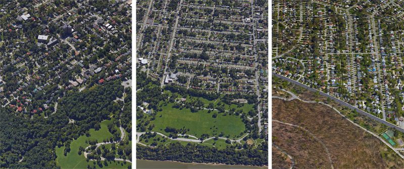
Dense walkable neighborhoods grew up around Louisville's Olmsted parks. Left to right: Cherokee Park; Shawnee Park; and Iroquois Park.
Dense walkable neighborhoods grew up around Louisville’s Olmsted parks. Left to right: Cherokee, Shawnee, and Iroquois.

Louisville experienced a population boom in the early to mid-20th century—55 percent growth from 1900 to 1940—and these parks became enveloped by neighborhoods and were quickly absorbed into the expanding city. During that period, cars were only beginning to emerge on the city scene and dense, walkable development routed along streetcar lines was still the norm. These were suburbs in the same way the Upper West Side was when Central Park was built.

Beautiful neighborhoods such as Beechmont and the Highlands were created through thoughtful planning and forecasting, in contrast to the haphazard and laissez-faire approach to current development. For instance, in 2008, the firm that designed the Parklands, Philadelphia-based Wallace Roberts & Todd, were commissioned by the city to develop a planning document to guide development surrounding the park, as Marcus Green from WDRB points out. The Floyds Fork Area Study, A Framework For Growth (FFAS) envisions residential development west of the park that’s served by dense, pedestrian friendly, mixed-use regional, town and village centers. Development to the east of the park should be “low-impact”. But the plan was never approved.
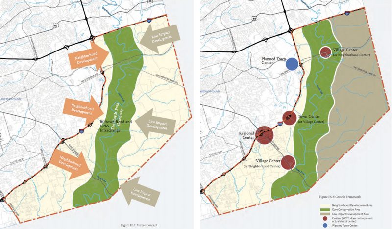
07-louisville-parklands-development-conservation-subdivisions
WRT’s “Floyds Fork Area Study, A Framework For Growth” called for development to be focused around walkable neighborhoods west of the Parklands. (Courtesy WRT)

Instead, the area is currently guided by ambiguous and unenforceable land use codes. The Floyds Fork Development Review Overlay (DRO) was included in the Land Development Code in 1993 to balance development and conservation surrounding the watershed. After 25 years of eastward expansion and the introduction of a famous park system, striking this balance is more difficult than ever. Adding to that challenge is the inclusion of so called “conservation subdivisions” to the Land Development Code in 2008. The result has been unrestrained exurban sprawl that clearly violates the spirit of the overlay district.

“Conservation subdivisions are the developers’ counter to the DRO”, Dr. Stephen Henry, former Lt. Governor and founder of The Future Fund Land Trust, told Broken Sidewalk. Henry is describing the commonly held view that “conservation subdivisions” were created to allow developers to ignore regulations limiting development near Floyds Fork. One such example is Covington By the Park, a 450 acre, 1400-lot development. In February, James Bruggers of the Courier-Journal reported that after purchasing the land last fall, the developer entered into a timber contract and began clear cutting large swaths of the property, violating the DRO.
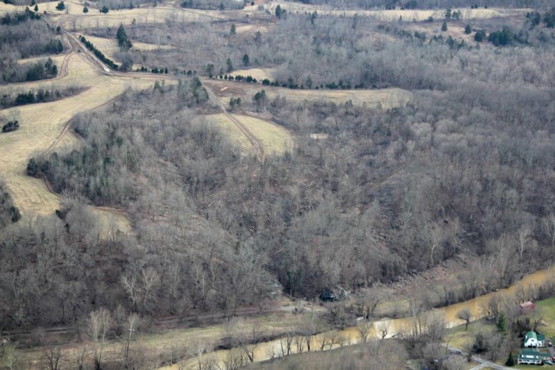
01-louisville-parklands-development-conservation-subdivisions
Aerial view of the Covington By the Park site, where 1,400 houses are planned. (Courtesy Fisherville Area Neighborhood Association)

Such massive developments have also exacerbated sprawl. Oddly, 21st Century Parks owns a “conservation subdivision”, Oakland Hills, a project that illustrates just how sprawl generates sprawl. The land that contains Oakland Hills is 363 acres; it’s just north of a proposed 26 acre subdivision, and neighbors the new Waterford Ridge and Equinox subdivisions. There’s also an additional 168 acres slated for development to Oakland Hills’s east. When we spoke with Scott Martin last year, he described the Parklands as an “urban edge” project. But last week, he said he’s not so sure about that now, “The edge is now Shelby, Oldham, and Bullitt Counties.”
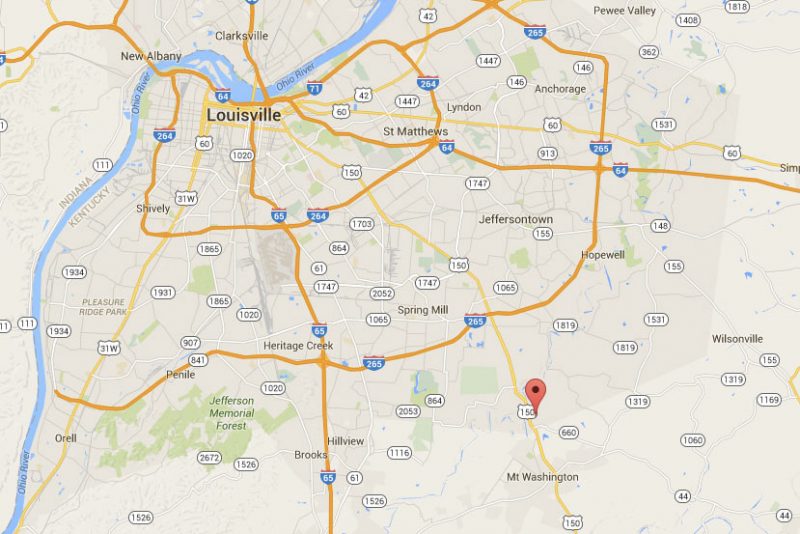
The location of the 363-acre Oakland Hills subdivision, being developed by 21st Century Parks. (Courtesy Google)

The Planning Commission is just beginning to realize, eight years later, that these “conservation subdivisions” might be a problem. Marcus Green recently reported that “the Louisville Metro Planning Commission has stopped reviewing “conservation subdivisions” in Jefferson County while it looks into whether regulations approved in 2008 achieve a goal of saving green space.” There’s little question that the regulations have failed—the lack of city planning for one of the most ambitious and significant infrastructure projects in the city’s history is breathtaking.
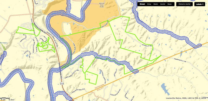
A zoning map showing proposed subdivisions in green—the big one in the middle is Oakland Hills. (Courtesy Lojic)

The Parklands succeeded because there was vision, collaboration, and planning—the same formula that created Olmsted’s parks, Louisville’s great neighborhoods; and it’s the key to building a successful 21st century east Louisville. So it’s alarming that when Broken Sidewalk asked Scott Martin about the Floyds Fork Area Study last week, he said he couldn’t speak to it because that process “operated in its own silo.” That’s not how great cities are built, and Louisville and the Parklands of Floyds Fork deserve better.

We’ve reached a pivotal juncture: the Planning Commission is taking a breath to reconsider the paradoxical “conservation subdivision”; the Parklands is complete, and there’s renewed interest in the Floyds Fork Area Study. This moment requires leadership and vision. Inaction would mean 1980s-style city planning pushes Louisville’s edge farther into Shelby and Bullitt Counties, and the Parklands of Floyds Fork remains unabashedly exurban.

[Top image of Broad Run Park by John Nation.]

Steeped in cycling history, Wayside Park will host 300 free bike parking spaces for the Kentucky Derby

While we all love the Kentucky Derby, getting there is usually a challenge. That’s because Louisville isn’t exactly set up to efficiently handle large events. The city relies on cars, and when you have hundreds of thousands of people trying to all get to one place in automobiles, it’s a recipe for disaster.

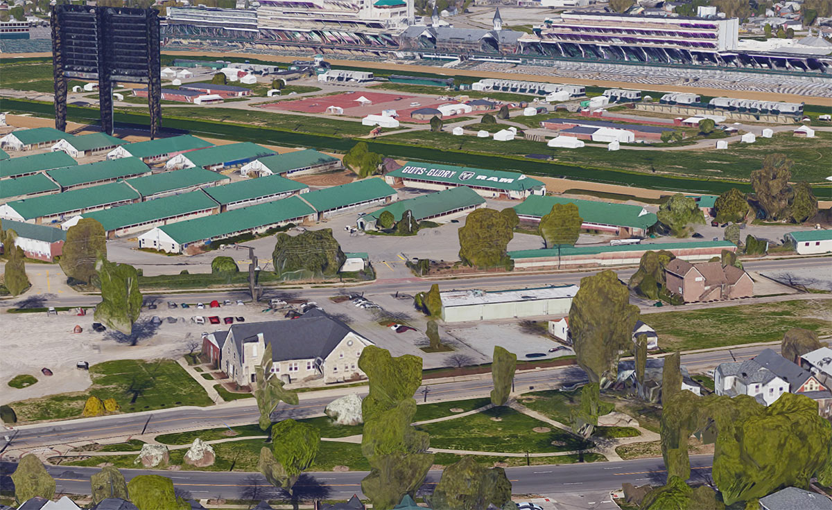
Luckily this year, you’ve got another option. Bicycling for Louisville is teaming up with Louisville Metro Parks & Recreation to offer 300 free bike parking spaces at Wayside Park, a triangular sliver of green space right next to Churchill Downs at 3190 South Third Street. Parking will be available on Thursday (Thurby), Friday (Oaks), and Saturday (Derby).

(Courtesy Metro Louisville)

“We’re hoping a lot of people use this option—as a way to save money and time, but also just as a fun way to get to and from Churchill,” said Chris Glasser, executive director of Bicycling for Louisville, said in a statement. “For events like this, biking can be a more convenient option, and we expect that lots of people—like they do for Forecastle and Thunder at Waterfront Park—will take advantage of it.”

There’s one small catch, though. The bike parking lot will not be monitored and the city says you’re on your own if your bike is damaged or stolen. So bring a good lock.

Riding your bike to the Derby is a great way to participate in National Bike Month, going on now. And if you take your ride at a leisurely pace, you’ll arrive at the Downs looking as dapper as those stepping out of the limos. But as Mayor Greg Fischer warned, “Be sure to hold onto your hat!”

(Courtesy Metro Louisville)

Wayside Park, one of Louisville’s original Frederick Law Olmsted–designed parks, boasts a unique bike tie-in from the 19th century. Back on October 8, 1897, when cycling in Louisville was all the rage, the park played host to the Cycle Carnival, a bike parade an estimated 10,000 cyclists strong and watched over by a 50,000-person crowd.

The Cycle Carnival began at Third Street at Broadway and made its way south past Wayside Park all the way down Southern Parkway to Iroquois Park. According to a historical marker in the park, the scene was quite a spectacle, with many cyclists in costume including ladies in bloomers, and cannon fire along the route.

(Courtesy Metro Louisville)

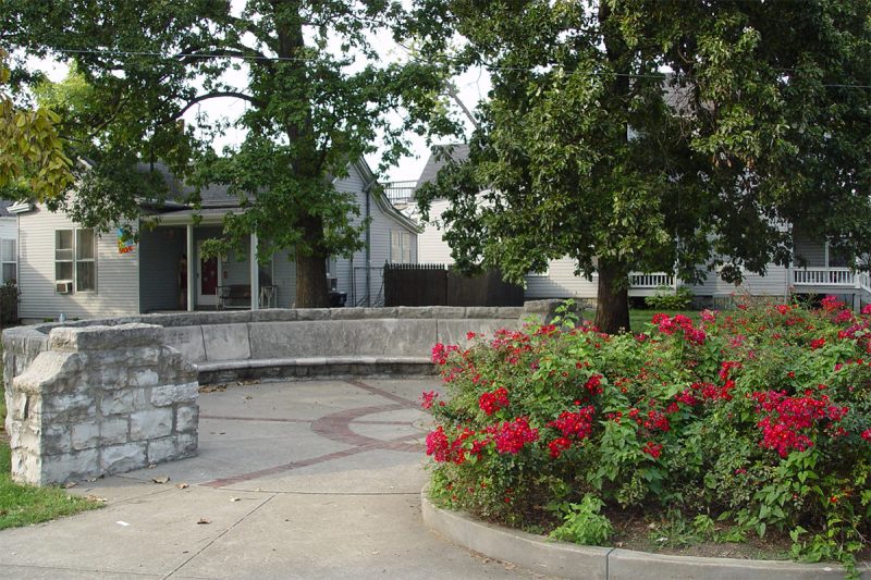
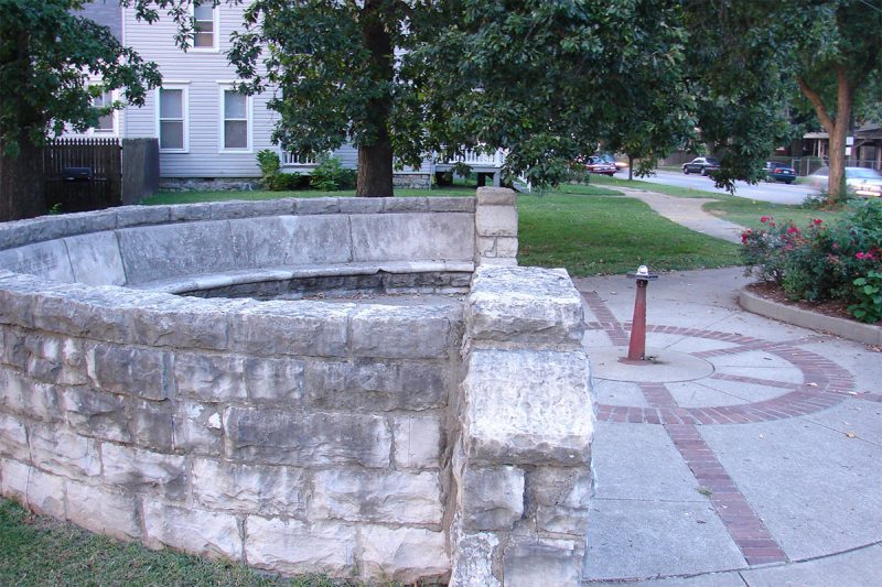
That same year, the Kentucky Division of the League of American Wheelmen built the park’s iconic Ruff Memorial Wheelmen’s Bench, a half-round stone seat with paving evoking the spokes on a bike wheel and a drinking fountain in the center. A marble fountain was also included.

The bench, designed by sculptor Enid Yandell, was a memorial to the division’s oldest member, A.D. Ruff, who died the previous year. In 1893, Ruff had cycled to Yellowstone National Park, no small feat.

Join Wayside Park’s storied cycling history this Derby with the introduction of free bike parking on Thursday, Friday, and Saturday!


Could an Appalachian food revival help revitalize a region’s economy?

0

Appalachian cuisine, which is quickly growing in popularity, could help revitalize a struggling economy, Jane Black reports for the Washington Post. “The foods of Central Appalachia constitute America’s own cucina povera, as rich and unexplored in the American culinary scene as Tuscan food was in the 1980s. It’s a scrappy, intelligent way of cooking that, out of necessity, embraced preserving, canning, fermenting and using every part of the animal long before all that was trendy. There are leather britches, beans that are strung up whole to dry, then brought back to life with water and a smoky ham hock. There is vinegar pie, a mountain version of the South’s lemon chess pie, with vinegar providing the acid in place of expensive or hard-to-find citrus.”

https://www.instagram.com/p/BCVicF7MEry/

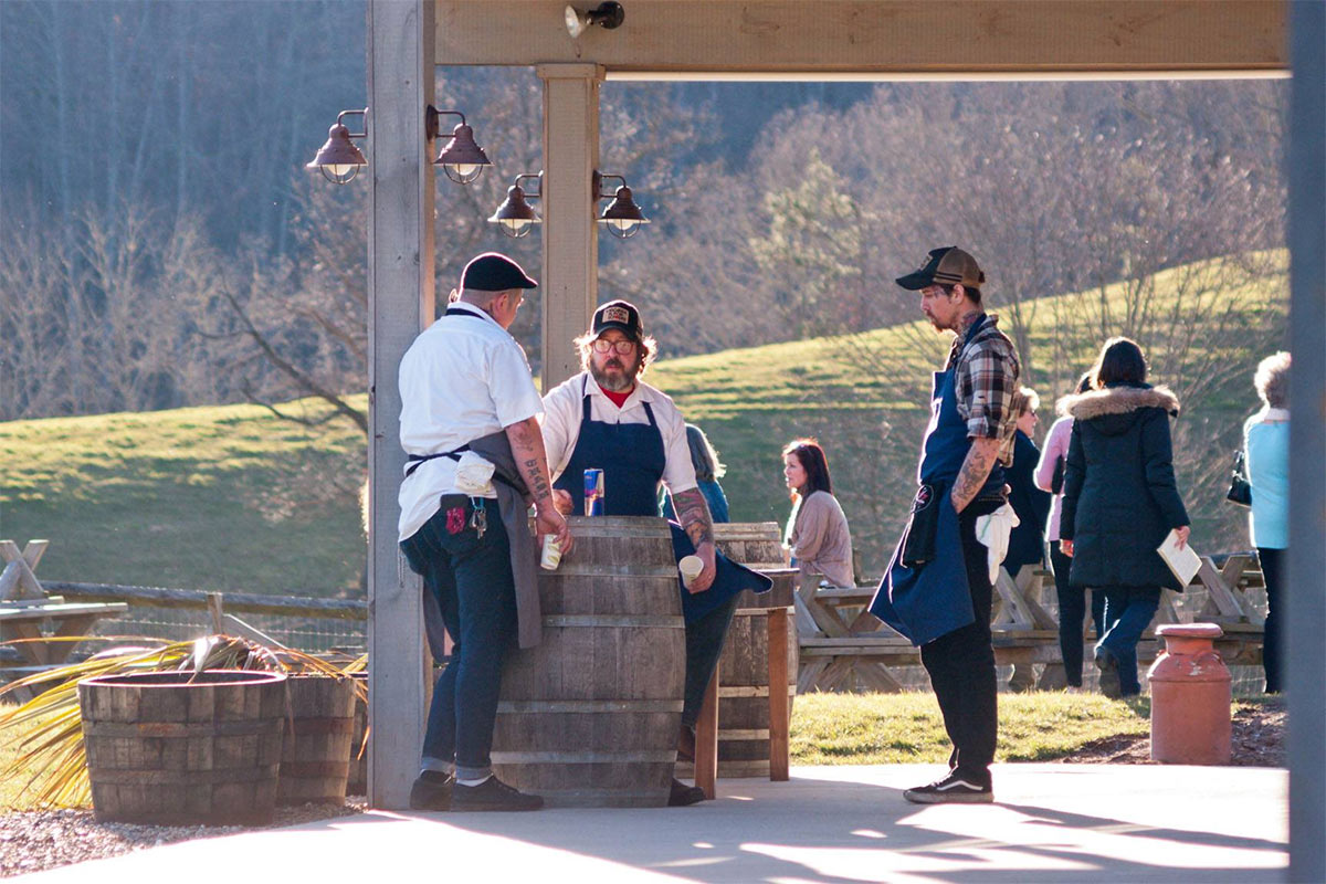
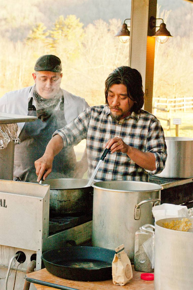
Louisville chef Edward Lee cooks an Appalachian meal at a special dinner hosted by Asheville's The Blind Pig restaurant. (Courtesy The Blind Pig / Facebook)
Louisville chef Edward Lee cooks an Appalachian meal at a special dinner hosted by Asheville’s The Blind Pig restaurant. (Courtesy The Blind Pig / Facebook)

“Last fall, scholars, chefs and activists hosted an Appalachian food summit in Abingdon, Va., to examine how the region’s food heritage can boost local economies,” Black writes. “In February, the James Beard Foundation hosted its first-ever salon for Appalachian chefs.” The Blind Pig, an Asheville, N.C. supper club, hosted six chefs for a dinner called Appalachian Storytellers, in which Tennessee chef Travis Milton served smoked venison, drizzled with a sauce made of malted sassafras and black birch syrup, and smoked collard greens (see photo above). The event, which hosted 140 people, sold out in a day.

Milton, who later this year will open Shovel & Pick, an Appalachian restaurant in Bristol, Tenn., is seeking traditional Appalachian ingredients by growing them himself, Black writes. He “is sowing 10 acres with greasies and other heirloom beans, cowpeas, creasy greens (a type of field cress), Candy Roaster squash, goosefoot (an Appalachian cousin of quinoa), blackberries, huckleberries and more… It’s all part of Milton’s grand plan to use food to ignite economic development in the region and end, once and for all, the pervasive stereotype of Appalachians as a bunch of toothless hillbillies.” Milton told her, “There’s real beauty in these dishes. They yield amazing flavors, the flavors of a subsistence culture. A humble pole bean tastes like a pot roast. You work with what you have because you have to eat.”

[Editor’s Note: This article has been cross-published from the Rural Blog. Top image of an Appalachian meal sponsored by Asheville’s The Blind Pig restaurant at Claxton Farm, NC, courtesy The Blind Pig / Facebook.]

Board of Zoning Adjustments takes up an anti-urban gas station proposal along West Broadway

3

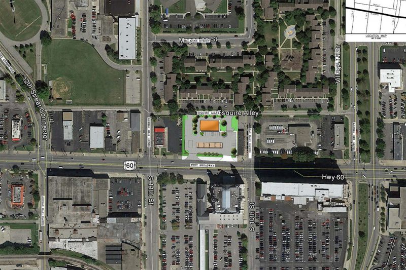
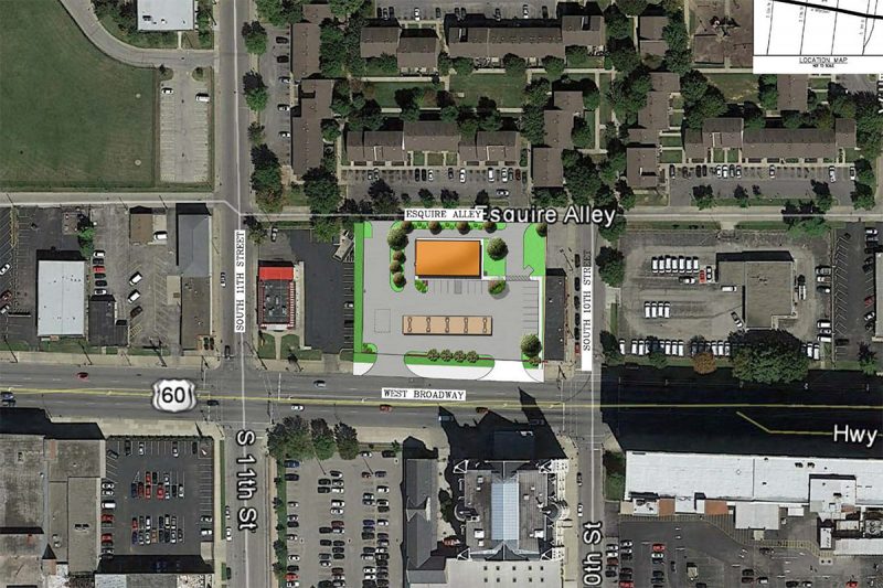
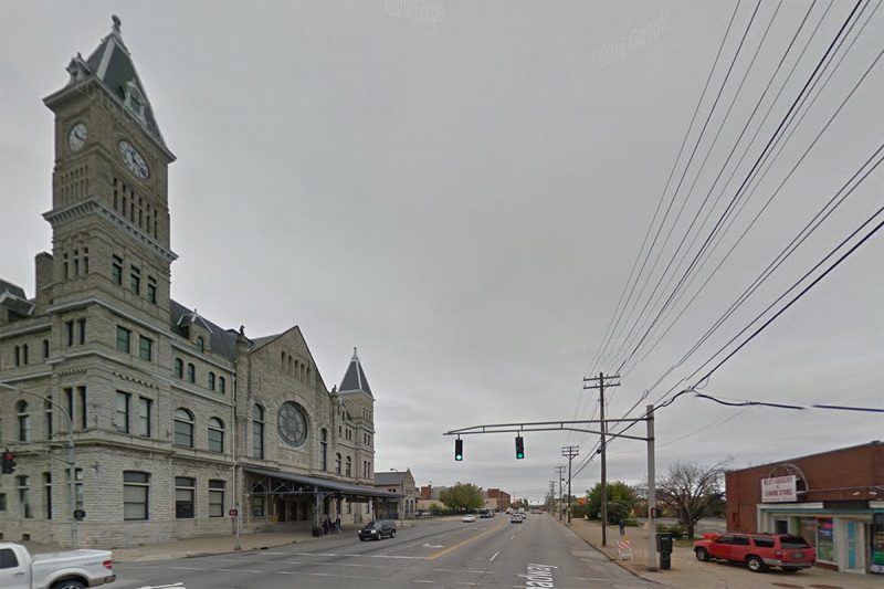
Right now, on Monday, May 2, the Board of Zoning Adjustments is deciding yet again whether Louisville’s Land Development Code is worth the paper it’s printed on. The commission tasked with granting waivers and variances to the land development code convened this morning, and one agenda item—a proposal for a suburban-style gas station at Tenth Street and Broadway across from the historic Union Station—threatens to continue to erode the urban fabric of the Broadway corridor.

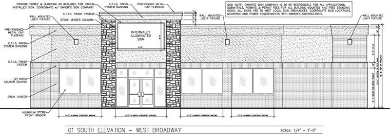
The proposal by West Broadway–based Stry Lenkoff Company (the landowner) and far-East End Shalimar Investments would build a 3,733-square-foot gas station and store with a drive-thru restaurant. The gas station would be built on several parcels zoned C2 and listed under the Traditional Marketplace Corridor form district of Cornerstone 2020, the city’s land development code.

07-louisville-broadway-gas-station-boza-hearingBut, of course, the project has nothing in common with the form district in which it is being built, making this project a little bit like a flashback to the shredding of the land development code in granting a Walmart Supercenter waivers and variances a few blocks to the west.

First, what’s a Traditional Marketplace Corridor? Here’s a bit from Cornerstone 2020:

The Traditional Marketplace Corridor is a form found along a major roadway where the pattern of development is distinguished by a mixture of low to medium intensity uses such as neighborhood-serving shops, small specialty shops, restaurants, and services. These uses frequently have apartments or offices on the second story. Buildings generally have little or no setback, roughly uniform heights and a compatible building style. Buildings are oriented toward the street. Buildings typically have 2-4 stories. New development and redevelopment should respect the predominant rhythm, massing and spacing of existing buildings.

08-louisville-broadway-gas-station-boza-hearingIn order to build the proposed gas station, the development team would need waivers and variances to wipe out pretty much every goal of the land development code. And the following six should about do that:

01-louisville-broadway-gas-station-boza-hearing

For the sake of time, let’s just discuss the variance calling for throwing out the maximum building setback of 15 feet from the street. The proposed structure would be set back 107 feet, 92 feet more than is allowed. And the developers give a doozie of a reason for the BOZA commission to grant the variance: Because gas stations are usually built that way.

“The variance requested allows the proposed gas/convenience/restaurant building to be located where convenience store buildings are universally located, behind the gas pump canopy,” an application from the development team reads. “The proposed development… sets the building where the traveling public expects a gas station to be.”

06-louisville-broadway-gas-station-boza-hearingAs we discussed in the West End Walmart debate, the West Broadway corridor has certainly been eroded over the years to the point where it looks a lot like a suburban arterial. But the land development code and its form districts were put in place to try to correct the mistakes of the past. That a strip mall was permitted in the 1990s should not guarantee that Louisville in the 21st century is held to the same suburban standards simply because that context now exists. Otherwise, we’ll never have any positive change in this city.

The variance application goes on to state that there are no other gas stations in the vicinity—despite there being one .4 miles to the west and another .8 miles to the east—and then goes on to say that its own setback is less than the typical setback of older gas stations in the area. If we make Downtown Louisville a driver’s paradise with auto-centric gas stations and drive thrus everywhere—including across the street from our historic Union Station—then we’re going to get the Downtown we deserve, filled with lifeless expanses of asphalt and empty sidewalks.

(Courtesy Google)
(Courtesy Google)

The developer finally admits in the application, “Were the developer to follow the strict application of the code, the construction of a new building would not be allowed due to the universal site design principles for gasoline stations and drive-thru restaurants.” And perhaps that’s the point. Maybe we shouldn’t be building a gas station nor a drive thru at this location.

Louisville’s Cornerstone 2020 document took years of work and countless people to put together. Each part of the city was scrutinized carefully. Sometimes you just don’t want a gas station or a drive thru in certain parts of the city. This is one of those cases.

05-louisville-broadway-gas-station-boza-hearingSo how did the staff of Louisville’s Planning & Design Services respond the request? Did they summarily throw it out because it destroys the intent of the land development code, sets a bad development precedent in the area and especially in front of a city landmark, because it promotes auto-centric built form in Downtown Louisville?

Not quite. The staff report reads as a document that doesn’t really want to take a stand but generally opposes the plan.

“The requested variance will not cause a hazard or nuisance to the public since safe pedestrian access is provided from the public rights-of-way to the building entrance and since safe vehicular maneuvering has been provided,” the staff report reads.

11-louisville-broadway-gas-station-boza-hearing
(Courtesy Google)

Yet in another spot, it says, “The requested variance will alter the essential character of the general vicinity since the site is located in a Traditional Form District that requires non-residential structures to be constructed close to the street with parking to the side and rear. There are a few properties in the vicinity that were constructed prior to the adoption of the regulation. However, the variance could create a precedence that will allow for the continuance of developments providing parking between the building and street.”

It rightly points out, “The requested variance will allow an unreasonable circumvention of the zoning regulation since the proposed development can be built on the site while complying with the setback requirement. There are no physical site restrictions preventing compliance with the setback requirement… There are other gas stations along Broadway with retail which have the building close to the street and the parking and canopy to the side.”

“The strict application of the provisions of the regulation would not deprive the applicant of reasonable use of the land or create an unnecessary hardship on the applicant since the proposed development can be built on the site while complying with the setback requirement.

The report concludes that the proposal “does not support the request to grant the waivers to allow the parking in front of the building; or to allow the gas canopy between the building and the street.” The staff then goes on to say that BOZA must make up its own mind in granting the variances and waivers.

Once the Board of Zoning Adjustments makes up its mind on this case, we’ll update this story. Stay tuned.

N is for Nulu: Designer children’s boutique Oso opens on East Market

0

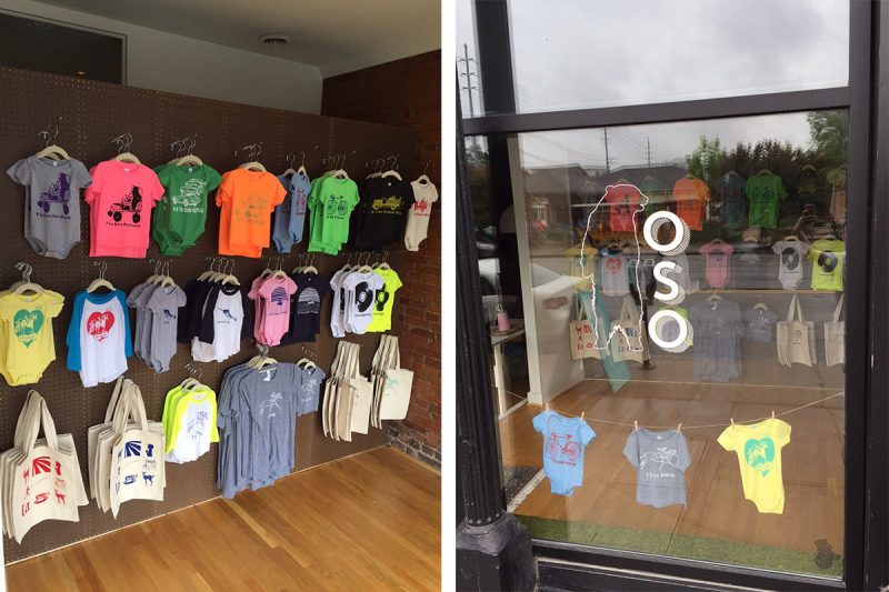
Is a neighborhood all grown up once it has a children’s store? Nulu now boasts a pop-up style kids boutique with hip t-shirts and onesies themed around Louisville neighborhoods.

The new store, called Oso, the Spanish word for bear, just held its grand opening on Saturday in the front of the Magnolia Photo Booth space at 709 East Market Street. “The front space of the Magnolia Photo Booth office on Market Street has been unused,” store proprietor Emily Tower told Broken Sidewalk. “So we thought it would be a good space for a pop-up shop.”

“We were wanting to open to make sure we had a presence for all the people who might be traveling in for Derby,” she added. “This time of year, knowing that there will be crowds on Market Street.”

An "N is for Nulu" onesie. (Courtesy Oso)
An “N is for Nulu” onesie. (Courtesy Oso)

The designs in the store today are the work of Edmonds, Washington–based graphic designer Anne-Lise Hurn. The collection includes screen-printed t-shirts, onesies, a tote bag, and one shirt for adults.

“The idea was neighborhoods,” Tower said. “We wanted to feature different neighborhoods in Louisville and some local places.” But the collection goes beyond the traditional places in Louisville you might imagine. “We wanted something playful since it is geared toward children,” she said. “We went with this theme of the alphabet with the first collection. One shirt is an old airplane and says ‘B is for Bowman Field’.” Other shirts read “D is for Dixie Highway”, “N is for Nulu”, and “P is for Portland.”

A "B is for Bowman Field" t-shirt. (Courtesy Oso)
A “B is for Bowman Field” t-shirt. (Courtesy Oso)

“She’s [Anne-Lise Hurn] not local, but we have other people in mind we want to start carrying once we get going,” Tower said. “The hope is to get more local artists and designers involved.” And Tower’s own designs will also be featured later this summer.

Tower has a passion for sewing and textiles that began as a little girl when she would sew with her grandmother. She later majored in theater and ballet costuming and moved to San Francisco where she worked in bridal design. After switching gears, moving back to her hometown Louisville, and getting her masters in teaching, and becoming a third-grade teacher, Tower continues to sew for private clients.

“The hope is we’ll open the shop and in the summer we’ll release more of the items I make for kids,” she said. “I plan to have one of my sewing machines in the shop.”

Inside the shop. (Courtesy Oso)

Tower has been watching Nulu transform into its current state over the past eight or so years as her husband, Peter Tower, worked at the Magnolia Photo Booth Company. Eight years ago, Nulu wasn’t yet Nulu, the street was dominated by vacant property and the Wayside Christian Mission, and only a handful of businesses like Red Tree boutique and Magnolia had set up shop.

“Together we’ve really seen the change in the neighborhood from the beginning when it was pretty desolate and there weren’t many businesses,” Tower said. “It’s been really exciting to see from the beginning.”

709 East Market Street. (Branden Klayko / Broken Sidewalk)

Magnolia has initially been located on the south side of Market Street but moved to the north side of the street when space became available. “Around that time, that’s when Nulu really started picking up with Please & Thank You and other boutiques,” she said.

“There’s definitely been a spike in restaurants and boutiques and shops, “Tower added. She said opening Oso was a logical next step for the neighborhood. “We felt this was something lacking in Nulu and in Louisville in general. There are baby shops, but this is different.”

Plus, Emily and Peter have their own personal connection for opening the shop: they have a one-year-old, Margot. “That was the excitement on our end personally.”

Oso is located at 709 East Market Street and is open Tuesday through Saturday, 10:00a.m. to 6:00p.m. Visit their website here.

This app makes taking TARC’s free ZeroBus easier than ever

Have you ridden the ZeroBus yet? (You’d better know what the ZeroBus is.) The cost-free, emission-free, electric Downtown circulator just got a little bit better with the launch today of its new app that details real-time bus locations, arrivals at stops, and displays popular destinations at each stop along its East–West and North–South routes.

The free Apple and Android app from TARC, the Transit Authority of River City, is summarized in the video above, provided by the authority.

“By clicking on a stop on a route map, app users can find out when the next ZeroBus will arrive there,” a press release reads. “App users can also search for and locate over 100 downtown destinations.”

To download the new app, search for ZeroBus in the Apple App Store or on Google Play.

When ZeroBus launched in January 2015, the fleet was to be ten buses strong, but only nine buses make the circuit today. “We didn’t get to take delivery of the 10th bus in the initial order,” TARC’s Kay Stewart told Broken Sidewalk. There was an incident at the South Carolina manufacturer Proterra and the company no longer makes the short bus model. “The nine ZeroBuses we have has been adequate to fulfill the schedule they’re on,” Stewart said.

In February 2015, TARC announced it received funding for five more electric buses, and Stewart said because of the mix-up, Proterra is now making that order six so the total number of buses will still add up. But the six new buses, to begin rolling out this summer, won’t be ZeroBuses.

Instead, the new buses, longer at 40 feet, will run on standard TARC routes that overlap with the existing electric charging infrastructure. They’ll look like ZeroBuses with a futuristic aesthetic, but they’ll be introduced on other routes reaching farther out into the city. No new charging stations are currently planned. Stewart declined to name which routes the new buses will use, but said the first buses could roll out in June.

36 Miles exhibition explores the impact of the Ohio River on Louisville

The Ohio River is the reason we’re all here, really. Had it not been for that 25 foot drop in elevation we call the Falls of the Ohio, riverboats could have just sailed right on past the site where our fair city grew up. But instead, they had to stop, portage their gear, and load up again below the walls. And this was born Louisville and Portland.

Over the centuries, Louisville has had a mixed experience with the mile-wide river that meanders slowly through. At various times, it’s been the untamed wilds requiring the fearless skill of the ol’ Kaintuck. At others, it was an engineering problem to be solved, eventually being tames with major dams and hydroelectric efforts. For much of the Louisville’s history, it was something to turn your back on and let be an open sewer that carries the city’s waste downstream.

But recently, society has been turning all of those notions on their heads: the river is an asset and place of identity and recreation. The city is like a teenager who finally grew up and realized his or her parents are actually kind of cool. We’re returning to the river.

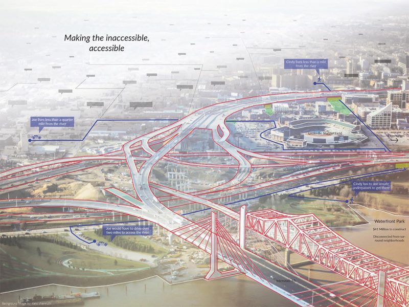
Infrastructure, created in collaboration by Jeff Embree (UK Landscape Architecture) and Kelsi Wermuth (UL Hite Art Institute).

Enter 36 Miles: Revealing the Ohio. Students from the University of Kentucky Department Of Landscape Architecture and the University of Louisville Hite Art Institute have been working together to study the impact of the river on the local community and now they’ve prepared an exhibition of their work.

Poetically named for the length of Ohio River shoreline in Jefferson County, 36 Miles opens tomorrow evening, Friday, April 29, from 5:00 to 8:00p.m. The free exhibition will be on display at the newly opened home of the Louisville Visual Arts Association, 1538 Lyle Street, in Portland.

You can RSVP for your free tickets here.

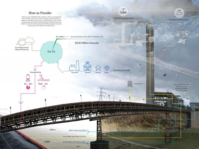
Louis R. Johnson, a landscape architect at Gresham Smith & Partners and professor working on the project, said the idea came from a collaboration between noted New York landscape architect Kate Orff (of SCAPE / Landscape Architecture) and photographer Richard Misrach. The duo published the remarkably beautiful book Petrochemical America combining moving environmental photos and environmental data.

“They had a really nice blend of putting technical information in an approachable way layered on top of richard photos,” Johnson told Broken Sidewalk. As landscape architects, “we’re constantly trying to take complex, data-driven, analytical information that deals with really important components of people’s lives—whether or not they know it—and make it digestible for everyone.”

Power Plant by Jeff Embree, UK Landscape Architecture.

Similarly, landscape architecture students and artists are translating the story of the Ohio River in ways that make its complex story understandable. Johnson pointed to one example where a student overlaid data about a coal power plant in the West End on top of a photo. “It explains why the river is necessary for a coal power plant,” he said.

Johnson said it’s crucial for the community to understand the river and what it means to the city.

“I came to the realization of how little I actually knew about the river,” Johnson, a Louisville native, said. He said if someone whose profession was tied to the ecologies that rise from the river itself doesn’t have an understanding of the river, then many others in the community likely don’t either.

The exhibition focuses on three critical elements: connecting Louisvillians to their river, building environmental public awareness locally, and bringing design education to the city.

“Our thesis is that the majority of Louisvillians are disconnected from the Ohio River physically, but more important, mentally,” a press release reads. “Most understand the river as the place Thunder Over Louisville happens, or the river that floods, or as Waterfront Park, but that connection is narrow indeed.”

That disconnect leads to a potentially harmful lack of environmental awareness. But education can help bridge that gap. “Design education is a critical component of Science, Technology, Environmental, Art and Mathematics educational curriculums (STEAM) and right now Louisville has an enormous void with no such opportunity at a university level,” the press release stated. “This project is a vital first step for illustrating the importance of these opportunities for the next generations of creative thinkers and keeping them within our region.”

36 Miles is just the beginning, a pilot project that will lead to further study. Mary Carothers, associate professor at the Hite Art Institute plans to expand the curriculum, creating an entire course around the river, and Johnson said UK will be leading additional multidisciplinary design studios on the topic.

[Top image by mcflygoes88mph / Flickr.]

Edwards Companies backs down from threat, moving forward with major East Broadway developments

0

It appears Metro Louisville called Columbus, Ohio–developer Edwards Companies’s bluff and won. Sheldon Shafer at the Courier-Journal has the big news today that those developers, who recently threatened to pull the plug on two major projects on East Broadway if the city didn’t offer nearly $3 million more in incentives, has announced the developments will move forward.

The 200-unit Mercy Apartments have already been approved. (Courtesy Edwards Companies)

Many in Louisville saw the developer’s actions, expressed through their attorney Bill Bardenwerper, as little more than a threat, including, apparently, the city’s economic development agency, Louisville Forward. Jessica Wethington, spokesperson for that agency, was quoted by Insider Louisville’s Caitlin Bowling as saying $7.5 million in incentives already offered for the project was “Metro Louisville’s best and final offer.”

The Phoenix Hill Apartments would bring a mix of 281 units and 33,000 square feet of retail. (Courtesy Edwards Companies)

In a commentary at WFPL, attorney and entrepreneur Dan Borsch called the move “a classic shakedown” while WDRB General Manager Bill Lamb said the developers could hit the road if the city’s $7.5 million incentive offer wasn’t good enough. According to Borsch’s commentary:

Are we investing in our community’s future? Or are we the chumps who mortgage our future for a ribbon cutting?

What does it say about our political environment when a developer has the audacity to accept huge public subsidies for a private project and then threatens to abandon the project unless an even larger amount of public dollars is approved?

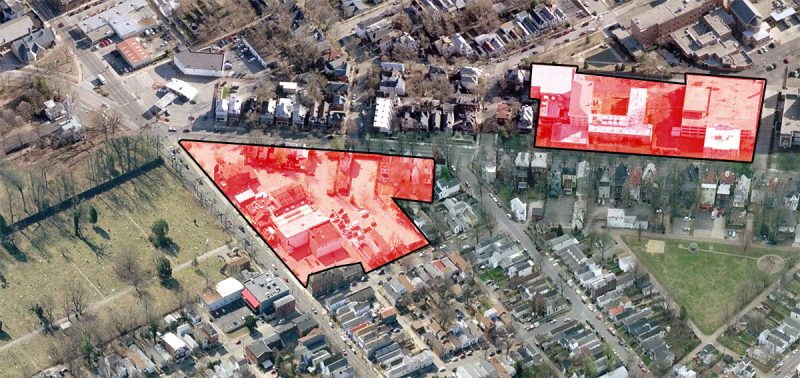
The Phoenix Hill Apartments site, left, and the Mercy Apartments site, right. (Montage by Broken Sidewalk)

Now the plans are again moving forward. “In an open letter ‘to the citizens of Louisville,’ the Edwards Companies said it has accepted the financial incentive package offered by the city’s development arm, Louisville Forward,” Shafer wrote, noting that it’s not currently know whether the developer will proceed with plans as proposed or scale back the project.

One other detail also came to light: Five historic houses along East Broadway that Edwards Companies agreed to save will be donated to a local preservation nonprofit. Two other facades are being incorporated into the Phoenix Hill Apartments.

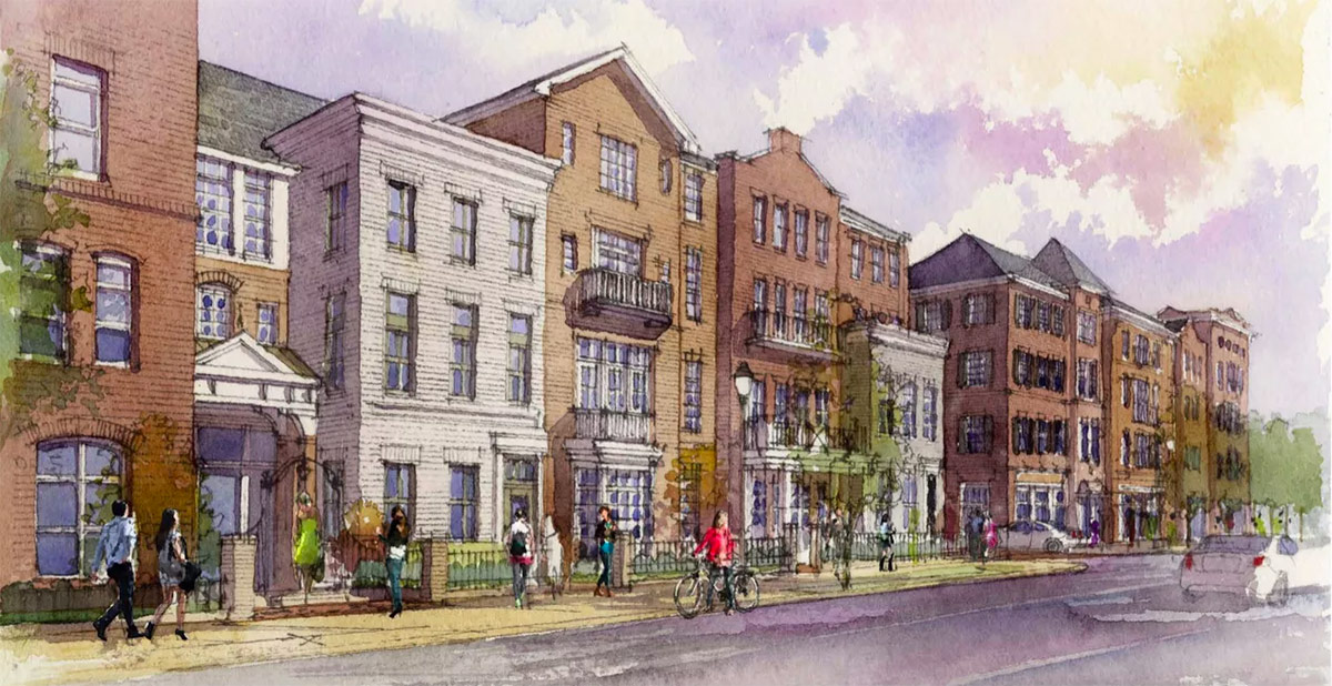
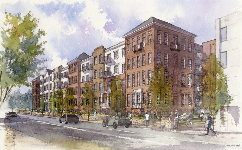
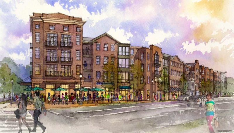
The two projects in question are the $25 million, 200-unit Mercy Apartments on East Broadway, sited on the former campus of Mercy Academy which has already been demolished, and the $52 million, 281-unit Phoenix Hill Apartments including 33,000 square feet of retail space, located on the site of the former Phoenix Hill Tavern.

Combined, these two projects will significantly change the Baxter Avenue corridor for the better, adding much needed retail space and creating density on a site known mostly for its surface level parking. Their visibility and scale will make them a significant contributor to the urban feel of the street corridor, adding activity, density, and an urban edge to a prominent intersection and corridor.

After devastating fire, The Tavern is completely rebuilt in Old Louisville

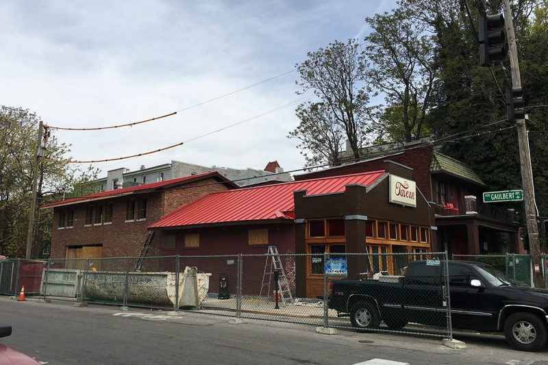
Around 3:30a.m. on a Tuesday morning in July 2014, The Tavern, an Old Louisville watering hole, caught fire. The blaze was the work of an arsonist who set a number of trash cans on fire in the neighborhood that night. Twenty two firefighters responded to the call, which destroyed the back portion of the building.

In 2012, attorney and entrepreneur Dan Borsch purchased the building through his family investment firm and he and business partner Scott Lukemire began to operate The Tavern business. “It was a bad fire,” Borsch told Broken Sidewalk. “We had been open just over a year when the arsonist hit.” At the time of the fire, Borsch had been renovation portions of the building.

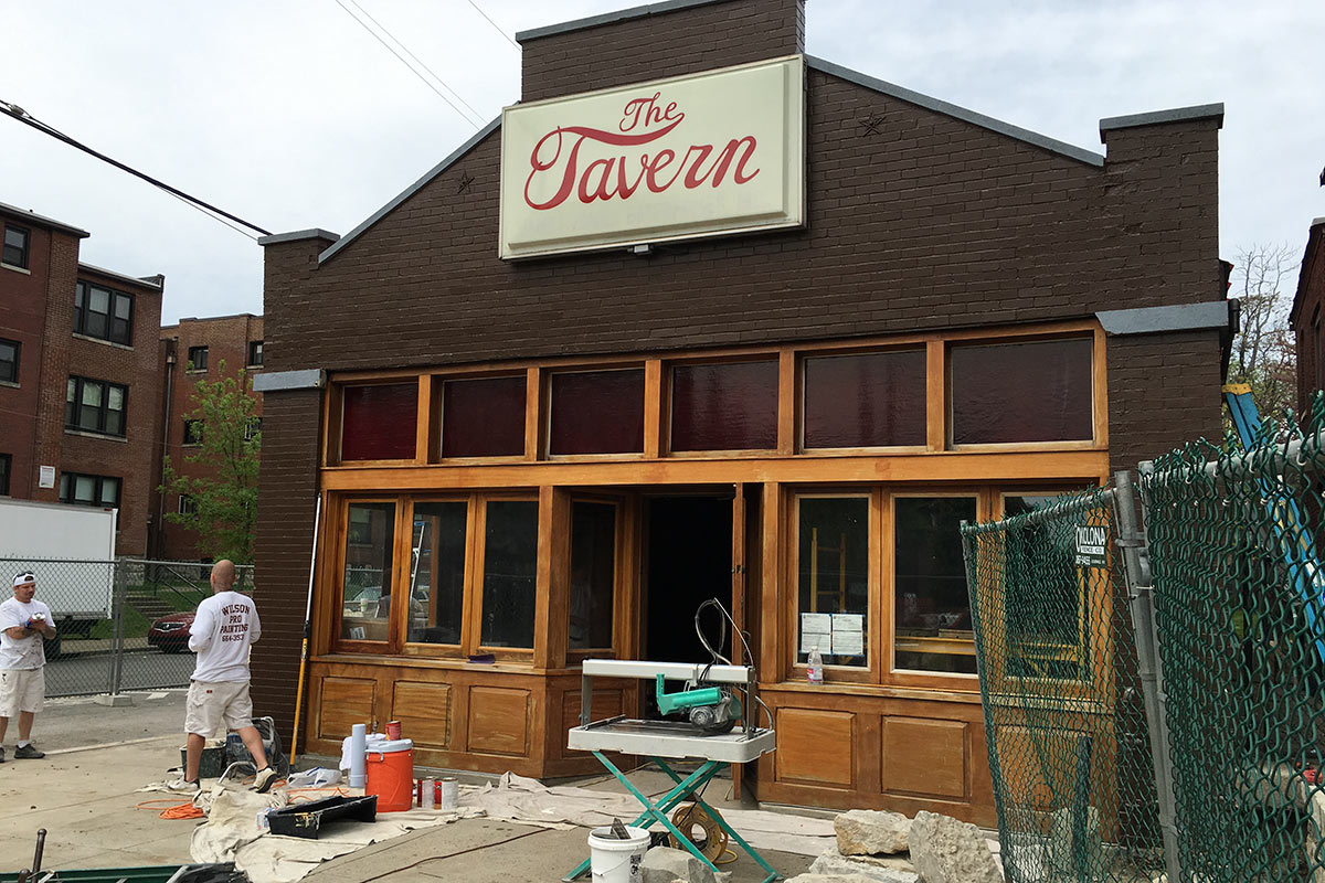
(Branden Klayko / Broken Sidewalk)

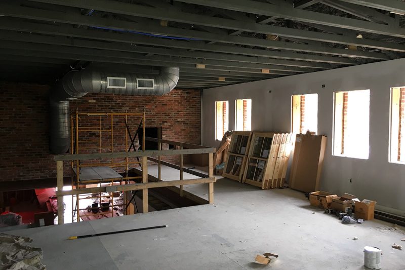
And while initial estimates of reopening in a few months turned into nearly two years, the wait has been well worth it. Borsch recently walked us through the busy construction site ahead of its May 2 opening and the new space is even better than the old.

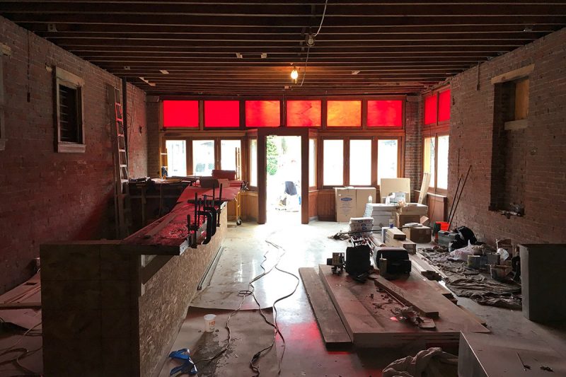
Walking in the front of the structure at Fourth Street and Gaulbert Avenue, new red stained glass transoms filtered the light shining through the front mahogany storefront facade. Borsch motioned to the left where several old doors and windows had been bricked in decades ago. He said those would receive the same red glass transoms as the front and serve as niches in the new space. Banquets are planned along the wall with a large bar on the opposite wall.

(Branden Klayko / Broken Sidewalk)

That bar will feature ancient timbers from another building Borsch owns, an old bourbon warehouse on First Street between Main and Market streets. That structure’s top two floors had to be demolished when a structural wall began to waver, but Borsch said he is closing in on a use for the remaining ground floor space next to the new Aloft Hotel. (Luckily Borsch gave us a tour of the building in 2008 before that demolition.) Joists with a 160-year-old patina now serve as The Tavern’s bar and a ledge along the front window.

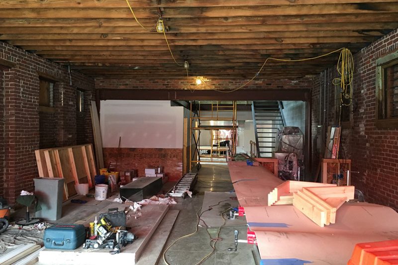
(Branden Klayko / Broken Sidewalk)

Original Terrazzo floors were mostly destroyed, but Borsch was able to save about the first six feet from the entrance. New polished, exposed-aggregate concrete floors mimic the original’s speckled patterns. Around the perimeter, new wainscotting is being installed, and overhead, Borsch is keeping the rafters exposed.

Cash Moter of Louisville’s Joseph & Joseph Architects drew up the designs for the new space.

(Branden Klayko / Broken Sidewalk)


The back portion of the structure had to be entirely rebuilt, and Borsch took the opportunity to add a second story for private events while maintaining the original style and feel of the old structure. Atop a set of steel stairs, the new space features hickory floors and an open, flexible arrangement.

(Branden Klayko / Broken Sidewalk)

An old wooden storefront that existed in the original building was rebuilt into the new facade along Gaulbert where The Tavern’s kitchen is located, itself clad in an expanse of white subway tiles and stainless steel appliances. Borsch plans to add the same red stained glass to that storefront’s transoms as the rest of the building.

(Branden Klayko / Broken Sidewalk)

Back in the ’20s, the rear storefront housed a restaurant called the Railroad Smoker, Borsch said. Up front was an A&P grocery store. He pointed to the strangely wide Gaulbert where all the buildings face away from the street toward pedestrian courts, noting that railroad tracks once came up through the area on their way east to connect to another rail line.

(Branden Klayko / Broken Sidewalk)

Outside, the building mass now pops up in the back, giving the vague appearance of a sort of commercial camelback design. Borsch was careful to match the existing details and salvage as much of the old building as he could. “We reclaimed a lot of brick from the old walls and used them on the facade,” he said.

Borsch pointed to a dividing line on the facade where The Tavern’s original wall, covered in paint, ended and the new wall began. He said the paint on the eastern half of the structure would be power washed off using a technique called “soda blasting.” It’s like sand blasting, but with baking soda instead of sand, Borsch explained, noting that soda is easier on the old building materials than sand.

(Branden Klayko / Broken Sidewalk)

In another gesture toward reuse, Borsch brought hand-shaped limestone pieces of the foundation wall no longer needed when a new structural wall was added to the front patio. You can see them today forming a retaining wall.

When it opens on May 2, the new Tavern will show off Borsch’s vision for the nearly century old corner commercial building. “It’s a nice mix of old and new,” he said. He and his architects have taken care to detail every piece of the building, from porcelain tiles in the bathrooms to the antique wood of the bars, to make sure the new space is better than the old.

“It was not inexpensive,” Borsch said. “But I’m excited to do it for the neighborhood. The neighborhood needs a nice place.”