Architect Kulapat Yantrasast discusses design of the Speed Art Museum before its March 12 grand reopening

4

The Speed Art Museum officially reopens on Saturday, March 12. And we couldn’t be more excited.

Ever since the project was announced in 2008 and construction began in 2011, we’ve been watching the design for the new museum, the work of New York– and Los Angeles–based architecture firm wHY and principal Kulapat Yantrasast, take shape on the edge of the University of Louisville‘s Belknap Campus on Third Street.

From the very beginning, the Speed sought out top notch architects for its project, shortlisting Bernard Tschumi, the Bjarke Ingels Group (BIG), Gluckman Mayner, Henning Larsen, SANAA, Snøhetta, Studio Gang, and wHY from a pool of more than 100 contending firms. We spoke with Yantrasast in 2009 when he explained his firm’s strategy of “Architectural Acupuncture.”

(Courtesy Speed Art Museum)

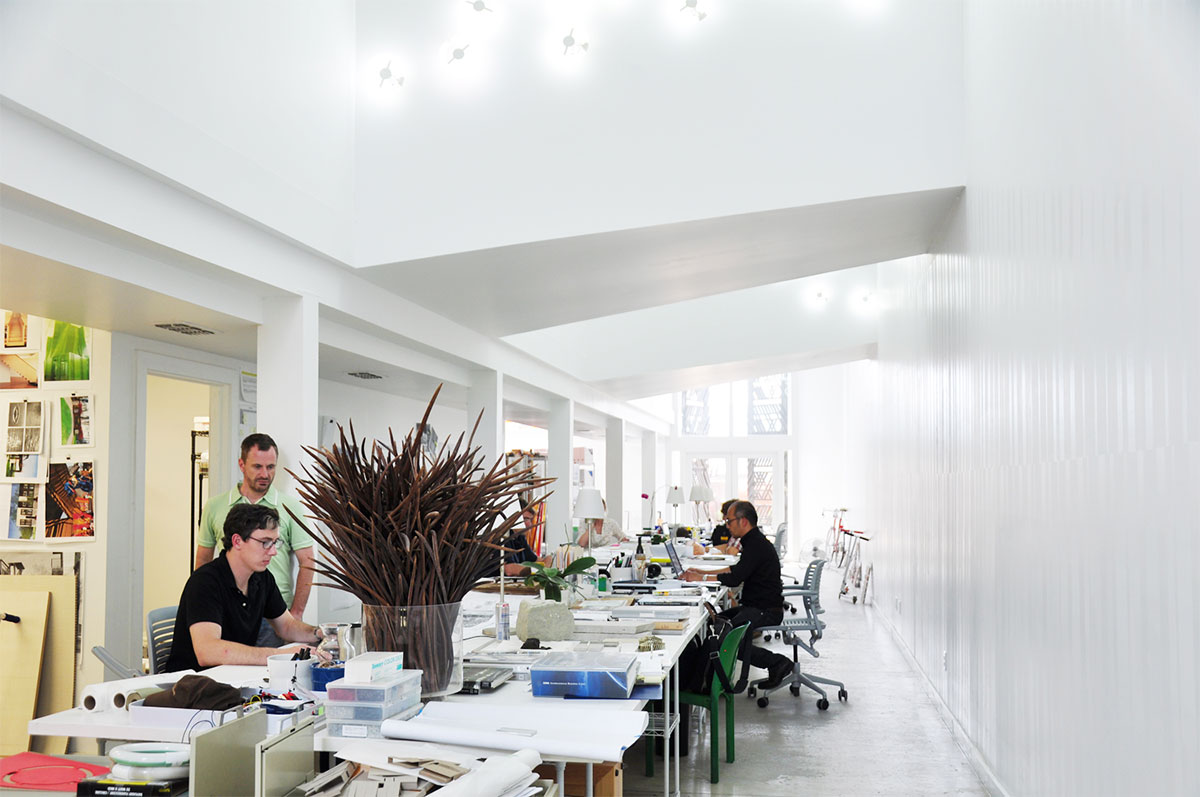
Yantrasast recently spoke with Interior Design magazine, where he elaborates on his design thinking at the Speed Art Museum and in his other commissions.

“Acupuncture believes that the body has the energy to heal itself. In a sense, this is about helping the energy of an institution resolve its own problems,” Yantrasast said in the interview. “‘Architecture acupuncture’ doesn’t look at a building as brick and mortar. It looks at it as a brand, as an institution, as alive. So your work is not just to add another wing, another limb, another body. Instead, you must try to help solve the problem that the old body has by clearing circulation, decentralizing functions, and creating a better connection from the body to the outside. This allows the soul of the museum to thrive and connect better to people and our time while maintaining its original DNA and identity.”

Here are a few quotes of interest on various topics of preservation, architecture, and the Speed.

On working with old buildings:

Some of the buildings we do—the Speed Art Museum for example, or the Art Museum of Chicago, or even the Harvard Art Museums—all of these buildings were built more than 100 years ago, or close to 100 years ago. Every institution is like a grandmother or grandfather. Just because something seems less relevant to our time doesn’t eradicate the history that it lived through. These buildings will continue to live beyond our time. We’ll be gone and this museum will continue to survive and have life beyond our involvement or intervention, so it would be sad to be shortsighted about trying to, I use the phrase, “put her in a mini skirt.” That impulse is mid-life crisis kind of thinking.

(Courtesy Speed Art Museum)

On working with clients:

The only way we can start is to really be very active listeners—not just hear what people say, but absorb beyond the words…

Obviously, giving people the chance to express themselves is the first step. And then responding to those thoughts with your own thoughts that have a resonance is always a key. It’s like playing tennis. If someone serves to you, and you cannot return that ball then it stops. So it becomes a bouncing of ideas across, and through that a friendship happens and trust happens.

On architecture engaging with the public:

In traditional museums, in traditional buildings for that matter, the design is like a peacock. You go into the lobby, and from the lobby you can go to all these different rooms, galleries, classrooms, auditorium, cafe, and bookstore. They all centralize through the entrance and they kind of fan out, like a peacock spreading its wings. The problem is that it’s so centralized that for the coffee shop to open after 5 o’clock, the whole museum would have to be open. And the problem, too, is that everything is contained within the walls and no one sees what’s going on.

What we have done at the Speed is to change from the peacock model to what I call the octopus model. With the octopus model, all these facilities that normally get hidden behind the grand lobby are now tentacles reaching out into the streets and the community. For example, the coffee shop has its own storefront, so if you want to open it after hours, you can do that easily without having to open the whole museum. The classroom can become another storefront and you can see the activities going on over there.

(Courtesy Speed Art Museum)

On natural light:

In the Grand Rapids Museum and the Speed, too, close to around 85 percent of the spaces have natural light, including the galleries, offices, and public spaces.

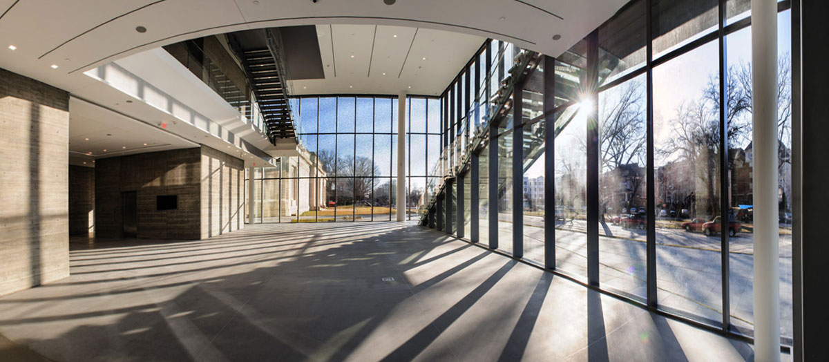
But as you know, most of the time art does not like light. Because art needs to be preserved, and so the light has to be appropriate, filtered, and harmless to the art conservation levels. We do that by introducing indirect ways for light to come through, filtered light as well as using it in a way that allows people to feel it. Because even though art doesn’t like light, people like light.

On concrete:

I love the fact that it’s not a cladding, that the structure is the finish. It tells you how it’s made because you can see the traces of the former. You can see the traces of people’s hands and nails and things like that. I like people to be able to read buildings and know how it’s made.

On art:

I definitely love Duchamp. He set a tone that I think makes art so open to everyone, including myself.

If we’re talking about an object that I could own that would make me so happy, it may be a Cy Twombly painting. His work just seems to give you that delight of revisiting and not a lot of art objects offer that delight.

Read the full interview with Yantrasast at Interior Design.

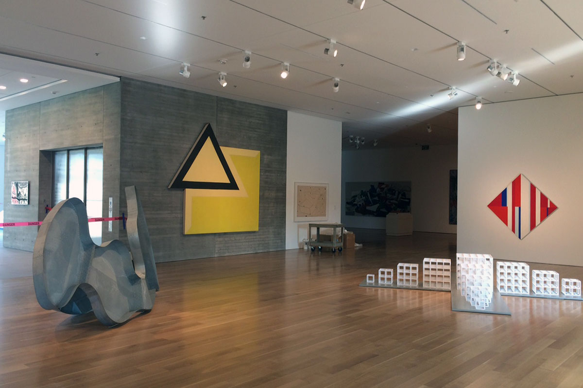
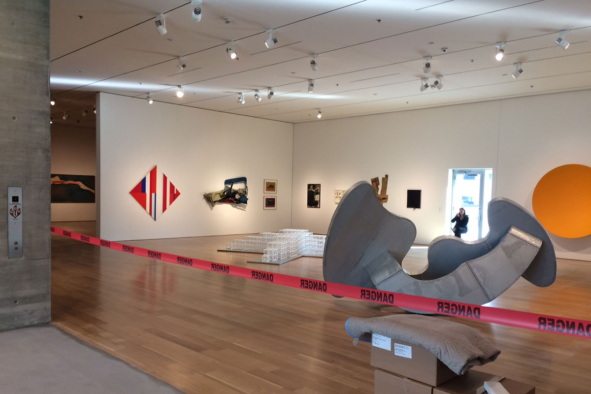
The new museum will cover over 250,000 square feet, wrapping an original 1927 Beaux Arts structure with a new 60,000-square-foot North Pavilion—the prominent new building we see walking along Third—and a South Pavilion containing an outdoor sculpture garden and a 142-seat theater for the museum’s new film program, to be called Speed Cinema. wHY previously peeled away a series of uncoordinated additions dating to 1954, 1983 and 1995. Local architecture firm K. Norman Berry Associates worked with wHY on the project.

When it opens on the 12th, the Speed will celebrate with 30 hours of continuous programming in its old and new spaces. (View a full schedule of events here.) In related news, Brown-Forman Corporation recently donated $1 million to the Speed to open the museum for free on Sundays for the next five years.

Architect Roberto de Leon elevated to the AIA’s College of Fellows

1

For architects, there are a number of awards and honors you might accrue over a lifetime, but one of the most sought after is being selected for the American Institute of Architect’s (AIA) College of Fellows. This Fellowship “not only recognizes the achievements of architects as individuals, but also their significant contribution to architecture and society on a national level,” the AIA writes of the honor.

Roberto de Leon.
Roberto de Leon.

This year, the AIA elevated 149 of its 88,000 members across the country to the College of Fellows, and one architect from Louisville made the cut. Roberto de Leon, principal at De Leon & Primmer Architecture Workshop in Nulu, will be officially honored at this year’s AIA National convention in Philadelphia.

“I’m truly humbled by the fact that our work in the Ohio Valley region has had a significant impact nationally & abroad in terms of expanding the discussion on what ‘architecture’(with a little ‘a’) can be,” De Leon told Broken Sidewalk in an email. He continued:

It has been immensely satisfying to tackle project challenges through an approach that combines both innovation and economy—it’s an argument that they’re not mutually exclusive. Within that framework, there’s an underlying optimism that architecture really can empower and be a catalyst for positive change—as exemplified in our project for Guthrie, Kentucky, which was the result of a grass-roots community effort to revitalize their historic downtown.

No Louisville architect has achieved this distinction since at least before 2012, when the AIA began keeping archives of the award on its website.

“My elevation to Fellowship in the AIA has been an especially meaningful honor for me because it’s an accolade that comes from my professional peers,” De Leon continued. “The recognition of Fellowship also comes with the responsibility to mentor, encourage and support emerging talent. It’s always been important to me that our studio and our working process inspires young architects, which is why I continue to stay active in academia in addition to professional practice.”

De Leon & Primmer has achieved significant success already. The firm was selected as an Emerging Voice of the Architectural League of New York in 2011, was included in the Walton Family Foundation’s Design Excellence list, and has garnered numerous local, state, and national awards, including a National Honor Award for its Wild Turkey Visitors Center and, most recently, two awards from the AIA’s Kentucky chapter.

“As our work continues to broaden in terms of project types, scales and different geographical regions,” De Leon added, “I’m excited to explore how our design methodology adapts and responds to new contexts & conditions.”

The firm is currently working on an addition to the Filson Historical Society in Old Louisville.

The 2016 Jury of Fellows included Diane Georgopulos of the Massachusetts Housing Finance Agency, Steve Crane of VCBO, Marleen Kay Davis of the University of Tennessee, Mary Katherine Lanzillotta of Hartman Cox Architects, David Messersmith of the University of Texas, Arlington, Karen V. Nichols, of Michael Graves & Associates, and Donald T. Yoshino of Yoshino Architecture.

Louisville lacks a meaningful way to build complete streets that benefit all road users

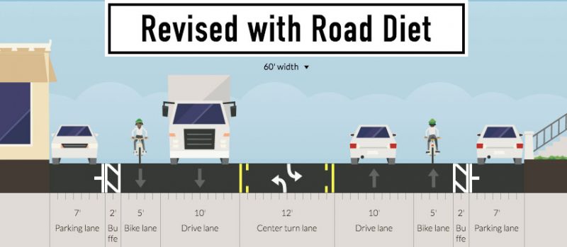
Below are two roads—both 60 feet wide. The top design does one thing incredibly well: it moves cars efficiently in a straight line. The next one, below, does this and many other things as well.
(Courtesy Chris Glasser)(Courtesy Chris Glasser)

This is because motorists do not drive only in straight lines—the “revised” layout includes a dedicated turning lane to prevent congestion. The resulting configuration slows traffic speeds with narrower driving lanes. There’s space for bikes. Parking lanes are right-sized—not nine feet wide but seven feet, with a two-foot buffer zone. With everything compartmentalized just so, traffic moves more efficiently, even with one less driving lane.

And what’s maybe less obvious is that this road is safer for pedestrians too: slower, more predictable traffic movements make it easier and safer to cross the street.

That “revised” street section is called a road diet. Among traffic engineers and city planners, the safety benefits of such a street design are well-known and well-understood. The debate over their usefulness is over and their benefits are clear.

How about more like this in Louisville?

So why doesn’t Louisville have more of these road diet configurations? One of Louisville’s public works employees told me he has a list of twenty or so city roads he’d like to see get a road diet. And yet in Louisville, we have no dedicated funding source for projects like this.

In the city budgets of the last three years, there has been funding for sidewalk improvements, for bike lanes, and for road repaving—all the ingredients needed for a complete street. But all  that money is in separate pots, all going to separate projects. We’ve got the ingredients we need, but no recipe to follow to make a better street. We don’t provide any funding for the holistic approaches that make the street safer for everyone. This needs to change.

In Louisville, we have an 8-year-old, 160-page document that’s gathering dust and the promise of a multi-modal plan that’s more than a year overdue. What we don’t have is  a strategy or funding source for implementing complete streets. Instead, we come by our most people-friendly streets somewhat haphazardly.

Sometimes “bike money” is used for these projects—as on Grinstead Drive in Crescent Hill. Sometimes “repaving money” will get used—as is the case in an upcoming project on Third Street in Beechmont. In both cases, a four lane road was “dieted” down to three. Considering that these projects affect all road users, their implementation should be more than an afterthought. Their funding mechanism must be more clearly defined.

A “complete street” isn’t one specific thing.

The term “complete street” is a general way to describe roads designed with all users in mind: people in cars, people riding transit, people walking, people on bikes. A street becomes “complete” when it is designed for people, not for quickly moving cars through a space.

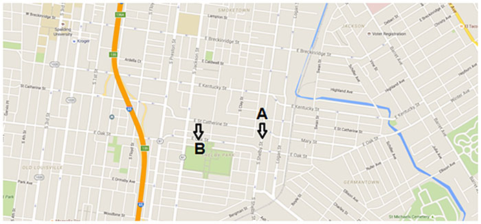
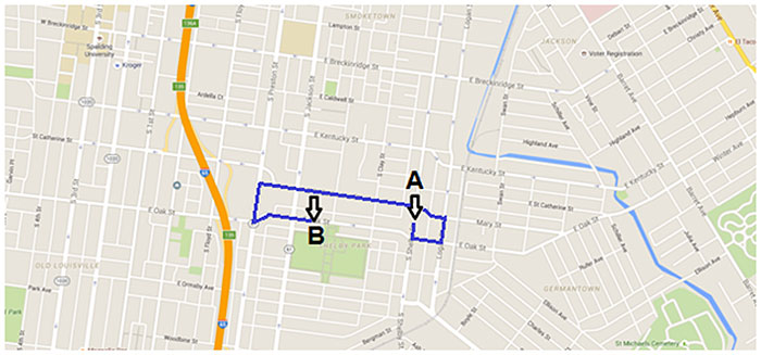
Here’s another example of what a complete street can be. Take this network of one-way streets in Shelby Park and plot your route from Point A to Point B.

03-louisville-complete-streets

02-louisville-complete-streets

The network above was designed for getting cars to and from downtown as quickly as possible. If you time the lights right on Oak Street, for example, you can get from Old Louisville to the Highlands without ever hitting the brakes, moving along at 30 or 40 miles an hour. This is great for motorists on their rush hour weekday commute, but bad for virtually everyone else every other time of the day. If you’re a resident, it makes your roads a maze to navigate—annoying and inconvenient. If you’re a kid playing in Shelby Park, it makes chasing a ball into Jackson or Oak streets potentially life-threatening.

Simply “two-waying” this grid would benefit everyone—in ways that go beyond safety. It’s important to remember here that streets are more than just places for people to get from Point A to Point B, they’re also the social and economic engines of our cities. Creating a two-way grid would increase property value and drive down abandoned property rates. It would enhance local business. Walkability would increase and speeds would settle to a safer level.

The advantages of two-waying, like the advantages of road diets, are well-known and well-understood. Both are examples of complete streets. Both benefit their surrounding communities.

And, unfortunately, both suffer from a lack of a dedicated funding source from Louisville Metro government.

What gives?

It’s not so much that this lack of a funding mechanism is disappointing as it is surprising. So many people in local government “get it”—from Metro Council members who clamor for road diets and two-way streets, to Public Works and Planning employees who can rattle off the benefits of these kinds of projects. Many times, Mayor Greg Fischer has spoken of the need for making our city’s streets more people friendly—it is literally the first goal in his strategic plan. And, yet again, there is no specific funding for these kinds of projects.

04-louisville-complete-streets

Why is this important? Here’s just one example: Metro Louisville Public Works is currently considering a redesign for Jefferson Street through Downtown. Their design features bus islands, a protected bike lane, and curb extensions for pedestrians. Four driving lanes would be taken down to three. These are all great things—design concepts that benefit all users.

But there’s one big problem. There’s no money for a project like this. To be sure, there is money in a city budget of hundreds of millions of dollars. For instance, “bike money” could pay for this project—but at the cost of 75 percent of its annual allotment on a bike lane that goes 0.9 miles and for which the vast majority of the project cost is not related to a bike lane. There is money available, just not money for this complete street project.

This is a problem.

And it’s a problem my organization, Bicycling for Louisville, is aiming to address. In the past, our mission has been to make streets safe and accessible to people on bicycles. Moving forward, our mission is expanding to advocate for better streets for everyone—to jumpstart more complete streets in Louisville.

Our new advocacy initiative, Streets for People, will be an attempt to change the way we look at our roadways. We want them to be seen as not just arteries for moving cars efficiently, but as public spaces that consider the safety and needs of all their users—neighborhood residents, commuting drivers, local drivers, pedestrians, transit users, and yes, bikers.

Our first goal is to see a funding mechanism for holistic roadway redesign implemented. Until that happens, this effort toward multi-modal street design will be staggered and piecemeal—a little here, a little there, none of it coordinated. If this truly is the number one goal for our city, let’s allocate some money for it. That seems like a simple first step.

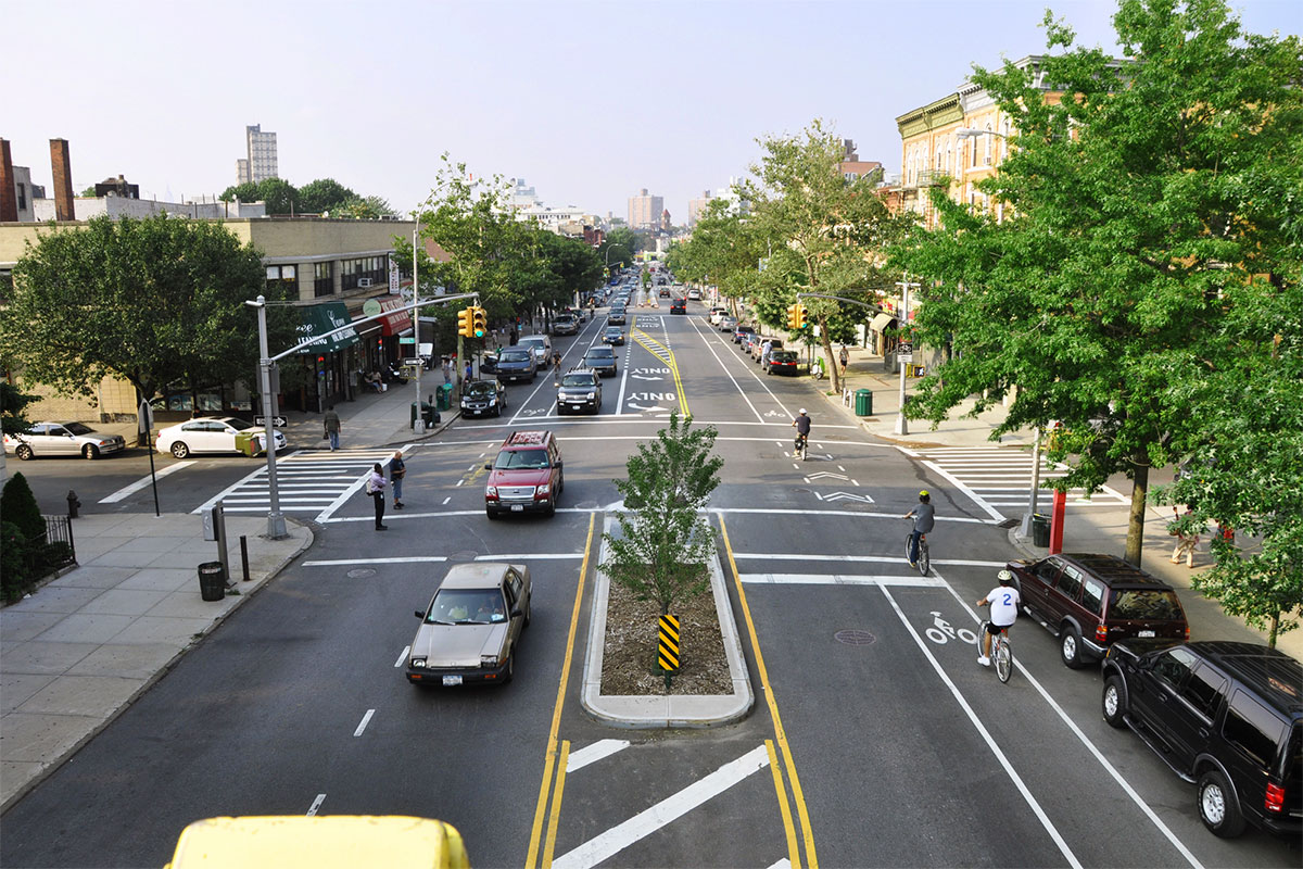
[Top photo of Vanderbilt Avenue in Brooklyn courtesy the New York City Department of Transportation / Flickr.]

Person struck by hit-and-run motorist on Preston Highway at Phillips Lane

(Courtesy Google)

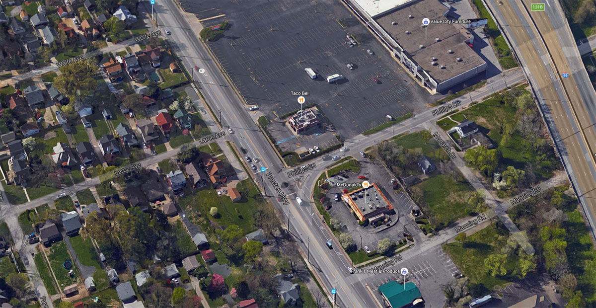
A man was struck by a hit-and-run motorist on Preston Highway at Phillips Lane. The collision took place on Sunday, February 21, 2016 at about 4:00a.m. The unidentified man suffered non-life-threatening injuries and was taken to University Hospital.

The incident was reported by WHAS11 and WLKY.

WHAS11 called the collision an accident. A witness told WHAS11 that “the driver sped through the red light, hitting the pedestrian.” It’s no accident that someone got hurt.

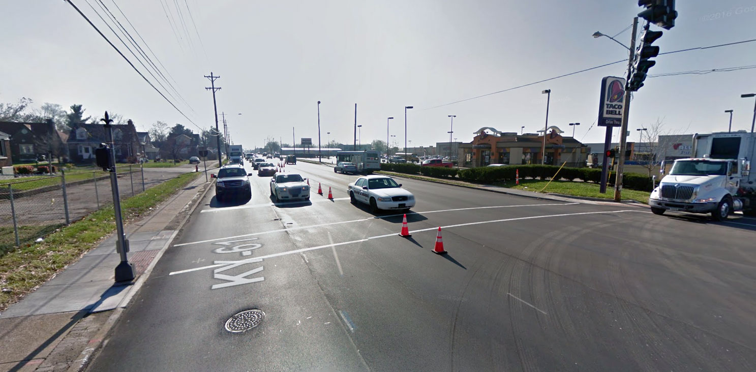
“I guess the car was trying to beat the yellow light and at that time, you hear a smacking as I was turning back towards him,” witness Zachary Goodlett told WHAS11. “About 8 feet before the stoplight, he got hit and just drug to about this area down here on top of the car and he come off right here in front of Taco Bell.”

Anyone with information about the hit-and-run is encouraged to call the Louisville Metro Police Department’s Anonymous Tip Line at 502-574-LMPD.

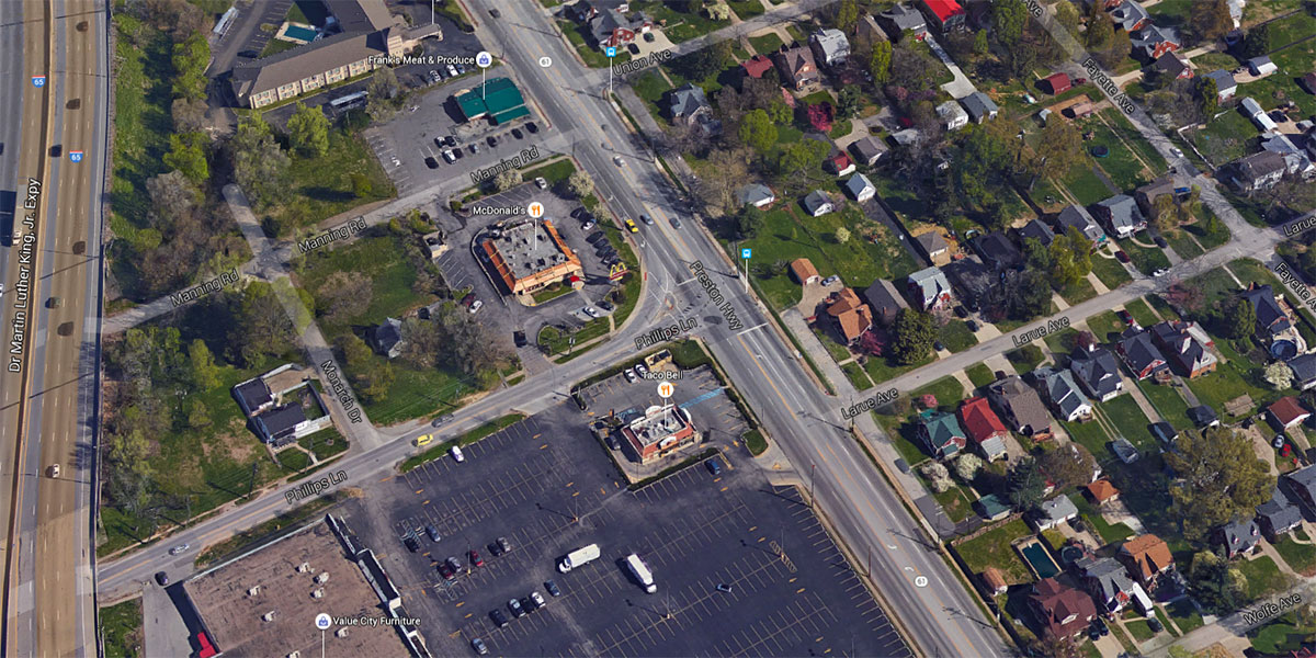
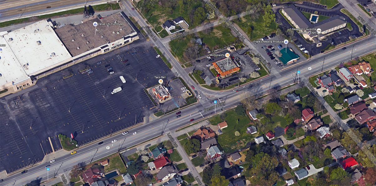
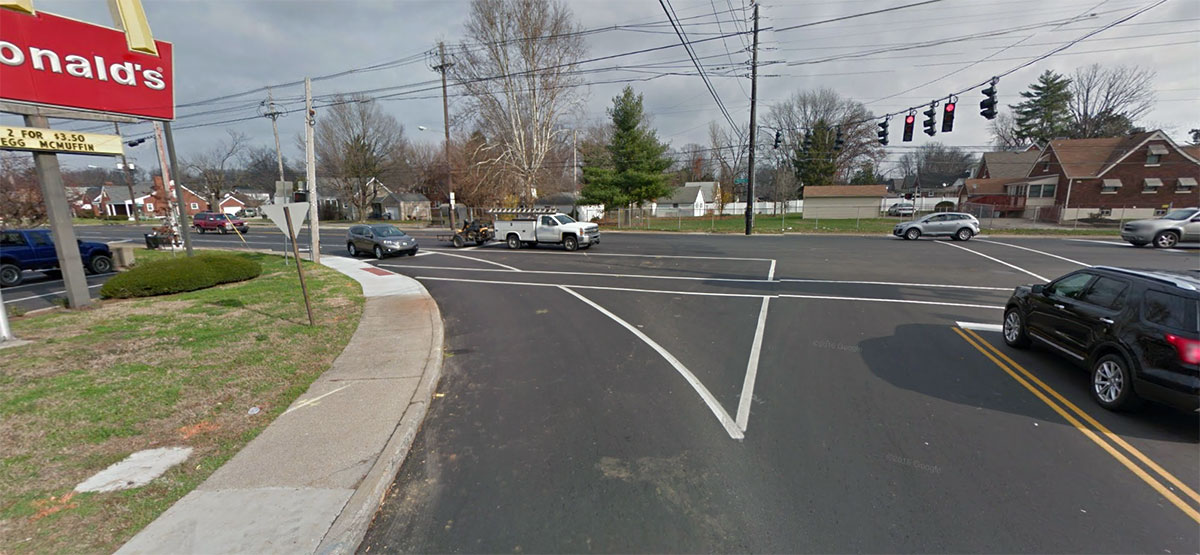
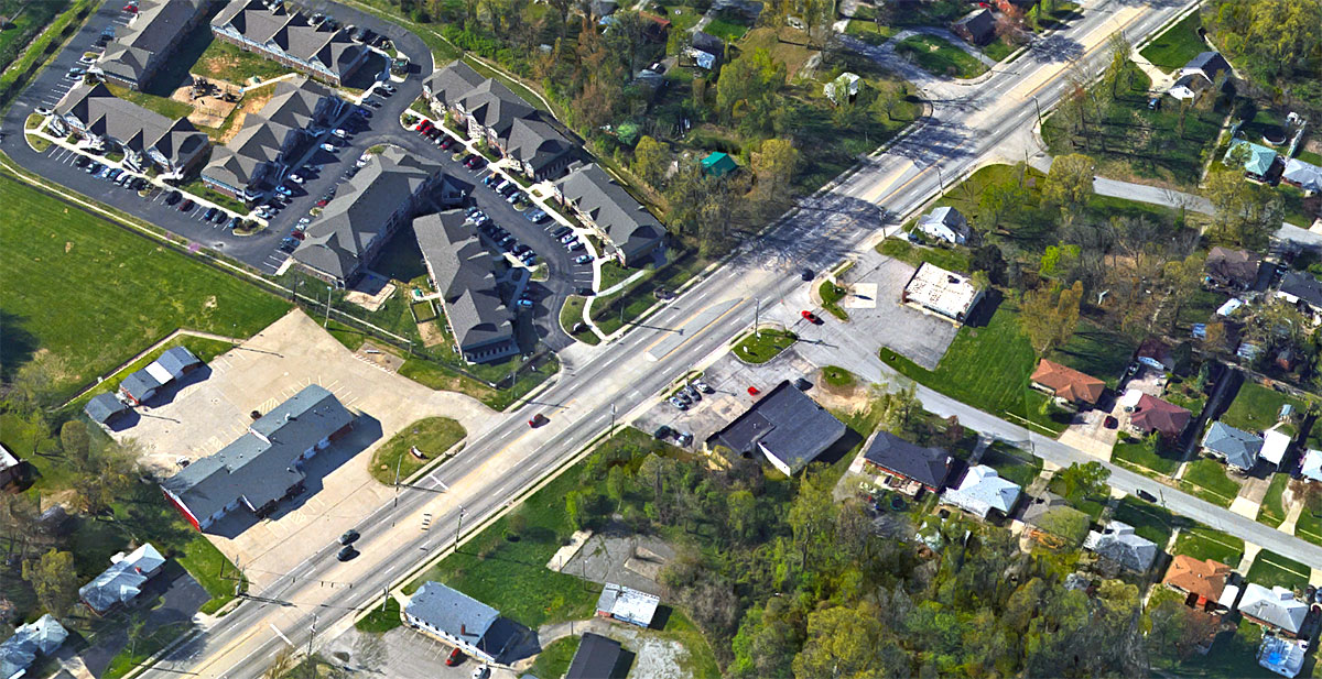
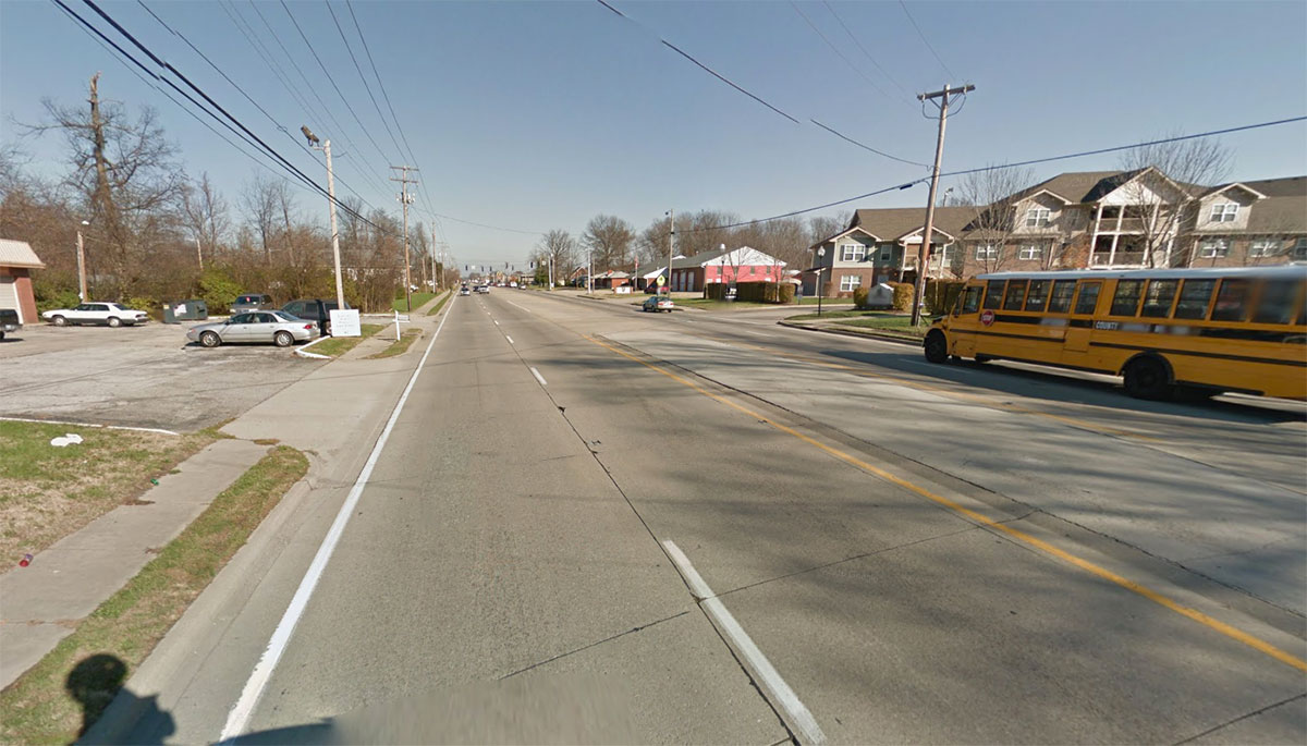
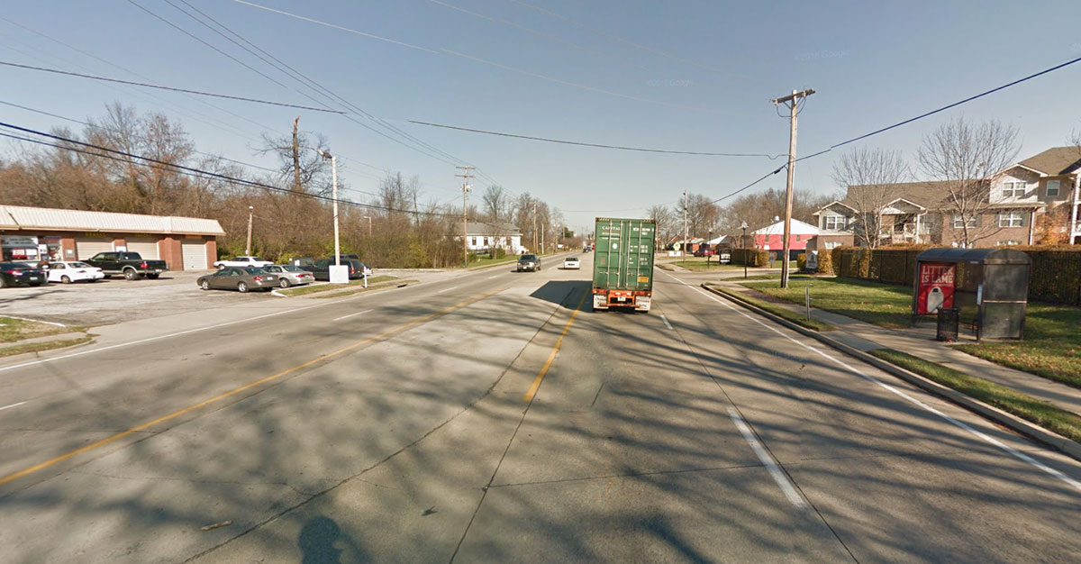
The speed limit in this area is 35 miles per hour, but the road is designed to accommodate much higher speeds. Sidewalks and one crosswalks is marked at Phillips Lane, but it’s still by no means pedestrian friendly. Oversized turning radii help motorists speed around corners and there are no refuges in crossing the five-lane street. And an enormous parking lot at a shopping center dwarfs the urban scale.

The next crosswalk to the north is 2,200 feet away at Audubon Parkway and the next to the south is 1,250 feet away at Belmar Drive. For comparison, intersections with crosswalks in Downtown Louisville are generally less than 500 feet apart.

Another pedestrian was struck on Preston Highway just south of this site at Male High School where a crossing guard was struck by a motorist on February 18.

Louisville is currently in the midst of a three-year pedestrian safety campaign called Look Alive Louisville. The federally funded program is in response to the city’s above average pedestrian fatality and collision rate.


Red State, Blue State: New report shows biking and walking investment crossing party lines

(Courtesy PeopleForBikes)

In a country where angry politics seem to be gnawing away more and more of our shared identity as Americans, here are two activities people of both big parties are getting behind: biking and walking.

A list of the top 15 state investments in biking and walking projects for the years 2012–2014 shows eight so-called “red states” from the 2012 presidential election and seven “blue states.”

That’s just one bit of interesting information gathered in the huge Benchmarking Report published every two years by our friends at the Alliance for Biking and Walking, an organization we support that backs up local advocacy groups around the country. The 2016 report came out today, chock-full of charts and data from many sources. It’s a free download, and a lot of its information is right on the web, too. Check it out.

[Editor’s Note: This article has been cross-posted from PeopleForBikes’s Green Lane Project blog. Top image courtesy PeopleForBikes.]

Hit-and-run motorist strikes girl walking on Cane Run Road

(Courtesy Google)

A 16-year-old girl was struck by a hit-and-run motorist on Cane Run Road. The collision took place around 7:00a.m. on Tuesday, March 1, but news reports give conflicting locations of the crash.

The incident was reported by WDRB, which said the girl was struck at Cane Run and Wilkie Road, and WLKY, which said the collision happened at Cane Run and Clarinet Drive near the Lake Dreamland Fire Department. Those two sites are about 1.2 miles apart.

The unidentified girl suffered non-life-threatening injuries to her arm and leg. She was taken to Kosair Children’s Hospital.

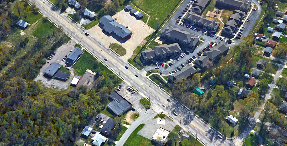
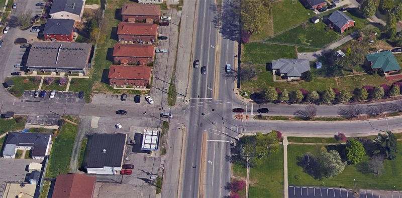
The victim was trying to cross Cane Run Road at this location, the site of several TARC bus stops, multi-family apartment buildings, and single-family homes, when she was struck. Witnesses did not get a good look at the motorist’s vehicle before he or she drove away.

Distance from the collision site to the nearest crosswalk and back. (Courtesy Google; Montage by Broken Sidewalk)

There are sidewalks in the area in various states of design and repair, but no crosswalks exist in the vicinity.

In fact, to cross in a crosswalk would require walking north to the intersection of Cane Run and South Crums Lane at Shanks Lane and back—that’s a distance of 3,560 feet. To the south, you’d have to walk to Cane Run at the intersection of Rockford Lane and Lees Lane and back—a whopping 8,090 feet or about a mile and a half.

Cane Run carries a posted speed limit of 35 miles per hour, but is designed like a divided highway that promotes much higher speeds. Several people have been struck and killed along this street in the past couple of years.
It’s irresponsible design to have transit stops along a street like this without providing a way for people using transit to cross the street to their destination. Cane Run Road is dangerous by design.

Louisville is currently in the midst of a three-year pedestrian safety campaign called Look Alive Louisville. The federally funded program is in response to the city’s above average pedestrian fatality and collision rate.


Man in wheelchair killed by motorist on Manslick Road

A man in a motorized wheelchair was killed by a motorist while crossing Manslick Road at March Boulevard and Manslick Court. The fatal collision happened just before 2:00p.m. on Monday, February 29, 2016.

The incident was reported by WLKY, WAVE3, WHAS11, and WDRB.

The crash took place in front of a convenience store. (Courtesy Google)

Melvin Kamber, 81, was struck by an unidentified motorist driving a pickup truck. A witness visiting her father inside an apartment building approximately 400 feet from the collision told WLKY that she could hear the collision take place. “Out of the blue we just heard a big bang,” Samantha Compton said.

WLKY, which called the collision an accident, reported that Louisville Metro Police Department (LMPD) “investigators are saying the man didn’t have the right of way.” WHAS11 and WAVE3 also termed the fatal crash as an accident. (WDRB initially called this an accident but removed it from an updated report.)


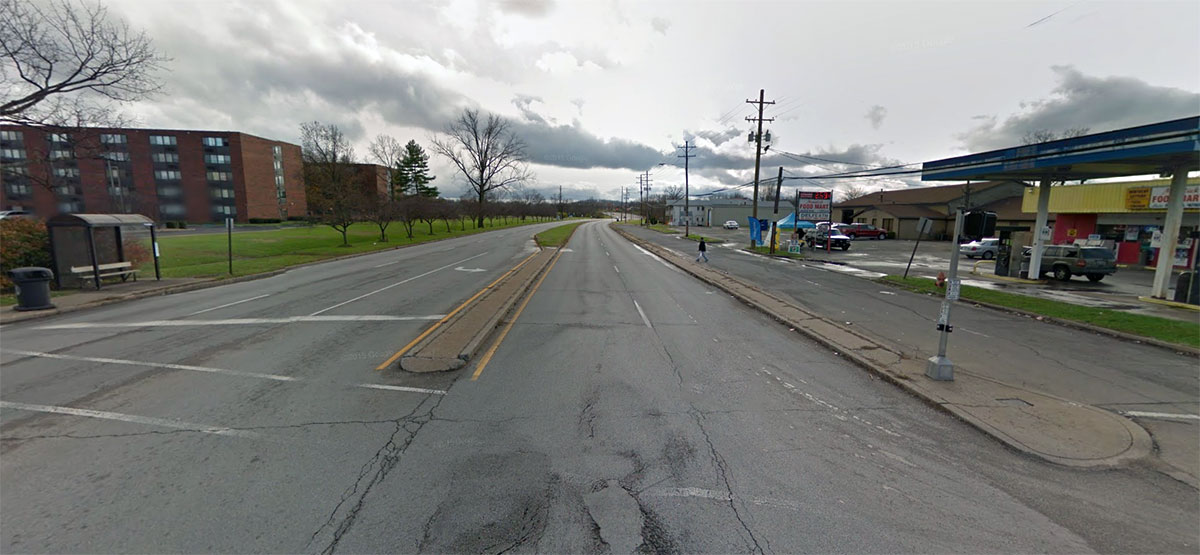
But this fatal collision was no accident. The cards are stacked against any person not behind the wheel of an automobile trying to navigate this area.

This stretch of Manslick Road carries a 35 mile per hour speed limit, which statistically means a person struck by a motorist has around a 40 percent chance of surviving. LMPD said speed was not an issue in the fatality, even though quite clearly it was. Had the motorist been traveling at a slower speed, or the street designed to promote slower speeds, Mr. Kamber might still be alive.

Instead of a sidewalk in front of senior apartments, there's a ditch people must climb over. (Courtesy Google)
Instead of a sidewalk in front of senior apartments, there’s a ditch people must climb over. (Courtesy Google)

Compounding this issue, there are no sidewalks in the area of the collision, yet there are four—yes four—separate roadways a person must cross to get to the Manslick Foodmart (where Mr. Kamber was headed) or Kings Kids Childcare. That includes the five-lane speedway of Manslick Road, another one- to two-lane access road on the west side of the street, followed by a parking lot driving lane.


Low-visibility crosswalks exist here, mostly worn away from lack of maintenance. There’s likely little time for a person to cross the street safely once the pedestrian light is illuminated via a beg button. Another witness told WLKY that the walk light could be longer.

“We can’t even get across it and you get halfway across, then it tells you to stop,” the victim’s neighbor, Scott Compton, told WDRB. “Then, you’re stuck out in the middle of the road, and you’re gonna get hit. We need to probably double the time, especially with the people in chairs.”

That’s not to mention that nothing in the area is remotely ADA accessible, meaning the deceased man in a wheelchair would have been forced to enter the roadway while trying to cross the street.

So-called “desire lines” where people walking have worn a path in the dirt are visible from the apartment complex, across a ditch, to a TARC bus stop.

The area includes a dense array of housing. (Courtesy Google)

Witnesses told WLKY that Kamber man lived across the street in a senior apartment complex. What’s it say about quality of life in this city when a handicapped man living in a fairly dense Louisville neighborhood can’t even cross the street to visit a convenience store without risking death?

The area is home to not only the American Village Senior Homes, but also a dense array of multi-family and single-family dwellings on both sides of the street. Just down March Boulevard sits Jacob Elementary School, which doesn’t even include a sidewalk to its front door.

If there were ever a case where traffic engineers should share in the blame for people being killed by their designs, this is it. Manslick Road here is a death trap—and its design is keeping it that way. It’s time Louisville demands better street design that is safe for all road users. Manslick Road is deadly by design.
 

Makeover of Iroquois Park’s Northern Overlook brings resiliency to Louisville’s most scenic view

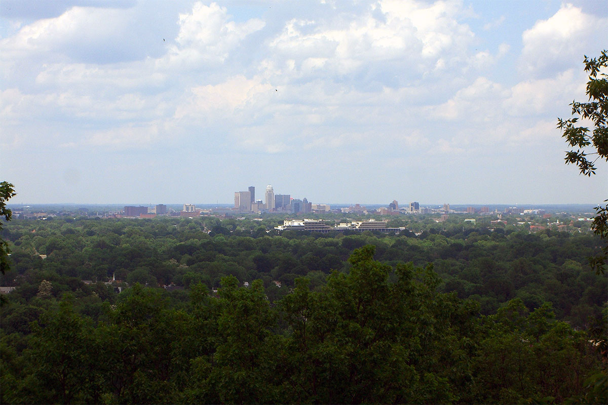
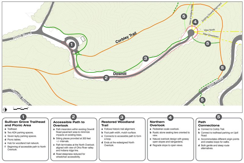
Iroquois Park’s Northern Overlook, with views of downtown and the Ohio River valley, offers the city’s finest natural panorama. After suffering decades of degradation from vandalism and erosion, Metro Parks, in partnership with the Olmsted Parks Conservancy, is spending $1 million to make the overlook more resilient, accessible, and handsome.

This project is the fourth in a series of major capital improvements that followed the release of a 1994 Iroquois Park Master Plan. It consists of three primary elements: a new overlook, an accessible path, and a parking lot. While these elements alone sound unremarkable, the project is well-designed to tackle the area’s fundamental weaknesses.

13-iroquois-park-louisville-northern-overlook

The summit of Iroquois Park, including the Northern Overlook, has been continually devastated by stormwater and drainage problems for a century. The overlook was previously accessible via the 23-foot-wide Downill Road (aka Iroquois Park Road), an immense road given its function. The water rushing down this road has destabilized the surrounding soil and causing severe erosion and the loss of a switchback trail that led to the summit.

Downill Road is now a narrow multi-use trail. (Courtesy Olmsted Conservancy)

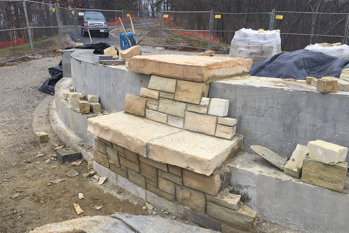
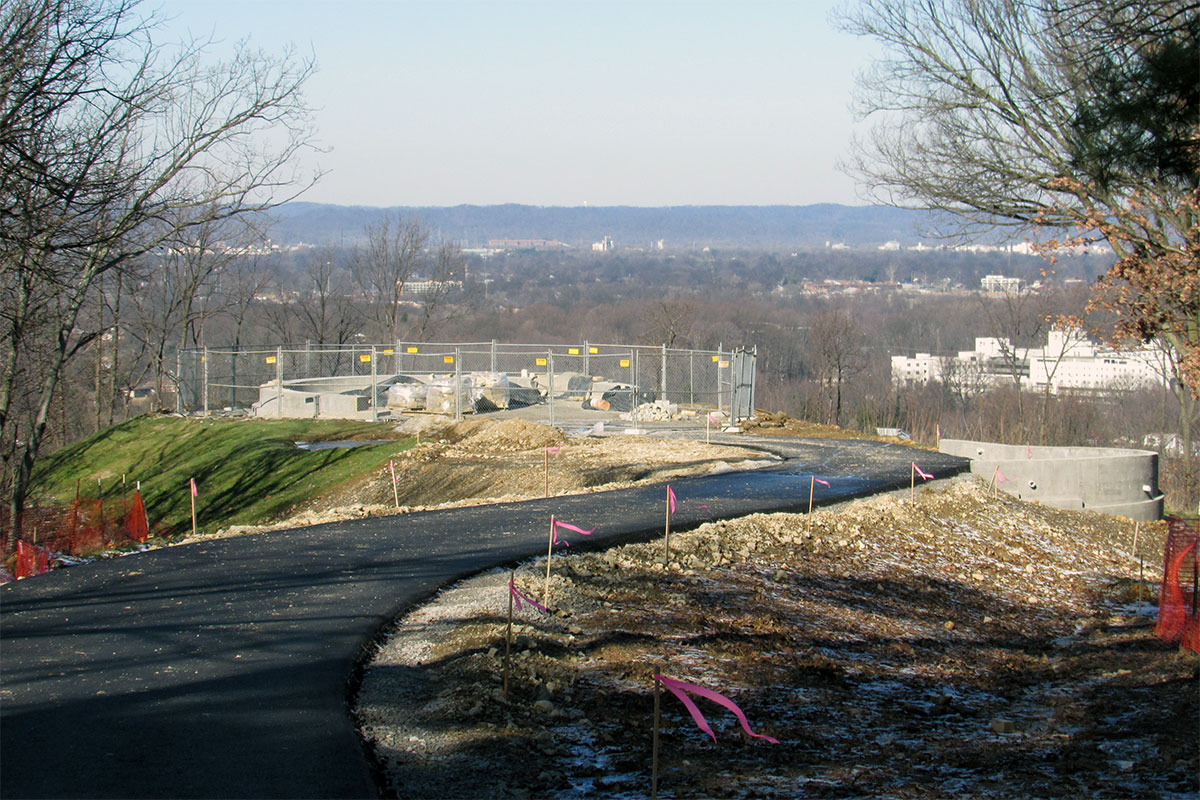
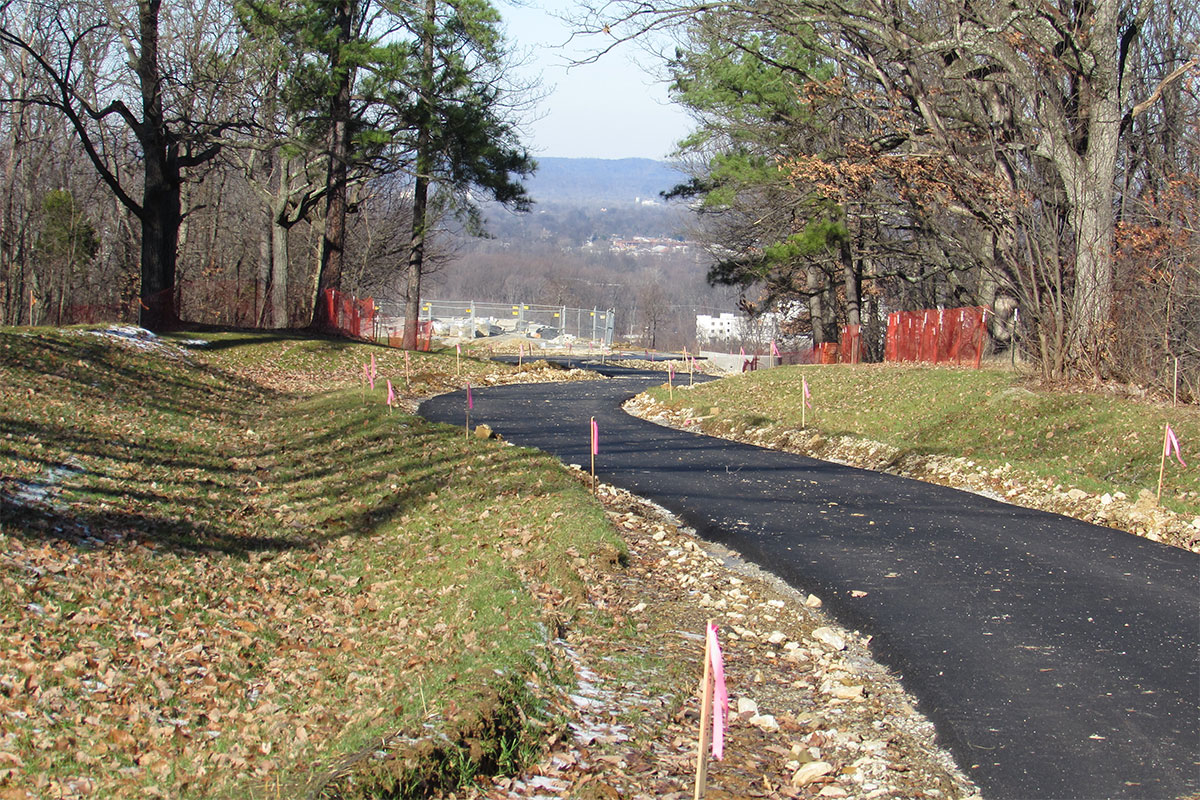
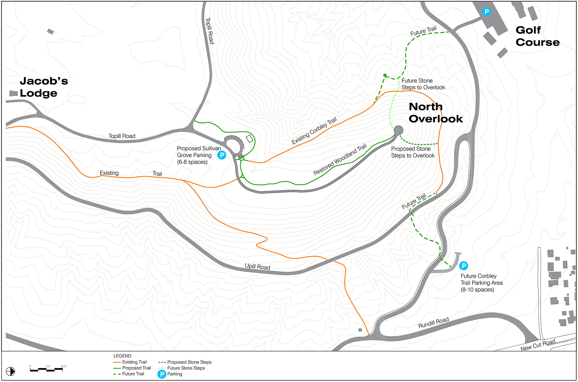
To contend with these problems, the portion of Downill Road that leads to the overlook is now car-free, and has been pared down and repurposed as a 10-foot-wide accessible path. There are rain gardens and bioswales on either side of this path that capture stormwater and runoff.

If you drive, there’s parking at the new Sullivan Grove lot that accommodates ten vehicles (two ADA, with eight additional spaces on the entry road and on Topill Road, for a total of 18 spaces). This new parking lot will act as a trailhead from which you can take the accessible path to the overlook. And stormwater shouldn’t be a problem here—the runoff from the parking lot will be directed into a bioswale where it’s held, and then slowly released.

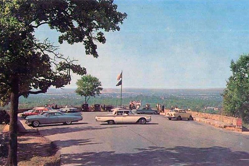
The Northern Overlook before renovations. (Courtesy Wikimedia Commons)

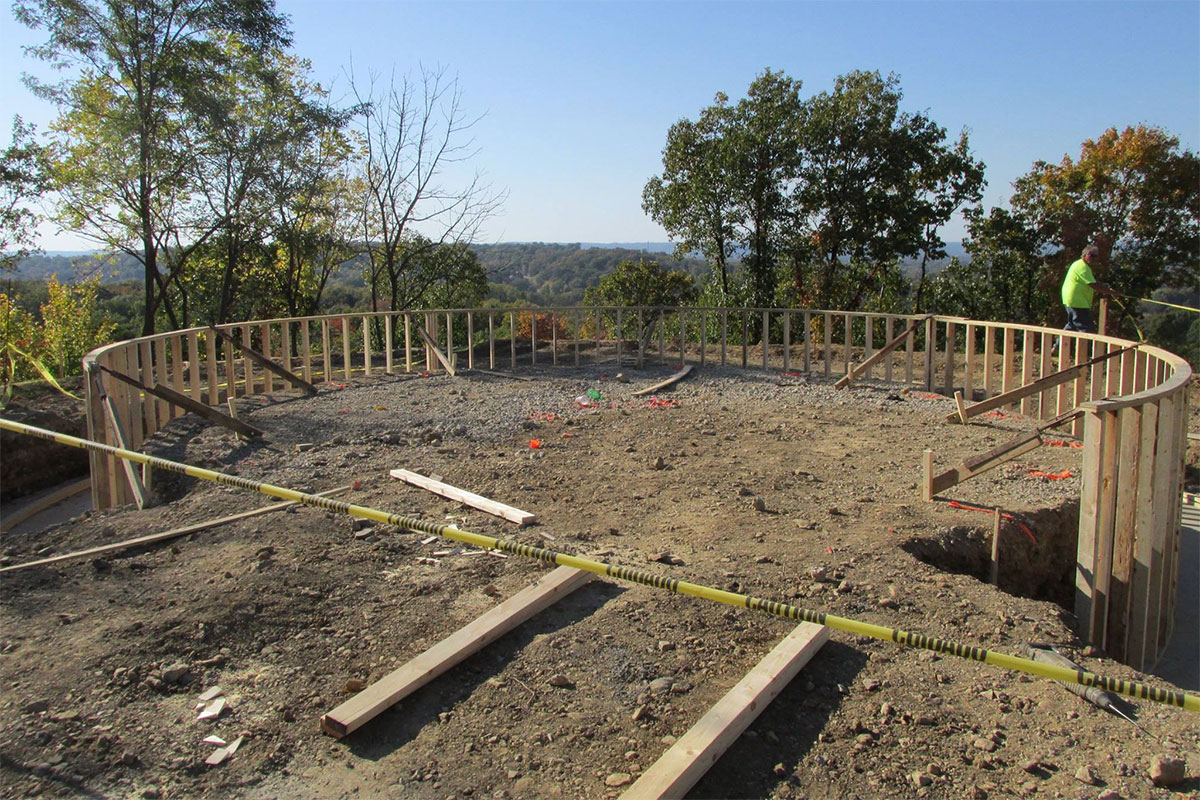
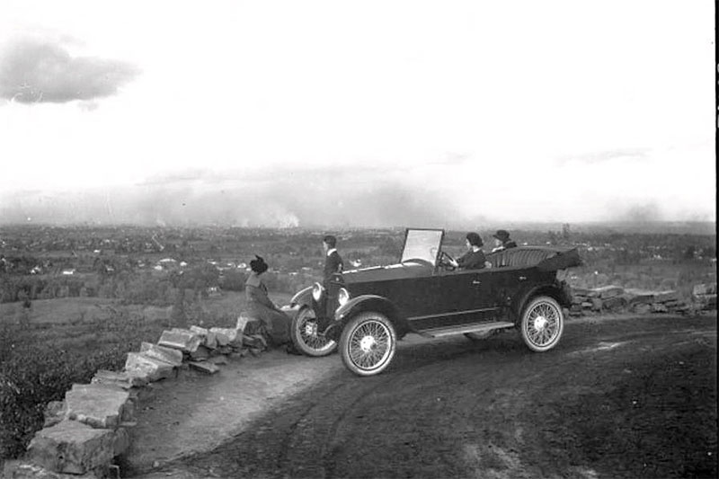
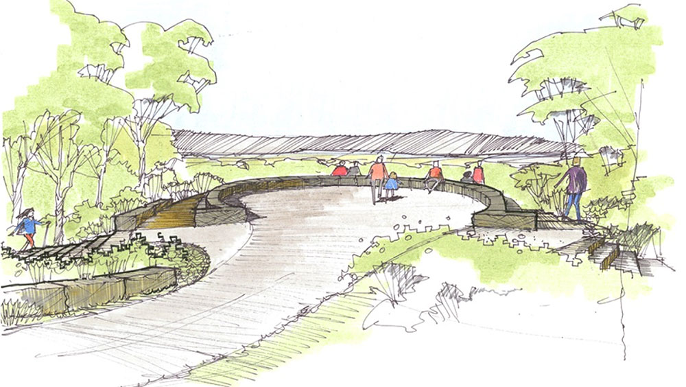
The overlook itself is also being reconstructed. Previously defined as much by the sea of pavement surrounding it and its resemblance to a hot tub, the new outlook is green and modest.

“The overlook itself has been raised in elevation by about six feet in order to meet pathway gradient requirements for the accessible path,” Martha Berner, landscape architect with Metro Parks, told Broken Sidewalk. “Most of the space between the new overlook and the edge of the old overlook will be a grassy slope for hanging out and watching the sunset. There will also be a stone bench and seat wall.”

“All of the fill used to raise the elevation of the path and overlook was recycled on-site from the demolished remains of the old overlook,” she continued. According to Berner, the cost of the recycling plan was $14,500—which included hauling away materials that couldn’t be reused. The recycling plan reduced the price of demolition hauling from $49,000 to $14,500, resulting in a cost savings of $34,500. Berner said this was the first time Metro Parks has recycled old materials on such a large scale.

[beforeafter]05-iroquois-park-louisville-northern-overlook02-iroquois-park-louisville-northern-overlook[/beforeafter]


Before image circa 1921 courtesy UL Photo Archives – Reference.

By addressing stormwater issues at its peak, this project is critical not only to Iroquois Park’s crown, but everything below. There’s new opportunity to restore trails that were destroyed by runoff. The next—currently unfunded—phase of this project will replace the old switchback trail that was washed away. Stairs will lead from the trail to the top of the overlook. The Corbly Trail has been redesigned, but needs funding; and the Woodland Trail also needs to be built.

Once these elements are complete, the Sullivan Grove parking lot will act as a junction, where multiple paths lead to the overlook. It’s well designed to accommodate a range of visitors. Until then, visitors can visit the reconstructed Sullivan Grove and Northern Overlook, set to be completed “this spring.”

[Top image of the view from the Northern Overlook by Bryan Siders / Flickr. Historic photo in the slideshow circa 1919 courtesy UL Photo Archives – Reference.]

Shelby Park and Schnitzelburg winners in latest round of METCO Loan funding

The city’s Louisville Metropolitan Business Development Corporation issued its latest round of funding under the METCO banner on Friday. Two loans totalling $112,580 were awarded to projects in Shelby Park and Germantown / Schnitzelburg that will help bolster private investment of $527,580.

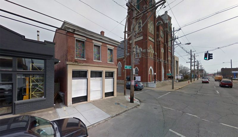
1155 South Shelby Street is being renovated into office and restaurant use. (Courtesy Google)

Urban Experience Housing, 1155 South Shelby Street, received a $62,580 facade loan that will “allow owner Access Ventures to make extensive improvements to the storefront with new windows, doors, painting and other necessary improvements,” a press release stated.

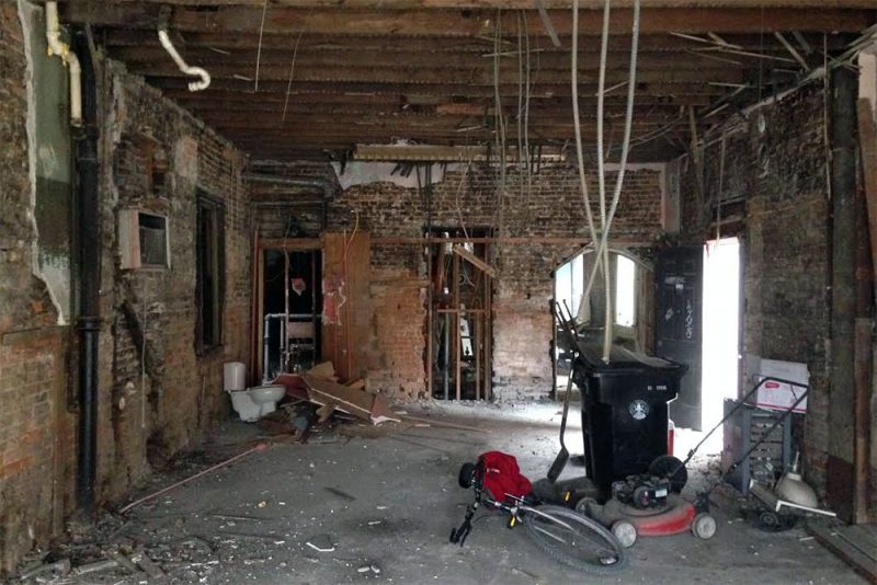
Inside 1155 South Shelby Street while it was under renovation in October 2015. (Branden Klayko / Broken Sidewalk)

The goal is to attract a restaurant to the first floor of the building at Shelby Street and Oak Street. Office space is planned above.

Access and others have been steadily working to improve the surrounding Shelby Park neighborhood, and this intersection alone has seen the recent opening of Scarlet’s Bakery, a wholesale coffee operation by Argo & Sons, and a mural by artist Gibbs Rounsavall.

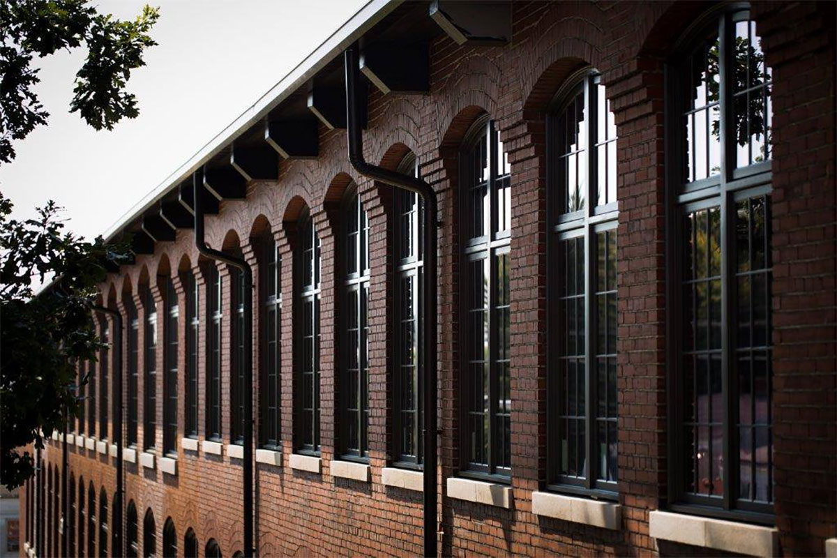
The Germantown Mill Lofts under construction. (Courtesy Germantown Mill Lofts)

Another $50,000 METCO loan was issued to a business called Flexwell, located in Suite 320 of the Butchertown Market, 1201 Story Avenue. The funding will allow Flexwell to open a gym in the Germantown Mill Lofts on Goss Avenue.

Owners Tina Ray and Dustin Harryman plan to initially hire two full-time employees for what will be the area’s first gym. The gym should be open by late spring or early summer, according to the gym’s Facebook page.

[Top image of windows at the Germantown Mill Lofts courtesy the developer.]