Worst: Louisville made a huge mistake trashing its once-robust trolley system

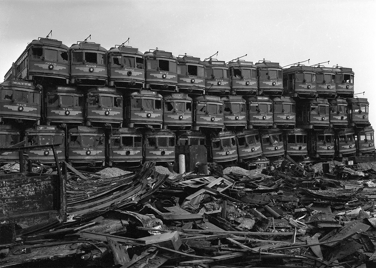
A stack of trolleys from Los Angeles at the scrapyard. (Courtesy Wikimedia Commons)

[Editor’s Note: Louisville has made some pretty amazing achievements in its first 238 years—but it’s made a few blunders along the way, too. This week, we’re launching a new contributed mini-series documenting eight of the best and eight of the worst decisions, ideas, or projects that have profoundly affected the city. This list is by no means complete—and you may have strong opinions of your own about what should be on the best or worst lists. Share your thoughts in the comments section below. Or check out the complete Best/Worst list here.]


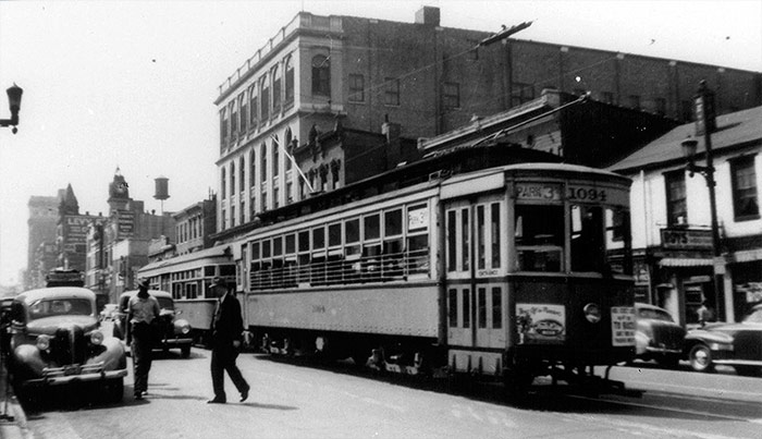
Derby Day, 1948, was the last day of trolley operation in Louisville. What once was an extensive, thriving transportation system has now been relegated to history’s trash heap.

Louisville was home to a Midwest trolley empire that included St. Louis, Indianapolis, Detroit, Cleveland, and more. It was owned by the duPont family, close relatives of the famous duPonts of Wilmington, Delaware.
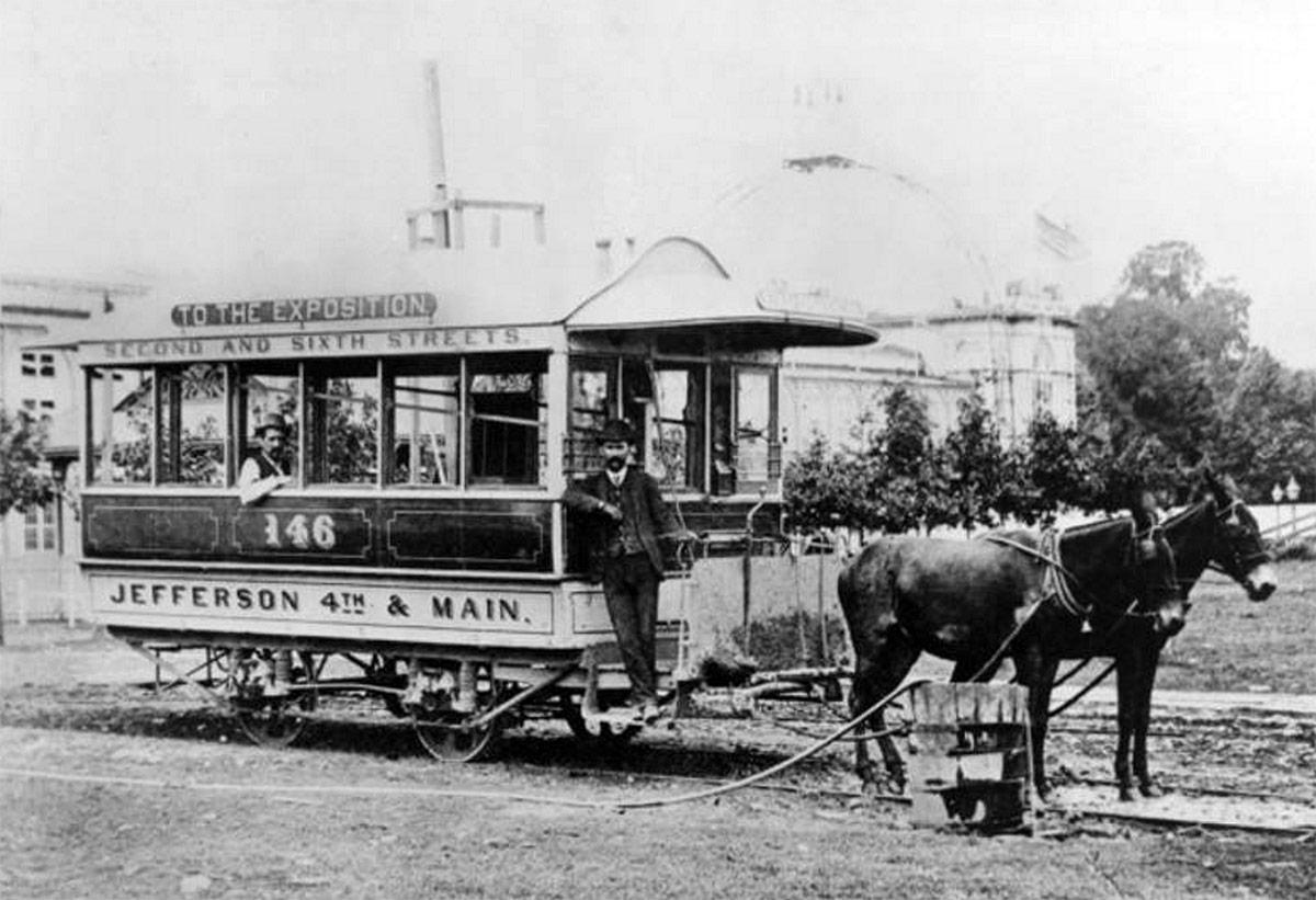
A mule-drawn streetcar at the Southern Exposition site in today's Central Park circa 1880s. (Courtesy UL Archives - Reference)
A mule-drawn streetcar at the Southern Exposition site in today’s Central Park circa 1880s. (Courtesy UL Archives – Reference)

Alfred and Antoine duPont relocated to Louisville in 1854 to seek their own fame and fortune on the expanding western frontier of the United States. They invested in a variety of businesses, but their purchase of a mule-pulled trolley line in 1866 resulted in a regional network of trolley systems.

[beforeafter]10-louisville-lost-trolley-streetcar-system11-louisville-lost-trolley-streetcar-system[/beforeafter]


When the duPont Company was struggling in the early 1900s and about to be sold, it was the Louisville duPonts who came to the rescue, relocating back to Wilmington. They used their entrepreneurial skills learned here to save the family business and help create the global mega-corporation that it is today. In so doing, they sold their trolley holdings.
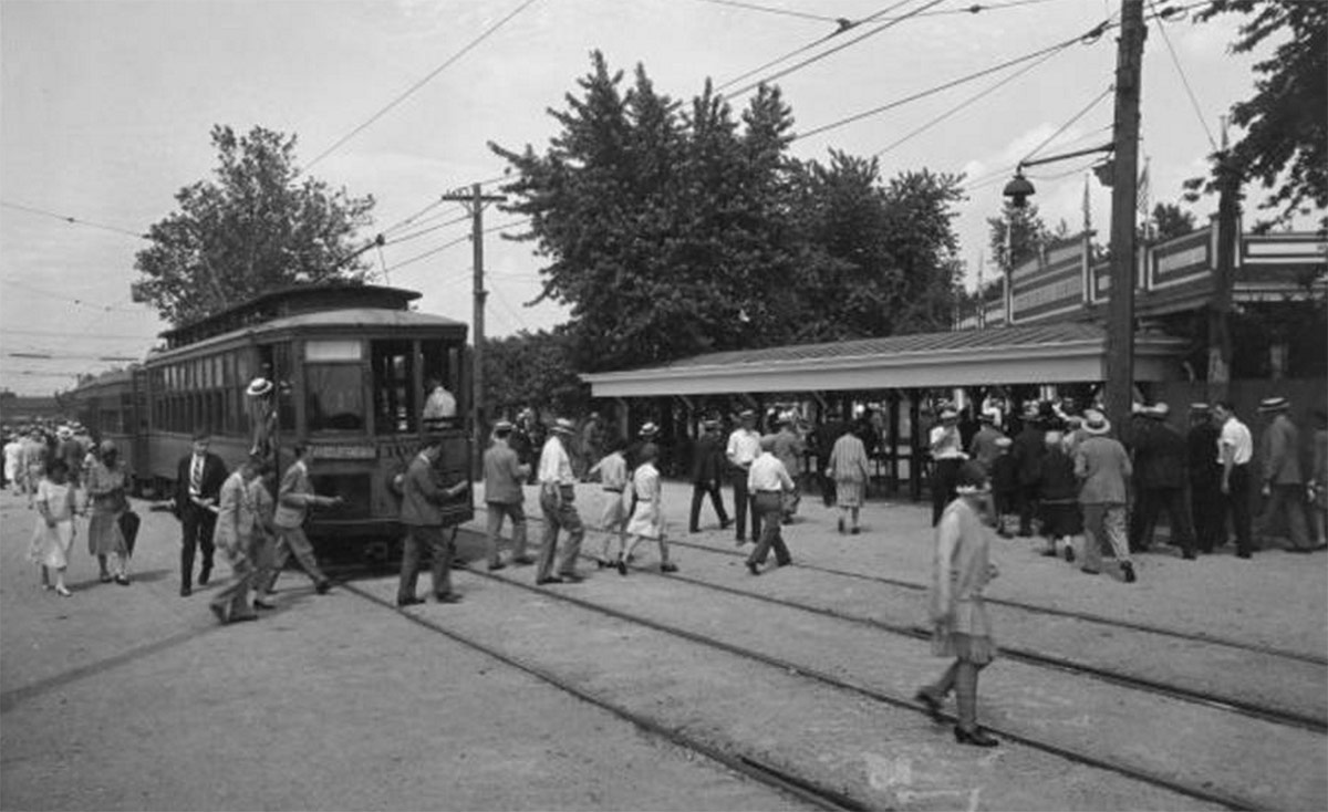
A streetcar drops passengers off at Churchill Downs in 1929. (Courtesy UL Archives - Reference)
A streetcar drops passengers off at Churchill Downs in 1929. (Courtesy UL Archives – Reference)

By the 1940s, automobiles had eroded trolley ridership to where it was no longer economically feasible to operate. There were no more trolleys running after May 1, 1948.

A Louisville Railway Company streetcar. (Courtesy Market Street Railway)

Fast forward seven decades. Trolleys have been supplanted by newer, similar technologies and rebranded as “streetcars” or “light rail.” Fixed-track mass transit is back in business across the country. St. Louis, Atlanta, Nashville, Denver, Kansas City, and others have viable rail transportation. Nearby Cincinnati is in the construction stages for its own.
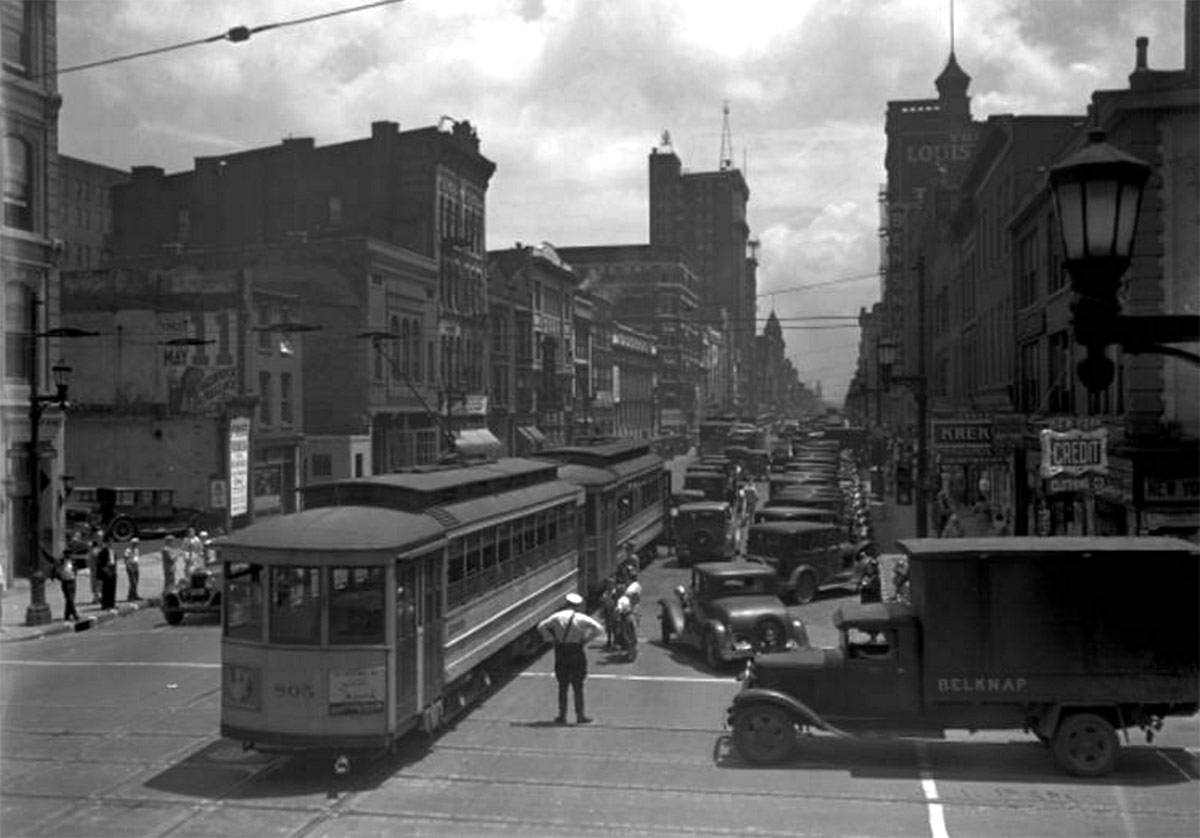
Trolleys on Market Street at Sixth Street in 1933. (Courtesy UL Archives - Reference)
Trolleys on Market Street at Sixth Street in 1933. (Courtesy UL Archives – Reference)
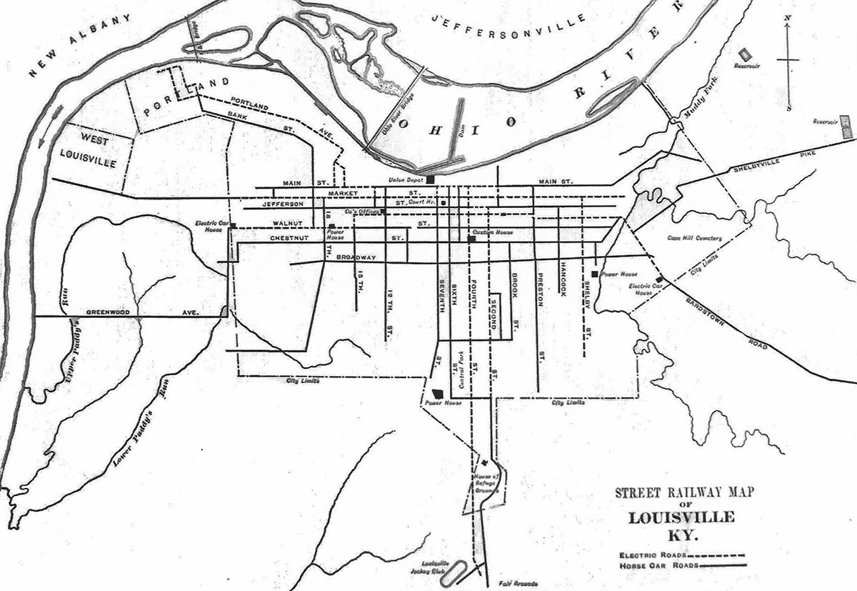
A map of Louisville's trolley system in 1891.
A map of Louisville’s trolley system in 1891.

In Louisville, there have been various studies for a light rail line, but nothing is even close to the implementation phase. Officially, the T2 light rail system proposal was investigated by TARC but is now thoroughly out of date. Most of the discussion of streetcars has come from the community. There have been proposals for a streetcar along Bardstown Road, along Market Street, and, most recently, along Fourth Street. All three of those once existed a century ago.

Instead of disbanding the entire system at once, what if Louisville had retained a select few lines that were still popular and profitable? The elevated “Daisy Line” that ran between Southern Indiana and Downtown across the K&I Bridge certainly would have had a good volume of passengers, and the east-west Market Street and north-south Fourth Street lines also would be popular today.
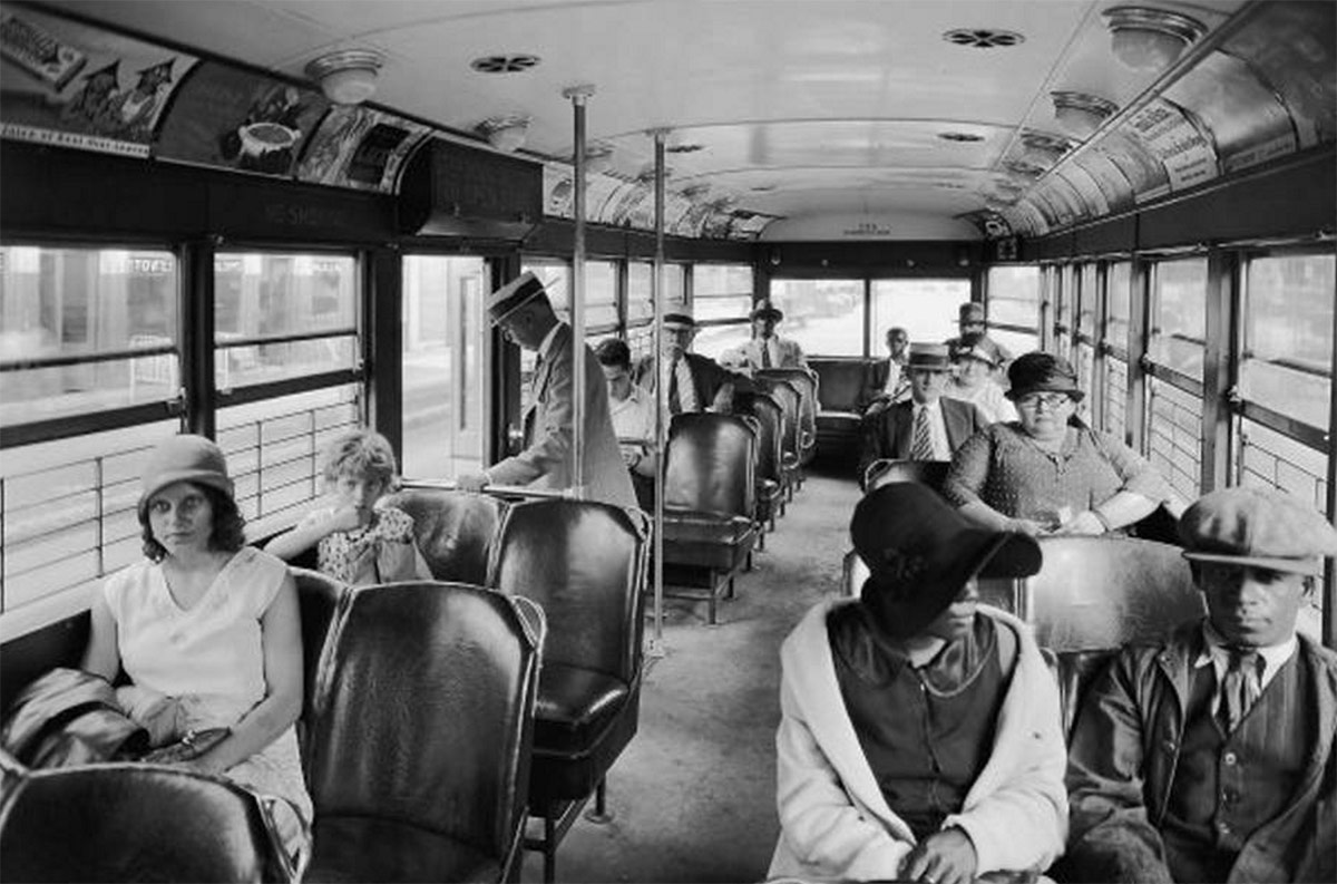
Inside a Louisville streetcar in 1929. (Courtesy UL Archives - Reference)
Inside a Louisville streetcar in 1929. (Courtesy UL Archives – Reference)

If Louisville had retained even a fragment of its historic system, it would have made Louisville a national leader in public transportation today.

How would even a single streetcar line or two change the city’s urban growth dynamics? Where you you like to see a rail-based streetcar or light rail line in Louisville today?

Remnants of Louisville’s trolley heydays exist just below the street asphalt surface. Paved over, these steel rails that once served the bustling network are periodically rediscovered during road repairs. They remind us today of “what if” the trolleys still existed.

[Top image of a stack of trolleys from Los Angeles at the scrapyard courtesy Wikimedia Commons.]

Best: Design keeps Louisville’s libraries at the center of the community

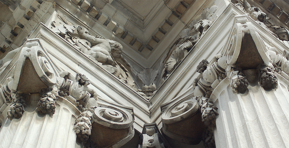
Detail of the Main Branch Library. (saxcubano / Flickr)

[Editor’s Note: Louisville has made some pretty amazing achievements in its first 238 years—but it’s made a few blunders along the way, too. This week, we’re launching a new contributed mini-series documenting eight of the best and eight of the worst decisions, ideas, or projects that have profoundly affected the city. This list is by no means complete—and you may have strong opinions of your own about what should be on the best or worst lists. Share your thoughts in the comments section below. Or check out the complete Best/Worst list here.]
 

“Libraries? Who goes to libraries anymore?” Well, anyone who might say that sure hasn’t visited a library in Louisville lately. Libraries today are far more than just book shelves and dusty tomes. They are activity centers with computers and events such as genealogy seminars and author presentations. They are filled with residents of all ages and backgrounds. And Louisville’s libraries are as strong as ever.

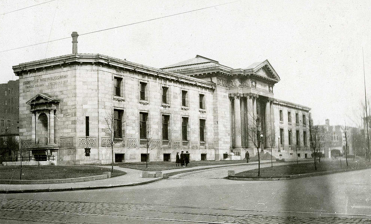
Main Branch of the Louisville Free Public Library. (Broken Sidewalk)

A community must have a solid educational foundation, and the popularity of our libraries is a good barometer in this regard.

Louisville’s libraries not only set a high educational standard, but a strong aesthetic sense of pride as well. From the Carnegie-funded buildings of the early 1900s, to today’s ultra-modern architecture, local libraries have always striven to be architectural landmarks within the community.

Main Branch of the Louisville Free Public Library in November 1923. (Courtesy of the National Park Service, Frederick Law Olmsted National Historic Site)
Main Branch of the Louisville Free Public Library in November 1923. (Courtesy National Park Service, Frederick Law Olmsted National Historic Site)

The Main Branch Library at Fourth Street and York Street in SoBro set the bar for design expectations high. Originally designed by George Tachau and Lewis Pilcher in 1908, the historic structure is a classic example of Beaux Arts style.

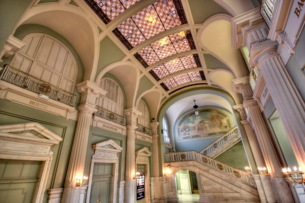
The interior vaulted lobby is a wonder-filled space of artwork, stained glass, and marble staircase. Natural light streams in from the large windows.

Inside the lobby of Louisville's Main Branch Library. (Daniel Light / Flickr)
Inside the lobby of Louisville’s Main Branch Library. (Daniel Light / Flickr)

A modern expansion in the Brutalist style was added in 1974 by architecture firm Louis & Henry Group, with architect Alvin Voit as the lead designer. While this type of poured concrete style has generated mixed reactions with the public, this addition is masterfully detailed and composed. Its “open plan” interior layout, while now over 40 years old, is still adaptable to today’s technological and programmatic changes.

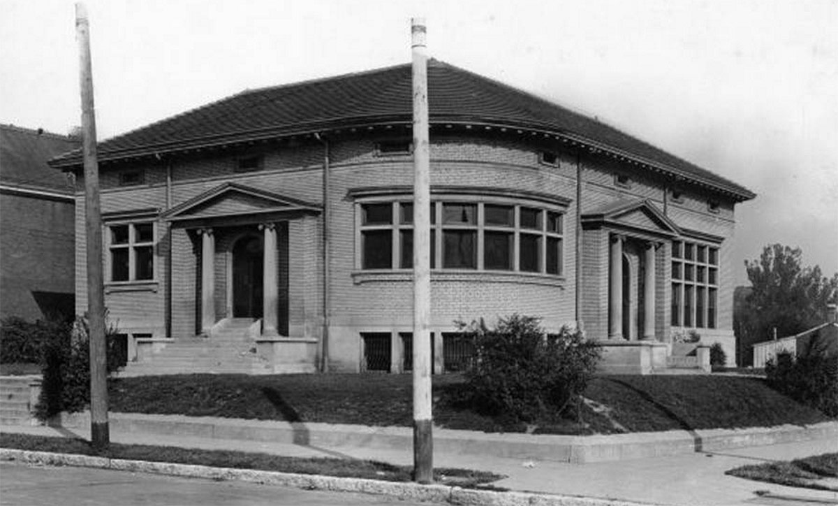
Louisville's Portland Branch Library in 1921. (Courtesy UL Archives - Reference)
Louisville’s Portland Branch Library in 1921. (Courtesy UL Archives – Reference)

The smaller branch libraries scattered around the city, likewise, are jewels within their respective neighborhoods. The Bon-Air branch is an attractive mid-century modern facility, while the Portland branch and the Crescent Hill branch are ornate traditional Carnegie buildings.

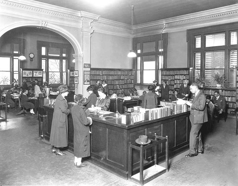
Inside Louisville's Western Branch Library in 1927. (Courtesy UL Archives - Reference)
Inside Louisville’s Western Branch Library in 1927. (Courtesy UL Archives – Reference)

Another historic gem, the Western Branch Library on Chestnut Street, still stands proud today. St. Matthews’ branch is in a renovated former school and is proposed to undergo an addition and renovation.

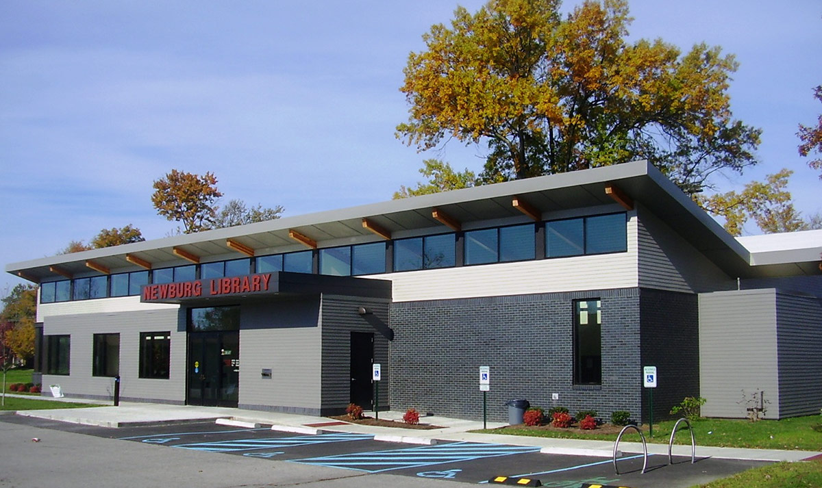
The Newburg Branch Library features a modern "butterfly roof." (Broken Sidewalk)
The Newburg Branch Library features a modern “butterfly roof.” (Broken Sidewalk)

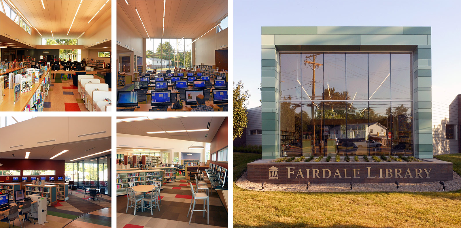
As the library system moves into the 21st Century, it is building new branches that are state-of-the-art both in educational resources as well as progressive design. The Fairdale branch offers a hip addition to the south-end neighborhood while the Newburg branch shows off sustainable design and a contemporary, V-shaped “butterfly roof” structure with clerestory windows.

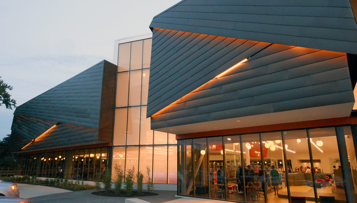
The Southwest Regional Library. (Broken Sidewalk)

Recognizing its role as a hub in the community, the Louisville Free Public Library system is expanding with a series of regional libraries and striking design. The recently opened Southwest Regional Library shows off dynamic lighting and an angular facade. There’s no mistaking this for one of the old Carnegie designs—it stands in stark modern contrast as an example of what 21st century libraries can be for their neighborhoods.

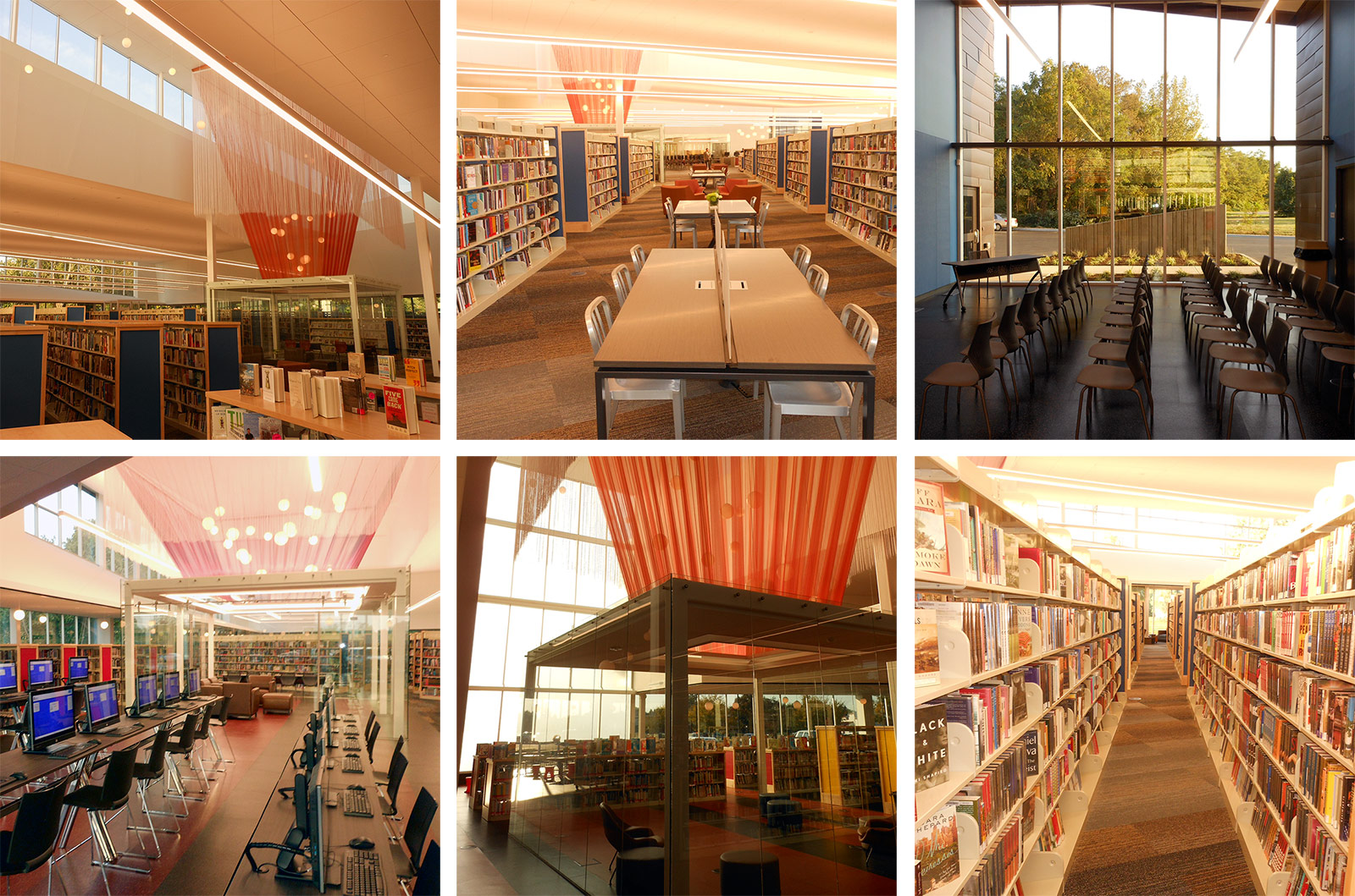
Inside the Southwest Regional Library. (Broken Sidewalk)

Louisville’s library system is using design and technology to get the community inside these branches, whether to read a book, search on the computer, or meet in one of the glass-enclosed community rooms.

05-louisville-free-public-library-system

These facilities are design for grownups and children alike with striking and playful design. And these newer libraries are often the best examples of modern architecture in their surrounding neighborhoods.

Well-thought and well designed: Louisville’s libraries are an educational and visual treasure that all can enjoy.

08-louisville-free-public-library-system

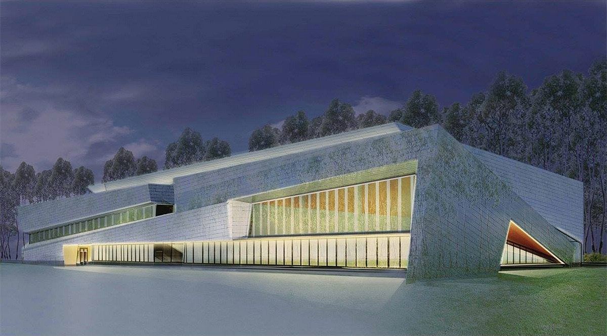
The Louisville Free Public Library is continuing with its regional expansion, and two more large-scale libraries are planned. Next up is the deeply angular South-Central Library, pictured above.

[Top image of a detail on the facade of the Main Branch Library by saxcubano / Flickr.]
Man killed by hit-and-run motorist at Bardstown Road and Emerson Avenue

A man was struck and killed by a hit-and-run motorist Sunday night at Bardstown Road and Emerson Avenue. Police found the victim Sunday morning around 6:00a.m. and the motorist is still at large.

The incident was covered by WDRB (with update), WHAS11, WAVE3 (with update), WLKY, and the Courier-Journal.

An investigation by the Louisville Metro Police Department (LMPD) revealed that Calvin E. Watkins, 51, was struck by a motorist travelling eastbound on Emerson Avenue, but police are unclear of when the collision took place. There were no witnesses.

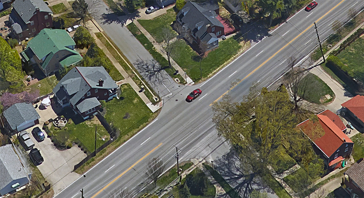
Looking east on Emerson Avenue from Bardstown Road. (Courtesy Google)

Conflicting reports note that Watkins was either crossing Emerson when he was struck or else walking eastbound along Emerson in the street when the motorist struck him.

Emerson Avenue carries a posted speed limit of 25 miles per hour and this stretch of Bardstown Road is posted at 35 miles per hour. According to studies, a person struck at 25mph has a 90 percent survival rate while a person’s chance of survival when struck at 35 drops to around 50 percent.

The eastbound side of Bardstown Road has no sidewalks in this area, although the pleasant residential street Emerson Avenue does have sidewalks. Emerson is just three blocks from Assumption High School and not much farther from Atherton High School.

Looking north on Bardstown at Emerson Avenue. (Courtesy Google)

Police are asking for help finding the hit-and-run motorist. According to LMPD, the vehicle is likely light blue in color and could have a broken or shattered windshield. Anyone with information is asked to call the police tip line at 502-574-LMPD.

Watkins was identified as homeless and the Jefferson County Coroner is also asking for help locating Watkins’ next of kin. Anyone with information can call 502-574-0123.

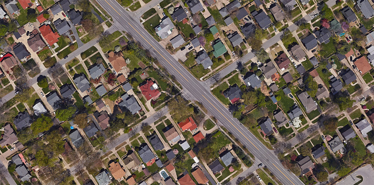
A map of the area. (Courtesy Google)

The local media did a much better job of reporting this incident. WAVE3 had the best of the group as their update was the only to note that a person was driving the vehicle involved in the collision. WDRB’s update and the C-J’s report were the only two to label the collision an accident rather than a crash.

This incident is the second pedestrian fatality of 2016, the third reported pedestrian collision, and the second hit-and-run. Louisville is still in the midst of a pedestrian safety campaign called Look Alive Louisville that was awarded a federal grant due to the city’s above-the-national-average rate of pedestrian fatalities.

Best: Louisville made bank with the architecture of today’s Actors Theater

[Editor’s Note: Louisville has made some pretty amazing achievements in its first 238 years—but it’s made a few blunders along the way, too. This week, we’re launching a new contributed mini-series documenting eight of the best and eight of the worst decisions, ideas, or projects that have profoundly affected the city. This list is by no means complete—and you may have strong opinions of your own about what should be on the best or worst lists. Share your thoughts in the comments section below. Or check out the complete Best/Worst list here.]


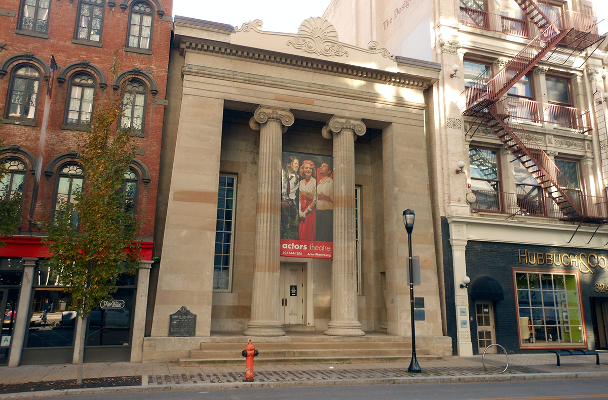
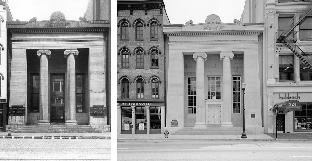
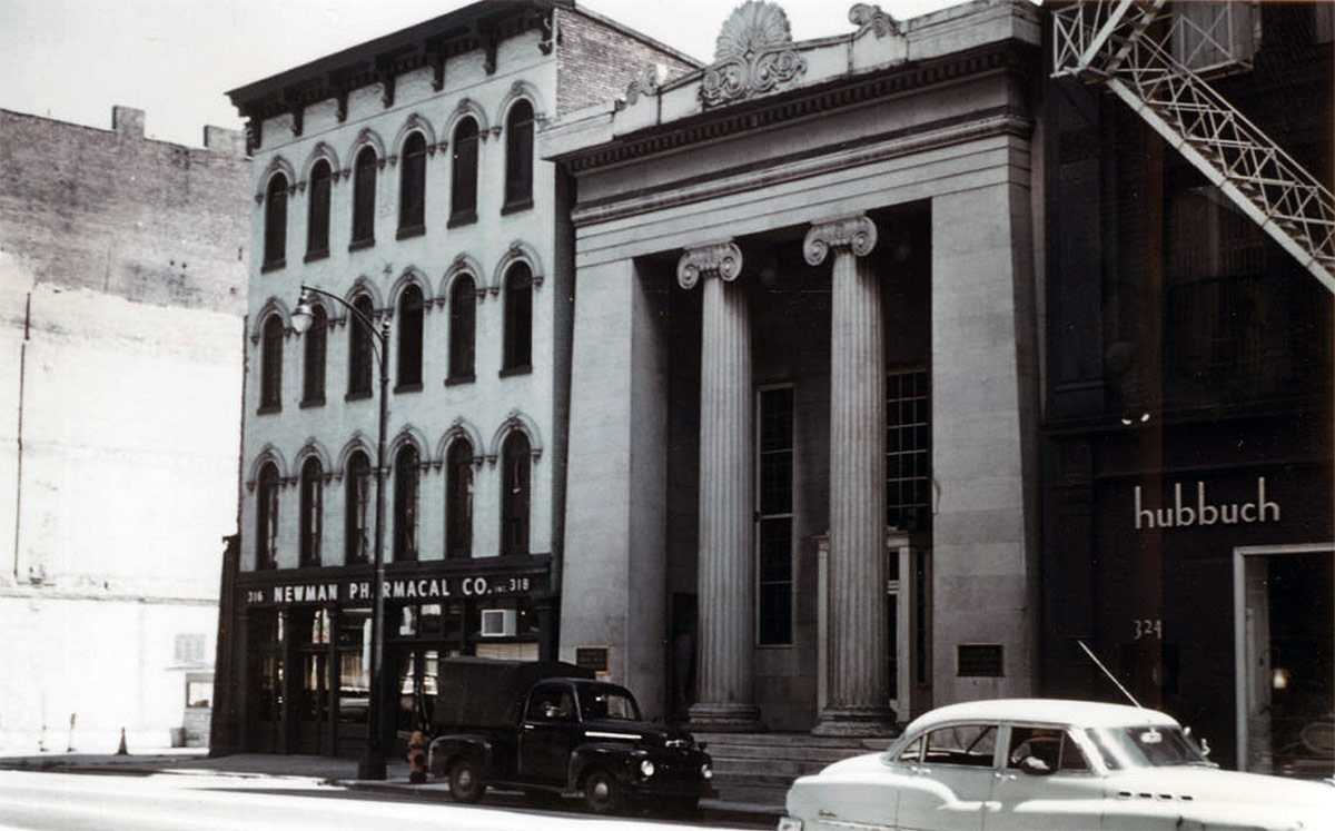
Built as the Bank of Louisville in 1837, this small but distinguished structure on Main Street has survived 180 years of weathering, and, more importantly, “urban renewal” that demolished nearly all of the buildings surrounding it. It was reborn in 1972 as the home of Actors Theater after a major overhaul and expansion by noted Chicago architect Harry Weese.

(Courtesy Library of Congress)
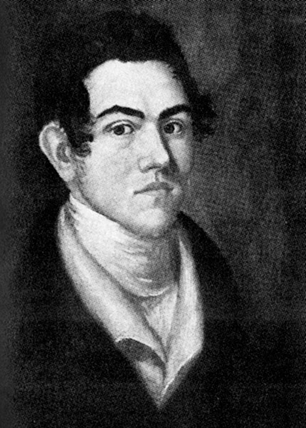
Gideon Shryock. (Kentucky Historical Society)

The building was initially thought to have been designed by famed local architect Gideon Shryock—there even a plaque on the facade that gives him credit. Shryock specialized in this Greek Revival style of architecture and has worked on other noted local buildings such as the city courthouse (begun 1830) and the Old State Capitol in Frankfort (1829).

The Bank of Louisville structure was actually designed by James H. Dakin, an architect originally from New York City.

The Bank of America in New York, suspected of being Dakin's inspiration for his Louisville building.
The Bank of America in New York, suspected of being Dakin’s inspiration for his Louisville building.

Dakin was relocating to New Orleans, where his brother lived, when he briefly stopped in Louisville and left us with this artistic masterpiece. It is believed that he based his design on a similar bank for the Bank of America (1835) in Manhattan which was designed by an architecture firm where he once worked.

The predecessor to the Bank of Louisville was more Classical in appearance, using flowery Corinthian columns and the structure’s cornice was less prominent than its Louisville counterpart.

The structure circa 1956-1966. (Courtesy UL Photo Archives - Reference)
The structure circa 1956-1966. (Courtesy UL Photo Archives – Reference)
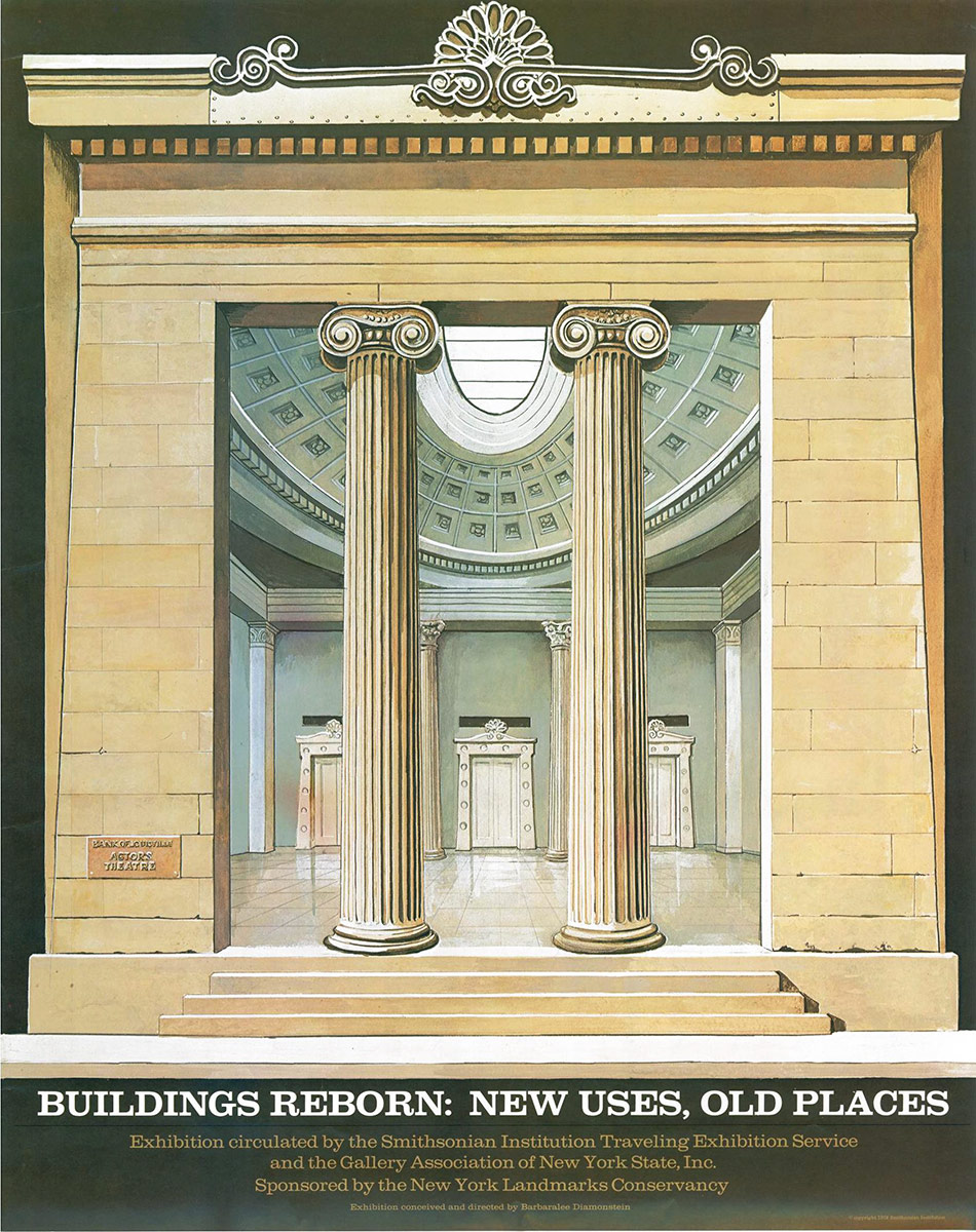
Cover of a Smithsonian exhibition on building reuse.

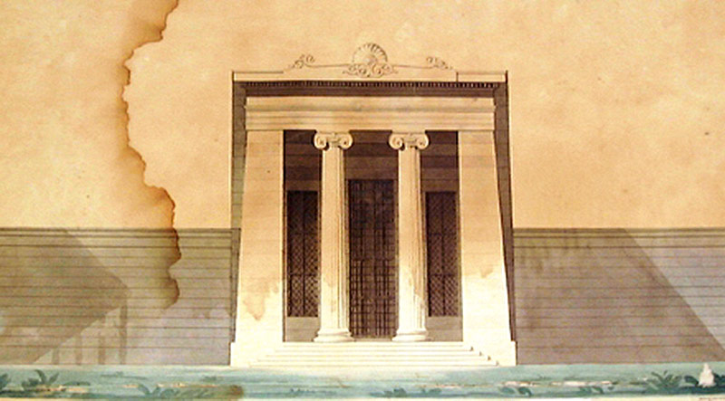
For Louisville, Dakin used curling Ionic columns and a large, artistically-inspired pediment. He also tapered the sides of the structure, which draws attention upward to the top center ornamentation and gives the structure a slight Egyptian flare, which was popular in the mid-19th century.

According to documents filed with the National Register of Historic Places:

The Old Bank of Louisville is built on a narrow rectangular downtown city lot flanked on either side by post-Civil War commercial buildings somewhat taller than the bank. The importance of the exterior of the bank is in the dramatic front elevation. It is, in brief, a Greek Revival distyle-in-antis doorway increased to the scale of an entire building. The effect is monumental. The facade is stone. The two fluted columns-in- antis are in the Ionic Order, and the flanking antae are battered, giving the whole building a tremendous visual focus. Above the columns and antae is a simple entablature carrying a superbly scaled cast iron parapet with bold anthemion cresting.

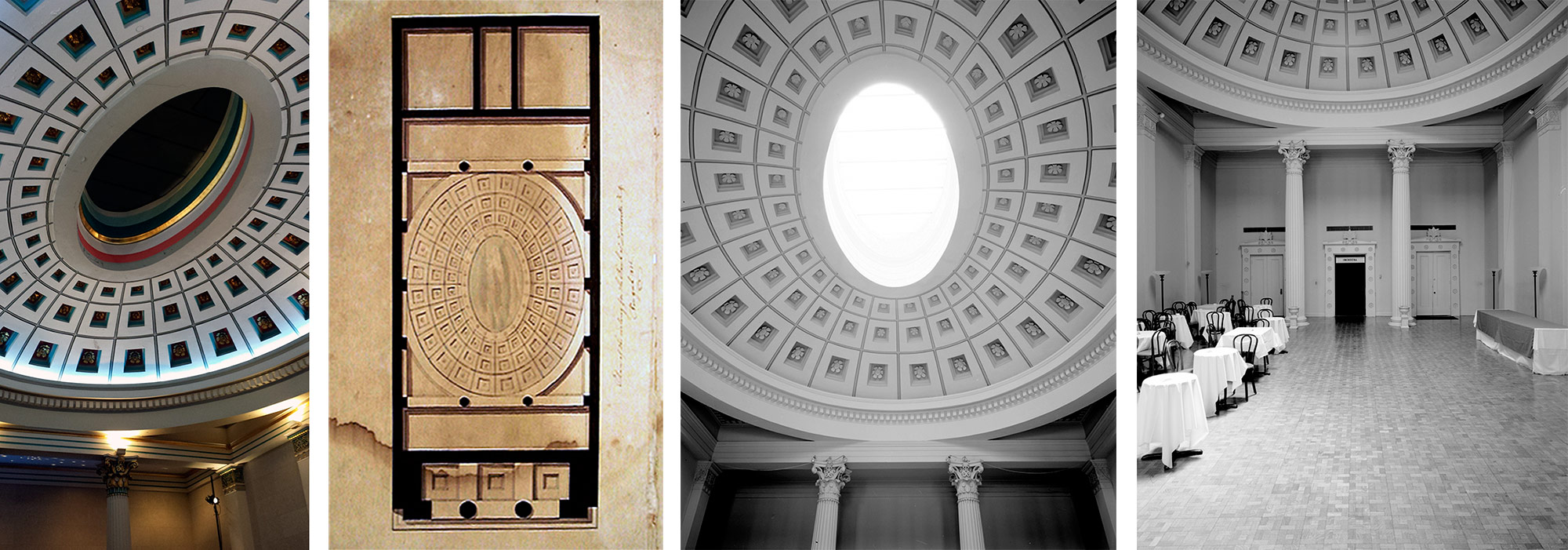
Interior views and ceiling plan. (Courtesy Tipster; New Orleans Public Library; Library of Congress)

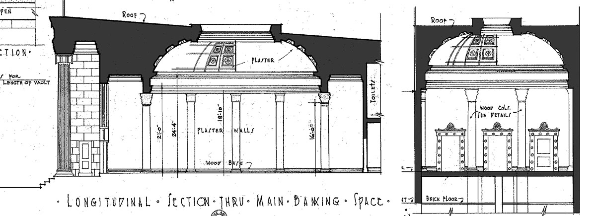
While the exterior is exquisite, the best aesthetic part is on the inside. The Bank of Louisville’s lobby is among the best interior spaces in the city, and could be counted among the best in the state, particularly for its scale.

Section through the bank showing the domed lobby. (Courtesy Library of Congress)
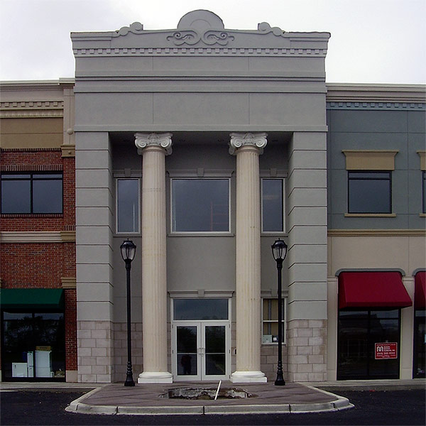
A strip mall replica of the Bank of Louisville building in the far eastern exurbs. (Courtesy Tipster)

Michael Graves, the architect of the Humana Building down the street, has said that this was his favorite Louisville structure.

Many, in fact, love the structure, and its doppelganger has appeared in the far-flung suburbs recreated as part of a strip mall. Rather than stone, the modern version is clad with faux stucco over styrofoam.

The building was designated a National Historic Landmark in 1972.

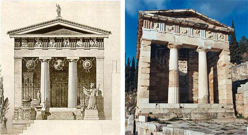
The Treasury of Athena, drawing and photo. (Courtesy Museum of Athena; Wikimedia Commons)

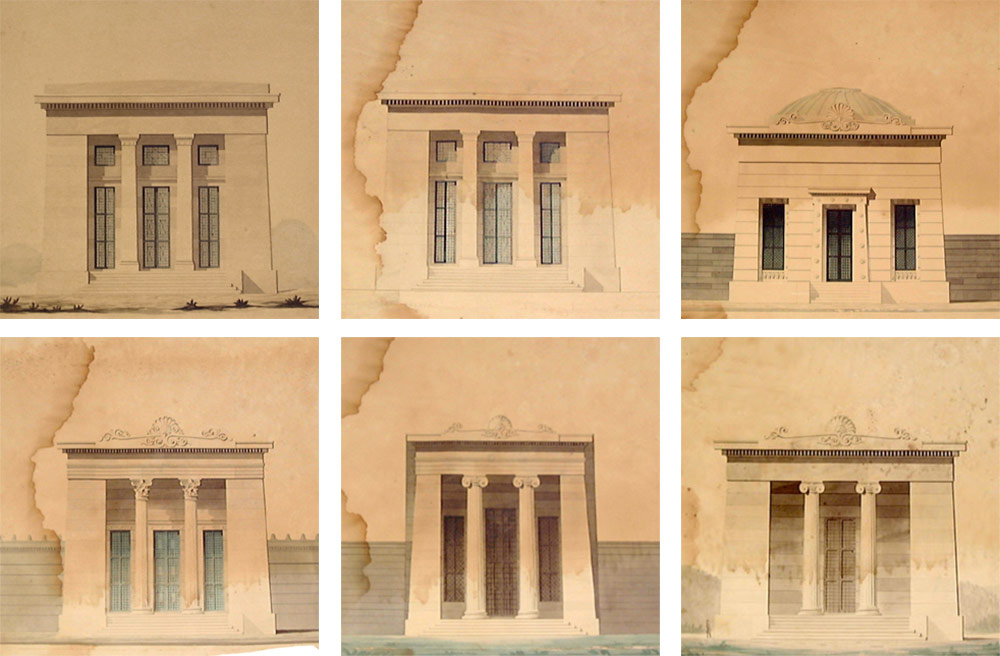
Both bank designs—New York’s Bank of America and Louisville’s own example—were based on another, more famous bank: the ancient Athenian Treasury in Greece. This ancient example established a basic form that has been adapted countless times over the millennia.

A series of Dakin's drawings showing a series of undated, "unidentified temple-like buildings" and the St. Peter St. Arsenal, upper left. The bottom row center appears to be a sketch of Louisville's structure. (Courtesy NOLA Public Library)
A series of Dakin’s drawings showing a series of undated, “unidentified temple-like buildings” and the St. Peter St. Arsenal, upper left. The bottom row center appears to be a sketch of Louisville’s structure. (Courtesy NOLA Public Library)

Dakin continued on his down-river journey without implementing any other known local buildings. After arriving in Louisiana, he designed a number of notable projects including the New Orleans City Hall, numerous churches, many elegant mansions, and even the state capitol.

(Courtesy New Orleans Public Library)

Dakin died at age 46 in 1852 from malaria, and is buried at an unknown location. We are glad, though, that he passed through Louisville and gave us this magnificent landmark.

Worst: Louisville loses when headquarters choose the suburbs over Downtown

[Editor’s Note: Louisville has made some pretty amazing achievements in its first 238 years—but it’s made a few blunders along the way, too. This week, we’re launching a new contributed mini-series documenting eight of the best and eight of the worst decisions, ideas, or projects that have profoundly affected the city. This list is by no means complete—and you may have strong opinions of your own about what should be on the best or worst lists. Share your thoughts in the comments section below. Or check out the complete Best/Worst list here.]


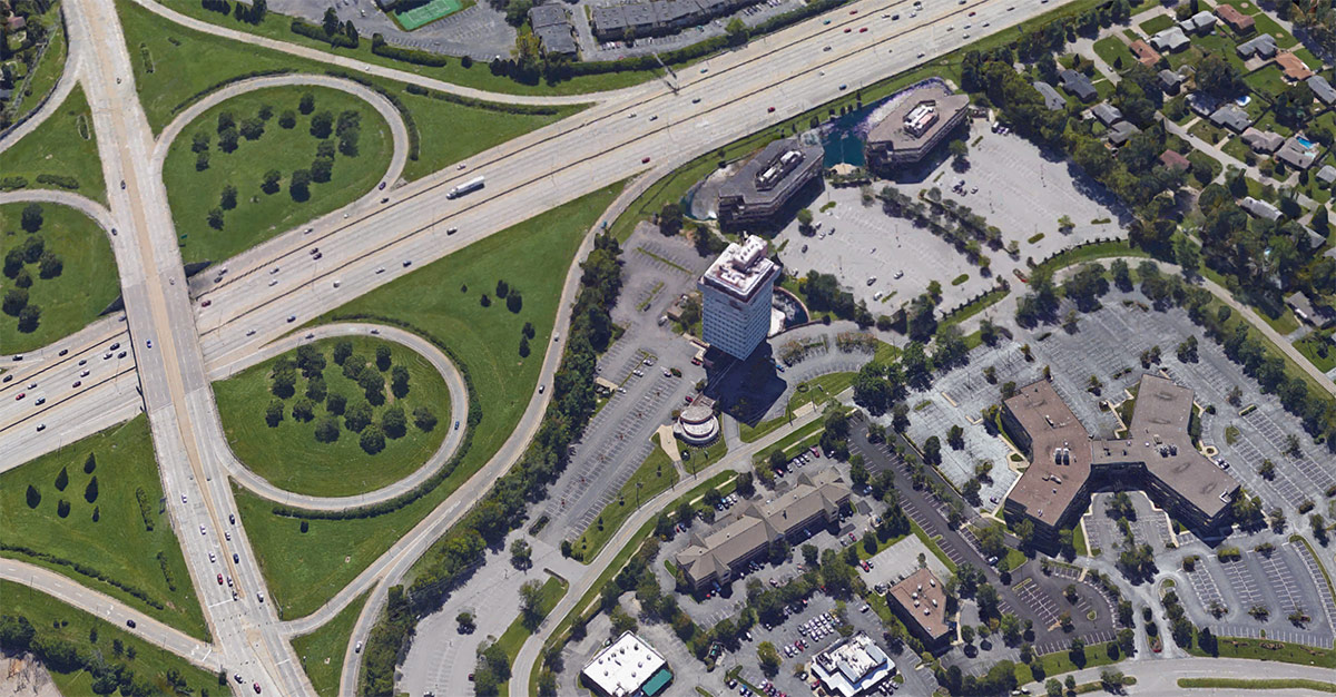
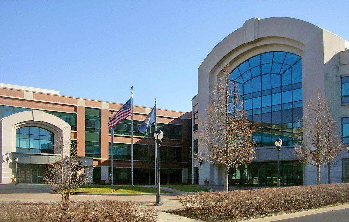
In 1964, Lincoln Income Life Insurance built the first major office in the suburbs at Breckenridge Lane and the Watterson Expressway. The resulting skyscraper is better known today as the Kaden Tower.

Completion of the structure signaled a significant shift in Louisville development‚ in effect serving as a billboard that the suburbs were open for business. Downtown was no longer the only place in which to build your company’s headquarters.

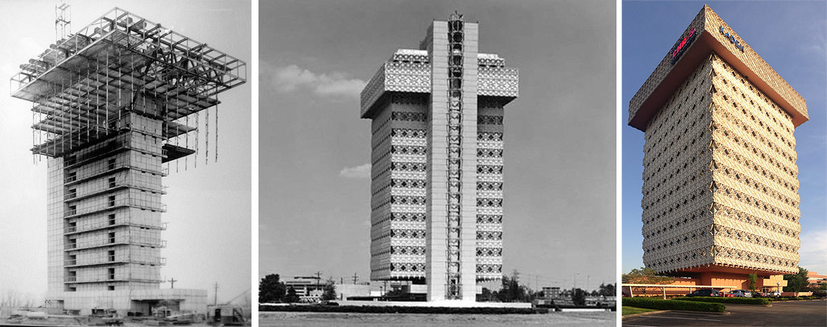
Lincoln Income Life Insurance Tower, now the Kaden Tower.

Besides locating hundreds of office staff in a remote site, away from other amenities like shops and restaurants, Lincoln built a world-class landmark designed by Taliesin Associates—the successor firm to the internationally acclaimed architect Frank Lloyd Wright.

The tower’s unique suspended-cable structural system flips construction upside down. Instead of building traditionally from the ground up, this feat of engineering suspends the tower’s floors down from an upper truss framework, a major technological innovation at the time.

The base of Kaden Tower. (Broken Sidewalk)

Other distinctive design components include a glass elevator that offers a dramatic ride up the side of the tower, a top-floor observation deck, and a spectacular, lower-level auditorium that has a sweeping view of a surrounding outdoor pool.

And while notable and impressive, one can only wonder how much greater the impact might have been if the tower had been centrally located in downtown? It certainly would have strengthened the business district when it needed it the most.

Papa John's headquarters. (Broken Sidewalk)
Papa John’s headquarters. (Broken Sidewalk)

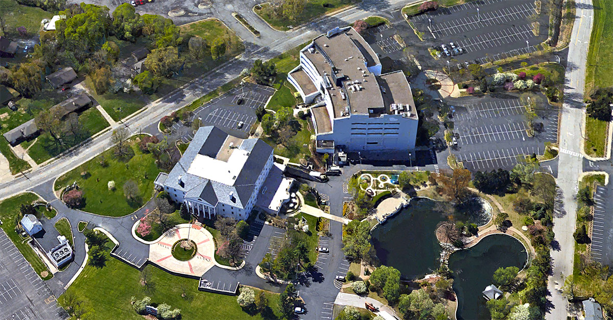
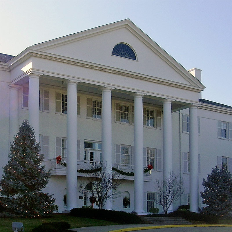
There are other prominent national and international headquarters in Louisville that are located in isolated, out-of-the-way places. Yum! Brands and KFC also chose to build alongside the Watterson, in a hard-to-find spot. And, to find the campus of Papa John’s Pizza, you’d need a GPS device.

Yum! Brands and KFC headquarters. (Courtesy Google)
KFC headquarters. (Broken Sidewalk)

What if these two high-profile companies were located in a prominent address, serving as anchors in a walkable part of town? How many restaurants, shops, etc., would they have supported? While both have signature arenas and stadiums named after them, it is challenging to find one of their restaurants in the core city.

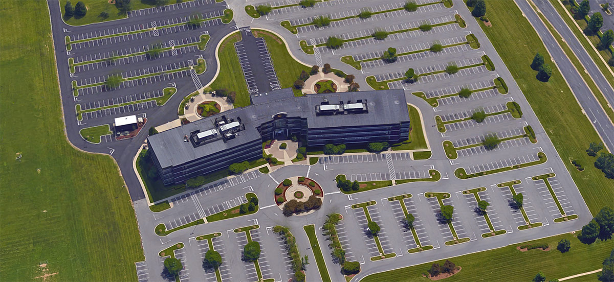
Headquarters of the UPS Air division off Hurstbourne Lane. (Courtesy Google)

There are plenty of other examples of major companies located on the suburban and exurban periphery. UPS’ Air division is located in a generic office park off Hurstbourne Parkway. Churchill Downs is another, more recent, local giant that placed offices well outside of Downtown or even its Central Avenue track. One division of the company now occupies a shiny suburban office building on Hurstbourne Parkway near Shelbyville Road.

Rendering of the new Thornton's headquarters. (Courtesy Thorntons)
Rendering of the new Thornton’s headquarters. (Courtesy Thorntons)

And others are still building new headquarters outside the city. In January, for example, Thorntons broke ground on its new HQ, termed a “Store Support Center,” on Old Henry Road in eastern Jefferson County. The nearly $30 million investment doubles the size of the company’s current suburban offices on Linn Station Road.

Fortunately, other corporations have invested heavily within the urban core over the years. Some of those include Humana, Kindred, and Aegon (formerly Capital Holding, which has since downsized and relocated).

At a time when corporations across the country embracing urban headquarters as a tool to attract the best talent, most notably with GE’s move from the Connecticut suburbs to downtown Boston, what would Louisville look like if we had a centralized corporate structure?

The synergy and density of multiple headquarters in downtown could create an environment of growth and vitality for all of Louisville, which in turn leads to a better place to live and call home.

[Top image of the Kaden Tower courtesy Google.]

It’s time for MSD to reinvest the $4 million it skimmed from Smoketown

5

As far as I can tell, Louisville’s Metropolitan Sewer District (MSD) owes Smoketown at least four million dollars. Let me tell you why.

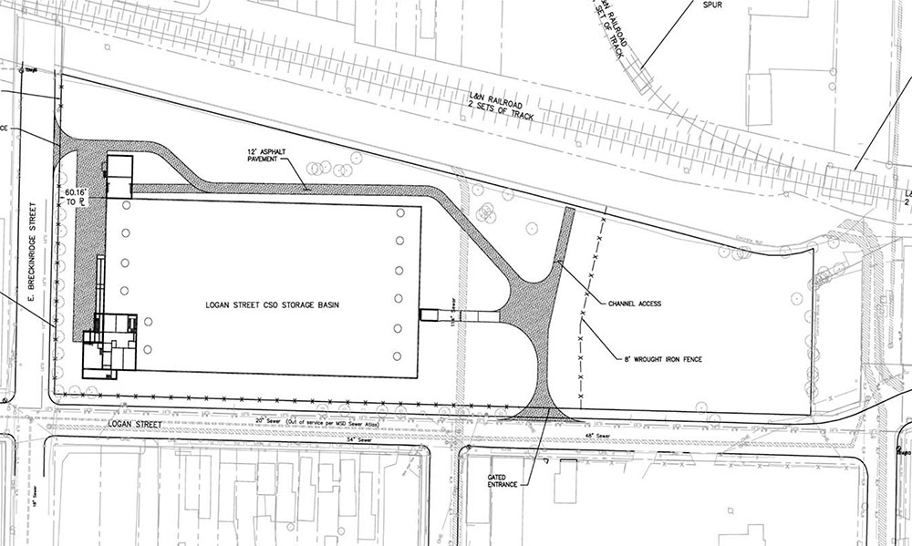
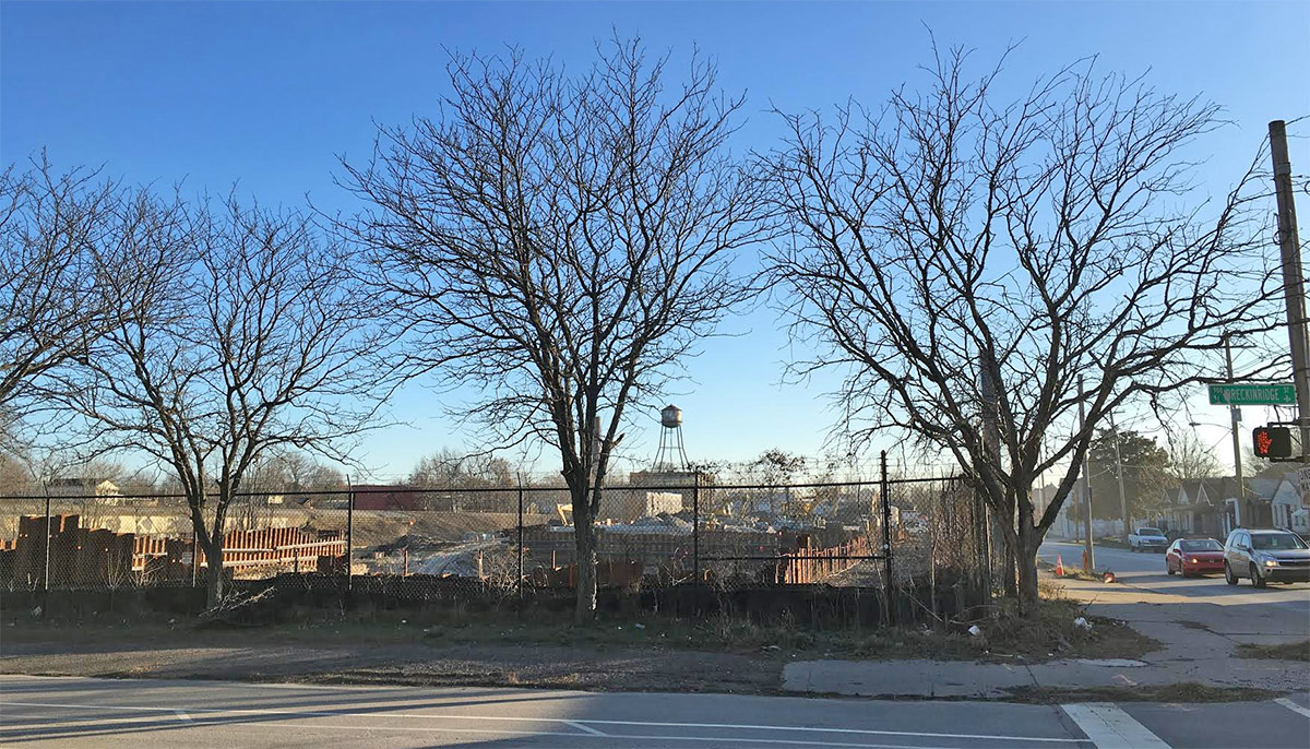
On November 16, I went to a community meeting about a building MSD is building in the neighborhood on the corner of Logan Street and Breckinridge Street. It’s called the “Logan CSO Interceptor Project.” CSO stands for “combined sewer overflows.” The “CSO Interceptor Project” is a fancy way of saying “catching the wastewater and stormwater before it flows into the Ohio River.”

The Logan CSO Interceptor is one of twelve CSO interceptors being built around the city. It’s part of MSD’s effort to comply with the Federal Consent Decree it entered into with the Environmental Protection Agency after the EPA found Louisville to be grossly and repeatedly out of compliance with the Clean Water Act.

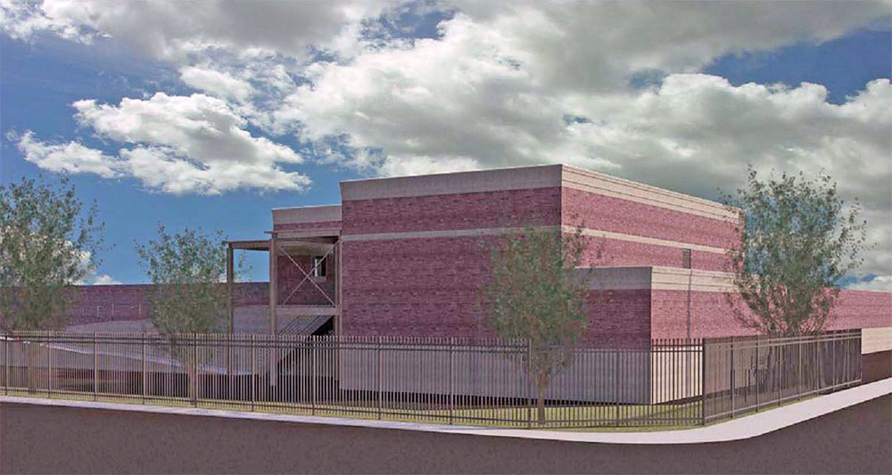
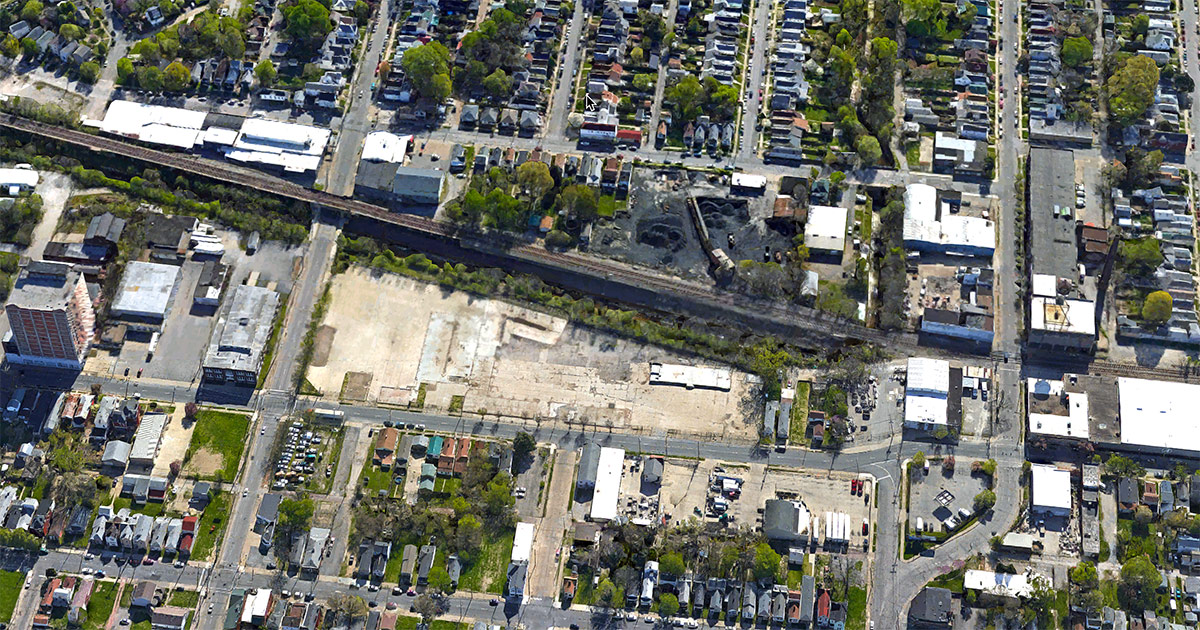
Each of the other 11 buildings are being built “to grade.” This means that the structure will actually be buried below ground and a park will exist on top of the building. However, the Logan CSO Interceptor will be  a block-long, windowless, two-story building in a part of town that desperately needs green space.

Site of the Logan CSO Interceptor before construction. (Courtesy Google)

Aside from feeling the blasting each day from the project in my law offices (one block west of the Interceptor), this November 16 meeting was my first exposure to the project. At the meeting, it was clear that neighborhood sentiment was strongly against the project.

The meeting opened with remarks from MSD’s new Executive Director, Tony Parrott. Mr. Parrott, responding to the dissatisfaction from Smoketown residents, admitted that the Logan project “did not have a good rollout” and lacked “community engagement.”

The Logan CSO Interceptor was the the first of the twelve CSO structures to be designed and built, Mr. Parrot explained, and he apologized for not developing good partnerships with Louisville Metro and for failing to get community input at the outset on the design of the building.

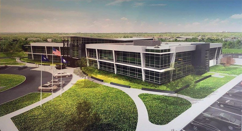
MSD's rendering of the Logan CSO Interceptor. (Courtesy MSD)
MSD’s rendering of the Logan CSO Interceptor. (Courtesy MSD)

During the course of the meeting, we learned that after receiving input from other neighborhoods on their CSO Interceptor projects, MSD decided to bury each of the other 11 structures at grade. It was clear from the comments made by neighbors at the meeting that this was their preferred design, as well. (Imagine preferring a block-sized park to a two-story windowless brick bunker.)

MSD had studied the possibility of implementing this same at-grade concept for the Logan CSO Interceptor project and determined that burying the facility at grade would have cost an additional $4 million.

MSD's rendering of the Logan CSO Interceptor. (Courtesy MSD)
MSD’s rendering of the Logan CSO Interceptor. (Courtesy MSD)

As a concession to the neighborhood, MSD is now offering the Smoketown community the opportunity to weigh in on the design of the two-story facade of the building. MSD has agreed to allow the community to spend $700,000 that was previously budgeted for bricks on some alternative facade of which the community approves.

This is a completely outrageous and unacceptable “concession” from MSD. It provides no new money to a project that, by MSD’s own admission, was created without community engagement. It asks the community to sign off on shortchanging the Smoketown community of at least $4 million.

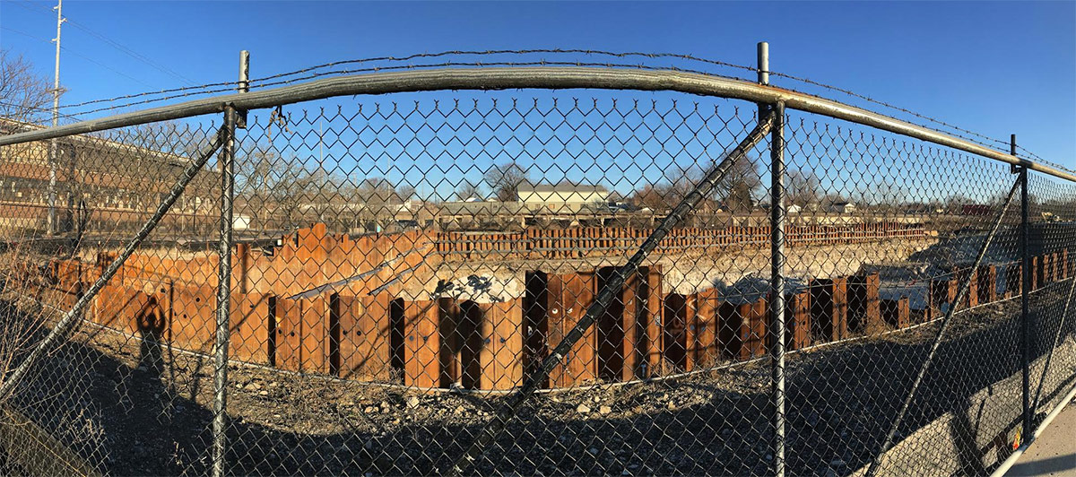
The Logan CSO Interceptor under construction. (Ben Carter)

MSD, without community input, decided to cut corners and save money on the Logan CSO Interceptor project. After hearing from other communities, it changed its Interceptor designs on every one of the other projects. These changes—no doubt—increased the cost of each of the other projects. Now, MSD is asking Smoketown to put $700,000 of lipstick on its pig instead of either:

  1. Revising the Logan CSO Interceptor project to offer the neighborhood the green space the other 11 projects are offering other neighborhoods, or
  2. Offering at least $4 million (the money it skimped on for the Logan CSO Interceptor) to the Smoketown community to use to change the design of Logan CSO Interceptor or devote to other community purposes (like securing other greenspace that the community will no longer have because of MSD’s design and community outreach failures).
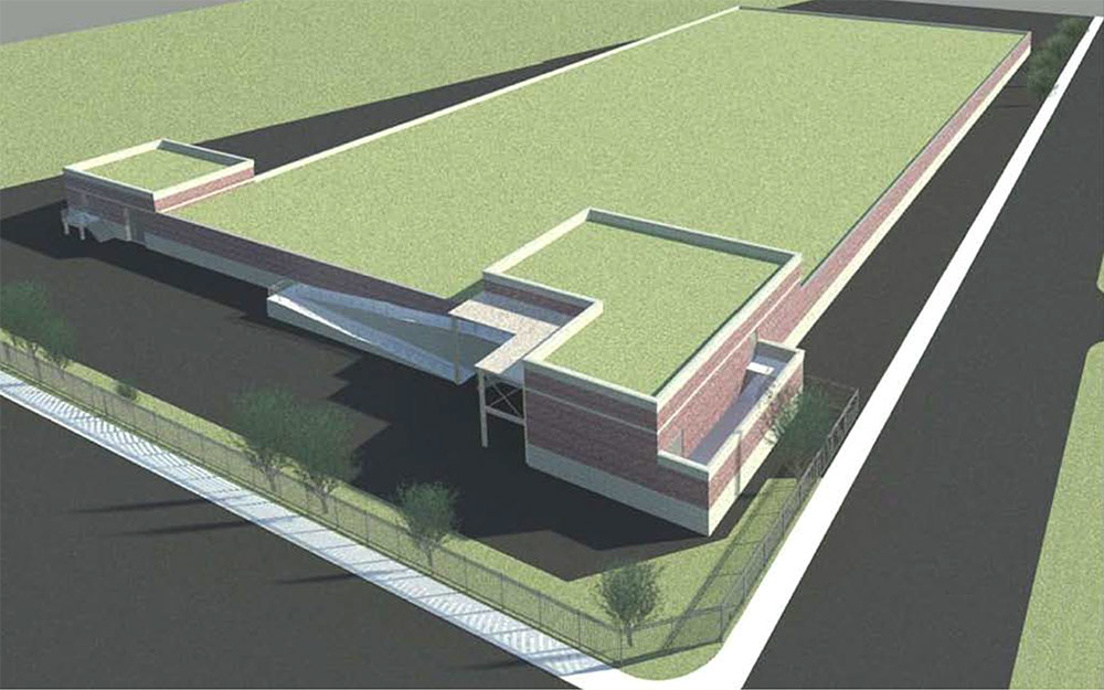
Site plan of MSD's Logan CSO Interceptor. (Courtesy MSD)
Site plan of MSD’s Logan CSO Interceptor. (Courtesy MSD)

Given MSD’s admitted shortcomings in its design and community engagement processes, MSD’s decision to save $4 million on its facility located in Smoketown can only be seen as shortchanging a neighborhood that is already all-too-familiar with shortchanging. That MSD expects Smoketown residents to be satisfied with a resolution that offers no new money but exchanges brick for some other veneer, is an insult to Smoketown.

Last week, the community had its first meeting for residents to sit down with the designers MSD has engaged to redesign the facade of MSD’s building. There are already some useful ideas about how the facility can be improved.

As the redesign process kicks off, I hope participants from Smoketown will use the “redesign process” to insist that MSD invest the $4 million it siphoned away from the Smoketown community back into the community.

Whether the residents want to invest the $4 million into the redesign of MSD’s building or insist on that money returning to the neighborhood in the form of a grant to the Smoketown Neighborhood Association is, as far as I’m concerned, up to the residents of Smoketown.

MSD has admitted its process was flawed. That flawed process led MSD to decide—without community input—to save $4 million on the Logan CSO Interceptor. After it got input from other communities, it learned that its decision at the Logan site was wrong and invested in more expensive projects in the 11 other neighborhoods. Yet, MSD has not returned to Smoketown to fix its $4 million mistake.

I urge Smoketown residents participating in the redesign project to insist that MSD reinvest into Smoketown the $4 million it mistakenly decided not to spend on our neighborhood.

[Editor’s Note. This article was cross-posted from the blog of the author’s, Ben Carter, law firm. It appears here with permission. Top image of the Logan CSO Interceptor under construction by Ben Carter.]

Worst: Louisville’s original layout didn’t encourage the synergy that could have made the city even greater

[Editor’s Note: Louisville has made some pretty amazing achievements in its first 238 years—but it’s made a few blunders along the way, too. This week, we’re launching a new contributed mini-series documenting eight of the best and eight of the worst decisions, ideas, or projects that have profoundly affected the city. This list is by no means complete—and you may have strong opinions of your own about what should be on the best or worst lists. Share your thoughts in the comments section below. Or check out the complete Best/Worst list here.]


Centuries ago, Louisville’s Central Business District (CBD) was planned with a “linear” layout, as opposed to a “compact” one. Instead of concentrating development around one dominant location and radiating outward, development was dispersed and not economically connected in a strategic manner.

This planning pattern manifested itself along a long growth spine at Fourth Street, beginning at the Ohio River to the north and running all the way past Old Louisville to the south. From either side of Fourth, Louisville became spread out, east and west.

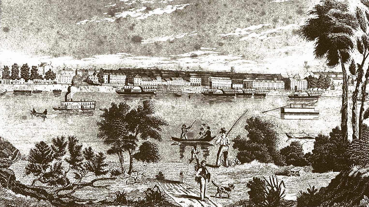
The Louisville waterfront in the 1840s. (Credit Unknown)

Unlike neighboring Indianapolis and Cincinnati, which have very defined centers—Monument Circle and Fountain Square—and are functionally organized, Louisville, historically, was never developed into a similarly grand plan.

Cincinnati and Indianapolis had a strong urban planning process from the start. Fountain Square and Monument Circle were defined early, and civic leaders maintained and enhanced this central focus for decades—and still do.

Government buildings surrounding Jefferson Square. (Broken Sidewalk)

Louisville does have a good government center roughly surrounding modern day Jefferson Square. That green space is surrounded by City Hall; the old Courthouse, now Metro Hall; the Judicial Center and Correctional Facility; the old jail; and the Hall of Justice. But this notion of a single-use civic center emerged much later and lacks the varied ingredients that make a vibrant city.

The economic engines—retail, hotels, offices, etc.—did not develop concentrically around this core or were scrubbed clean and demolished. Before we had Jefferson Square and the PNC Tower, we had the Realty Building and the Willard Hotel on this site.

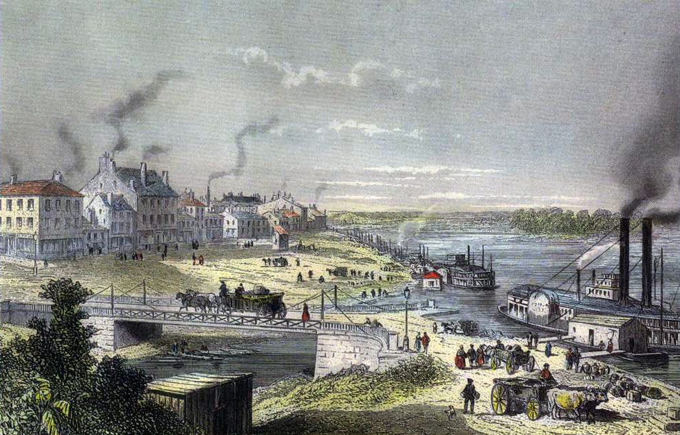
A view of the Louisville wharf in 1856. (Louisville Historical League)

This essential mix of uses follow linear east-west routes in the age of the steam boat, mainly along Main and Market streets, and then shifted away from the river to Fourth Street from Main to Broadway. While business boomed along these corridors, there was no “center”—no place one could point to as the center of town. Had such a center existed from the beginning, a more vibrant synergy could have spurred more economic activity in the city’s core.

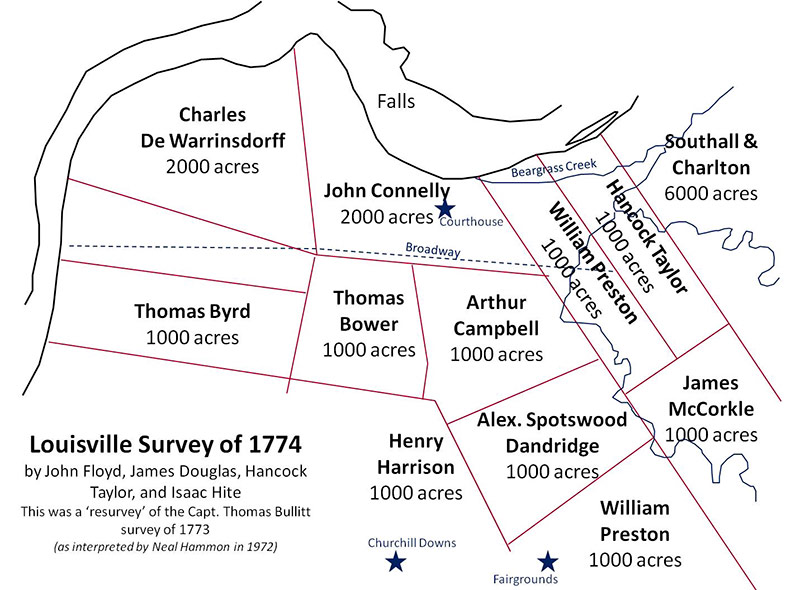
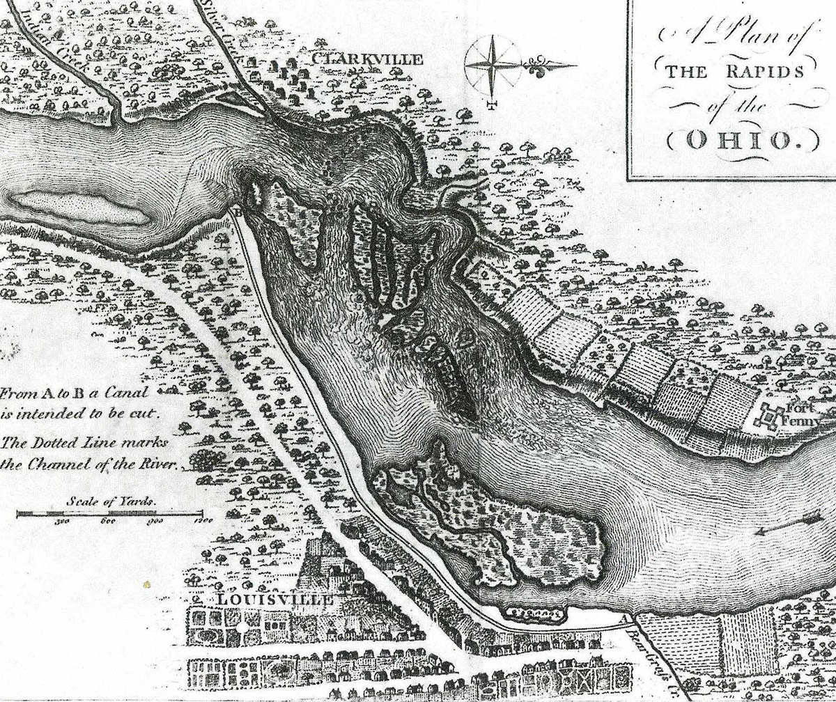
A map showing the original land grants circa 1774 that eventually shaped the city's layout.
A map showing the original land grants circa 1774 that eventually shaped the city’s layout.
A map of Louisville in the 1780s.

This urban pattern may have evolved from the very beginning, when George Rogers Clark arrived in 1778. He confiscated a land grant from John Connelly, who mistakenly decided to side with the British in the Revolutionary War. That grant covered most of what is today considered Downtown Louisville.

In taking Connelly’s land, the initial street plan—most likely prepared by a military cartographer—included a very wide boulevard street at the southern edge of Connelly’s land grant.

This wide street was originally called Dunkirk Street and later renamed to Prather Street in honor of a prominent civic leader, Thomas Prather. Today that wide boulevard is known as Broadway.

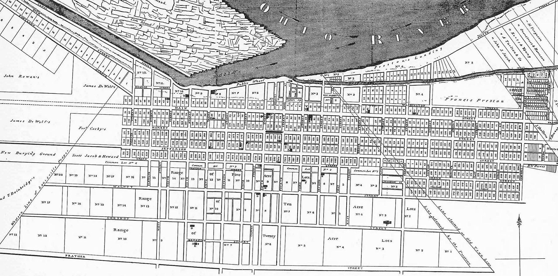
An 1832 map of Louisville showing the east-west alignment of streets and Broadway at the south end.

Three grand east-west streets closer to the Ohio River were also planned: Main Street, Market Street, and Jefferson Street.

The original plan also included a prominent landscaped “commons,” a sort of linear park running along the narrow block between Jefferson and Liberty streets. Prior to being renamed to Liberty in 1917 (a patriotic maneuver during World War 1), this street was known as Green Street since it ran along this park-like series of blocks.

A city graveyard was shown aligning with those blocks on the west edge of town, today the only remaining original green parcel left, although Baxter Park and Jefferson Square are not also in alignment.

Whatever happened to that landscaped “commons” between Jefferson and Liberty streets? To pay off city debts, most of the what would have been a pioneering green space at the time was sold for private development.

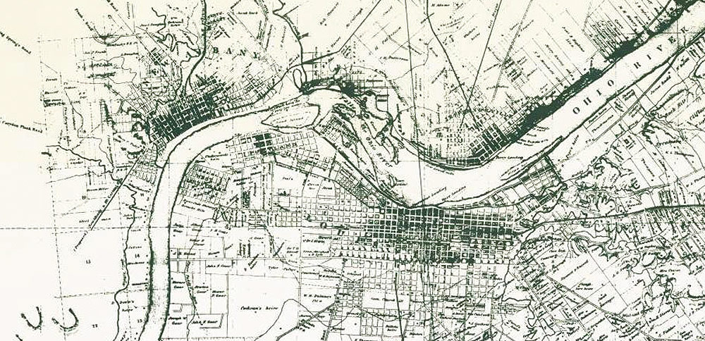
Detail of the 1858 Bergman map of Louisville.

Louisville’s numbered street system also shows a few quirks from this early layout. In most river cities—Cincinnati, St. Louis, or Memphis, among others—the numbered streets (First, Second, Third, etc.) are positioned parallel to their adjacent river. In Louisville, strangely, the numbered streets are located perpendicular to the Ohio River.

This created some confusion and orientation problems for new residents and visitors to the city. Trying to give directions to out-of-towners along Fourth Street is challenging, and the numbered blocks helped people understand how far they would have to walk. Most locals, for instance, don’t know how many blocks there are from Main Street to Chestnut Street (answer: five) in order to determine if one should walk or take a cab to the Palace Theater.

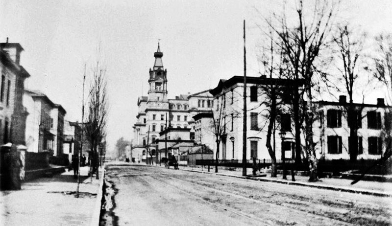
Fourth Street 1898 was lined with houses, not stores. Here, the old St. Joseph Hospital is on the right looking toward Chestnut Street (Courtesy UL Archives)

Over the next hundred years, the city expanded along Fourth Street from the river to Broadway, which had come to exemplify the high fashion of Louisville’s wealthy citizens. It was here that the city’s elite built their elegant mansions.

Families like Avery, Ford, Newcomb, Vogt, and Brandeis were among those who called the street home. All but one of Downtown’s elegant residences have since been bulldozed for lesser quality buildings and parking lots. The lone survivor is the grand old Brennan House on Fifth Street.

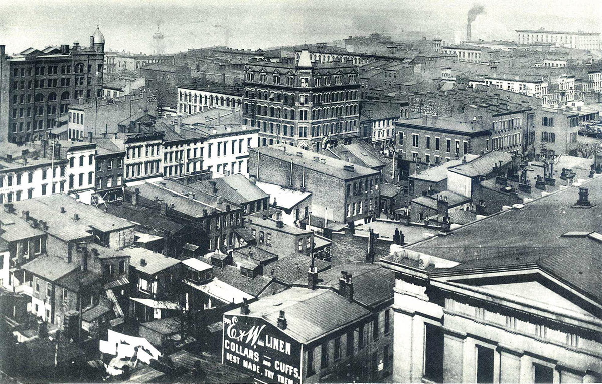
The Louisville skyline in 1889. (Credit Unknown)

Several nodes of concentrated activity did form around Downtown, including the Theater District (Fourth between Chestnut and Broadway), the Government district (around Sixth and Jefferson, surrounding what today is Jefferson Square), and various business hubs along Main and Market streets. And one day, one of these hubs may come to represent for Louisville what Monument Circle and Fountain Square do for Indianapolis and Cincinnati, but we’re still largely a city without an official central point.

What’s Louisville’s “center” to you? Where should the central point or public space of the city be? Share your thoughts in the comments below.

Best: Louisville’s Olmsted parks are the gift that’s been giving back for a century

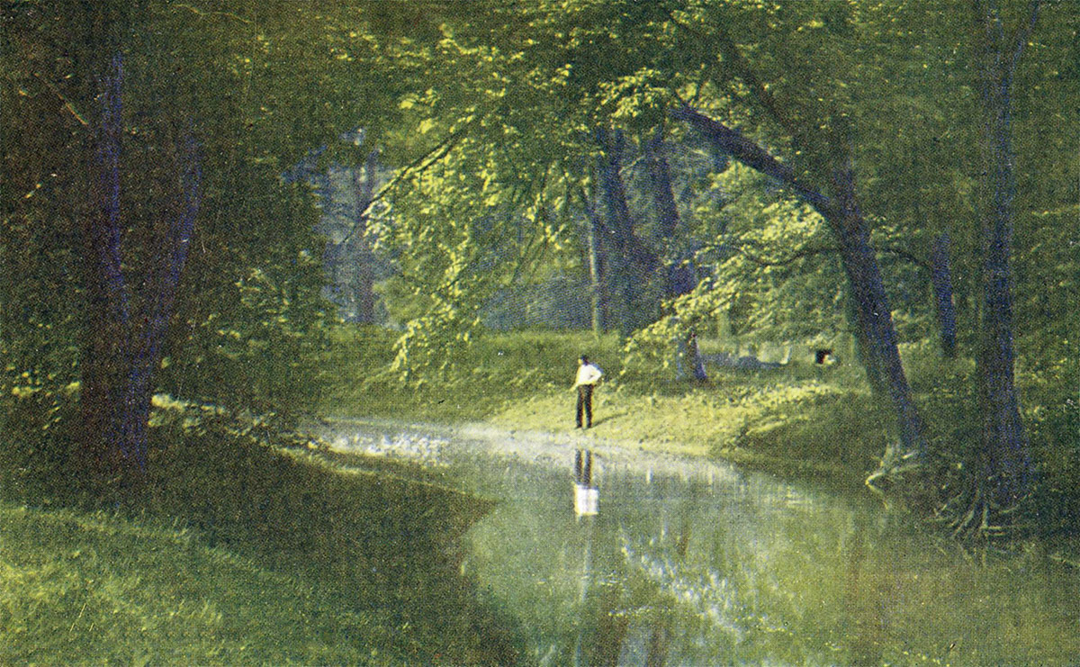
A scene along Beargrass Creek in Cherokee Park circa 1909. (Courtesy of the National Park Service, Frederick Law Olmsted National Historic Site)

[Editor’s Note: Louisville has made some pretty amazing achievements in its first 238 years—but it’s made a few blunders along the way, too. This week, we’re launching a new contributed mini-series documenting eight of the best and eight of the worst decisions, ideas, or projects that have profoundly affected the city. This list is by no means complete—and you may have strong opinions of your own about what should be on the best or worst lists. Share your thoughts in the comments section below. Or check out the complete Best/Worst list here.]


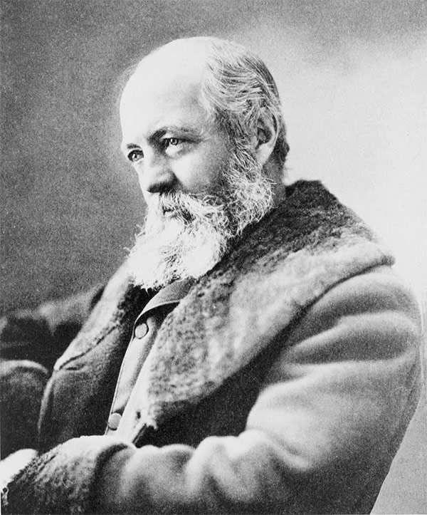
Frederick Law Olmsted. (Courtesy Architect of the Capitol)

May 20, 1891, is a landmark date in Louisville planning history. That was the day when Frederick Law Olmsted—the Father of Landscape Architecture himself—arrived in Louisville by train from Chicago where he was preparing the World’s Columbian Exposition that would dazzle the world when it opened to the public in 1893.

Olmsted was in town to speak to a select group of civic leaders at the Pendennis Club. Shortly thereafter, Mayor Charles Jacob commissioned Olmsted to develop a parks system for the city. Olmsted, after all, was the famed designer of New York City’s spectacular Central Park in 1857 and Prospect Park in 1867.

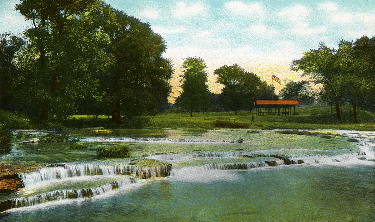
The Falls at Beargrass Creek in Cherokee Park circa 1914. (Courtesy of the National Park Service, Frederick Law Olmsted National Historic Site)
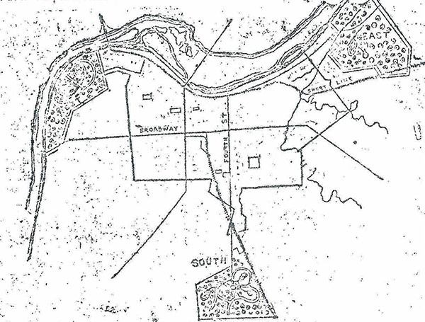
An early sketch of Louisville's parks system.
An early sketch of Louisville’s parks system.

Prior to hiring Olmsted, the business community had set out a grand vision. City leaders wanted Louisville to retain its position as one of America’s top tier cities, and to do that, they sought to expand its manufacturing base. To achieve this, the city needed more blue collar workers for these factories. And parks played a key role in attracting that labor force to the city. Thus, they saw parks as an economic development strategy.

To Louisville’s early industrialists—and very much to Olmsted—parks were a way of improving the health of cities by providing pastoral landscapes in which the working class to escape the tedium and pollution of city life. These so-called “pleasure grounds” were spaces for workers and their families to enjoy and relax, since they could not afford large landscaped yards or travel abroad.

An aerial view of Shawnee Park along the Ohio River. (Courtesy Google)

While Frederick Law Olmsted is touted as the mastermind of Louisville’s parks system, he actually only worked on the initial conceptual layout. By the mid-1890s, Olmsted was in his early 70s and suffered from deteriorating health. His sons, John Charles Olmsted and Frederick Law Olmsted, Jr., succeed their father in implementing the Louisville park system. The duo formed their new firm, Olmsted Brothers, in 1898.

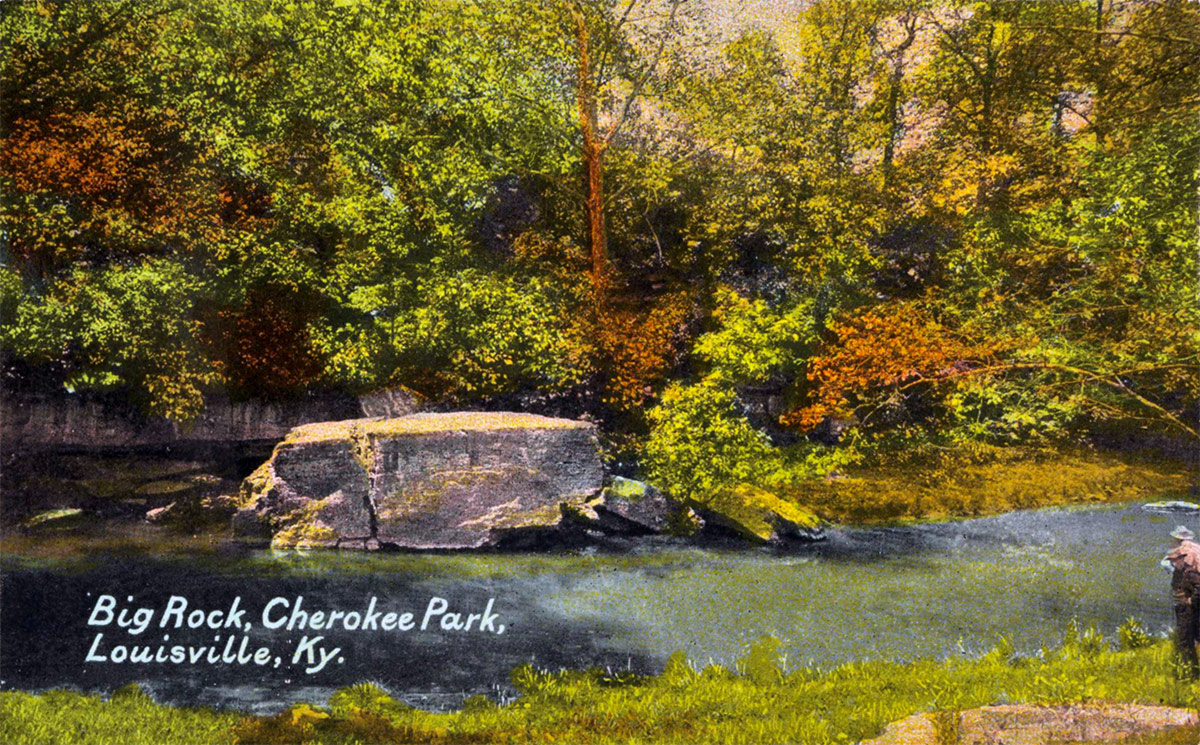
An early view of Big Rock in Cherokee Park circa 1903.
An early view of Big Rock in Cherokee Park circa 1903. (Art Work of Louisville)
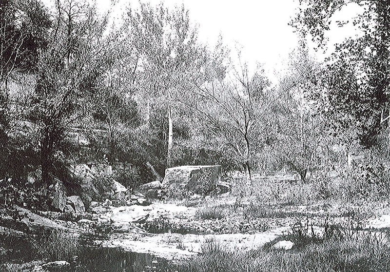
Big Rock along Beargrass Creek in Cherokee Park. (Courtesy of the National Park Service, Frederick Law Olmsted National Historic Site)

One other person also needs to be recognized for making certain the parks were built: Andrew Cowan. Cowan was not a native Louisvillian but relocated here after a distinguished military service in the Civil War.

Cowan is recognized as one of the heroes at Gettysburg, where he kept his cannon battery focused on repelling Pickett’s Charge on July 3rd, 1863.

It was Cowan who guided Olmsted around to the various proposed park locations during his 1891 visit. He became passionately dedicated to getting the parks implemented. Cowan eventually built a magnificent mansion adjacent to Cherokee Park, near Big Rock.

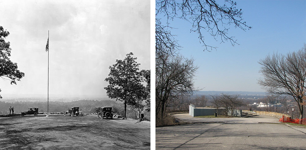
The lookout in Iroquois Park in 1921 and again in 2008 before renovations began. (Courtesy UL Archives; Broken Sidewalk)

Described as an Emerald Necklace around the city, the three major parks—Shawnee, Iroquois, and Cherokee—are all connected via landscaped parkways, although there are a few gaps. To this day, Eastern Parkway terminating at Cherokee Park, Southern Parkway leading to Iroquois Park and Algonquin Parkway and Southwestern Parkway pointing to Shawnee Park are among Louisville’s most pleasant thoroughfares lined with majestic oak trees and stately homes.

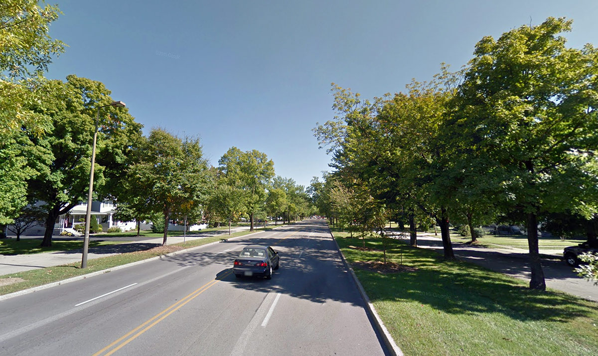
A view of Southern Parkway, Louisville's only true Boulevard. (Courtesy Google)
A view of Southern Parkway, Louisville’s only true Boulevard. (Courtesy Google)

Once the Olmsted brothers had built these three masterpieces, there was plenty of demand for more projects from those around Louisville enamored with the beautiful landscapes. Many smaller city parks—Central Park, Shelby Park, and Chickasaw Park, among others—bear the signature Olmsted design sensibilities. Many stately mansions throughout the city, lining the parks and perched atop river bluffs, are also surrounded by Olmsted landscapes.

Louisville’s Olmsted Parks System is today overseen by the Olmsted Parks Conservancy and Metro Parks. The parks system is undeniably a magnificent amenity for the residents of Louisville and a major asset to their quality of life. The civic ambition that led to their creation is one that should inspire us to this day.

City leaders celebrate ceremonial groundbreaking for the 30-story Omni Louisville Hotel

3

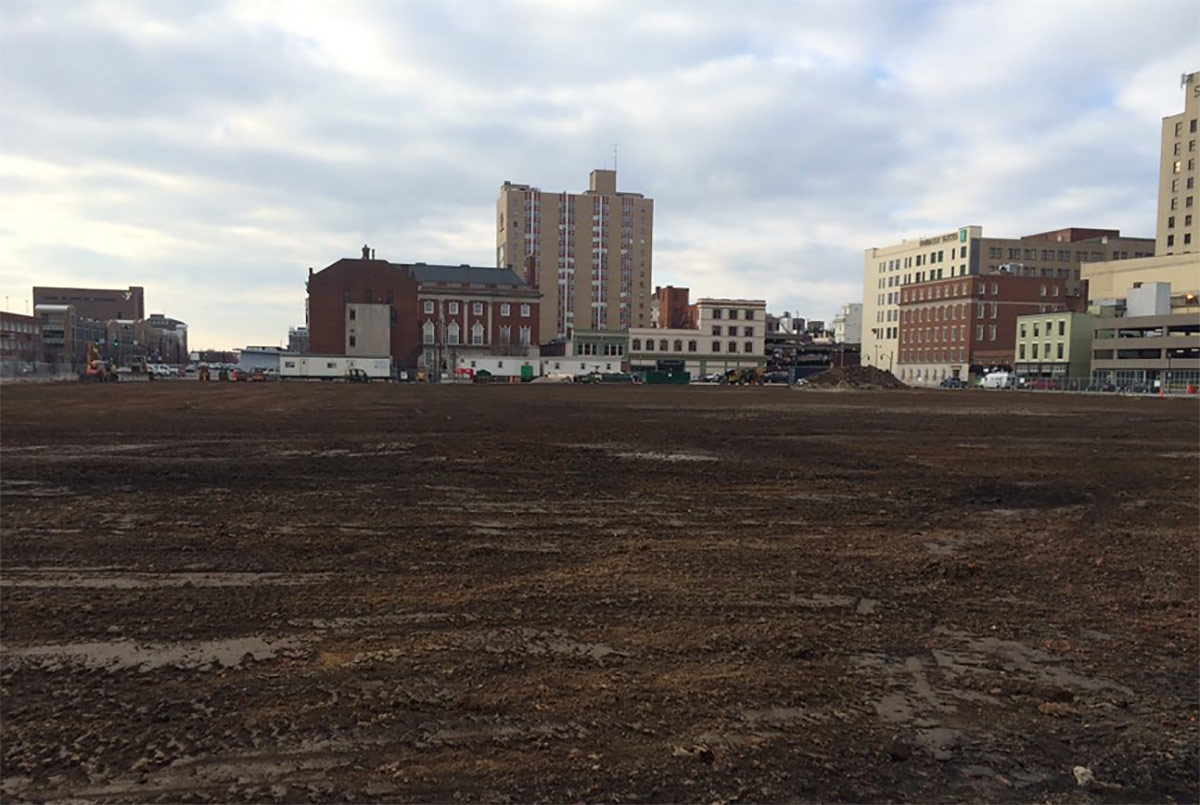
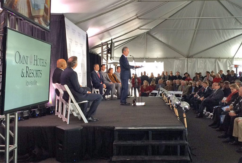
Downtown Louisville’s Omni Hotel & Residences—now called the Omni Louisville Hotel—is officially underway. The mega-project held a ceremonial groundbreaking at the corner of Second Street and Liberty Street where crowds packed a tent in the oversized dirt block that’s about to become the city’s largest construction site.

On hand were Mike Deitemeyer, president of Omni Hotels & Resorts; Louisville Mayor Greg Fischer; a cadre of Metro Council members; and heads from the Louisville Convention & Visitors Bureau and the Louisville Downtown Partnership.

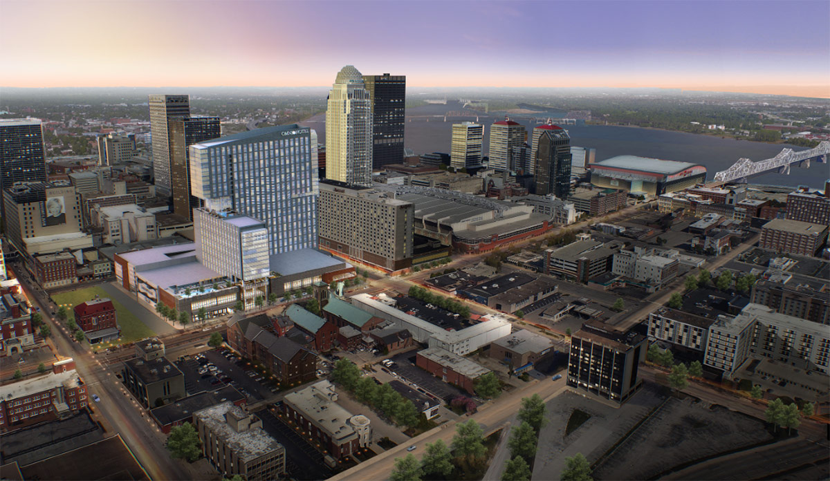
(Courtesy Omni)
(Courtesy Omni)

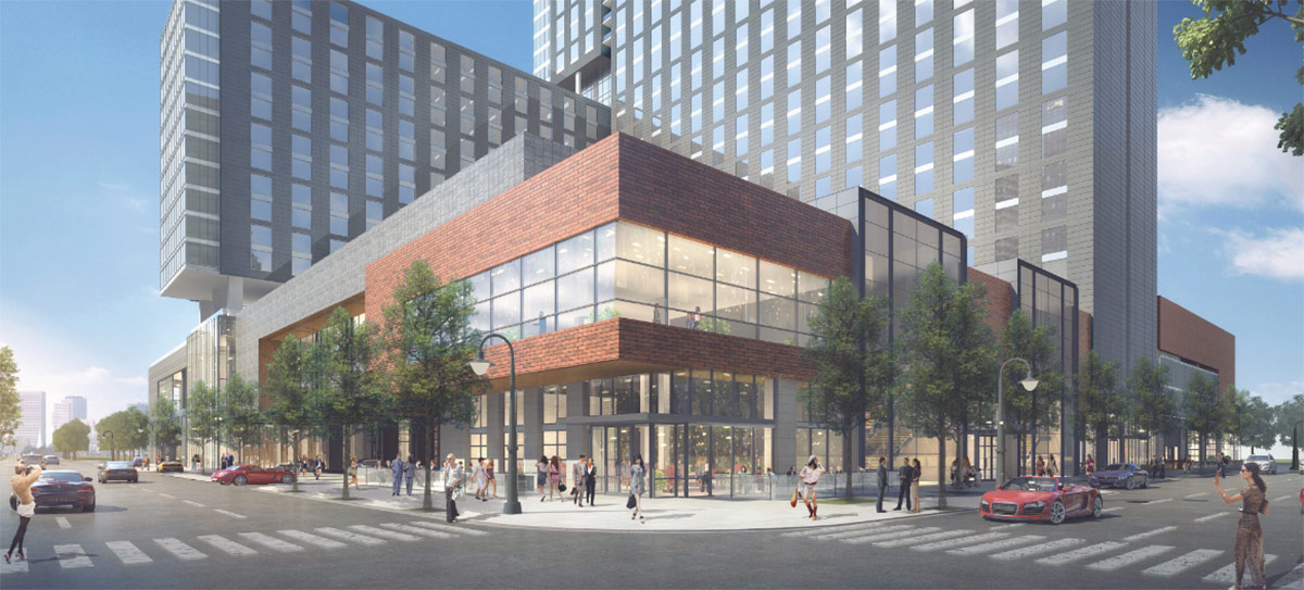
The public-private-partnership will bring 612 hotel rooms, 225 luxury apartments, a smattering of retail, and 70,000 square feet of ballrooms and meeting space all wrapped up in a large podium and 30-story tower. The project is laying claim to the title of the tallest hotel in Louisville.

That lucrative meeting space earns the Omni Louisville Hotel a place in the company’s so-called “Convention Collection” of hotels supporting the convention and meeting industry. Omni operates other convention center hotels in Atlanta, Dallas, Fort Worth, Nashville, Providence, San Diego, and Washington D.C.

A block north, the Kentucky International Convention Center is about to undergo a $180 million expansion, that, combined with the Omni, is expected to keep the city competitive in an arms race of meeting space between the likes of Indianapolis, Nashville, and others.

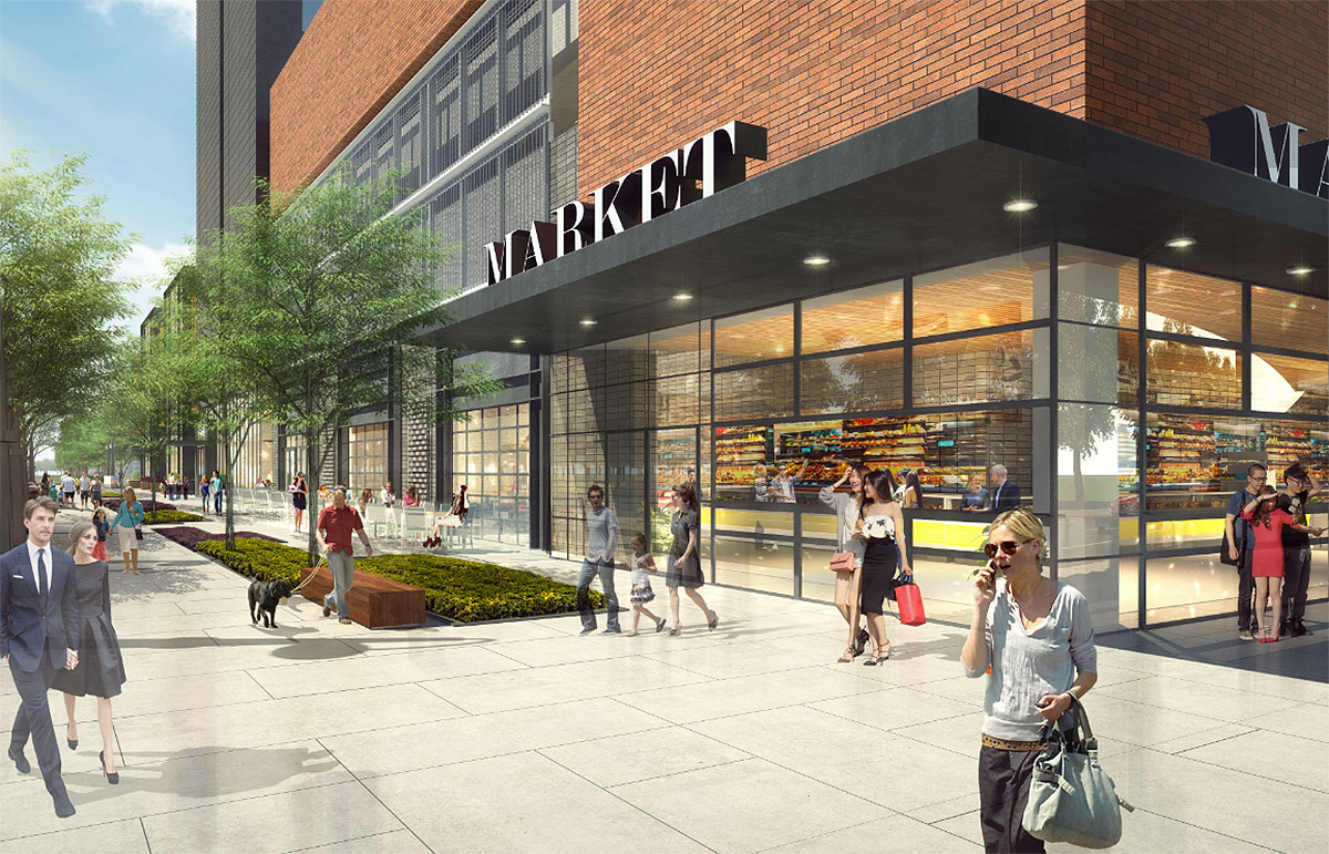
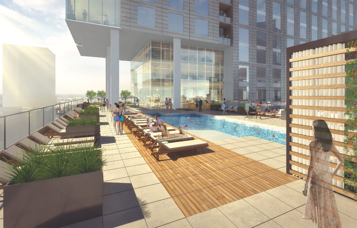
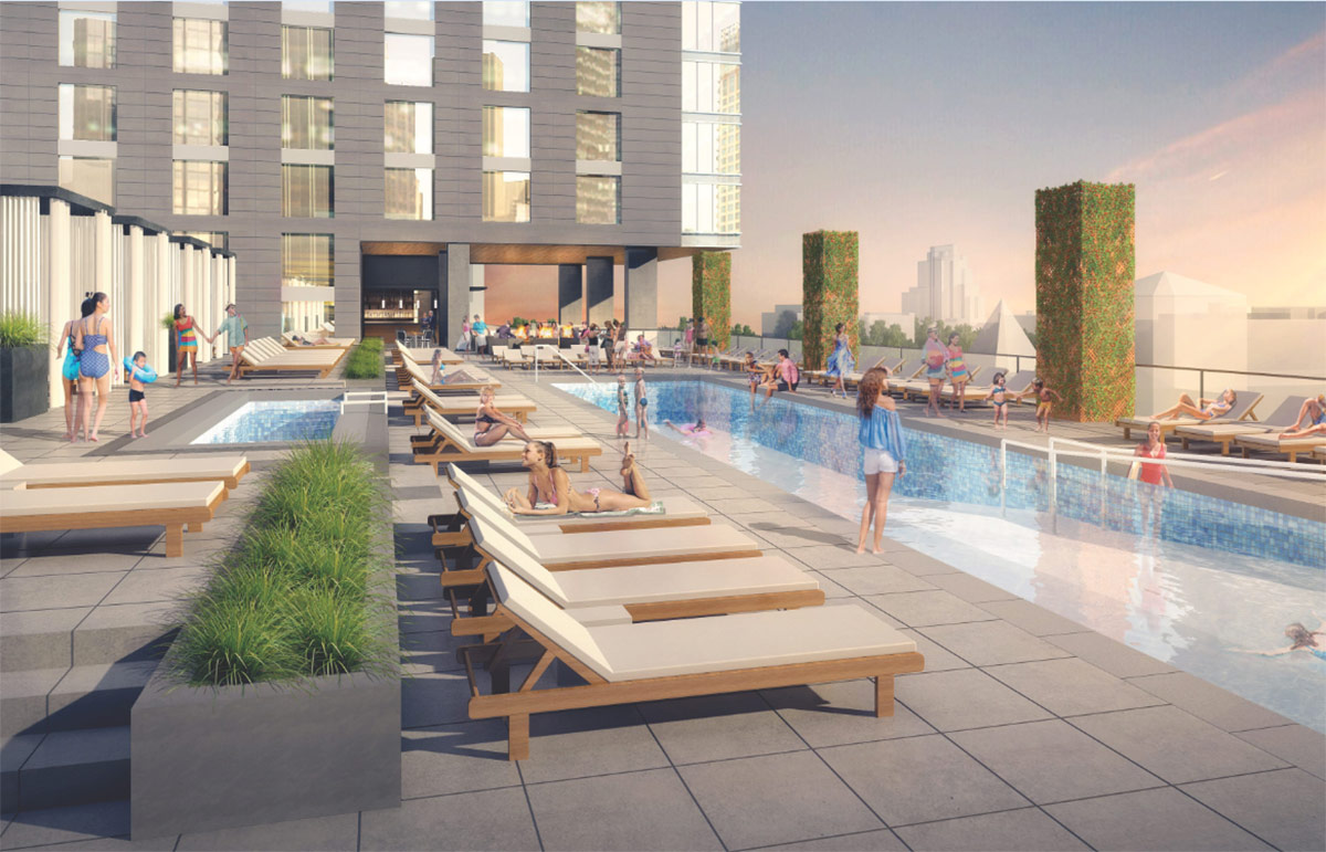
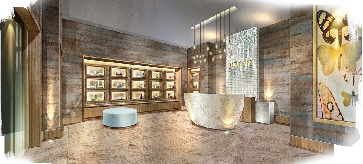
The Omni’s retail components include Bob’s Steak & Chop House, a three-meal-a-day restaurant, a speakeasy with a bowling alley off the alley, a lobby lounge, a rooftop pool with a bar & grill, and the infamous “dynamic, modern urban lifestyle market.” Other hotel amenities include a fitness center, Mokara spa, and a lobby art gallery.

The structure was designed by the hospitality division of Texas-based HKS Architects and interiors are the work of Dallas’ waldrop + nichols studio. Birmingham, Ala.–based Brasfield & Gorrie is serving as the project’s general contractor.

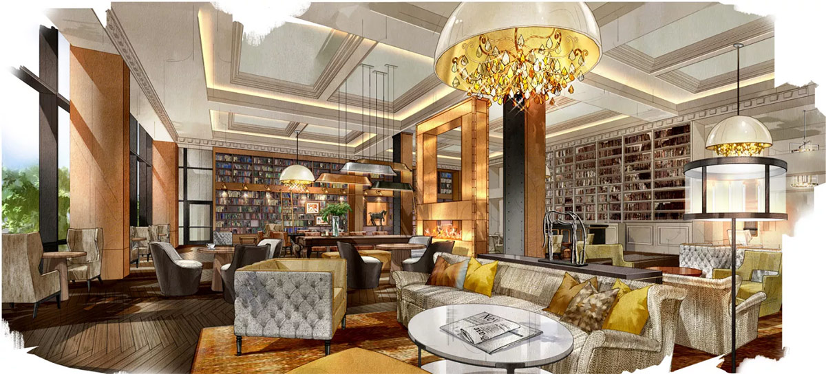
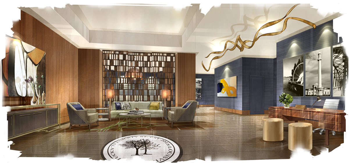
While the exterior of the project has not significantly changed since it was approved by the Downtown Development Review Overlay (DDRO) committee last summer, we now have a much clearer idea of what the project’s interiors will look like.

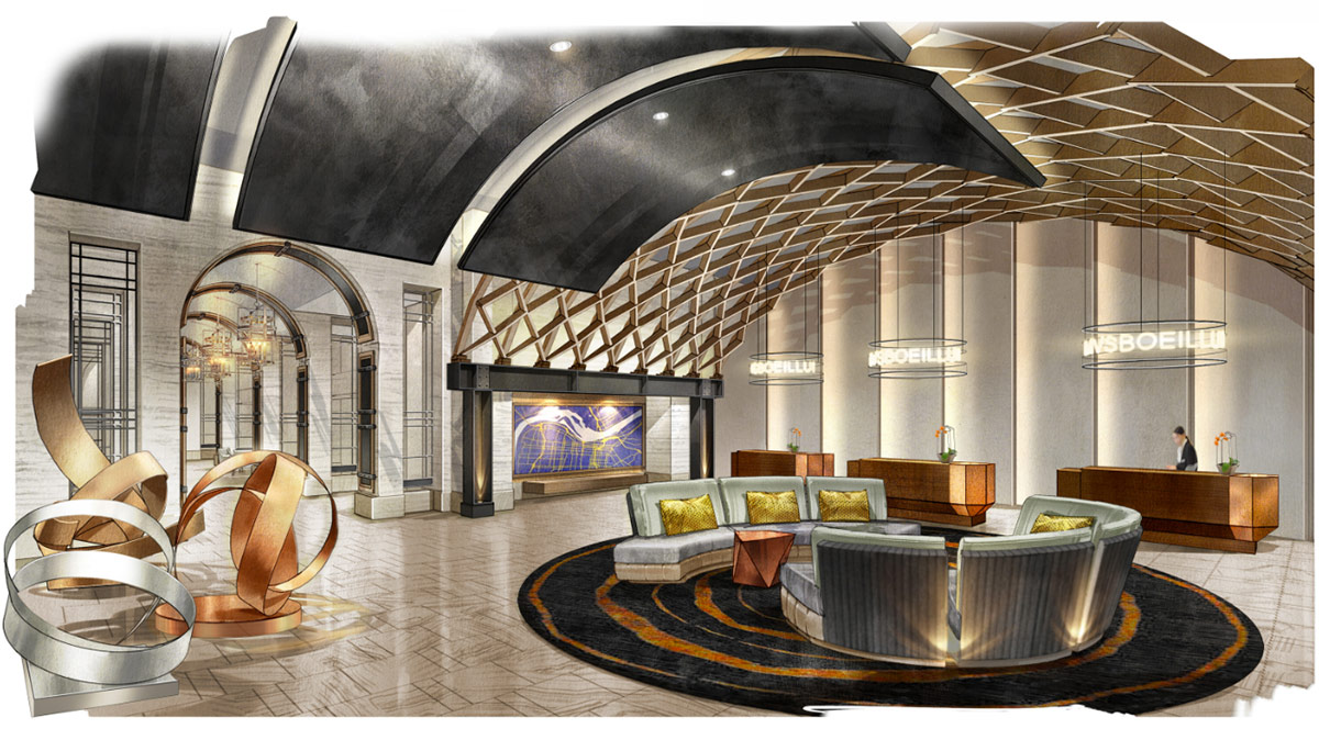
Inside, the lobby features a spectacular barrel arch vault that call to mind the work of noted Japanese architect Shigeru Ban while dually referencing an artful arrangement of bourbon barrel staves. The interior spaces offer a sort of moody modern aesthetic, including dark colors, sumptuous textures, and warm lighting. In one lobby seating area, a screen vaguely reminiscent of a Harry Bertoia screen in New York City creates a porous division of space.

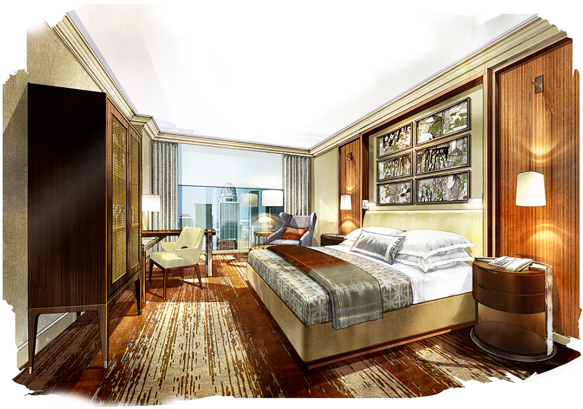
Inside the guest rooms, the design takes a more conventional turn, with sedate crown moldings, amber hues, and plenty of stone. Renderings depict spaces meant to feel luxurious for those visiting the hotel.

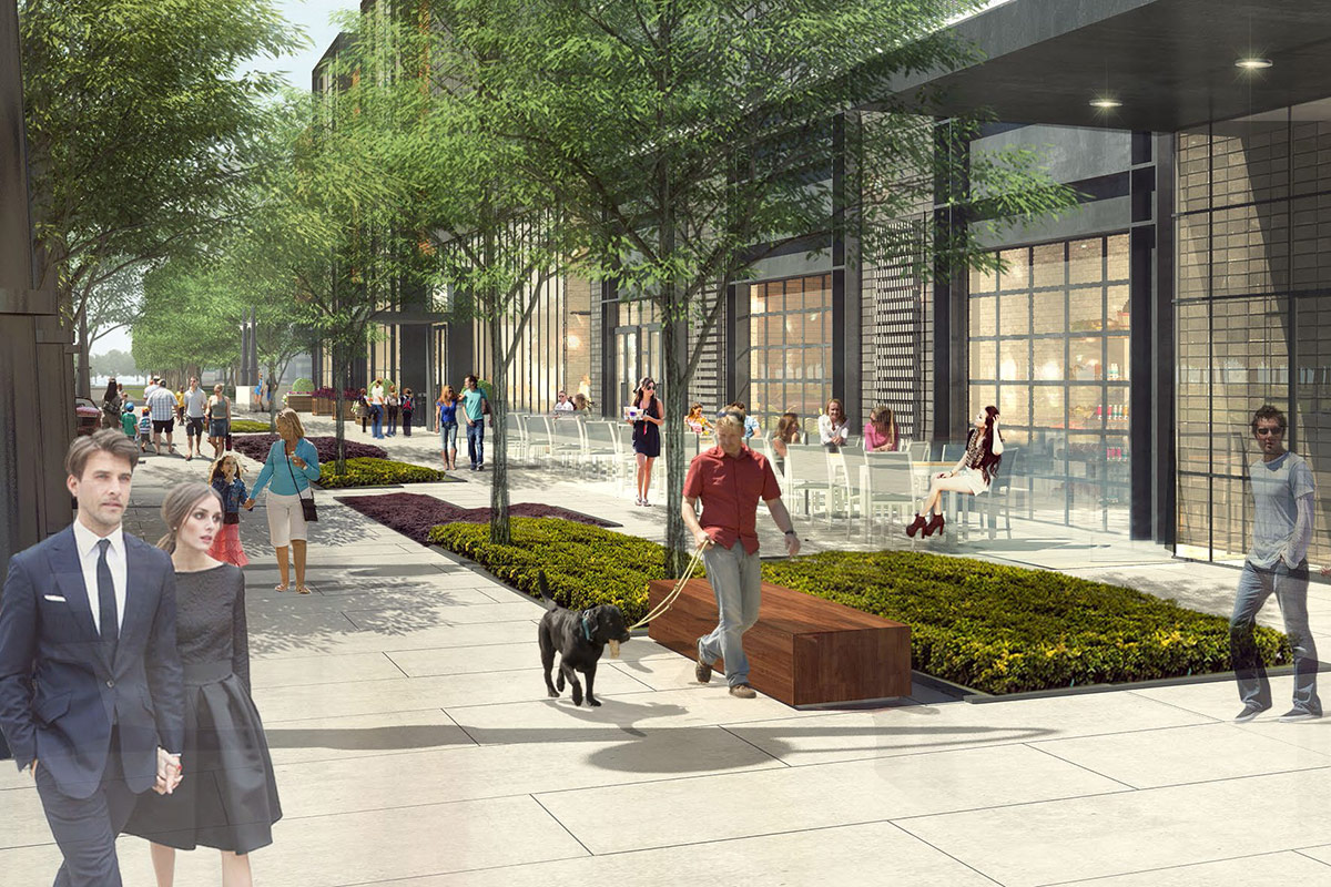
The redesigned Liberty Street. (Courtesy Omni)

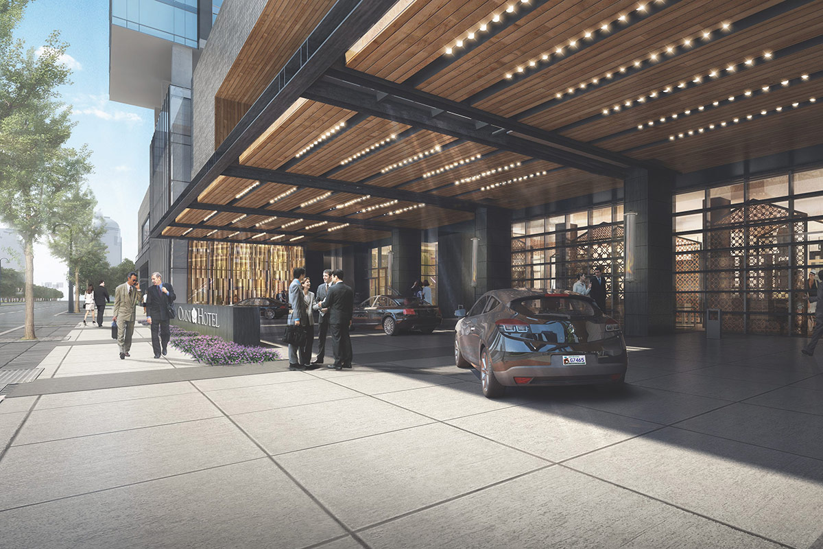
The development’s main contribution to the city’s urban design is a redefinition of Liberty Street as a major pedestrian thoroughfare. Because the main entrance faces Second with a side entrance off Liberty, many a hotel guest will use this route as a passageway to and from the convention center.

The Omni sought and received special permission from the Board of Zoning Adjustments (BOZA) to set the building back from the property line at Liberty to create a wider pedestrian space that accommodates outdoor dining, wide sidewalks, wooden block benches, and a double row of trees.

The other side of Liberty where the Marriott Hotel resides, will not be nearly as nice as the hotel’s blank wall is punctuated only by an enormous loading dock and entrance to an underground parking garage.

(Courtesy Omni)
(Courtesy Omni)

Construction will begin immediately and the Omni Louisville Hotel is expected to open in early 2018. The company said this is its first project in Kentucky and that it will create 320 permanent jobs. Louisville’s Omni is hoping to achieve a LEED Silver certification for sustainable architecture.

The project budget now stands at $289 million, according to a press release, with Omni paying $150 million (52 percent) and the city and state covering the remaining $139 million (48 percent). The public component includes tax rebates, $17 million for the Third Street–killing parking garage, and an entire block of land valued at $17 million. The Parking Authority of River City (PARC) is responsible for the 820-car garage.

The fate of the southern third of the block containing the historic Oddfellows Hall remains uncertain. According to Sheldon Shafer’s report in the Courier-Journal, Omni has no long-term plans for the site and no plans to demolish the structures that remain there. A parking lot on the southwest corner will serve as the staging grounds for the Omni Louisville Hotel. Once construction is complete, Omni is required to make that area a grassy open space until final plans are developed. The company said it might set up a sales office and model hotel room inside the Oddfellows Hall this summer.

Today’s groundbreaking event wasn’t without some controversy. The group Citizens of Louisville Organized and United Together, or CLOUT, used the occasion to protest in favor of affordable housing in the city. The group is asking for steady funding for Louisville’s Affordable Housing Trust Fund. Read more about the protests from Philip Bailey at the Courier Journal or from Caitlin Bowling at Insider Louisville.

Mayor Fischer addresses the crowd at the Omni groundbreaking. (Courtesy Mayor's Office)
Mayor Fischer addresses the crowd at the Omni groundbreaking. (Courtesy Mayor’s Office)

But today was ultimately a day for project backers to tout their progress, and they certainly did so. Holding true to his long-standing description of the project, Mayor Fischer continued to label the project as “transformational.” The mayor has been known to use the adjective on every occasion when speaking about the Omni. “Today’s groundbreaking is symbolic of the future transformation of our city and the prosperity yet to come,” he said at the groundbreaking.

“Today was much more than just breaking ground on the Omni Louisville Hotel,” the mayor said. And he’s right. This is a large project that will shine a focus on what’s happening Downtown. In the end after much debate, discussion, and learning, it will be exciting to watch as the Omni Louisville Hotel as it rises into the skyline and pushes development energy into the Second Street corridor.